Black Moss
Downs, Moorland in Northumberland
England
Black Moss

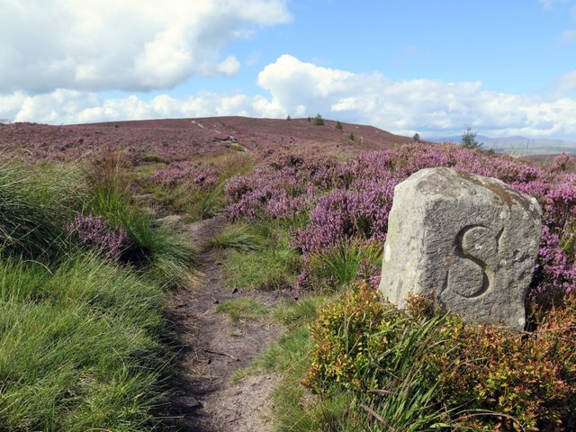
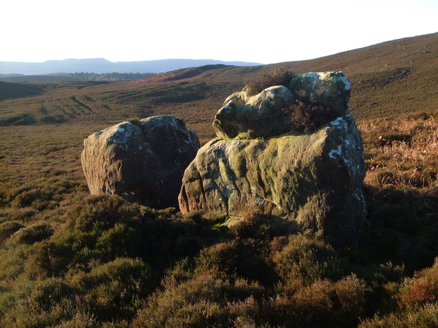
Black Moss is a vast expanse of moorland located in the county of Northumberland, England. Situated in the northern part of the county, it covers an area of approximately 10 square kilometers. The moorland is part of the Northumberland National Park, renowned for its breathtaking landscapes and rich biodiversity.
Characterized by its dark peaty soil, Black Moss is predominantly covered with heather and grasses, providing a unique habitat for many plant and animal species. The moorland is a paradise for birdwatchers, as it is home to a variety of avian species, including grouse, curlew, and skylarks. Additionally, small mammals such as voles and shrews can be spotted amidst the dense vegetation.
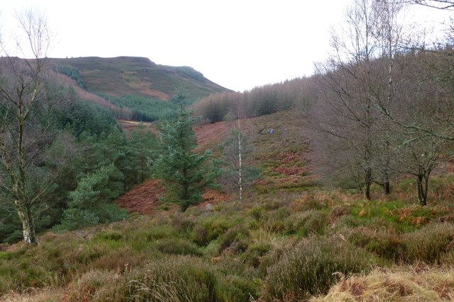
The area is intersected by several streams and small rivers, which add to the scenic beauty of Black Moss. These water sources also provide a habitat for a range of aquatic creatures, including trout and salmon, making it a popular spot for fishing enthusiasts.
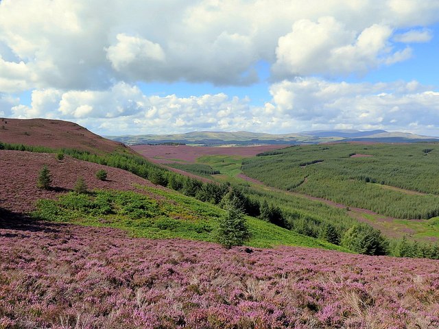
Black Moss is a haven for outdoor enthusiasts, offering numerous walking and hiking trails that allow visitors to explore the rugged charm of the moorland. The area's diverse topography, with rolling hills and steep slopes, presents a challenge for adventurous hikers. Moreover, the moorland's proximity to Hadrian's Wall, a UNESCO World Heritage Site, provides an opportunity for visitors to combine their exploration of ancient Roman history with the natural beauty of Black Moss.
Overall, Black Moss is a place of remarkable natural beauty, offering visitors a chance to immerse themselves in the tranquility of Northumberland's moorland landscape while experiencing its rich biodiversity.
If you have any feedback on the listing, please let us know in the comments section below.
Black Moss Images
Images are sourced within 2km of 55.347262/-1.9033726 or Grid Reference NU0605. Thanks to Geograph Open Source API. All images are credited.


Black Moss is located at Grid Ref: NU0605 (Lat: 55.347262, Lng: -1.9033726)
Unitary Authority: Northumberland
Police Authority: Northumbria
What 3 Words
///sprouted.fattening.disposal. Near Rothbury, Northumberland
Nearby Locations
Related Wikis

Long Crag
Long Crag is a hill to the north of Rothbury in Northumberland, England. It lies within the Thrunton Woods, a Forestry Commission-owned area of forestry...
Northumberland Sandstone Hills
The Northumberland Sandstone Hills are a major natural region in the English county of Northumberland. The hills form distinctive skylines with generally...

Cartington Castle
Cartington Castle is a ruinous, partly restored medieval English castle in the hamlet of Cartington, 2 miles (3.2 km) north-west of Rothbury in the county...

Thrunton Wood
Thrunton Wood is an area of woodland and open moor in Northumberland. It is popular with walkers, mountain bikers and horse riders, and home to two waymarked...

Cartington
Cartington is a village and former civil parish, now in the parish of Thropton, in Northumberland, England. It is about 11 miles (18 km) south west of...
Callaly
Callaly is a village and civil parish in Northumberland, England. It is about 9 miles (14 km) to the west of Alnwick. The main A697 road (to Morpeth) is...

Cragside
Cragside is a Victorian Tudor Revival country house near the town of Rothbury in Northumberland, England. It was the home of William Armstrong, 1st Baron...

Callaly Castle
Callaly Castle is a Grade I listed building and a substantial country house to the north of the village of Callaly, which is some 14.5 km (9.0 mi) to the...
Nearby Amenities
Located within 500m of 55.347262,-1.9033726Have you been to Black Moss?
Leave your review of Black Moss below (or comments, questions and feedback).