Barford Down

Downs, Moorland in Wiltshire

England

Barford Down

The Orange Way in Wiltshire (117) The wood ahead on the left is West Thornhills.
The Orange Way in Wiltshire (117) Credit: Shazz

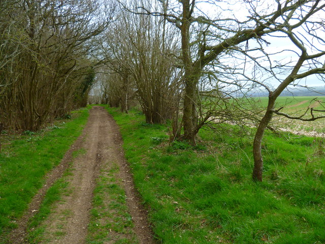
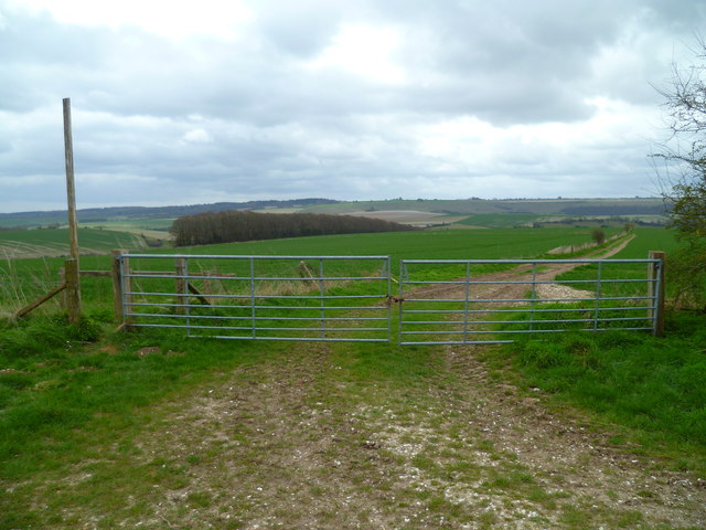
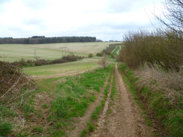
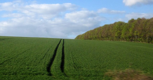
Barford Down is a picturesque area located in the county of Wiltshire, England. Situated on the edge of the Salisbury Plain, it is a vast expanse of downs and moorland that spans over several miles. The landscape of Barford Down is characterized by rolling hills, undulating valleys, and open grasslands, providing visitors with stunning panoramic views.

The area is renowned for its rich biodiversity, with a variety of flora and fauna calling Barford Down their home. The grasslands are adorned with a diverse array of wildflowers, including yellow rattle, cowslips, and harebells, creating a vibrant tapestry of colors during the summer months. The downs also provide an ideal habitat for a plethora of bird species, such as skylarks, kestrels, and peregrine falcons, making it a haven for birdwatching enthusiasts.

Barford Down is also steeped in history, with evidence of human activity dating back thousands of years. Ancient burial mounds and standing stones can be found scattered across the landscape, serving as reminders of the area's Neolithic and Bronze Age past. Furthermore, the down was once part of a medieval hunting ground, and remnants of old hunting lodges can still be seen today.

The area offers numerous recreational activities for visitors to enjoy. Walking and hiking trails crisscross the downs, allowing visitors to explore the stunning scenery and discover hidden gems along the way. Additionally, the open grasslands provide an ideal setting for picnicking, kite flying, and simply enjoying the tranquility of nature.

In conclusion, Barford Down is a captivating destination that seamlessly blends natural beauty with historical significance. Whether one seeks to immerse themselves in the great outdoors or delve into the area's rich past, Barford Down offers a truly memorable experience for all who visit.

If you have any feedback on the listing, please let us know in the comments section below.

Barford Down Images

Images are sourced within 2km of 51.094473/-1.9212108 or Grid Reference SU0532. Thanks to Geograph Open Source API. All images are credited.

The Orange Way in Wiltshire (117) The wood ahead on the left is West Thornhills.
The Orange Way in Wiltshire (117)
The wood ahead on the left is West Thornhills.
The Orange Way in Wiltshire (118) The Way enters West Thornhills.
The Orange Way in Wiltshire (118)
The Way enters West Thornhills.
The Orange Way in Wiltshire (119) Here the track is rougher and grassy.
The Orange Way in Wiltshire (119)
Here the track is rougher and grassy.
The Orange Way in Wiltshire (120) The route dips into a valley and climbs up again.
The Orange Way in Wiltshire (120)
The route dips into a valley and climbs up again.
The Orange Way in Wiltshire (121) A bridleway crosses here and the view stretches ahead for a long way.
The Orange Way in Wiltshire (121)
A bridleway crosses here and the view stretches ahead for a long way.
The Orange Way in Wiltshire (122) The byway continues past a joining bridleway.
The Orange Way in Wiltshire (122)
The byway continues past a joining bridleway.
The Orange Way in Wiltshire (123) Here's a confusing junction of ways at the end of a lane.
The Orange Way in Wiltshire (123)
Here's a confusing junction of ways at the end of a lane.
The Orange Way in Wiltshire (124) This is somewhat monotonous.
The Orange Way in Wiltshire (124)
This is somewhat monotonous.
The Orange Way in Wiltshire (125) This is a field boundary with trees which makes it a bit interesting.
The Orange Way in Wiltshire (125)
This is a field boundary with trees which makes it a bit interesting.
The Orange Way in Wiltshire (126) More trees are visible from here.
The Orange Way in Wiltshire (126)
More trees are visible from here.
The Orange Way in Wiltshire (127) The scenery has become less monotonous.
The Orange Way in Wiltshire (127)
The scenery has become less monotonous.
Farmland on Crouch's Down A crop grows apace on rolling downland on the north side of the Nadder valley. There are patches of woodland around, but I can't quite understand the wedge-shaped feature in the centre, half scrub and half apparently bare earth. It's on the side of a steep re-entrant, but doesn't appear from the shape to be anything to do with an old chalk pit, for instance.
Farmland on Crouch's Down
A crop grows apace on rolling downland on the north side of the Nadder valley. There are patches of woodland around, but I can't quite understand the wedge-shaped feature in the centre, half scrub and half apparently bare earth. It's on the side of a steep re-entrant, but doesn't appear from the shape to be anything to do with an old chalk pit, for instance.
Crop near Barford St Martin A line of trees forms a shelter belt beside this field on the downs north of the Nadder valley. View from a train on the railway line between Tisbury and Salisbury.
Crop near Barford St Martin
A line of trees forms a shelter belt beside this field on the downs north of the Nadder valley. View from a train on the railway line between Tisbury and Salisbury.
The Barford Inn, Barford St Martin
Bridge over River Nadder at Barford St Martin
The Barford Inn, Barford St Martin
Filling station on A30 east of Barford St Martin This is now a BP station; formerly it was a Texaco station <a href="https://www.geograph.org.uk/photo/331372">SU0631 : Tinkerbell Service Station, Barford St Martin</a>
Filling station on A30 east of Barford St Martin
This is now a BP station; formerly it was a Texaco station SU0631 : Tinkerbell Service Station, Barford St Martin
Barford St Martin Churchyard (1)
Show me another place!

Barford Down is located at Grid Ref: SU0532 (Lat: 51.094473, Lng: -1.9212108)

Unitary Authority: Wiltshire

Police Authority: Wiltshire

What 3 Words

///radically.daffodils.invented. Near Stapleford, Wiltshire

Related Wikis

Barford St Martin

Barford St Martin is a village and civil parish in Wiltshire, England, about 2.5 miles (4 km) west of Wilton, around the junction of the A30 and the B3089...

Grovely Wood

Grovely Wood is one of the largest woodlands in southern Wiltshire, England. It stands on a chalk ridge above the River Wylye in Barford St Martin parish...

Baverstock Juniper Bank

Baverstock Juniper Bank (grid reference SU035336) is a 2.6 hectare Biological Site of Special Scientific Interest to the north of the village of Baverstock...

Burcombe

Burcombe is a village in the civil parish of Burcombe Without, in Wiltshire, England. The village is about 4.5 miles (7 km) west of Salisbury city centre...

Nearby Amenities

Located within 500m of 51.094473,-1.9212108
Barford Down
Place: locality
Source: OS OpenData StreetView
Lat/Long: 51.0954789/-1.9268794
Power: pole
Lat/Long: 51.0932136/-1.9274834
Power: pole
Lat/Long: 51.0930858/-1.9186804
Power: pole
Lat/Long: 51.0932844/-1.9220439
Power: pole
Lat/Long: 51.0930049/-1.9278858
Power: pole
Lat/Long: 51.093308/-1.92022
Power: pole
Lat/Long: 51.0931018/-1.92132
Power: pole
Lat/Long: 51.0930453/-1.9255791
Power: pole
Lat/Long: 51.0931262/-1.9144318
Power: pole
Lat/Long: 51.0932271/-1.9257883
Power: pole
Lat/Long: 51.093372/-1.9147161
Power: pole
Lat/Long: 51.0933282/-1.9185839
Power: pole
Lat/Long: 51.0932305/-1.9242487
The data included in this document is from www.openstreetmap.org. The data is made available under ODbL.

Have you been to Barford Down?

Leave your review of Barford Down below (or comments, questions and feedback).