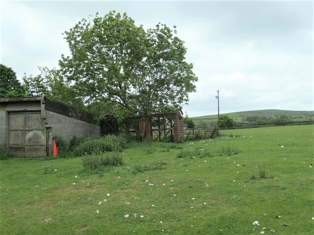
Addingham Low Moor

Downs, Moorland in Yorkshire

England

Addingham Low Moor

Old Boundary Marker on Drughton Moor Boundary Marker inscribed in the right-hand gatepost on Draughton Moor 730 metres north of Bank End Farm. Draughton parish. Inscribed JC, probably the initials of a landowner. See also <a title="https://www.geograph.org.uk/photo/2351032" href="https://www.geograph.org.uk/photo/2351032">Link</a>.

Milestone Society National ID: YW_DRAJC04bm
Old Boundary Marker on Drughton Moor Credit: D Phillips

Addingham Low Moor is a picturesque area located in the county of Yorkshire, England. Situated in the heart of the Yorkshire Dales, this region boasts stunning downs and moorland landscapes that attract visitors from near and far.

Covering a vast expanse of rolling hills and open grasslands, Addingham Low Moor is a haven for nature enthusiasts and outdoor adventurers. Its diverse ecosystem supports a wide array of flora and fauna, making it a popular destination for birdwatching and wildlife spotting. Visitors can expect to encounter species such as curlews, lapwings, and golden plovers, among others.

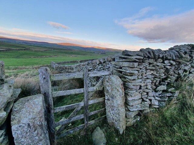
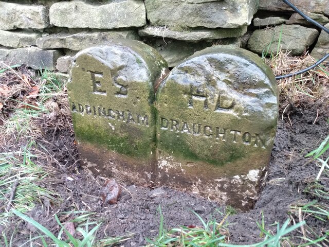
The moorland itself is characterized by its heather-clad hills, offering a vibrant purple hue during the summer months. Walking trails crisscross the area, providing opportunities for hikers to explore the vast expanses and take in the breathtaking views. The moorland is also home to several archaeological sites, with ancient burial mounds and stone circles offering a glimpse into the area's rich history.

Addingham Low Moor is conveniently located near the village of Addingham, which offers amenities such as pubs, shops, and accommodations for visitors. The area's accessibility and proximity to other Yorkshire attractions, such as the Yorkshire Dales National Park and the market town of Skipton, make it an ideal base for exploring the region.

Overall, Addingham Low Moor, Yorkshire, is a captivating destination that showcases the beauty of the English countryside. Its downs and moorland provide a peaceful retreat for those seeking a break from the hustle and bustle of city life, while its natural wonders and historical sites offer a wealth of opportunities for exploration and discovery.

If you have any feedback on the listing, please let us know in the comments section below.

Addingham Low Moor Images

Images are sourced within 2km of 53.94376/-1.9197533 or Grid Reference SE0549. Thanks to Geograph Open Source API. All images are credited.

Old Boundary Marker on Drughton Moor Boundary Marker inscribed in the right-hand gatepost on Draughton Moor 730 metres north of Bank End Farm. Draughton parish. Inscribed JC, probably the initials of a landowner. See also <a title="https://www.geograph.org.uk/photo/2351032" href="https://www.geograph.org.uk/photo/2351032">Link</a>.

Milestone Society National ID: YW_DRAJC04bm
Old Boundary Marker on Drughton Moor
Boundary Marker inscribed in the right-hand gatepost on Draughton Moor 730 metres north of Bank End Farm. Draughton parish. Inscribed JC, probably the initials of a landowner. See also Link. Milestone Society National ID: YW_DRAJC04bm
Old Boundary Marker on the A65 near Chelker Reservoir Parish Boundary Marker formed by two similar stones side by side against a drystone wall on the southwest side of the A65, adjacent to a cattle crossing warning signal. Inscribed ES / ADDINGHAM and HD / DRAUGHTON. On the boundary of Addingham and Draughton parishes, and now between West and North Yorkshire. ESHD stands for East Staincliffe Highway District and this dates the stone between 1862 and 1894.

Milestone Society National ID: YW_ADDDRA01pb
Old Boundary Marker on the A65 near Chelker Reservoir
Parish Boundary Marker formed by two similar stones side by side against a drystone wall on the southwest side of the A65, adjacent to a cattle crossing warning signal. Inscribed ES / ADDINGHAM and HD / DRAUGHTON. On the boundary of Addingham and Draughton parishes, and now between West and North Yorkshire. ESHD stands for East Staincliffe Highway District and this dates the stone between 1862 and 1894. Milestone Society National ID: YW_ADDDRA01pb
High Laithe, from the north This farm building is shown on the large-scale OS map surveyed in 1850. It is now next to Bracken Ghyll golf course [founded 1993].
High Laithe, from the north
This farm building is shown on the large-scale OS map surveyed in 1850. It is now next to Bracken Ghyll golf course [founded 1993].
Warning to footpath users, Bracken Ghyll golf course The public footpath from Addingham to Highfield Farm crosses the golf course.
Warning to footpath users, Bracken Ghyll golf course
The public footpath from Addingham to Highfield Farm crosses the golf course.
Highfield House, near Addingham A house or farm called Highfield is shown here on the large-scale OS map surveyed in 1850. Seen from the public footpath from Addingham  to Highfield Farm.
Highfield House, near Addingham
A house or farm called Highfield is shown here on the large-scale OS map surveyed in 1850. Seen from the public footpath from Addingham to Highfield Farm.
Elegant metal stile, near Highfield House One of two here, on the public footpath from Addingham to Highfield Farm.
Elegant metal stile, near Highfield House
One of two here, on the public footpath from Addingham to Highfield Farm.
Highfield Farm, north of Addingham On the very edge of Bradford MDC and West Yorkshire. The large-scale OS map surveyed in 1850 shows this farm but calls it Hag Head. Five footpaths meet here.
Highfield Farm, north of Addingham
On the very edge of Bradford MDC and West Yorkshire. The large-scale OS map surveyed in 1850 shows this farm but calls it Hag Head. Five footpaths meet here.
Derelict railway goods wagon at Highfield Farm The dismantled Ilkley - Skipton railway line is only about a kilometre away.
Derelict railway goods wagon at Highfield Farm
The dismantled Ilkley - Skipton railway line is only about a kilometre away.
Route of a water pipeline, below Chelker reservoir Bradford Corporation built the reservoir in 1866. It takes its water from the River Wharfe. The wall marks the boundary between Bradford, West Yorkshire [this side] and Craven, North Yorkshire [far side].
Route of a water pipeline, below Chelker reservoir
Bradford Corporation built the reservoir in 1866. It takes its water from the River Wharfe. The wall marks the boundary between Bradford, West Yorkshire [this side] and Craven, North Yorkshire [far side].
Stile, boundary, boundary marker and valve house The stile carries the public footpath between Highfield Farm and Berwick East. The wall is the boundary between Bradford MDC, West Yorkshire [this / south side] and Craven, North Yorkshire [far / north side]. The BCWW boundary marker refers to Bradford Corporation Water Works, which opened the nearby Chelker reservoir in 1866. On the horizon is the valve house, which relates to the covered pipeline <a href="https://www.geograph.org.uk/photo/7496730">SE0651 : Route of a water pipeline, below Chelker reservoir</a> immediately to the right of this image.
Stile, boundary, boundary marker and valve house
The stile carries the public footpath between Highfield Farm and Berwick East. The wall is the boundary between Bradford MDC, West Yorkshire [this / south side] and Craven, North Yorkshire [far / north side]. The BCWW boundary marker refers to Bradford Corporation Water Works, which opened the nearby Chelker reservoir in 1866. On the horizon is the valve house, which relates to the covered pipeline SE0651 : Route of a water pipeline, below Chelker reservoir immediately to the right of this image.
Farmland east of Chelker reservoir dam Judging by the smell and colour, the muck spreader had been busy here this spring.
Farmland east of Chelker reservoir dam
Judging by the smell and colour, the muck spreader had been busy here this spring.
Old guidestone On Height Lane, south of the A65 at Draughton, this stone is where an old route between Skipton and Addingham can still be followed on foot. The left face is inscribed with a hand pointing left To/hton/Draug/1 mile/To hand to right/n/Silsde/3 mls.   Note the n at the end of Skipton and the am at the end of Addingham, the mileage to which, hidden by the nettles, is 2mLs.
Grade II listed 1317055.
Old guidestone
On Height Lane, south of the A65 at Draughton, this stone is where an old route between Skipton and Addingham can still be followed on foot. The left face is inscribed with a hand pointing left To/hton/Draug/1 mile/To hand to right/n/Silsde/3 mls. Note the n at the end of Skipton and the am at the end of Addingham, the mileage to which, hidden by the nettles, is 2mLs. Grade II listed 1317055.
Jowett's Crag, from the south On the east side of Bank Lane. The summit is just under 300 metres above sea level.
Jowett's Crag, from the south
On the east side of Bank Lane. The summit is just under 300 metres above sea level.
Jowett's Crag, from the north-west The summit is just under 300 metres high.
Jowett's Crag, from the north-west
The summit is just under 300 metres high.
Boundary marker, Addingham Low Moor Not lettered or numbered, but on the boundary between Addingham and Silsden civil parishes. Just within Bradford metropolitan district, the boundary of which runs along the first wall beyond the stone.
Boundary marker, Addingham Low Moor
Not lettered or numbered, but on the boundary between Addingham and Silsden civil parishes. Just within Bradford metropolitan district, the boundary of which runs along the first wall beyond the stone.
On the gentle summit of Counter Hill Looking north-east past Chelker reservoir. At 290 metres, this is a local high point, with fine views in most directions. No wonder that the land around the summit is full of prehistoric earthworks <a href="https://www.geograph.org.uk/photo/7621648">SE0549 : Prehistoric earthwork below Counter Hill</a> <a href="https://www.geograph.org.uk/photo/7622540">SE0550 : Round Dikes, Counter Hill, east side</a>.
On the gentle summit of Counter Hill
Looking north-east past Chelker reservoir. At 290 metres, this is a local high point, with fine views in most directions. No wonder that the land around the summit is full of prehistoric earthworks SE0549 : Prehistoric earthwork below Counter Hill SE0550 : Round Dikes, Counter Hill, east side.
Sheep on the summit of Counter Hill Looking towards Beamsley Beacon. At 290 metres, this is a local high point, with fine views in most directions. No wonder that the land around the summit is full of prehistoric earthworks <a href="https://www.geograph.org.uk/photo/7621648">SE0549 : Prehistoric earthwork below Counter Hill</a> <a href="https://www.geograph.org.uk/photo/7622540">SE0550 : Round Dikes, Counter Hill, east side</a>.
Sheep on the summit of Counter Hill
Looking towards Beamsley Beacon. At 290 metres, this is a local high point, with fine views in most directions. No wonder that the land around the summit is full of prehistoric earthworks SE0549 : Prehistoric earthwork below Counter Hill SE0550 : Round Dikes, Counter Hill, east side.
Round Dikes, Counter Hill, north-west side A large oval Iron Age enclosure, one of many prehistoric earthworks around this hill.
Round Dikes, Counter Hill, north-west side
A large oval Iron Age enclosure, one of many prehistoric earthworks around this hill.
Show me another place!

Addingham Low Moor is located at Grid Ref: SE0549 (Lat: 53.94376, Lng: -1.9197533)

Division: West Riding

Unitary Authority: Bradford

Police Authority: West Yorkshire

What 3 Words

///dentures.variety.masking. Near Addingham, West Yorkshire

Related Wikis

Chelker Reservoir

Chelker Reservoir is a man-made lake in North Yorkshire, England. It lies in the parish of Draughton, immediately north of the A65 road, between Skipton...

Craven (Bradford ward)

Craven is an electoral ward within the City of Bradford Metropolitan District Council, West Yorkshire, England. The population of the ward at the 2011...

Addingham railway station

Addingham railway station was on the Midland Railway route from Skipton to Ilkley. It served the village of Addingham in West Yorkshire, England. ��2...

Addingham

Addingham (formerly Haddincham c. 972, Odingehem 1086) is a village and civil parish in the City of Bradford in West Yorkshire, England. It is situated...

Related Videos

Yorkshire Dales Walks - Addingham Moor circular in the snow

A circular walk in the snow over Addingham moor. Only a short walk of around 2.2 miles on 3.12.2023.

Embsay and Bolton Abbey Steam Railway I Vintage Rail 1st Class Travel in UK I @bloomingdreamz V- 47

Embsay and Bolton Abbey Steam Railway : Embsay & Bolton Abbey Steam Railway Situated near Skipton in Yorkshire. It built in ...

Remember that happiness is a way of travel–NOT a destination. #happiness #asmaachaudhry #travelling

Remember that happiness is a way of travel – not a destination. Enjoyed Vintage era ride at Embsay station. Bhut hi zabrdast ...

Nearby Amenities

Located within 500m of 53.94376,-1.9197533
tumulus
Archaeological Site: tumulus
Historic: archaeological_site
Source: NPE;OS 1:25k
Lat/Long: 53.9469019/-1.9176038
Addingham Low Moor
Natural: moor
Source: NPE
Lat/Long: 53.9467762/-1.9155449
Counter Hill
Natural: peak
Source: OS OpenData StreetView
Lat/Long: 53.9468643/-1.9232957
Counter Hill Ironage camp
Alt Name: Round Dikes
Historic: archaeological_site
Source Alt Name: OS 1:25k
Lat/Long: 53.9470869/-1.9171989
Archaeological Site: tumulus
Historic: archaeological_site
Lat/Long: 53.941496/-1.9252034
Power: pole
Source: Bing
Lat/Long: 53.9429148/-1.9126002
The data included in this document is from www.openstreetmap.org. The data is made available under ODbL.

Have you been to Addingham Low Moor?

Leave your review of Addingham Low Moor below (or comments, questions and feedback).