Bostock Plantation

Downs, Moorland in Derbyshire High Peak

England

Bostock Plantation

The Pennine Way near Mill Hill
The Pennine Way near Mill Hill Credit: Dave Kelly

Bostock Plantation is a scenic and diverse natural area located in Derbyshire, England. Situated in the heart of the county, it spans across the Downs and Moorland regions, providing visitors with a rich tapestry of landscapes to explore. The plantation encompasses a total area of approximately 500 acres, making it a significant and expansive site for nature enthusiasts.

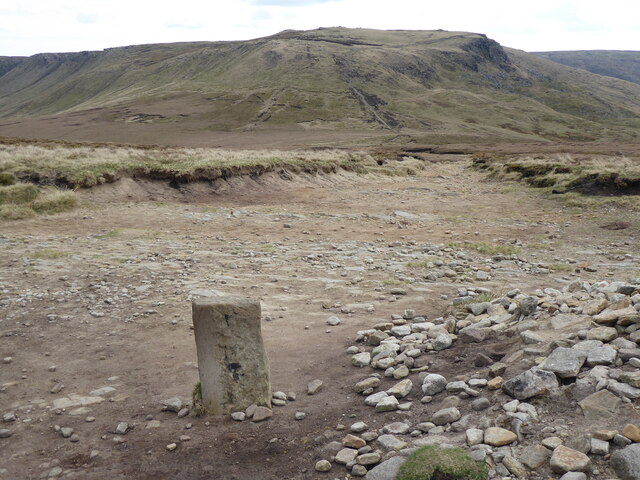
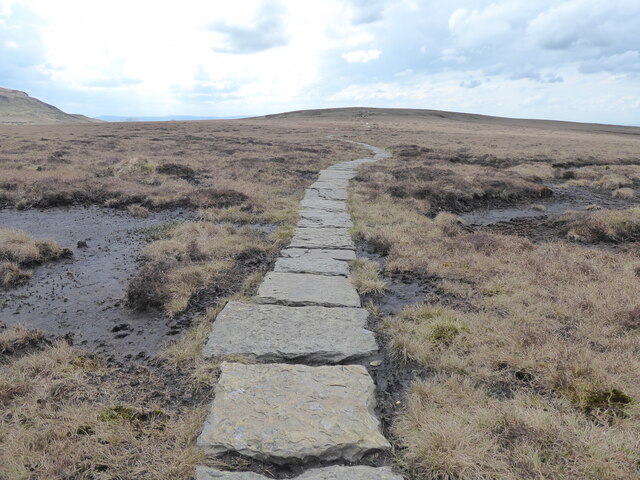
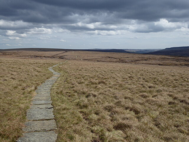
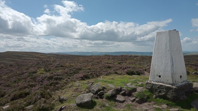
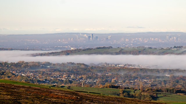
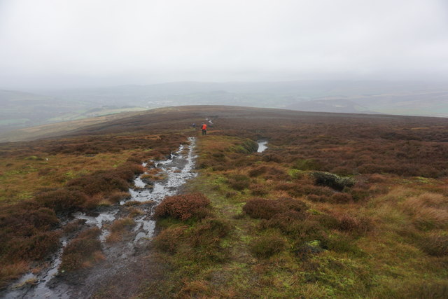
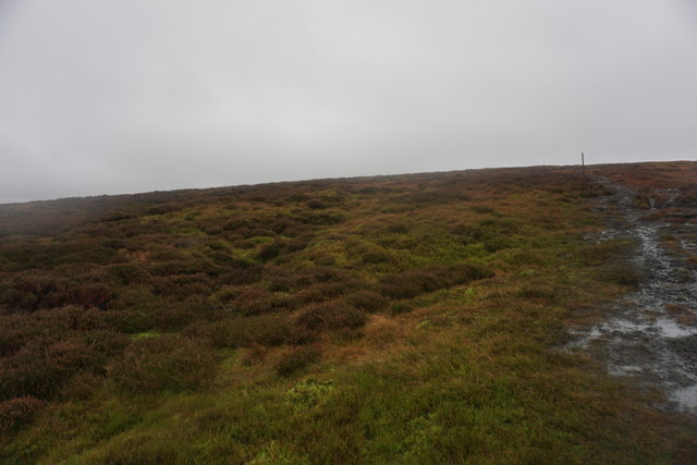
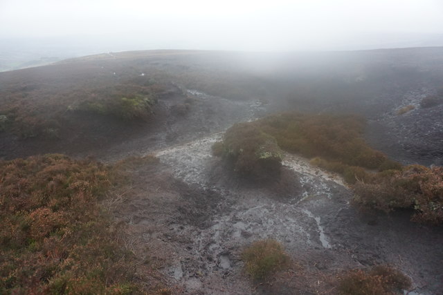
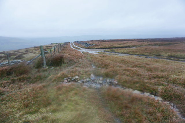
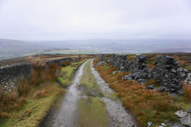
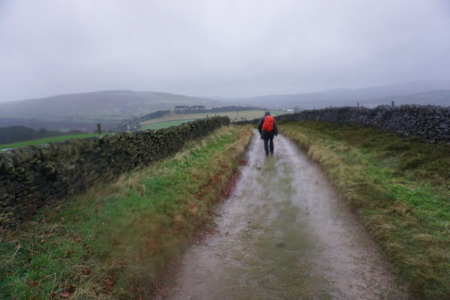
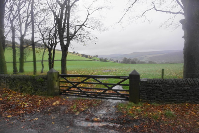
Within Bostock Plantation, the terrain varies greatly, showcasing the unique characteristics of both the Downs and Moorland. The Downs section of the plantation features rolling hills and wide open spaces, offering stunning panoramic views of the surrounding countryside. It is home to a variety of grasses, wildflowers, and shrubs, creating a vibrant and colorful landscape during the warmer months.

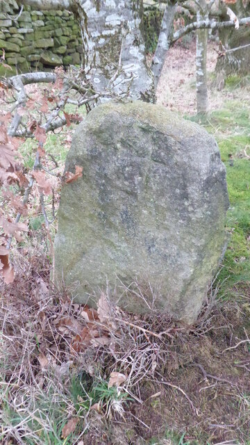
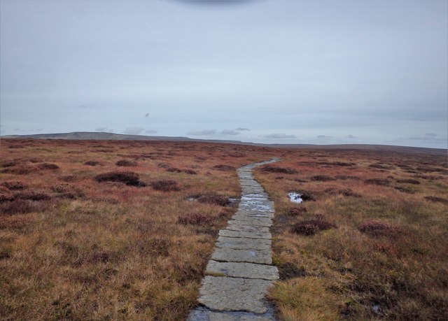
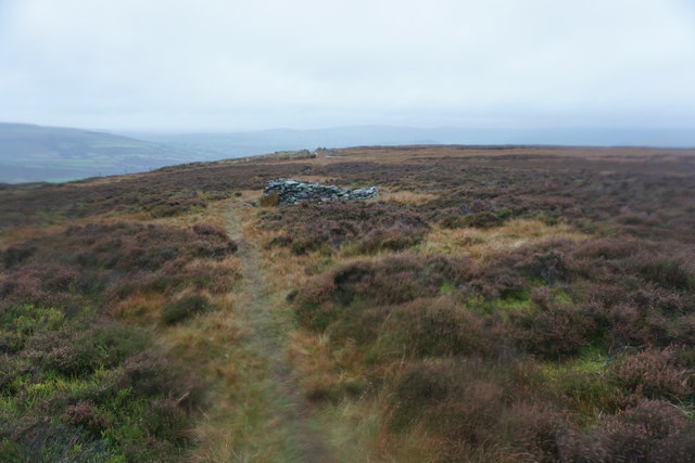
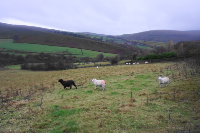
Moving into the Moorland section of the plantation, visitors will encounter a different environment characterized by heather-covered hills and scattered rocky outcrops. This area provides a habitat for a range of wildlife species, including grouse, foxes, and various bird species, making it a popular destination for birdwatchers.

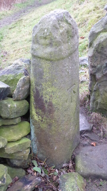
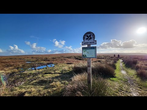
Bostock Plantation offers a network of well-maintained walking trails, allowing visitors to explore the different sections of the plantation at their own pace. The trails are suitable for all levels of hikers and provide opportunities for picnicking and wildlife spotting. Additionally, the plantation is equipped with informative signage, providing visitors with insights into the local flora and fauna.

Overall, Bostock Plantation is a captivating natural area that showcases the diverse beauty of Derbyshire's Downs and Moorland regions. With its picturesque landscapes and abundant wildlife, it offers a tranquil and immersive experience for nature lovers and outdoor enthusiasts alike.

If you have any feedback on the listing, please let us know in the comments section below.

Bostock Plantation Images

Images are sourced within 2km of 53.426449/-1.9215704 or Grid Reference SK0592. Thanks to Geograph Open Source API. All images are credited.

The Pennine Way near Mill Hill
The Pennine Way near Bakestone Delph Clough
The Pennine Way near Moss Castle
View from Harry Hut The view direction given may be out by 90°. I have gone with what I typed into my phone's notebook, though it could be SouthEast - geographing would be a lot easier if 'w' and 'e' weren't right next to each other on the keyboard I often think!
Sitting amongst lots of pretty purple heather, the hill itself is fairly unremarkable apart from the trig pillar; it's more of a bump on a plateau shared with Burnt Hill, which is due South, before the land slowly rises again to the East. Its name is pretty good though, and nobody seems to have a clue where it comes from. If there was a hut here once - which is surely the most logical explanation - should it not have been called 'Harry's Hut'?  The answer will no doubt be in an old book somewhere.
The trig point's height is 441 metres. All four sight-holes at the base are still there, which is fairly unusual, but on the other hand  the bit in the middle of the top mounting plate has been concreted over.
View from Harry Hut
The view direction given may be out by 90°. I have gone with what I typed into my phone's notebook, though it could be SouthEast - geographing would be a lot easier if 'w' and 'e' weren't right next to each other on the keyboard I often think! Sitting amongst lots of pretty purple heather, the hill itself is fairly unremarkable apart from the trig pillar; it's more of a bump on a plateau shared with Burnt Hill, which is due South, before the land slowly rises again to the East. Its name is pretty good though, and nobody seems to have a clue where it comes from. If there was a hut here once - which is surely the most logical explanation - should it not have been called 'Harry's Hut'? The answer will no doubt be in an old book somewhere. The trig point's height is 441 metres. All four sight-holes at the base are still there, which is fairly unusual, but on the other hand the bit in the middle of the top mounting plate has been concreted over.
Old Wayside Cross on Carr House Lane, Glossop Carr House Lane Cross, a cross incised in a carved stone beside the footpath called Carr House Lane from Cliffe Road in Glossop to Derbyshire Level. Read N. T Sharpe (2002), Crosses of the Peak District and <span class="nowrap"><a title="https://glossopcuriosities.wordpress.com/2017/12/01/carr-house-lane-stone/" rel="nofollow ugc noopener" href="https://glossopcuriosities.wordpress.com/2017/12/01/carr-house-lane-stone/">Link</a><img style="margin-left:2px;" alt="External link" title="External link - shift click to open in new window" src="https://s1.geograph.org.uk/img/external.png" width="10" height="10"/></span>.

Milestone Society National ID: DEHP_GLO04
Old Wayside Cross on Carr House Lane, Glossop
Carr House Lane Cross, a cross incised in a carved stone beside the footpath called Carr House Lane from Cliffe Road in Glossop to Derbyshire Level. Read N. T Sharpe (2002), Crosses of the Peak District and LinkExternal link. Milestone Society National ID: DEHP_GLO04
Old Wayside Cross in Glossop Whitfield Cross, the shaft of an old wayside cross now part of a stile on the footpath from High Street East in Glossop to Cliffe Road. Read N. T Sharpe (2002), Crosses of the Peak District and <span class="nowrap"><a title="https://glossopcuriosities.wordpress.com/2017/09/07/whitfield-cross/" rel="nofollow ugc noopener" href="https://glossopcuriosities.wordpress.com/2017/09/07/whitfield-cross/">Link</a><img style="margin-left:2px;" alt="External link" title="External link - shift click to open in new window" src="https://s1.geograph.org.uk/img/external.png" width="10" height="10"/></span>.

Milestone Society National ID: DEHP_GLO05
Old Wayside Cross in Glossop
Whitfield Cross, the shaft of an old wayside cross now part of a stile on the footpath from High Street East in Glossop to Cliffe Road. Read N. T Sharpe (2002), Crosses of the Peak District and LinkExternal link. Milestone Society National ID: DEHP_GLO05
Manchester View of Manchester seen from the A57, Snake Road.
Manchester
View of Manchester seen from the A57, Snake Road.
Pennine Way Beyond Mill Hill
Pennine Way
Beyond Mill Hill
Path on Black Moor A route from the Pennine Way down towards Glossop. Glossop itself is a bit obscured by the weather ahead.
Path on Black Moor
A route from the Pennine Way down towards Glossop. Glossop itself is a bit obscured by the weather ahead.
Path on Black Moor As with many moorland climbs, there are not many features ahead to inspire one.
Path on Black Moor
As with many moorland climbs, there are not many features ahead to inspire one.
Peat grough on Black Moor Viewed looking directly into oncoming wind and rain. This has to be negotiated on the path down the hillside.
Peat grough on Black Moor
Viewed looking directly into oncoming wind and rain. This has to be negotiated on the path down the hillside.
Path coming off Black Moor The beginning of a proper track down to Moorfield can be seen on the rise ahead.
Path coming off Black Moor
The beginning of a proper track down to Moorfield can be seen on the rise ahead.
The top of a track on Highmoor Pits The track assists shooting on Black Moor, and comes up from Moorfield. The view is made more challenging by oncoming wind and rain.
The top of a track on Highmoor Pits
The track assists shooting on Black Moor, and comes up from Moorfield. The view is made more challenging by oncoming wind and rain.
Track down to Moorfield The track is mainly used for shooting at this level, though lower down there is still sheep farming. The view is a bit obscured by oncoming wind and rain.
Track down to Moorfield
The track is mainly used for shooting at this level, though lower down there is still sheep farming. The view is a bit obscured by oncoming wind and rain.
Track down to Moorfield An opportunity for wet weather walking which the Pennines are very good at providing.
Track down to Moorfield
An opportunity for wet weather walking which the Pennines are very good at providing.
Outbuildings of Moorfield House The former mill-owner's house was subsequently for a time a Catholic seminary, which may have some bearing on the buildings visible here. Many of the buildings have been adapted for holiday accommodation.
Outbuildings of Moorfield House
The former mill-owner's house was subsequently for a time a Catholic seminary, which may have some bearing on the buildings visible here. Many of the buildings have been adapted for holiday accommodation.
Farmland near Moorfield Looking in the direction of Glossop on a wet day.
Farmland near Moorfield
Looking in the direction of Glossop on a wet day.
Sheep on a wet day Looking down from Kidd Road. In the distance, you can see the A624 climbing past Chunal.
Sheep on a wet day
Looking down from Kidd Road. In the distance, you can see the A624 climbing past Chunal.
Show me another place!

Bostock Plantation is located at Grid Ref: SK0592 (Lat: 53.426449, Lng: -1.9215704)

Administrative County: Derbyshire

District: High Peak

Police Authority: Derbyshire

What 3 Words

///exploring.equality.rumbles. Near Glossop, Derbyshire

Related Wikis

Hurst Reservoir

Hurst Reservoir is a former, now disused, reservoir near Glossop, north Derbyshire. == History == In 1837, 50 local millowners and gentlemen, known as...

Chunal

Chunal is a hamlet in Derbyshire, England. It is located on the A624 road, 1 mile south of Glossop. The philosopher Ludwig Wittgenstein conducted aeronautical...

Mill Hill (Derbyshire)

Mill Hill is an open, flat-topped hill, 1,785 feet (544 m) above sea level, in the Peak District in the county of Derbyshire in England. == Location... ==

Charlestown, Derbyshire

Charlestown is a village in Glossopdale, Derbyshire, England. It is in the Simmondley Ward of the High Peak District Council. The village is situated on...

Related Videos

Is abandoning a hike a failure? - Harry Hut Trig. 88 Trig Point Challenge 2023 - Trig 11 of 88.

88 Trig Point Challenge 2023 - Harry Hut. Trig 11 of 88. Today, I intend to hike a circular route, taking in three Trigs, Harry Hut, and ...

Ethel Challenge 2022 - Featherbed Top. Ethel 56. 39 Ethels to go. Peak District National Park.

Ethel Challenge 2022. I hope one day to complete this Ethel Challenge and keep hiking in the Peak District National Park & The ...

Nearby Amenities

Located within 500m of 53.426449,-1.9215704
Bray Clough
Place: locality
Source: Bing
Lat/Long: 53.4231927/-1.9215039
The data included in this document is from www.openstreetmap.org. The data is made available under ODbL.

Have you been to Bostock Plantation?

Leave your review of Bostock Plantation below (or comments, questions and feedback).