Gillum's Clump

Downs, Moorland in Wiltshire

England

Gillum's Clump

Warning Notices on Salisbury Plain
Warning Notices on Salisbury Plain Credit: Rog Frost

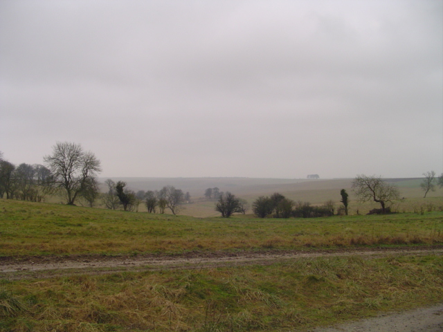
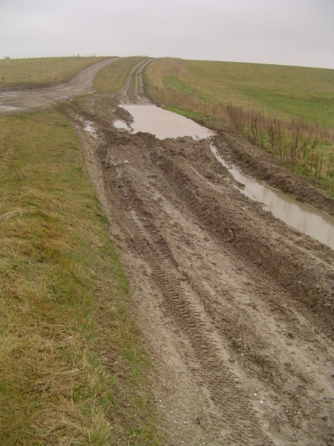
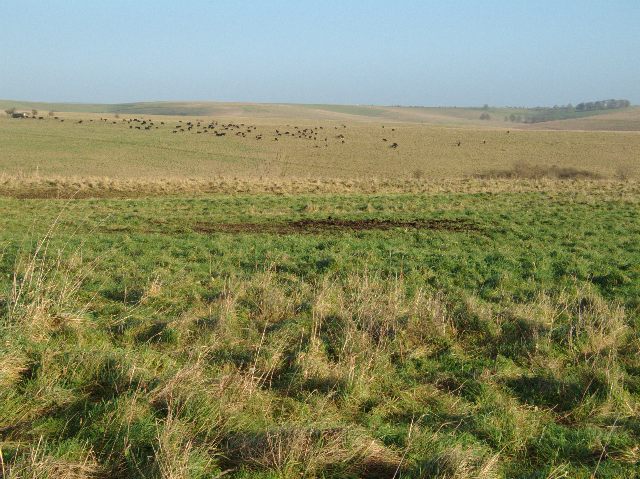
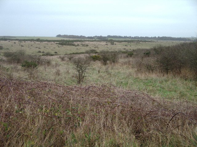
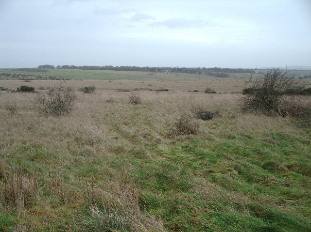
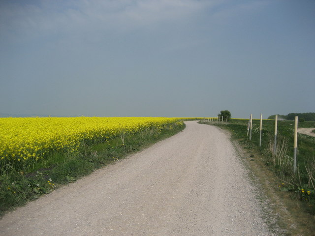
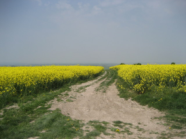
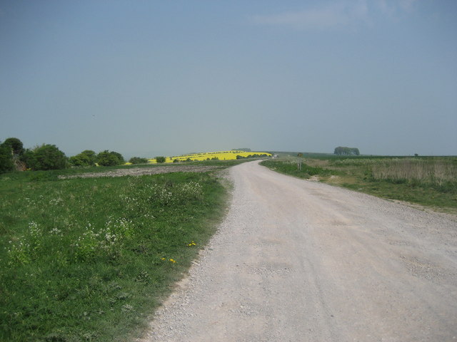
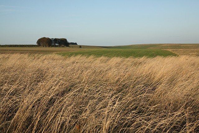
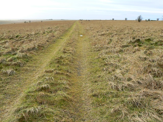
Gillum's Clump is a picturesque area located in the county of Wiltshire, England. Situated within the Downs and Moorland region, it offers a captivating natural landscape that attracts both locals and tourists alike. Spanning across several hectares, Gillum's Clump is characterized by rolling hills, open fields, and dense woodlands, providing visitors with a diverse and enchanting environment to explore.

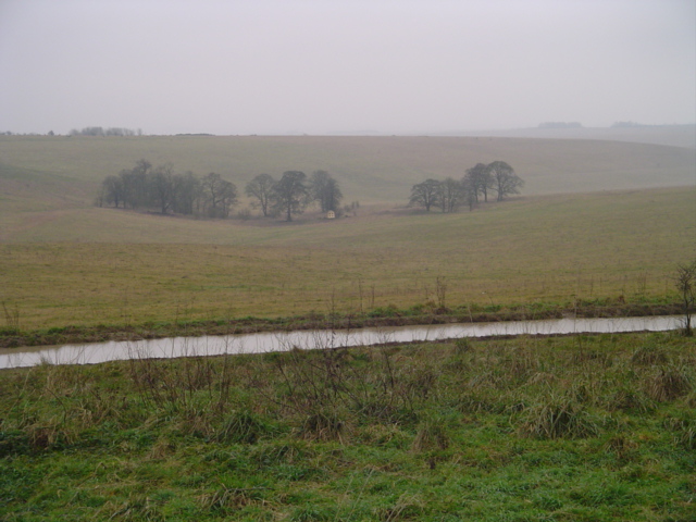
The area is known for its rich biodiversity, with an abundance of flora and fauna species. The woodland areas are home to a variety of trees, including oak, beech, and birch, which create a vibrant and colorful setting throughout the seasons. The open fields are often adorned with wildflowers, adding to the visual appeal of the landscape.

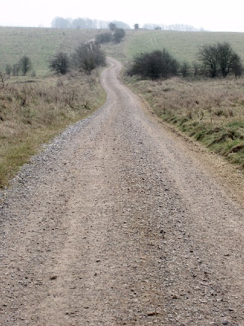
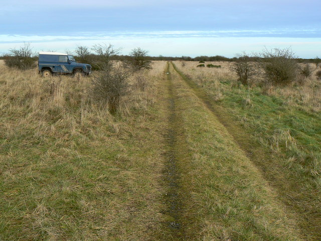
Gillum's Clump offers numerous walking trails and footpaths, allowing visitors to immerse themselves in the serenity of the surroundings. Hiking enthusiasts can enjoy panoramic views from the hilltops, while nature lovers will appreciate the opportunity to spot a wide range of wildlife, including deer, rabbits, and various bird species.

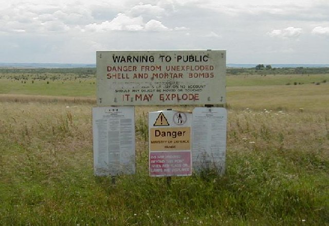
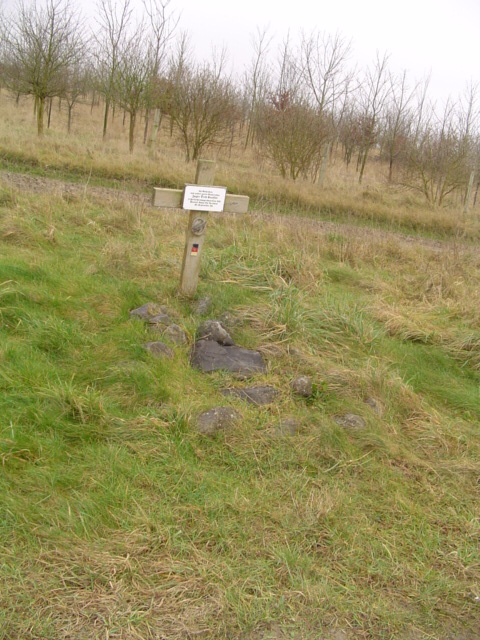
The area is well-maintained, with designated picnic spots and benches strategically placed for visitors to rest and take in the breathtaking views. Additionally, the local authorities have installed informational signs and maps to ensure visitors can navigate the area easily and safely.

Gillum's Clump is a haven for outdoor enthusiasts, providing an idyllic retreat from the hustle and bustle of urban life. Its natural beauty and tranquil ambiance make it a popular destination for those seeking a peaceful escape in the heart of Wiltshire's Downs and Moorland region.

If you have any feedback on the listing, please let us know in the comments section below.

Gillum's Clump Images

Images are sourced within 2km of 51.282369/-1.9357306 or Grid Reference SU0453. Thanks to Geograph Open Source API. All images are credited.

Warning Notices on Salisbury Plain
"The Road Goes Ever On" Track across the military range near Market Lavington
"The Road Goes Ever On"
Track across the military range near Market Lavington
Larkhill Artillery Range Larkhill Artillery Range, taken from the perimeter road west of Redhorn Vedette.
Larkhill Artillery Range
Larkhill Artillery Range, taken from the perimeter road west of Redhorn Vedette.
Larkhill Artillery Range I think the little square in the centre is a house-shaped target.
Larkhill Artillery Range
I think the little square in the centre is a house-shaped target.
Perimeter Road, Larkhill Artillery Range Perimeter Road, Larkhill Artillery Range.
Popular with 4WD vehicles and motorcycles!
Perimeter Road, Larkhill Artillery Range
Perimeter Road, Larkhill Artillery Range. Popular with 4WD vehicles and motorcycles!
Memorial to German Soldier Memorial to German Soldier who "accidentally passed away ..1993" . Presumably during a military exercise.
Memorial to German Soldier
Memorial to German Soldier who "accidentally passed away ..1993" . Presumably during a military exercise.
View across Church Hill Grazing cattle can be seen in the distance
View across Church Hill
Grazing cattle can be seen in the distance
View across artillery range Just south of this image is an area called Chirton Gorse.  Whether this relates to the plant or not this area does indeed seem to have more gorse than other areas of the artillery range.  As can be seen in the image brambles can also be found here whilst being not particularly widespread elsewhere in the artillery range.
View across artillery range
Just south of this image is an area called Chirton Gorse. Whether this relates to the plant or not this area does indeed seem to have more gorse than other areas of the artillery range. As can be seen in the image brambles can also be found here whilst being not particularly widespread elsewhere in the artillery range.
View across Chirton Down
Track by Penning Down This part of a long long track adopted by the Wessex Ridgeway that runs between Urchfont Hill and Lavington Hill.
Track by Penning Down
This part of a long long track adopted by the Wessex Ridgeway that runs between Urchfont Hill and Lavington Hill.
Bridleway leading down to Easterton One of the many tracks that descend from the Wessex Ridgeway between Urchfont Hill and Lavington Hill.
Bridleway leading down to Easterton
One of the many tracks that descend from the Wessex Ridgeway between Urchfont Hill and Lavington Hill.
Track from Lavington Hill Long track adopted by both the Wessex Ridgeway and the White Horse Trail on endless downs as far as Urchfont Hill on the horizon.
Track from Lavington Hill
Long track adopted by both the Wessex Ridgeway and the White Horse Trail on endless downs as far as Urchfont Hill on the horizon.
View Towards Penning Down This view across the downland is taken from what seems to be the least used right of way on the ranges: although the start and end of the right of way are clearly marked there are no signs of recent usage.
View Towards Penning Down
This view across the downland is taken from what seems to be the least used right of way on the ranges: although the start and end of the right of way are clearly marked there are no signs of recent usage.
Ruin on the Westdown Artillery Range The collection of rotting wood and rusting corrugated iron is marked on the OS map as a building.  Probably not for much longer.
Ruin on the Westdown Artillery Range
The collection of rotting wood and rusting corrugated iron is marked on the OS map as a building. Probably not for much longer.
Track near Little Hill, Salisbury Plain Little Hill is behind the viewpoint and is used in the title simply as a means of identifying the location. This view is facing east out of the square, the Landrover being parked rather fortuitously just about on the eastern gridline.
Track near Little Hill, Salisbury Plain
Little Hill is behind the viewpoint and is used in the title simply as a means of identifying the location. This view is facing east out of the square, the Landrover being parked rather fortuitously just about on the eastern gridline.
Landrover on the byway near Chirton Down Most of the 4x4s I saw skirted round the large puddle. Thankfully this driver was a bit more adventurous.
Landrover on the byway near Chirton Down
Most of the 4x4s I saw skirted round the large puddle. Thankfully this driver was a bit more adventurous.
Military debris in the half-light near Chirton Down There aren't quite as many derelict tanks in the SU part of the Plain as compared with the Imber ranges. This one has been here a while; it is clearly visible on Google Earth. Getting towards the last useable daylight, which makes the scenery no less bleak.
Military debris in the half-light near Chirton Down
There aren't quite as many derelict tanks in the SU part of the Plain as compared with the Imber ranges. This one has been here a while; it is clearly visible on Google Earth. Getting towards the last useable daylight, which makes the scenery no less bleak.
Track towards Little Hill, Salisbury Plain Bleak but not entirely featureless, this part of the Plain is just a bit forbidding at this time of year. The track changes direction out of sight about 500 metres ahead.
Track towards Little Hill, Salisbury Plain
Bleak but not entirely featureless, this part of the Plain is just a bit forbidding at this time of year. The track changes direction out of sight about 500 metres ahead.
Show me another place!

Gillum's Clump is located at Grid Ref: SU0453 (Lat: 51.282369, Lng: -1.9357306)

Unitary Authority: Wiltshire

Police Authority: Wiltshire

What 3 Words

///waggled.conquests.embraced. Near Market Lavington, Wiltshire

Nearby Locations

Gillum's Clump

Related Wikis

Easterton

Easterton is a village and civil parish in Wiltshire, England, 4 miles (6.4 km) south of Devizes. The parish includes the hamlets of Easterton Sands and...

Wiltshire

Wiltshire (; abbreviated to Wilts) is a ceremonial county in South West England. It borders Gloucestershire to the north and the north-west, Oxfordshire...

Market Lavington

Market Lavington is a civil parish and large village with a population of about 2,200 on the northern edge of Salisbury Plain in Wiltshire, England, 5...

Urchfont

Urchfont is a rural village and civil parish in the southwest of the Vale of Pewsey and north of Salisbury Plain in Wiltshire, England, about 3+1⁄2 miles...

Have you been to Gillum's Clump?

Leave your review of Gillum's Clump below (or comments, questions and feedback).