Shaw Moor

Downs, Moorland in Derbyshire High Peak

England

Shaw Moor

View from Harry Hut The view direction given may be out by 90°. I have gone with what I typed into my phone's notebook, though it could be SouthEast - geographing would be a lot easier if 'w' and 'e' weren't right next to each other on the keyboard I often think!
Sitting amongst lots of pretty purple heather, the hill itself is fairly unremarkable apart from the trig pillar; it's more of a bump on a plateau shared with Burnt Hill, which is due South, before the land slowly rises again to the East. Its name is pretty good though, and nobody seems to have a clue where it comes from. If there was a hut here once - which is surely the most logical explanation - should it not have been called 'Harry's Hut'?  The answer will no doubt be in an old book somewhere.
The trig point's height is 441 metres. All four sight-holes at the base are still there, which is fairly unusual, but on the other hand  the bit in the middle of the top mounting plate has been concreted over.
View from Harry Hut Credit: Ian Dodds

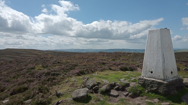
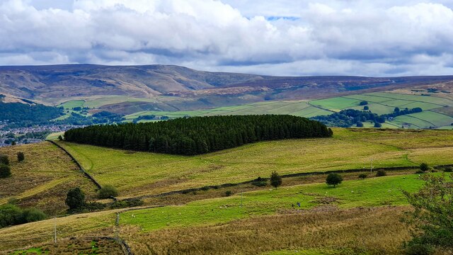
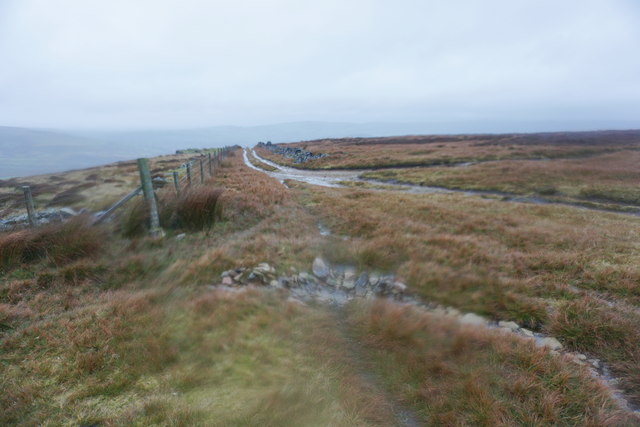
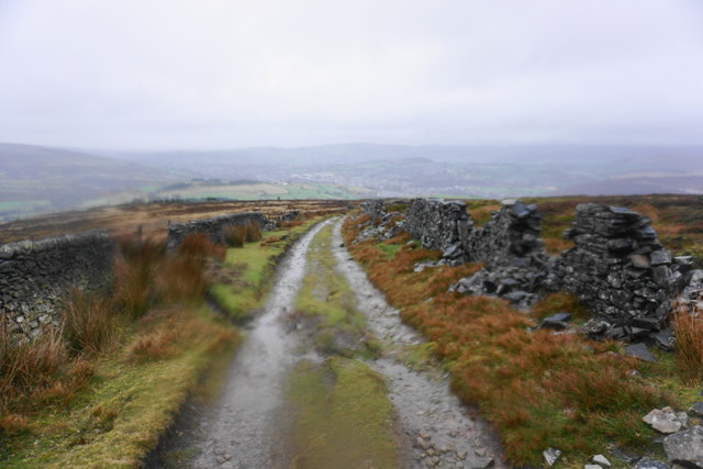
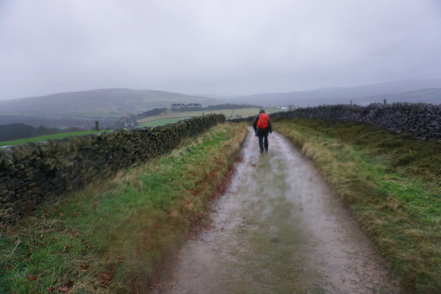
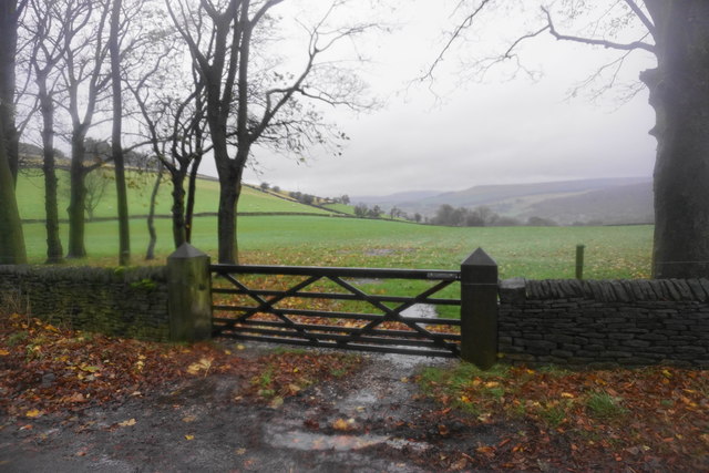
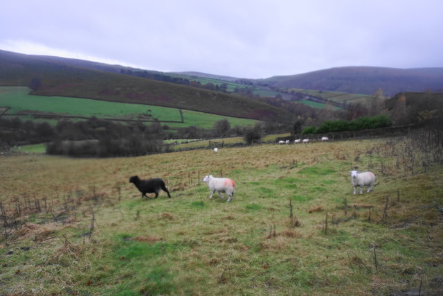
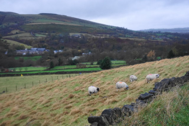
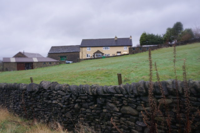
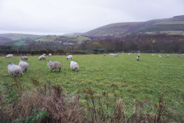
Shaw Moor is a picturesque area located in Derbyshire, England. Nestled in the heart of the Peak District National Park, it is known for its stunning natural beauty and diverse landscapes. The moorland stretches for miles, offering a peaceful and tranquil escape from the hustle and bustle of city life.

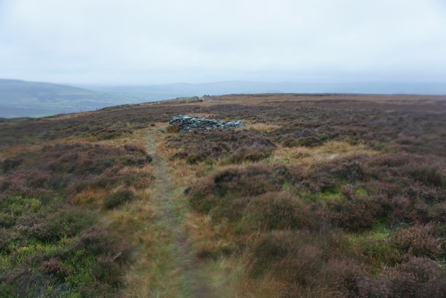
The terrain of Shaw Moor is characterized by rolling hills, open expanses of heather, and scattered woodlands. The area is a haven for wildlife enthusiasts, as it is home to a variety of bird species, including kestrels, buzzards, and peregrine falcons. Additionally, visitors may spot other animals such as deer, hares, and rabbits.

The moorland is crisscrossed by numerous footpaths and trails, making it a popular destination for hikers, walkers, and nature lovers. One of the most notable paths is the Pennine Way, which passes through Shaw Moor, offering stunning views of the surrounding countryside.

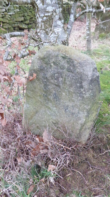
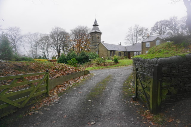
Shaw Moor is also rich in history and heritage. The area has been inhabited for centuries, and remnants of ancient settlements, stone circles, and burial mounds can still be found in the vicinity. These archaeological sites provide a glimpse into the area's past and attract history enthusiasts.

Overall, Shaw Moor is a haven for those seeking a peaceful retreat in nature. Its combination of stunning landscapes, diverse wildlife, and historical significance make it a must-visit destination in Derbyshire.

If you have any feedback on the listing, please let us know in the comments section below.
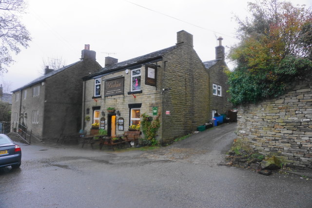
Shaw Moor Images

Images are sourced within 2km of 53.420967/-1.9379969 or Grid Reference SK0491. Thanks to Geograph Open Source API. All images are credited.

View from Harry Hut The view direction given may be out by 90°. I have gone with what I typed into my phone's notebook, though it could be SouthEast - geographing would be a lot easier if 'w' and 'e' weren't right next to each other on the keyboard I often think!
Sitting amongst lots of pretty purple heather, the hill itself is fairly unremarkable apart from the trig pillar; it's more of a bump on a plateau shared with Burnt Hill, which is due South, before the land slowly rises again to the East. Its name is pretty good though, and nobody seems to have a clue where it comes from. If there was a hut here once - which is surely the most logical explanation - should it not have been called 'Harry's Hut'?  The answer will no doubt be in an old book somewhere.
The trig point's height is 441 metres. All four sight-holes at the base are still there, which is fairly unusual, but on the other hand  the bit in the middle of the top mounting plate has been concreted over.
View from Harry Hut
The view direction given may be out by 90°. I have gone with what I typed into my phone's notebook, though it could be SouthEast - geographing would be a lot easier if 'w' and 'e' weren't right next to each other on the keyboard I often think! Sitting amongst lots of pretty purple heather, the hill itself is fairly unremarkable apart from the trig pillar; it's more of a bump on a plateau shared with Burnt Hill, which is due South, before the land slowly rises again to the East. Its name is pretty good though, and nobody seems to have a clue where it comes from. If there was a hut here once - which is surely the most logical explanation - should it not have been called 'Harry's Hut'? The answer will no doubt be in an old book somewhere. The trig point's height is 441 metres. All four sight-holes at the base are still there, which is fairly unusual, but on the other hand the bit in the middle of the top mounting plate has been concreted over.
Whiteley Nab Whiteley Nab seen from Monks' Road.
Whiteley Nab
Whiteley Nab seen from Monks' Road.
Old Wayside Cross on Carr House Lane, Glossop Carr House Lane Cross, a cross incised in a carved stone beside the footpath called Carr House Lane from Cliffe Road in Glossop to Derbyshire Level. Read N. T Sharpe (2002), Crosses of the Peak District and <span class="nowrap"><a title="https://glossopcuriosities.wordpress.com/2017/12/01/carr-house-lane-stone/" rel="nofollow ugc noopener" href="https://glossopcuriosities.wordpress.com/2017/12/01/carr-house-lane-stone/">Link</a><img style="margin-left:2px;" alt="External link" title="External link - shift click to open in new window" src="https://s1.geograph.org.uk/img/external.png" width="10" height="10"/></span>.

Milestone Society National ID: DEHP_GLO04
Old Wayside Cross on Carr House Lane, Glossop
Carr House Lane Cross, a cross incised in a carved stone beside the footpath called Carr House Lane from Cliffe Road in Glossop to Derbyshire Level. Read N. T Sharpe (2002), Crosses of the Peak District and LinkExternal link. Milestone Society National ID: DEHP_GLO04
A624 The A624 seen from the path above Tom Heys Farm.
A624
The A624 seen from the path above Tom Heys Farm.
Path coming off Black Moor The beginning of a proper track down to Moorfield can be seen on the rise ahead.
Path coming off Black Moor
The beginning of a proper track down to Moorfield can be seen on the rise ahead.
The top of a track on Highmoor Pits The track assists shooting on Black Moor, and comes up from Moorfield. The view is made more challenging by oncoming wind and rain.
The top of a track on Highmoor Pits
The track assists shooting on Black Moor, and comes up from Moorfield. The view is made more challenging by oncoming wind and rain.
Track down to Moorfield The track is mainly used for shooting at this level, though lower down there is still sheep farming. The view is a bit obscured by oncoming wind and rain.
Track down to Moorfield
The track is mainly used for shooting at this level, though lower down there is still sheep farming. The view is a bit obscured by oncoming wind and rain.
Track down to Moorfield An opportunity for wet weather walking which the Pennines are very good at providing.
Track down to Moorfield
An opportunity for wet weather walking which the Pennines are very good at providing.
Outbuildings of Moorfield House The former mill-owner's house was subsequently for a time a Catholic seminary, which may have some bearing on the buildings visible here. Many of the buildings have been adapted for holiday accommodation.
Outbuildings of Moorfield House
The former mill-owner's house was subsequently for a time a Catholic seminary, which may have some bearing on the buildings visible here. Many of the buildings have been adapted for holiday accommodation.
Farmland near Moorfield Looking in the direction of Glossop on a wet day.
Farmland near Moorfield
Looking in the direction of Glossop on a wet day.
Sheep on a wet day Looking down from Kidd Road. In the distance, you can see the A624 climbing past Chunal.
Sheep on a wet day
Looking down from Kidd Road. In the distance, you can see the A624 climbing past Chunal.
Sheep above Charlestown Looking across the valley from Hague Street.
Sheep above Charlestown
Looking across the valley from Hague Street.
Lane Ends Farm Looking up from Hague Street on the southern tip of Glossop.
Lane Ends Farm
Looking up from Hague Street on the southern tip of Glossop.
Cottages on Hague Street on a wet day This is just about the southern edge of Glossop.
Cottages on Hague Street on a wet day
This is just about the southern edge of Glossop.
Footpath off Hague Street Uninviting conditions currently for a path which skirts round the edge of Glossop.
Footpath off Hague Street
Uninviting conditions currently for a path which skirts round the edge of Glossop.
Sheep on the edge of Glossop They were more disturbed by me than by the wet conditions.
Sheep on the edge of Glossop
They were more disturbed by me than by the wet conditions.
The Beehive, Glossop A homely local pub with some good national beer, slightly off the beaten track.
The Beehive, Glossop
A homely local pub with some good national beer, slightly off the beaten track.
Black Moor View of Black Moor seen from Castlehill.
Black Moor
View of Black Moor seen from Castlehill.
Show me another place!

Shaw Moor is located at Grid Ref: SK0491 (Lat: 53.420967, Lng: -1.9379969)

Administrative County: Derbyshire

District: High Peak

Police Authority: Derbyshire

What 3 Words

///estimates.infants.steady. Near Glossop, Derbyshire

Related Wikis

Chunal

Chunal is a hamlet in Derbyshire, England. It is located on the A624 road, 1 mile south of Glossop. The philosopher Ludwig Wittgenstein conducted aeronautical...

Charlestown, Derbyshire

Charlestown is a village in Glossopdale, Derbyshire, England. It is in the Simmondley Ward of the High Peak District Council. The village is situated on...

Abbot's Chair

The Abbot's Chair is the common name of a former monastic cross, the Charlesworth Cross. Only the socket remains of this boundary cross, built by the monks...

Glossopdale

Glossopdale is the area around Glossop, Derbyshire, England, the valley of the Glossop Brook. It includes Glossop, Hadfield, Charlesworth, Dinting, Dinting...

Nearby Amenities

Located within 500m of 53.420967,-1.9379969
Worm Stones
Natural: rock
Source: local knowledge
Lat/Long: 53.4197012/-1.9369861
The data included in this document is from www.openstreetmap.org. The data is made available under ODbL.

Have you been to Shaw Moor?

Leave your review of Shaw Moor below (or comments, questions and feedback).