Carlton Peat Moor

Downs, Moorland in Yorkshire Richmondshire

England

Carlton Peat Moor

On Height of Hazely, Penhill Looking down over the junction of Wensleydale and Bishopdale. This is open access land but the route up from West Burton is complicated by new fences and blocked gateways.
On Height of Hazely, Penhill Credit: Karl and Ali

Carlton Peat Moor is a picturesque region located in the county of Yorkshire, England. Situated amidst the stunning Yorkshire Downs and Moorland, this area is renowned for its breathtaking natural beauty and diverse ecosystems.

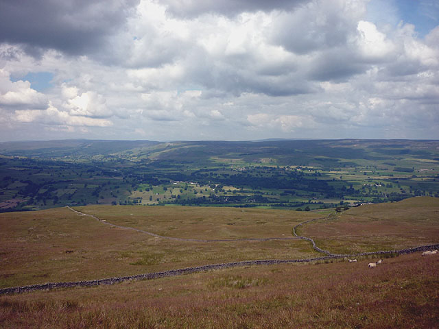
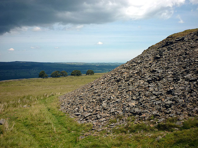
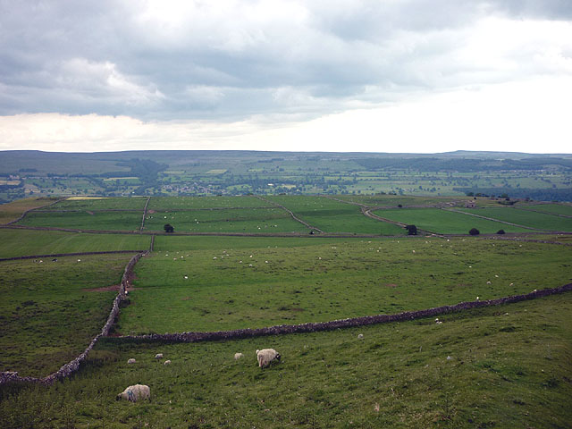
Covering an extensive area, Carlton Peat Moor is characterized by its vast open spaces, rolling hills, and heather-covered moorlands. The region's rich peat soil provides a unique habitat for a variety of plant species, including heather, bilberry, and cotton grass, creating a colorful tapestry that stretches as far as the eye can see.

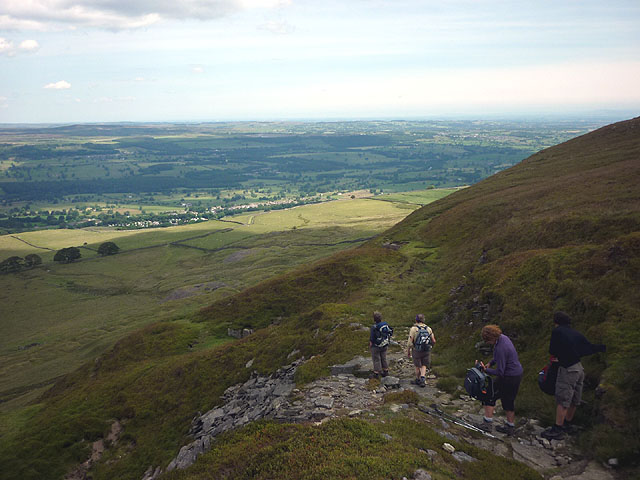
The moorland is also home to a plethora of wildlife, making it a haven for nature enthusiasts and birdwatchers. Visitors may spot a range of avian species, such as the curlew, lapwing, and red grouse, as well as birds of prey like the kestrel and buzzard. The moorland's tranquil atmosphere and stunning vistas make it an ideal location for hiking, cycling, and nature walks.

In addition to its natural wonders, Carlton Peat Moor has a rich cultural heritage. The region is dotted with ancient archaeological sites, including stone circles and burial mounds, which offer insight into the area's prehistoric past. The nearby villages of Carlton and Peatmoor provide visitors with a glimpse into traditional Yorkshire life, with charming cottages, quaint tea rooms, and a warm community spirit.

Overall, Carlton Peat Moor, with its captivating landscapes and rich biodiversity, serves as a remarkable destination for those seeking a peaceful retreat in the heart of Yorkshire's stunning countryside.

If you have any feedback on the listing, please let us know in the comments section below.

Carlton Peat Moor Images

Images are sourced within 2km of 54.26618/-1.9390591 or Grid Reference SE0485. Thanks to Geograph Open Source API. All images are credited.
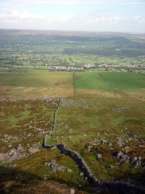
On Height of Hazely, Penhill Looking down over the junction of Wensleydale and Bishopdale. This is open access land but the route up from West Burton is complicated by new fences and blocked gateways.
On Height of Hazely, Penhill
Looking down over the junction of Wensleydale and Bishopdale. This is open access land but the route up from West Burton is complicated by new fences and blocked gateways.
Descending north off Penhill An engineered path descends to the east of Black Scar with views to the lower part of Wensleydale around West Witton and Leyburn.
Descending north off Penhill
An engineered path descends to the east of Black Scar with views to the lower part of Wensleydale around West Witton and Leyburn.
Spoil heap, Penhill Quarry (disused) There is a long line of tips below the north flank of Penhill. The rock is a kind of fine grained sandstone that splits into thin, evenly bedded flags probably once used for roofing and building.
Spoil heap, Penhill Quarry (disused)
There is a long line of tips below the north flank of Penhill. The rock is a kind of fine grained sandstone that splits into thin, evenly bedded flags probably once used for roofing and building.
Sheep on West Witton Moor above High Lane The path from Black Crags descends through an extensive complex of grazing pastures above lower Wensleydale.
Sheep on West Witton Moor above High Lane
The path from Black Crags descends through an extensive complex of grazing pastures above lower Wensleydale.
Boulder field, Penhill A jumble of gritstone boulders fallen from Penhill Scar. West Witton far below.
Boulder field, Penhill
A jumble of gritstone boulders fallen from Penhill Scar. West Witton far below.
Wall below Penhill Scar Threading through a jumble of gritstone boulders fallen from Penhill Scar. West Witton far below.
Wall below Penhill Scar
Threading through a jumble of gritstone boulders fallen from Penhill Scar. West Witton far below.
Thupton Gill Road On the way towards Cote Bridge
Thupton Gill Road
On the way towards Cote Bridge
Benchmarked gatepost beside track over Burton Moor Ordnance Survey cut mark benchmark described on the Bench Mark Database at <span class="nowrap"><a title="http://www.bench-marks.org.uk/bm44095" rel="nofollow ugc noopener" href="http://www.bench-marks.org.uk/bm44095">Link</a><img style="margin-left:2px;" alt="External link" title="External link - shift click to open in new window" src="https://s1.geograph.org.uk/img/external.png" width="10" height="10"/></span>
Benchmarked gatepost beside track over Burton Moor
Ordnance Survey cut mark benchmark described on the Bench Mark Database at LinkExternal link
Rushes on Harland Hill
Looking up Harland Hill
Dry stone wall beside track over Burton Moor There is an OS benchmark <a href="https://www.geograph.org.uk/photo/3064453">SE0385 : Benchmarked gatepost beside track over Burton Moor</a> on the gatepost
Dry stone wall beside track over Burton Moor
There is an OS benchmark SE0385 : Benchmarked gatepost beside track over Burton Moor on the gatepost
Height of Hazely [Carlton Moor] Parked after cattle grid on way to Melmerby. Walk back down road through red get sign Penhill. Penhill Beacon, trig then fallow wall until after second gate where headed south over flattish moorland. GPS used to locate summit. Cool Sunny and damp under foot.
Name: Height of Hazely [Carlton Moor]
Hill number: 3617
Height: 553m / 1814ft
Area: 35B: The Central Pennines
Class: Hu,5
Grid ref: SE 03744 85990
Summit feature: no feature
Drop: 124m
Col: 429m  SE021826
Height of Hazely [Carlton Moor]
Parked after cattle grid on way to Melmerby. Walk back down road through red get sign Penhill. Penhill Beacon, trig then fallow wall until after second gate where headed south over flattish moorland. GPS used to locate summit. Cool Sunny and damp under foot. Name: Height of Hazely [Carlton Moor] Hill number: 3617 Height: 553m / 1814ft Area: 35B: The Central Pennines Class: Hu,5 Grid ref: SE 03744 85990 Summit feature: no feature Drop: 124m Col: 429m SE021826
Penhill Trig Penhill trig point bagged on the way to Carlton Moor.
Penhill Trig
Penhill trig point bagged on the way to Carlton Moor.
Approaching Carlton Moor Walked up from Penhill Beacon and trig over this damp moorland to walk around the flat top of Height of Hazely (Carlton Moor).
Approaching Carlton Moor
Walked up from Penhill Beacon and trig over this damp moorland to walk around the flat top of Height of Hazely (Carlton Moor).
Penhill track This track goes to the top of Penhill.
Penhill track
This track goes to the top of Penhill.
Ramsgill Head Penhill track at Ramsgill Head.
Ramsgill Head
Penhill track at Ramsgill Head.
Penhill view Looking NE from above Black Scar.
Penhill view
Looking NE from above Black Scar.
Penhill Beacon
Penhill Beacon
Show me another place!

Carlton Peat Moor is located at Grid Ref: SE0485 (Lat: 54.26618, Lng: -1.9390591)

Division: North Riding

Administrative County: North Yorkshire

District: Richmondshire

Police Authority: North Yorkshire

What 3 Words

///budgeted.popped.things. Near Leyburn, North Yorkshire

Nearby Locations

Carlton Peat Moor

Related Wikis

Penhill

Penhill (526 metres (1,726 ft) high at the trig point, 553 metres (1,814 ft) at Height of Hazely) is a prominent hill, 5.5 miles (9 km) south west of Leyburn...

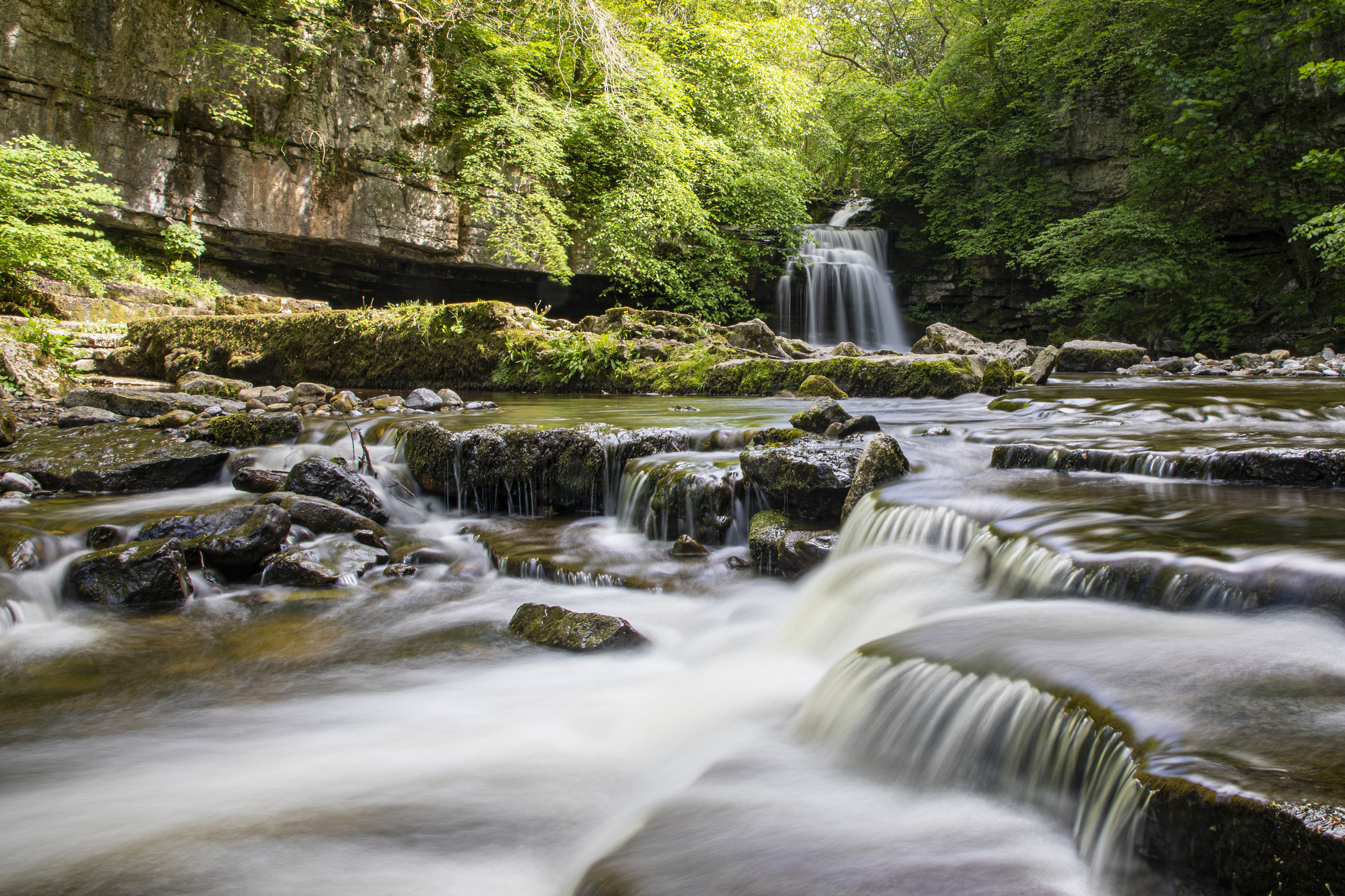
Cauldron Falls (North Yorkshire)

Cauldron Falls (also known as West Burton falls), is a series of waterfalls on Walden Beck in the village of West Burton, North Yorkshire, England. It...

West Burton, North Yorkshire

West Burton is a village in Bishopdale, a side valley of Wensleydale, in the Yorkshire Dales, North Yorkshire, England. It lies 6.2 miles (10 km) south...

Coverdale, North Yorkshire

Coverdale is a dale in the far east of the Yorkshire Dales, North Yorkshire, England. It takes its name from the River Cover, a tributary of the River...

Nearby Amenities

Located within 500m of 54.26618,-1.9390591
Height of Hazely
Ele: 550
Natural: peak
Lat/Long: 54.269597/-1.9436524
The data included in this document is from www.openstreetmap.org. The data is made available under ODbL.

Have you been to Carlton Peat Moor?

Leave your review of Carlton Peat Moor below (or comments, questions and feedback).