Carlton Moor

Downs, Moorland in Yorkshire Richmondshire

England

Carlton Moor

Benchmarked gatepost beside track over Burton Moor Ordnance Survey cut mark benchmark described on the Bench Mark Database at <span class="nowrap"><a title="http://www.bench-marks.org.uk/bm44095" rel="nofollow ugc noopener" href="http://www.bench-marks.org.uk/bm44095">Link</a><img style="margin-left:2px;" alt="External link" title="External link - shift click to open in new window" src="https://s1.geograph.org.uk/img/external.png" width="10" height="10"/></span>
Benchmarked gatepost beside track over Burton Moor Credit: Roger Templeman

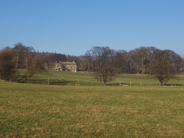
Carlton Moor is a picturesque area located in the county of Yorkshire, England. It is situated in the northern part of the North York Moors National Park, specifically in the Hambleton district. Known for its stunning natural beauty, Carlton Moor encompasses both downs and moorland landscapes.

The downs in Carlton Moor are characterized by rolling hills and expansive fields with fertile soils. These downs provide a perfect habitat for various plant species, including wildflowers and grasses, which create a vibrant and colorful scenery, especially during the spring and summer months. The area is also dotted with small patches of woodland, adding to its charm.

The moorland in Carlton Moor is a unique and rugged landscape, featuring vast stretches of open heather-covered hills and valleys. This type of terrain is a haven for wildlife, with several species of birds, such as the red grouse and curlew, making their homes here. Visitors to Carlton Moor can often spot these birds, as well as other wildlife such as rabbits and hares, roaming freely in their natural habitat.

The area is a popular destination for outdoor enthusiasts and nature lovers, offering a range of activities such as hiking, cycling, and birdwatching. There are well-maintained trails and paths that allow visitors to explore the beauty of Carlton Moor while taking in the breathtaking views of the surrounding countryside.

In summary, Carlton Moor in Yorkshire offers a captivating blend of downs and moorland landscapes, providing a haven for wildlife and an ideal destination for those seeking to immerse themselves in the beauty of nature.

If you have any feedback on the listing, please let us know in the comments section below.

Carlton Moor Images

Images are sourced within 2km of 54.250076/-1.9417838 or Grid Reference SE0383. Thanks to Geograph Open Source API. All images are credited.

Benchmarked gatepost beside track over Burton Moor Ordnance Survey cut mark benchmark described on the Bench Mark Database at <span class="nowrap"><a title="http://www.bench-marks.org.uk/bm44095" rel="nofollow ugc noopener" href="http://www.bench-marks.org.uk/bm44095">Link</a><img style="margin-left:2px;" alt="External link" title="External link - shift click to open in new window" src="https://s1.geograph.org.uk/img/external.png" width="10" height="10"/></span>
Benchmarked gatepost beside track over Burton Moor
Ordnance Survey cut mark benchmark described on the Bench Mark Database at LinkExternal link
Rushes on Harland Hill
Looking up Harland Hill
Dry stone wall beside track over Burton Moor There is an OS benchmark <a href="https://www.geograph.org.uk/photo/3064453">SE0385 : Benchmarked gatepost beside track over Burton Moor</a> on the gatepost
Dry stone wall beside track over Burton Moor
There is an OS benchmark SE0385 : Benchmarked gatepost beside track over Burton Moor on the gatepost
Track and broken wall to the north of Bleaberry Pots Looking westward.
Track and broken wall to the north of Bleaberry Pots
Looking westward.
Summit of track from West Burton to Carlton Looking north-eastward.
Summit of track from West Burton to Carlton
Looking north-eastward.
Path over moors with Howden Lodge in the trees ahead Looking south-eastward
Path over moors with Howden Lodge in the trees ahead
Looking south-eastward
Track and cattle grid at The Knowle Looking north-eastward.
Track and cattle grid at The Knowle
Looking north-eastward.
On North Tarn Hills No Tarn - not much of a hill either.  
This looks north along the line of the boundary wall towards Harland Hill
On North Tarn Hills
No Tarn - not much of a hill either. This looks north along the line of the boundary wall towards Harland Hill
Dry Stone Wall at the base of Harland Hill Below the southern flanks of Harland Hill
Dry Stone Wall at the base of Harland Hill
Below the southern flanks of Harland Hill
On the Summit of Harland Hill Following the boundary wall across the summit of Harland Hill - the Height of Hazely peeping above the scene in the distance.
On the Summit of Harland Hill
Following the boundary wall across the summit of Harland Hill - the Height of Hazely peeping above the scene in the distance.
Boundary Stone on Carlton Moor Passed on the bridleway between Carlton in Coverdale to West Burton in the valley called Walden.
Boundary Stone on Carlton Moor
Passed on the bridleway between Carlton in Coverdale to West Burton in the valley called Walden.
On the Northern Flanks of Harland Hill View from the flanks of Harland Hill towards the Height of Hazely
On the Northern Flanks of Harland Hill
View from the flanks of Harland Hill towards the Height of Hazely
Saddle between Harland Hill and Height of Hazely
Gate between Height of Hazely and Harland Hill This gate marks the highest point on the bridleway between Carlton in Coverdale and West Burton in the valley called Walden.
It is located on the saddle that separates Harland Hill from the Height of Hazely.
Gate between Height of Hazely and Harland Hill
This gate marks the highest point on the bridleway between Carlton in Coverdale and West Burton in the valley called Walden. It is located on the saddle that separates Harland Hill from the Height of Hazely.
Track on Carlton Moor Fine promenade through heather moors, accompanied by the odd grouse butt - heading towards Coverdale.
Track on Carlton Moor
Fine promenade through heather moors, accompanied by the odd grouse butt - heading towards Coverdale.
Howden Lodge Shooting Lodge with gothic style windows on the edge of Carlton Moor
Howden Lodge
Shooting Lodge with gothic style windows on the edge of Carlton Moor
Walled Track descending into Coverdale Part of the bridleway between Carlton in Coverdale and West Burton
Walled Track descending into Coverdale
Part of the bridleway between Carlton in Coverdale and West Burton
Show me another place!

Carlton Moor is located at Grid Ref: SE0383 (Lat: 54.250076, Lng: -1.9417838)

Division: North Riding

Administrative County: North Yorkshire

District: Richmondshire

Police Authority: North Yorkshire

What 3 Words

///warms.glow.hedgehog. Near Leyburn, North Yorkshire

Related Wikis

Gammersgill

Gammersgill is a hamlet in Coverdale in the Yorkshire Dales, North Yorkshire, England. It is about 7 miles (11 km) south-west of Leyburn. The toponym is...

Horsehouse

Horsehouse is a village in Coverdale in the Yorkshire Dales, North Yorkshire, England. It is listed as a hamlet in many texts, but the presence of the...

Coverdale, North Yorkshire

Coverdale is a dale in the far east of the Yorkshire Dales, North Yorkshire, England. It takes its name from the River Cover, a tributary of the River...

Burton-cum-Walden

Burton-cum-Walden is a civil parish in North Yorkshire, England, in the Yorkshire Dales National Park. It had a population of 303 according to the 2011...

Penhill

Penhill (526 metres (1,726 ft) high at the trig point, 553 metres (1,814 ft) at Height of Hazely) is a prominent hill, 5.5 miles (9 km) south west of Leyburn...

Walden, North Yorkshire

Walden is a dale and hamlet in the Yorkshire Dales, North Yorkshire, England. The dale is a side dale of Wensleydale, sometimes known as Waldendale or...

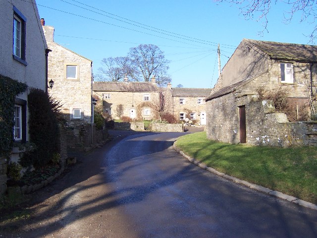
Carlton, Richmondshire

Carlton is a village in the civil parish of Carlton Town in the Richmondshire district of North Yorkshire, England. According to the 2011 Census it had...

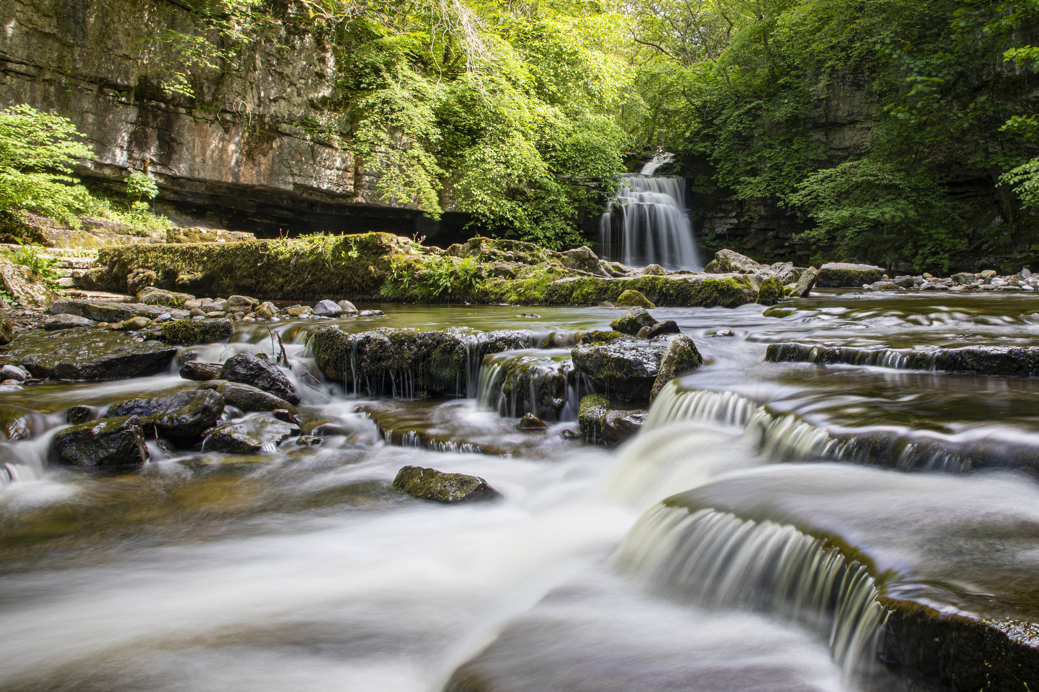
Cauldron Falls (North Yorkshire)

Cauldron Falls (also known as West Burton falls), is a series of waterfalls on Walden Beck in the village of West Burton, North Yorkshire, England. It...

Nearby Amenities

Located within 500m of 54.250076,-1.9417838
Carlton Moor
Natural: moor
Source: NPE
Lat/Long: 54.2537892/-1.9449554
Generator Method: wind_turbine
Generator Source: wind
Power: generator
Lat/Long: 54.2502372/-1.9376705
The data included in this document is from www.openstreetmap.org. The data is made available under ODbL.

Have you been to Carlton Moor?

Leave your review of Carlton Moor below (or comments, questions and feedback).