Burton Moor

Downs, Moorland in Yorkshire Richmondshire

England

Burton Moor

On Height of Hazely, Penhill Looking down over the junction of Wensleydale and Bishopdale. This is open access land but the route up from West Burton is complicated by new fences and blocked gateways.
On Height of Hazely, Penhill Credit: Karl and Ali

Burton Moor is a picturesque area situated in the county of Yorkshire, England. Nestled between the Yorkshire Downs and Moorland, it offers stunning natural beauty and a rich historical background. Covering a vast expanse of land, it is a haven for outdoor enthusiasts and nature lovers.

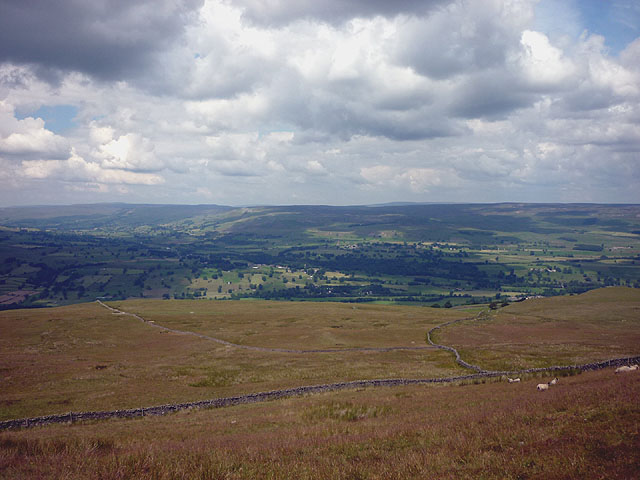
The moorland of Burton Moor is characterized by its rolling hills, heather-covered landscapes, and scattered woodland areas. It provides a habitat for a diverse range of flora and fauna, including rare bird species such as the curlew and golden plover. The area is also known for its bogs and peatlands, which add to its unique charm.

In addition to its natural wonders, Burton Moor boasts a fascinating history. Evidence of human activity can be traced back to prehistoric times, with ancient burial mounds and stone circles dotting the landscape. The area was also inhabited during the Roman era, as evidenced by the remnants of a Roman road that once crossed the moor.

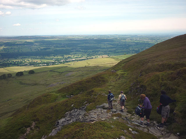
Visitors to Burton Moor can enjoy a variety of activities. Hiking and walking trails crisscross the moorland, offering panoramic views of the surrounding countryside. The area is also popular for birdwatching, with several designated viewpoints providing excellent opportunities for spotting rare species. For those interested in history, there are guided tours available that explore the ancient monuments and archaeological sites.

Overall, Burton Moor is a captivating destination that offers a combination of natural beauty and historical significance. Its tranquil moorland setting and abundance of wildlife make it a must-visit location for those seeking a peaceful retreat in the heart of Yorkshire.

If you have any feedback on the listing, please let us know in the comments section below.

Burton Moor Images

Images are sourced within 2km of 54.268425/-1.9572197 or Grid Reference SE0285. Thanks to Geograph Open Source API. All images are credited.

On Height of Hazely, Penhill Looking down over the junction of Wensleydale and Bishopdale. This is open access land but the route up from West Burton is complicated by new fences and blocked gateways.
On Height of Hazely, Penhill
Looking down over the junction of Wensleydale and Bishopdale. This is open access land but the route up from West Burton is complicated by new fences and blocked gateways.
Descending north off Penhill An engineered path descends to the east of Black Scar with views to the lower part of Wensleydale around West Witton and Leyburn.
Descending north off Penhill
An engineered path descends to the east of Black Scar with views to the lower part of Wensleydale around West Witton and Leyburn.
Climbing above West Burton It's a steep pull up the lower flanks of Penhill through several bands of limestone. Down below is West Burton and the valley of Bishopdale extending away beyond. The flat-topped hill on the right is Addlebrough.
Climbing above West Burton
It's a steep pull up the lower flanks of Penhill through several bands of limestone. Down below is West Burton and the valley of Bishopdale extending away beyond. The flat-topped hill on the right is Addlebrough.
Waterfall at West Burton
The Walden Beck Burton Bridge in West Burton.
The Walden Beck
Burton Bridge in West Burton.
Fox & Hounds
Fox & Hounds
West Burton from Town Head
Footpath towards Barrack Wood
Footpath in Barrack Wood
Morpeth Gate
Morpeth Gate
The Cross and stocks
Sheep pasture and Barrack Wood
Benchmark on Burton Bridge over Walden Beck The old benchmark, to the left of the 'Y', is described on the Bench Mark Database at <span class="nowrap"><a title="http://www.bench-marks.org.uk/bm43764" rel="nofollow ugc noopener" href="http://www.bench-marks.org.uk/bm43764">Link</a><img style="margin-left:2px;" alt="External link" title="External link - shift click to open in new window" src="https://s1.geograph.org.uk/img/external.png" width="10" height="10"/></span>
Benchmark on Burton Bridge over Walden Beck
The old benchmark, to the left of the 'Y', is described on the Bench Mark Database at LinkExternal link
Walden Beck over the north parapet of Burton Bridge The remnants of an old OS benchmark <a href="https://www.geograph.org.uk/photo/3027144">SE0187 : Benchmark on Burton Bridge over Walden Beck</a> can be seen to the left of the 'Y' of the Yorkshire North Riding emblem.
Walden Beck over the north parapet of Burton Bridge
The remnants of an old OS benchmark SE0187 : Benchmark on Burton Bridge over Walden Beck can be seen to the left of the 'Y' of the Yorkshire North Riding emblem.
Benchmark on barn near 'Howraine' Ordnance Survey cut mark benchmark described on the Bench Mark Database at <span class="nowrap"><a title="http://www.bench-marks.org.uk/bm43765" rel="nofollow ugc noopener" href="http://www.bench-marks.org.uk/bm43765">Link</a><img style="margin-left:2px;" alt="External link" title="External link - shift click to open in new window" src="https://s1.geograph.org.uk/img/external.png" width="10" height="10"/></span>
Benchmark on barn near 'Howraine'
Ordnance Survey cut mark benchmark described on the Bench Mark Database at LinkExternal link
Small barn on north side of Morpeth Gate There is an OS benchmark <a href="https://www.geograph.org.uk/photo/3027201">SE0287 : Benchmark on barn near 'Howraine'</a> on the road face of the barn
Small barn on north side of Morpeth Gate
There is an OS benchmark SE0287 : Benchmark on barn near 'Howraine' on the road face of the barn
Behind the waterfall at West Burton Due to the overhanging limestone strata it is possible to get right behind the fall.
Behind the waterfall at West Burton
Due to the overhanging limestone strata it is possible to get right behind the fall.
Hudson Quarry Lane There are excellent views of lower Wensleydale to be had from this walled track which runs across the mid-flanks of Penhill (but sadly not for us today!).
Hudson Quarry Lane
There are excellent views of lower Wensleydale to be had from this walled track which runs across the mid-flanks of Penhill (but sadly not for us today!).
Show me another place!

Burton Moor is located at Grid Ref: SE0285 (Lat: 54.268425, Lng: -1.9572197)

Division: North Riding

Administrative County: North Yorkshire

District: Richmondshire

Police Authority: North Yorkshire

What 3 Words

///purifier.legwork.trespass. Near Leyburn, North Yorkshire

Nearby Locations

Burton Moor Long Ing Wood

Related Wikis

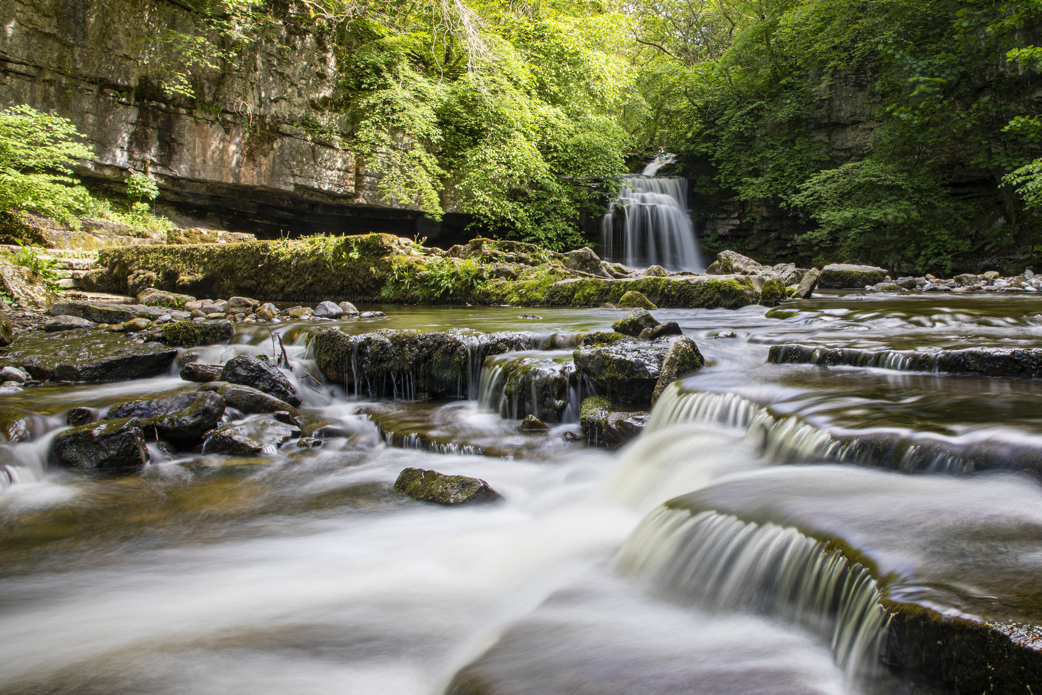
Cauldron Falls (North Yorkshire)

Cauldron Falls (also known as West Burton falls), is a series of waterfalls on Walden Beck in the village of West Burton, North Yorkshire, England. It...

West Burton, North Yorkshire

West Burton is a village in Bishopdale, a side valley of Wensleydale, in the Yorkshire Dales, North Yorkshire, England. It lies 6.2 miles (10 km) south...

Penhill

Penhill (526 metres (1,726 ft) high at the trig point, 553 metres (1,814 ft) at Height of Hazely) is a prominent hill, 5.5 miles (9 km) south west of Leyburn...

Burton-cum-Walden

Burton-cum-Walden is a civil parish in North Yorkshire, England, in the Yorkshire Dales National Park. It had a population of 303 according to the 2011...

Thoralby

Thoralby is a village and civil parish in the Richmondshire district of North Yorkshire, England. It lies south of Aysgarth, is within a mile of both Newbiggin...

Penhill Preceptory

Penhill Preceptory was a priory on the northern flanks of Penhill in Wensleydale, North Yorkshire, England, which functioned from about 1142 to 1308–12...

Newbiggin, south Wensleydale

Newbiggin is a village and civil parish in Bishopdale, a side dale on the south side of Wensleydale, in the Yorkshire Dales in North Yorkshire, England...

St Andrew's Church, Aysgarth

St Andrew's Church, Aysgarth, is a Grade II* listed parish church in the Church of England: 66  in Aysgarth, North Yorkshire. It is located on the south...

Nearby Amenities

Located within 500m of 54.268425,-1.9572197
Archaeological Site: settlement
Historic: archaeological_site
Source: gps
Lat/Long: 54.2699671/-1.9539831
foundations
Historic: archaeological_site
Source: OS 1:25k
Lat/Long: 54.265276/-1.9549137
The data included in this document is from www.openstreetmap.org. The data is made available under ODbL.

Have you been to Burton Moor?

Leave your review of Burton Moor below (or comments, questions and feedback).