Braidley Moor

Downs, Moorland in Yorkshire Richmondshire

England

Braidley Moor

Ford and Footbridge at Braidley This ford is found on the River Cover at Braidley.
Ford and Footbridge at Braidley Credit: John Walton

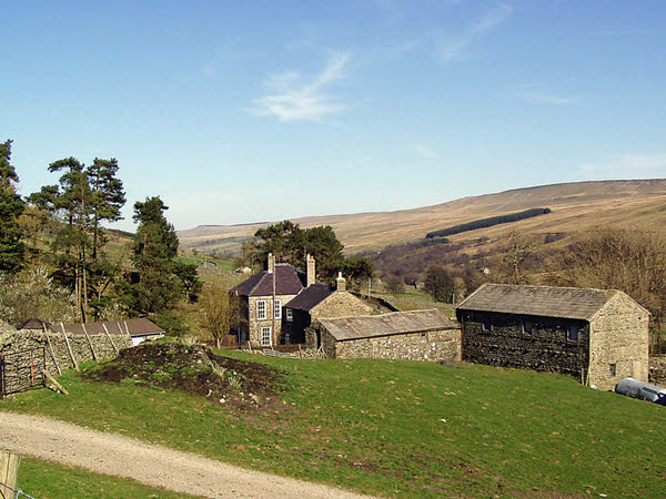
Braidley Moor is a picturesque area located in the county of Yorkshire, England. Situated within the Yorkshire Dales National Park, it is renowned for its stunning natural beauty, characterized by rolling hills, expansive moorland, and breathtaking views.

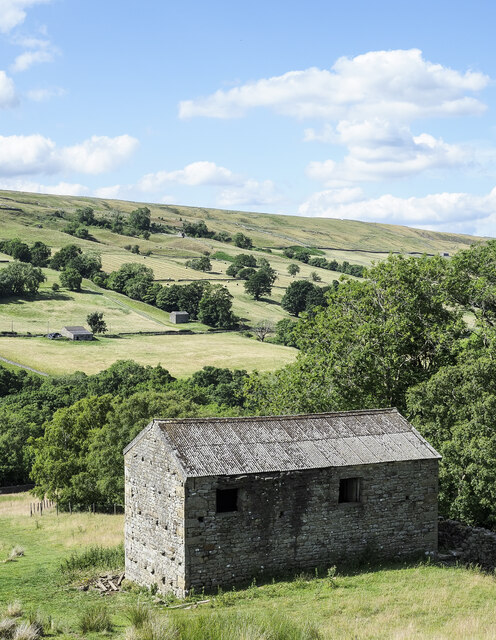
Covering an area of approximately 10 square kilometers, Braidley Moor is known for its unique landscape, which combines open grasslands, heather-covered moors, and scattered limestone outcrops. The area is rich in wildlife, offering a diverse range of habitats for various species. Visitors can often spot birds of prey such as kestrels and buzzards soaring above, while curlews and lapwings can be seen nesting on the moorland.

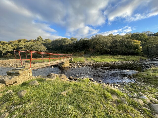
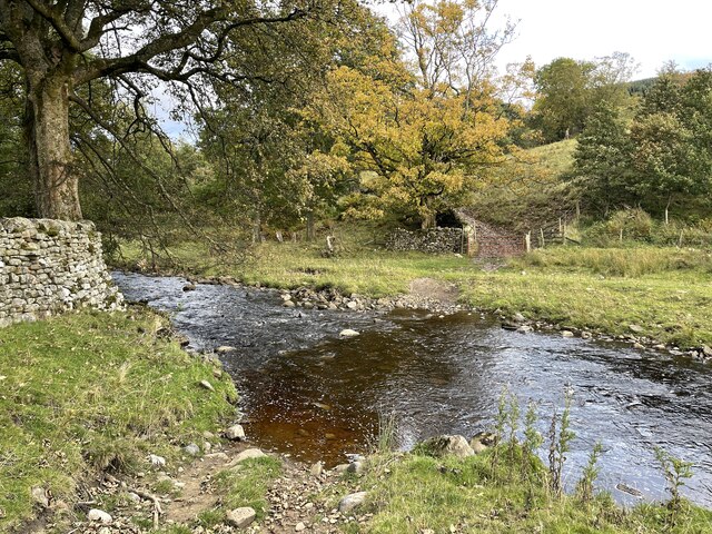
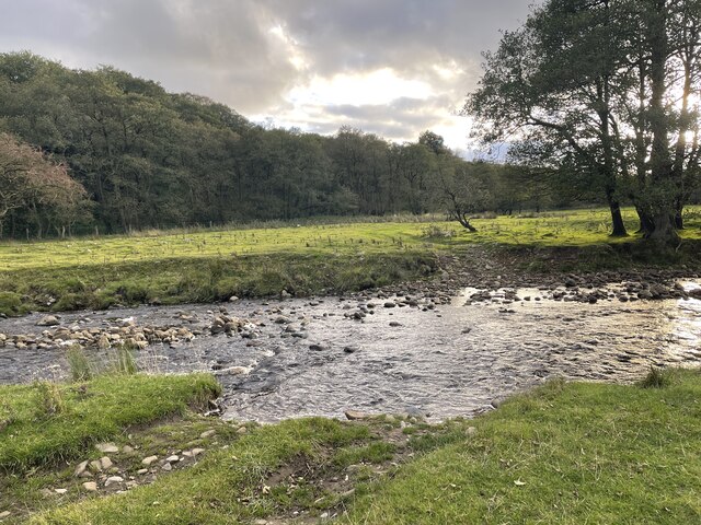
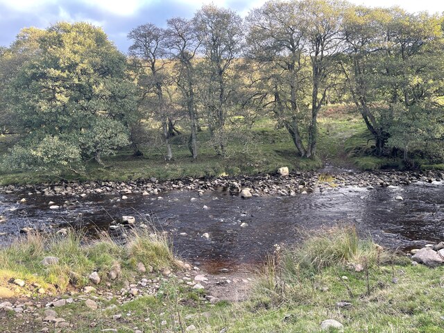
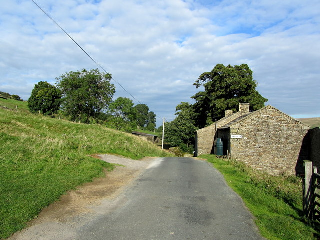
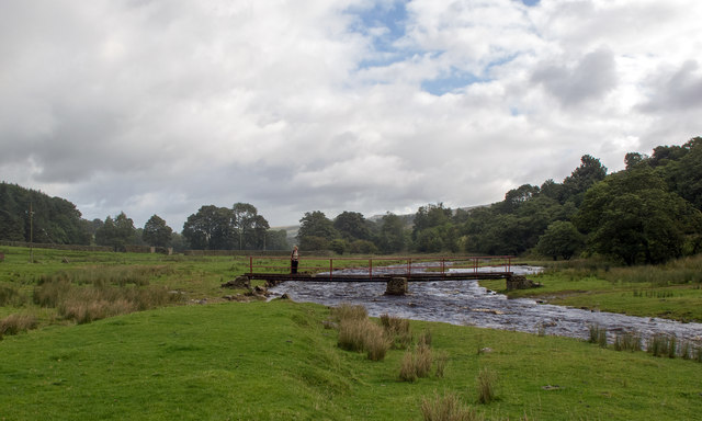
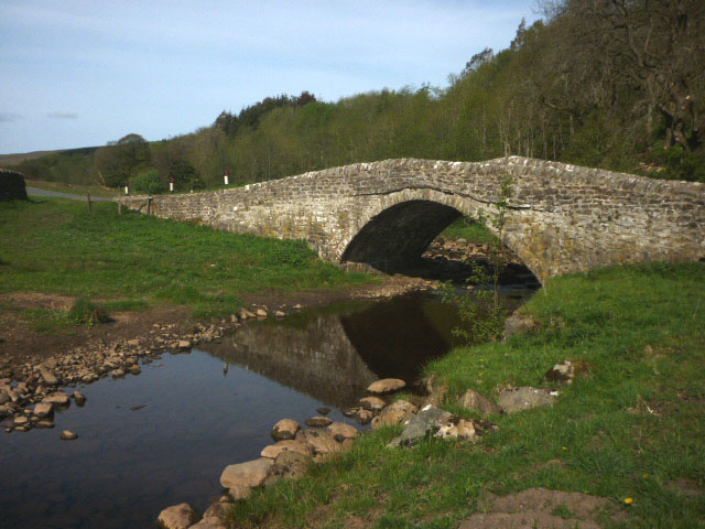
The moorland is intersected by several walking trails, making it a popular destination for hikers and nature enthusiasts. One of the highlights is the Braidley Beck, a charming stream that meanders through the moor, creating a peaceful atmosphere. The area is also home to a number of sheep farms, contributing to the rural and agricultural character of the surroundings.

Braidley Moor offers visitors a chance to escape the hustle and bustle of urban life and immerse themselves in the tranquility of nature. It is a place where one can enjoy long walks, experience stunning sunsets, and appreciate the unspoiled beauty of the Yorkshire countryside. Whether it is for a leisurely stroll, a family picnic, or wildlife spotting, Braidley Moor is a destination that captivates all who visit.

If you have any feedback on the listing, please let us know in the comments section below.

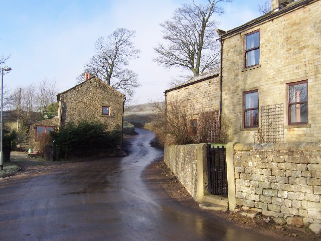
Braidley Moor Images

Images are sourced within 2km of 54.220482/-1.9703815 or Grid Reference SE0280. Thanks to Geograph Open Source API. All images are credited.

Ford and Footbridge at Braidley This ford is found on the River Cover at Braidley.
Ford and Footbridge at Braidley
This ford is found on the River Cover at Braidley.
Ford on the River Cover This is a second ford on the River Cover at Braidley.
Ford on the River Cover
This is a second ford on the River Cover at Braidley.
River Cover Ford A third ford on the River Cover at this location.
River Cover Ford
A third ford on the River Cover at this location.
River Cover Ford This is another of the series of fords on the River Cover at this location.
River Cover Ford
This is another of the series of fords on the River Cover at this location.
River Cover Ford This is the final ford at this stretch of the River Cover.
River Cover Ford
This is the final ford at this stretch of the River Cover.
Sun and mist in Coverdale A similar view to one taken almost 3 years previously, but on this occasion the late November sun contrasted with lengthening shadows and mist that was creeping over the fell tops from Nidderdale.
Sun and mist in Coverdale
A similar view to one taken almost 3 years previously, but on this occasion the late November sun contrasted with lengthening shadows and mist that was creeping over the fell tops from Nidderdale.
Mist creeping into the dale The view up Coverdale towards Woodale on a late autumn afternoon when mist was creeping in over the felltops to eventually fill the valley.
Mist creeping into the dale
The view up Coverdale towards Woodale on a late autumn afternoon when mist was creeping in over the felltops to eventually fill the valley.
Large barn beside Harkera Gill The barn appears to be in good repair. Harkera Gill flows unseen within the trees as it descends to join the River Cover.
Large barn beside Harkera Gill
The barn appears to be in good repair. Harkera Gill flows unseen within the trees as it descends to join the River Cover.
Cover Bridge There are two stone bridges bearing this name, this one at the head of Coverdale and another at the foot where the A6108 crosses the river by the Cover Bridge Inn.
Cover Bridge
There are two stone bridges bearing this name, this one at the head of Coverdale and another at the foot where the A6108 crosses the river by the Cover Bridge Inn.
Lodge Dale Lathe Stone barn to be found on the narrow road between the tiny communities of Woodale and Braidley, in the secluded valley of Coverdale.
Lodge Dale Lathe
Stone barn to be found on the narrow road between the tiny communities of Woodale and Braidley, in the secluded valley of Coverdale.
Pastures near Woodale Following a footpath that runs down from Woodale, to loosely follow the north bank of the River Cover.
Pastures near Woodale
Following a footpath that runs down from Woodale, to loosely follow the north bank of the River Cover.
Stone Barn in Coverdale A faint grass footpath leads passed this stone barn in the secluded valley of Coverdale.
Stone Barn in Coverdale
A faint grass footpath leads passed this stone barn in the secluded valley of Coverdale.
Gate on Cow Side Retrospective view over Coverdale, while ascending Little Whernside from the north - a feat not recommended due to the thickness of vegetation that saps the strength from all but the fittest legs.
Gate on Cow Side
Retrospective view over Coverdale, while ascending Little Whernside from the north - a feat not recommended due to the thickness of vegetation that saps the strength from all but the fittest legs.
View towards High Pasture Fellside moorland dominates, looking down towards Coverdale.
View towards High Pasture
Fellside moorland dominates, looking down towards Coverdale.
Approaching Braidley This quiet road that runs the length of Coverdale, seen here approaching the hamlet of Braidley
Approaching Braidley
This quiet road that runs the length of Coverdale, seen here approaching the hamlet of Braidley
Woodale seen from the top of Little Whernside Looking down towards Woodale from the top of Little Whernside.
Woodale seen from the top of Little Whernside
Looking down towards Woodale from the top of Little Whernside.
River Cover footbridge at Braidley This footbridge is not shown on my OS map which denotes a ford crossing the River Cover. The public footpath between Woodale and Arkleside passes along the north bank of the river and gives access to the small village of Braidley.
River Cover footbridge at Braidley
This footbridge is not shown on my OS map which denotes a ford crossing the River Cover. The public footpath between Woodale and Arkleside passes along the north bank of the river and gives access to the small village of Braidley.
Cover Bridge Carrying the Cam Gill Road over the River Cover.
Cover Bridge
Carrying the Cam Gill Road over the River Cover.
Show me another place!

Braidley Moor is located at Grid Ref: SE0280 (Lat: 54.220482, Lng: -1.9703815)

Division: North Riding

Administrative County: North Yorkshire

District: Richmondshire

Police Authority: North Yorkshire

What 3 Words

///respected.sandwich.this. Near Leyburn, North Yorkshire

Related Wikis

Carlton Highdale

Carlton Highdale is a civil parish in Coverdale, North Yorkshire, England. According to the 2001 census it had a population of 95. The parish covers the...

Woodale

Woodale is a hamlet in Coverdale in the Yorkshire Dales in England. It lies in the civil parish of Carlton Highdale in the Richmondshire district of North...

Braidley

Braidley is a hamlet in Coverdale in the Yorkshire Dales, England. It lies in the civil parish of Carlton Highdale in the Richmondshire district of North...

Walden, North Yorkshire

Walden is a dale and hamlet in the Yorkshire Dales, North Yorkshire, England. The dale is a side dale of Wensleydale, sometimes known as Waldendale or...

Little Whernside

Little Whernside is a hill in the Yorkshire Dales, North Yorkshire, England, 2.82 miles (4.54 km) north east of Great Whernside. It is on the boundary...

Horsehouse

Horsehouse is a village in Coverdale in the Yorkshire Dales, North Yorkshire, England. It is listed as a hamlet in many texts, but the presence of the...

Burton-cum-Walden

Burton-cum-Walden is a civil parish in North Yorkshire, England, in the Yorkshire Dales National Park. It had a population of 303 according to the 2011...

Walden Head

Walden Head is a hamlet in the Yorkshire Dales, North Yorkshire. It lies 5 miles (8 km) of Aysgarth and to the north is a similar village Walden. The village...

Have you been to Braidley Moor?

Leave your review of Braidley Moor below (or comments, questions and feedback).