Arnfield Low Moor

Downs, Moorland in Cheshire High Peak

England

Arnfield Low Moor

Swineshaw Reservoirs Taken from the four Myriads SD, SE, SJ and SK intersection looking over to the south east into the rest of SK.
Swineshaw Reservoirs Credit: Andy Beecroft

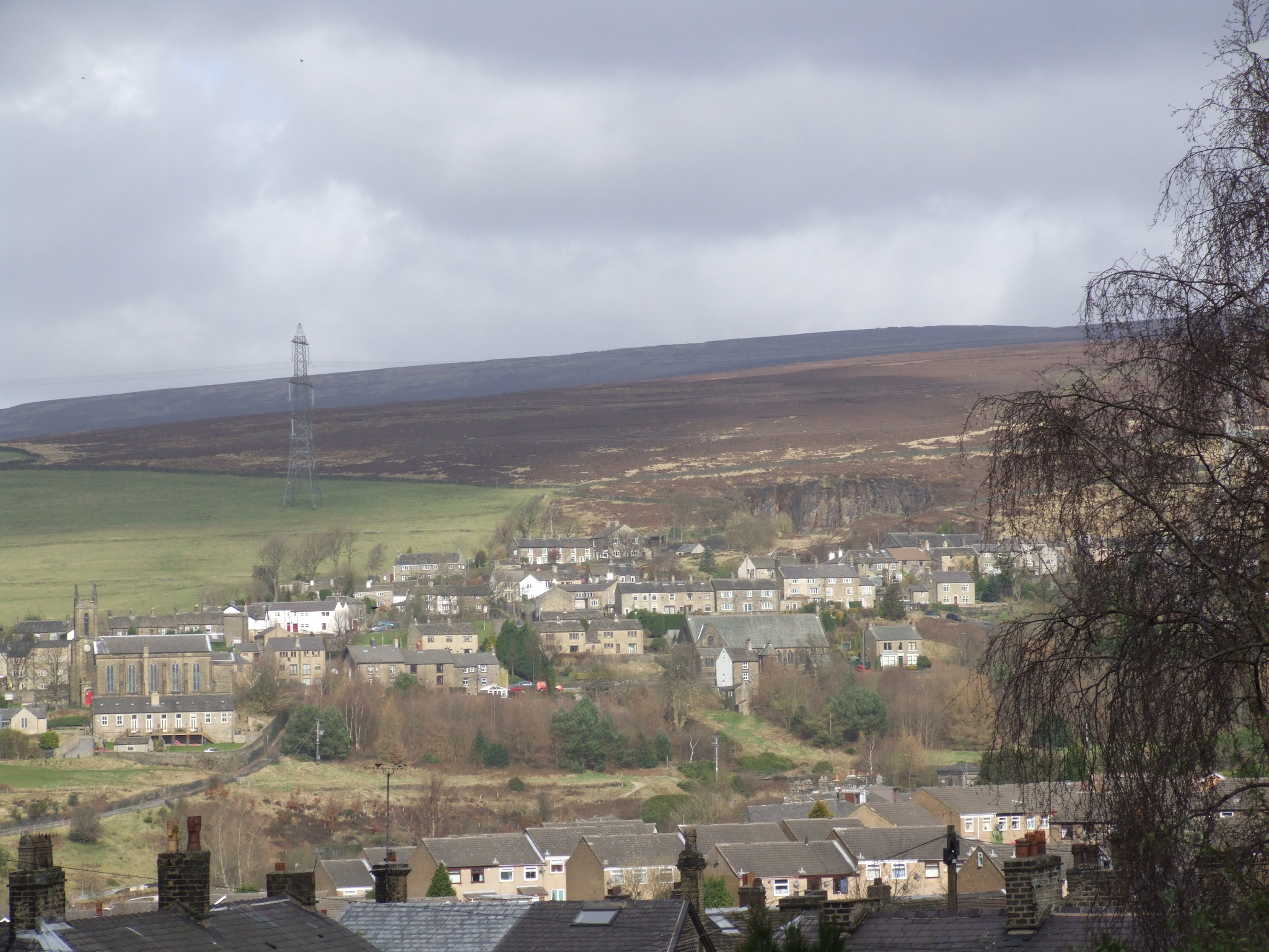
Arnfield Low Moor is a picturesque area located in Cheshire, England. Situated in the Peak District National Park, it offers a stunning combination of rolling hills, vast moorland, and captivating natural beauty. Covering an area of approximately 7 square kilometers, Arnfield Low Moor is known for its scenic landscapes and diverse wildlife.

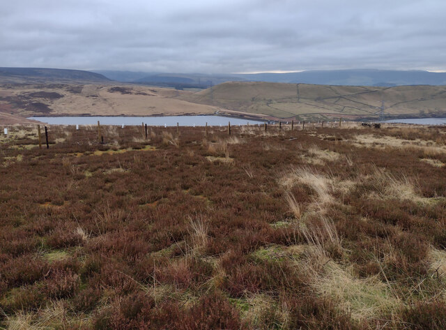
The moorland in Arnfield Low Moor is characterized by its heather-covered expanses, providing a rich habitat for a variety of bird species, including curlews, lapwings, and golden plovers. This makes it a popular destination for birdwatchers and nature enthusiasts. The area also boasts an array of wildflowers, adding bursts of color to the otherwise rugged landscape.

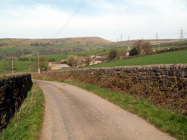
The terrain of Arnfield Low Moor is undulating and is intersected by several small streams and rivers. The area is crisscrossed with public footpaths and trails, allowing visitors to explore the moorland and enjoy the breathtaking views. The nearby Arnfield Reservoir offers opportunities for fishing and boating, while the surrounding woodlands provide a peaceful setting for leisurely walks.

Historically, Arnfield Low Moor was used for grazing sheep and cattle, and remnants of old stone walls can still be seen in some areas. The moorland has also played a part in the industrial history of the region, with evidence of lead mining and quarrying activities.

Overall, Arnfield Low Moor is a captivating destination that offers a tranquil escape from the hustle and bustle of modern life. With its stunning natural landscapes and abundant wildlife, it is a place of beauty and serenity, attracting visitors from far and wide.

If you have any feedback on the listing, please let us know in the comments section below.

Arnfield Low Moor Images

Images are sourced within 2km of 53.484888/-1.9732879 or Grid Reference SK0198. Thanks to Geograph Open Source API. All images are credited.

Swineshaw Reservoirs Taken from the four Myriads SD, SE, SJ and SK intersection looking over to the south east into the rest of SK.
Swineshaw Reservoirs
Taken from the four Myriads SD, SE, SJ and SK intersection looking over to the south east into the rest of SK.
Post Box in Tintwistle SK13 173. Royal Mail list this box as 'New Road DD'.
Post Box in Tintwistle
SK13 173. Royal Mail list this box as 'New Road DD'.
Horse field Several horses in field adjacent to Crossgates farm.
Horse field
Several horses in field adjacent to Crossgates farm.
Farm sale Several items in today's farm sale.
Farm sale
Several items in today's farm sale.
Farm sale field Looking across the sale field with the crowd bidding for the next item to be sold.
Farm sale field
Looking across the sale field with the crowd bidding for the next item to be sold.
Allotments over the hedge Several local allotments.
Allotments over the hedge
Several local allotments.
Old wall An unusual wall together with the air shaft top, this is difficult to spot for the bushes and overgrowth surrounding it.
Old wall
An unusual wall together with the air shaft top, this is difficult to spot for the bushes and overgrowth surrounding it.
Crossgates Farm This farm is now an equestrian centre and camp site, the tables are for the adjacent cafe.
Crossgates Farm
This farm is now an equestrian centre and camp site, the tables are for the adjacent cafe.
Resident Peahen The farm Peahen after scraps of food.
Resident Peahen
The farm Peahen after scraps of food.
Lane and Reservoir The lane leading up to Crossgates, Arnfield reservoir can be seen through the trees.
Lane and Reservoir
The lane leading up to Crossgates, Arnfield reservoir can be seen through the trees.
Petting Goats Goats for visitors to pet.
Petting Goats
Goats for visitors to pet.
Arnfield Reservoir Fishing boats tied to the pier at Arnfield reservoir.
Arnfield Reservoir
Fishing boats tied to the pier at Arnfield reservoir.
Water Treatment at Arnfield Reservoir Water treatment plant at Arnfield reservoir, Tintwistle
Water Treatment at Arnfield Reservoir
Water treatment plant at Arnfield reservoir, Tintwistle
Green algae on Arnfield Reservoir Boats moored on the pier at Arnfield. Lots of algae on the surface.
Green algae on Arnfield Reservoir
Boats moored on the pier at Arnfield. Lots of algae on the surface.
Tintwistle, pavement A welcome, albeit short-lived, relief from walking along the kerb of A628.
Tintwistle, pavement
A welcome, albeit short-lived, relief from walking along the kerb of A628.
Lees Hill Footpath along the side of Lees Hill.
Lees Hill
Footpath along the side of Lees Hill.
Quarry Quarry near Lower Swineshaw Reservoir.
Quarry
Quarry near Lower Swineshaw Reservoir.
Lees Hill Looking across Swineshaw Reservoir to field boundaries on Lees Hill.
Lees Hill
Looking across Swineshaw Reservoir to field boundaries on Lees Hill.
Show me another place!

Arnfield Low Moor is located at Grid Ref: SK0198 (Lat: 53.484888, Lng: -1.9732879)

Administrative County: Derbyshire

District: High Peak

Police Authority: Derbyshire

What 3 Words

///harps.cavalier.drawn. Near Hollingworth, Manchester

Nearby Locations

Arnfield Low Moor

Related Wikis

Nearby Amenities

Located within 500m of 53.484888,-1.9732879
Barrier: stile
Lat/Long: 53.4847623/-1.9776966
Barrier: stile
Lat/Long: 53.4837067/-1.9778353
Design: barrel
Power: tower
Lat/Long: 53.4844642/-1.9775993
Design: barrel
Power: tower
Lat/Long: 53.4813262/-1.9747686
Barrier: stile
Lat/Long: 53.4865694/-1.9763167
Barrier: stile
Lat/Long: 53.4822/-1.973091
Design: barrel
Power: tower
Lat/Long: 53.482765/-1.9758207
The data included in this document is from www.openstreetmap.org. The data is made available under ODbL.

Have you been to Arnfield Low Moor?

Leave your review of Arnfield Low Moor below (or comments, questions and feedback).