Buckstones Moss

Downs, Moorland in Yorkshire

England

Buckstones Moss

Not so old Boundary Marker beside the Pennine Way County Boundary Marker beside the Pennine Way between the A640 and White Hill. Saddleworth parish. Erected by the Friends of the Real Lancashire, one of four marking the former boundaries of the counties. See also <a title="https://www.geograph.org.uk/photo/5159487" href="https://www.geograph.org.uk/photo/5159487">Link</a> , <a title="https://www.geograph.org.uk/photo/7172751" href="https://www.geograph.org.uk/photo/7172751">Link</a> and <a title="https://www.geograph.org.uk/photo/7668008" href="https://www.geograph.org.uk/photo/7668008">Link</a>.

Milestone Society National ID: LA_SADD01cb
Not so old Boundary Marker beside the Pennine Way Credit: T Wall

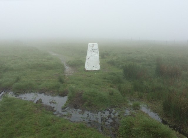
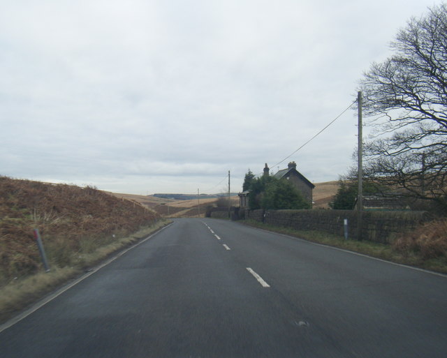
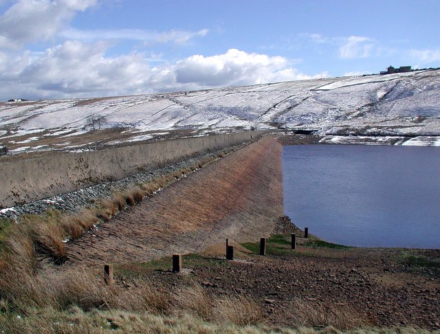
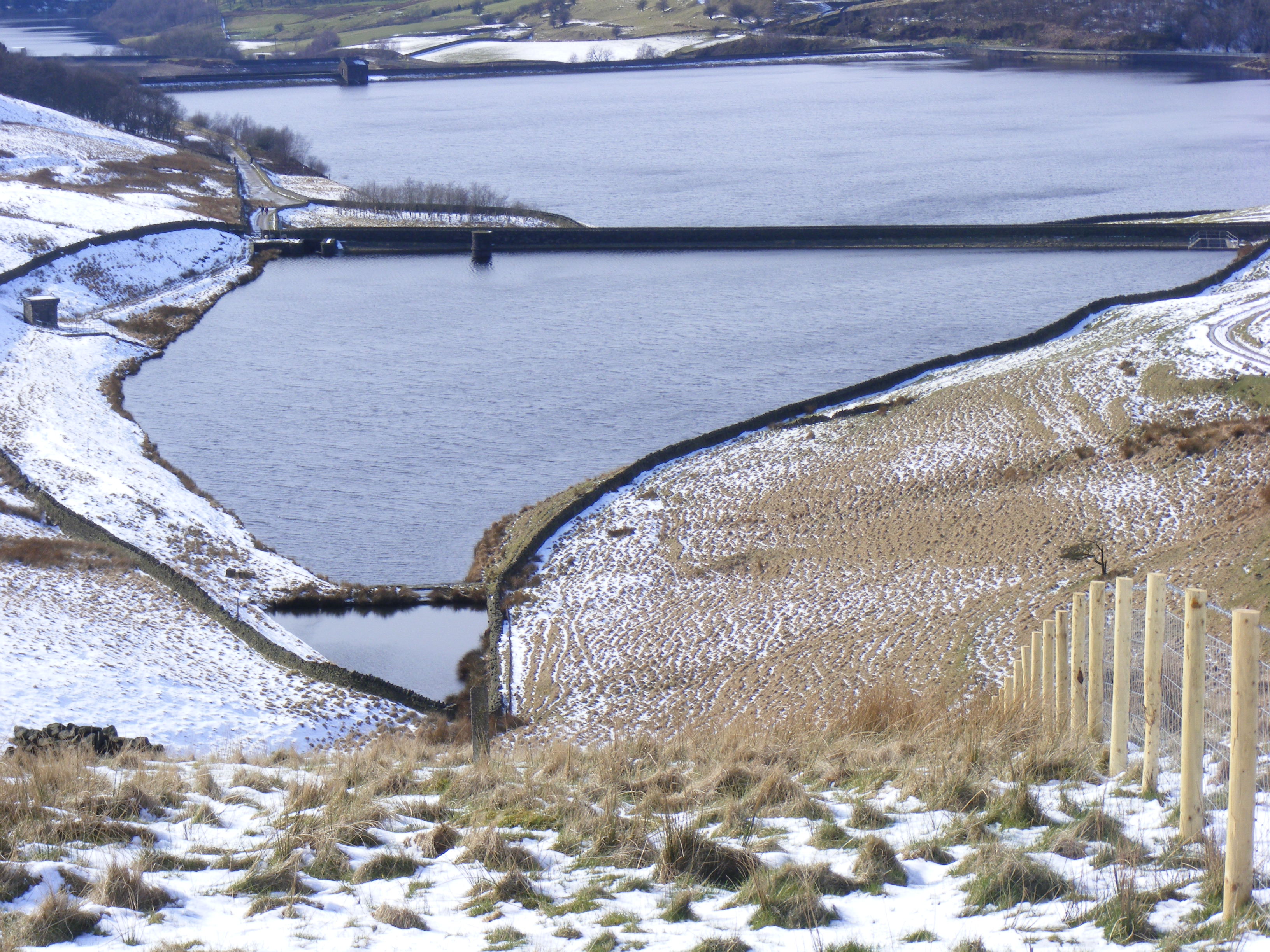
Buckstones Moss is a picturesque area located in Yorkshire, England. Nestled within the rolling Yorkshire Downs and expansive moorland, it offers a unique blend of natural beauty and tranquility. The moss itself is a sprawling expanse of wetland, characterized by its boggy terrain and an abundance of mosses, heathers, and grasses.

The area is a haven for wildlife enthusiasts and nature lovers. It is home to a diverse range of flora and fauna, including various species of birds, insects, and small mammals. Rare plants, such as the carnivorous sundew, can also be found in this pristine habitat.

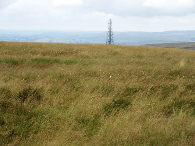
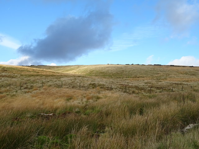
The landscape of Buckstones Moss is a sight to behold. Its undulating hills, covered in vibrant purple heather during the summer months, provide a stunning backdrop against the vast expanse of moorland. The moss itself is dotted with small pools of water, giving it a serene and ethereal feel.

Visitors to Buckstones Moss can enjoy a range of outdoor activities. Walking and hiking trails crisscross the area, offering breathtaking views and the opportunity to explore the diverse ecosystem up close. Birdwatching is also a popular pastime, with bird hides strategically placed to observe the various avian residents.

The tranquil atmosphere and unspoiled beauty of Buckstones Moss make it an ideal destination for those seeking solace in nature. With its rich biodiversity and stunning scenery, this Yorkshire gem is a must-visit for anyone looking to immerse themselves in the wonders of the natural world.

If you have any feedback on the listing, please let us know in the comments section below.

Buckstones Moss Images

Images are sourced within 2km of 53.62092/-1.9906947 or Grid Reference SE0013. Thanks to Geograph Open Source API. All images are credited.

Not so old Boundary Marker beside the Pennine Way County Boundary Marker beside the Pennine Way between the A640 and White Hill. Saddleworth parish. Erected by the Friends of the Real Lancashire, one of four marking the former boundaries of the counties. See also <a title="https://www.geograph.org.uk/photo/5159487" href="https://www.geograph.org.uk/photo/5159487">Link</a> , <a title="https://www.geograph.org.uk/photo/7172751" href="https://www.geograph.org.uk/photo/7172751">Link</a> and <a title="https://www.geograph.org.uk/photo/7668008" href="https://www.geograph.org.uk/photo/7668008">Link</a>.

Milestone Society National ID: LA_SADD01cb
Not so old Boundary Marker beside the Pennine Way
County Boundary Marker beside the Pennine Way between the A640 and White Hill. Saddleworth parish. Erected by the Friends of the Real Lancashire, one of four marking the former boundaries of the counties. See also Link , Link and Link. Milestone Society National ID: LA_SADD01cb
Track to Readycon Reservoir
Moorland by the A640 Haigh Gutter goes off to the left. Little Moss is in the centre of the picture.
Moorland by the A640
Haigh Gutter goes off to the left. Little Moss is in the centre of the picture.
A welcome sight The trig pillar on White Hill (1530'/466m) looms out of the mist.
A welcome sight
The trig pillar on White Hill (1530'/466m) looms out of the mist.
Ruined wall, fence and tower of stones, Rape Hill
Linsgreave Head
Linsgreave Head
The most easterly point of Lancashire, Milnrow This has been erected by The Friends of Real Lancashire, and is the last of a series of posts on each of the four extremities of the historic county. Actually the point is a little further east, but the post has been sited next to the Pennine Way where it can be seen by all who pass by. There is a 'dog-stile' on the right.

See <span class="nowrap"><a title="http://abcounties.com/documents/2015/03/forl-press-release-18-march-2015.pdf" rel="nofollow ugc noopener" href="http://abcounties.com/documents/2015/03/forl-press-release-18-march-2015.pdf">Link</a><img style="margin-left:2px;" alt="External link" title="External link - shift click to open in new window" src="https://s1.geograph.org.uk/img/external.png" width="10" height="10"/></span>
The most easterly point of Lancashire, Milnrow
This has been erected by The Friends of Real Lancashire, and is the last of a series of posts on each of the four extremities of the historic county. Actually the point is a little further east, but the post has been sited next to the Pennine Way where it can be seen by all who pass by. There is a 'dog-stile' on the right. See LinkExternal link
The Pennine Way approaching a stile, Milnrow The post shown in <a href="https://www.geograph.org.uk/photo/5159487">SD9912 : The most easterly point of Lancashire, Milnrow</a> is to the left of the path, and there is a sign indicating that you are entering Marsden Moor (National Trust). There is a dog-stile to the left of the normal stile.
The Pennine Way approaching a stile, Milnrow
The post shown in SD9912 : The most easterly point of Lancashire, Milnrow is to the left of the path, and there is a sign indicating that you are entering Marsden Moor (National Trust). There is a dog-stile to the left of the normal stile.
Rainbow on White Hassock It was fine and sunny in Yorkshire, whilst Lancashire was covered by dark clouds and rain. However the sun found a gap and produced this rainbow, caused by rain that had drifted over the county boundary, The crock of gold is under two metres of peat.
Rainbow on White Hassock
It was fine and sunny in Yorkshire, whilst Lancashire was covered by dark clouds and rain. However the sun found a gap and produced this rainbow, caused by rain that had drifted over the county boundary, The crock of gold is under two metres of peat.
The Pennine Way approaching a small valley, Saddleworth
The Pennine Way crossing a small valley, Saddleworth The old public footpath is a little way upstream, and the caption 'fords' appears on OS maps. The Pennine Way is evidently on a better route, and crosses two streams by stone slab bridges, with a paved path between them. The steps lead down to the first bridge.
The Pennine Way crossing a small valley, Saddleworth
The old public footpath is a little way upstream, and the caption 'fords' appears on OS maps. The Pennine Way is evidently on a better route, and crosses two streams by stone slab bridges, with a paved path between them. The steps lead down to the first bridge.
The triangulation pillar on White Hill, 466m, Milnrow The Pennine Way has parted company with the public footpath, and passes over the summit of White Hill.
The triangulation pillar on White Hill, 466m, Milnrow
The Pennine Way has parted company with the public footpath, and passes over the summit of White Hill.
A672 descending from the M62
On Rape Hill On The Pennine Way
On Rape Hill
On The Pennine Way
Trig Pillar, White Hill Newly painted
Trig Pillar, White Hill
Newly painted
Moorland above the Way Stone Windy Hill transmitter on the horizon.
Moorland above the Way Stone
Windy Hill transmitter on the horizon.
Denshaw Moor View from Huddersfield Road (A640).
Denshaw Moor
View from Huddersfield Road (A640).
Huddersfield Road (A640) Long uphill slog over Denshaw Moor.
Looking north east.
Huddersfield Road (A640)
Long uphill slog over Denshaw Moor. Looking north east.
Show me another place!

Buckstones Moss is located at Grid Ref: SE0013 (Lat: 53.62092, Lng: -1.9906947)

Division: West Riding

Unitary Authority: Kirklees

Police Authority: West Yorkshire

What 3 Words

///jousting.animals.encodes. Near Marsden, West Yorkshire

Related Wikis

A640 road

The A640 is a road in England which runs between Rochdale in Greater Manchester and Huddersfield in West Yorkshire. The road's most westbound point as...

Marsden Moor Estate

The Marsden Moor Estate is a large expanse of moorland in the South Pennines, between the conurbations of West Yorkshire and Greater Manchester in the...

Booth Wood Reservoir

Booth Wood Reservoir is a man-made upland reservoir that lies north of the M62 motorway and south of the A672 road near to Rishworth and Ripponden in Calderdale...

Deanhead Reservoir

Deanhead Reservoir is a reservoir near Scammonden, in the metropolitan district of Kirklees, West Yorkshire, England. It is named after Dean Head, a village...

Stott Hall Farm

Stott Hall Farm is a farm located between the eastbound and westbound carriageways of the M62 motorway in Calderdale, England. It is the only farm in the...

Norman Hill Reservoir

Norman Hill Reservoir is a reservoir in the Piethorne Valley in the Metropolitan Borough of Rochdale, within Greater Manchester, England. == References ==

Blackstone Edge

Blackstone Edge ( BLAK-stən) is a gritstone escarpment at 472 metres (1,549 ft) above sea level in the Pennine hills surrounded by moorland on the boundary...

Hanging Lees Reservoir

Hanging Lees Reservoir is a small reservoir in the Piethorne Valley in the Metropolitan Borough of Rochdale, within Greater Manchester, England. It is...

Nearby Amenities

Located within 500m of 53.62092,-1.9906947
Parking
Lat/Long: 53.6196908/-1.9845836
The data included in this document is from www.openstreetmap.org. The data is made available under ODbL.

Have you been to Buckstones Moss?

Leave your review of Buckstones Moss below (or comments, questions and feedback).