Cleavers Mining Ground

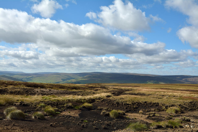
Downs, Moorland in Yorkshire Richmondshire

England

Cleavers Mining Ground

Above Carperby One of several Landrover tracks which make for easy walking over bleak moorlands.
Above Carperby Credit: Colin Gregory

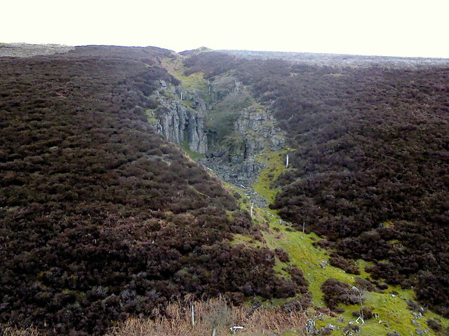
Cleavers Mining Ground, located in Yorkshire, is a prominent site known for its rich mineral deposits and historical significance in the mining industry. Situated amidst the picturesque landscape of the Yorkshire Downs and Moorland, this mining ground has a long and storied history dating back several centuries.

The region is renowned for its abundance of minerals, with Cleavers Mining Ground being particularly recognized for its coal reserves. The coal mining industry in this area flourished during the 18th and 19th centuries, playing a vital role in the industrial revolution and fueling the growth of nearby towns and cities.

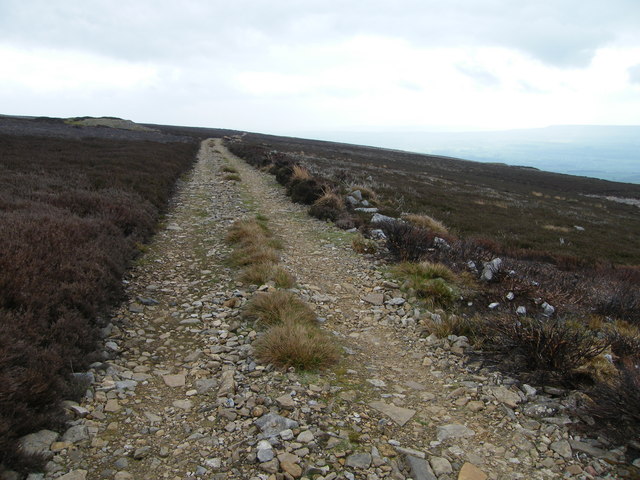
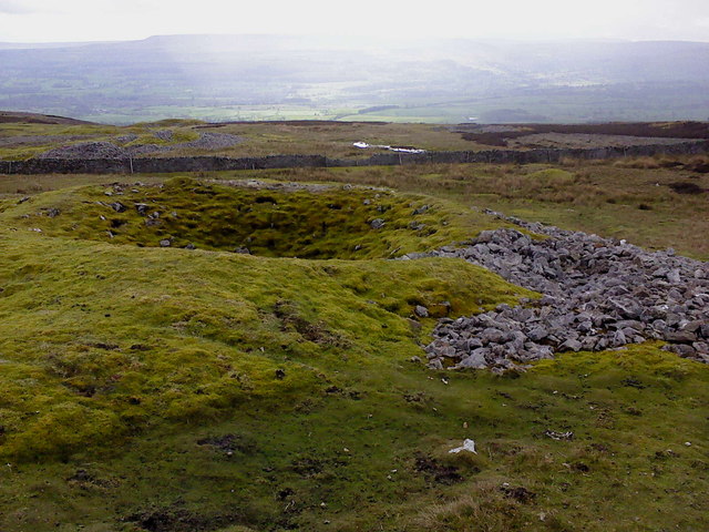
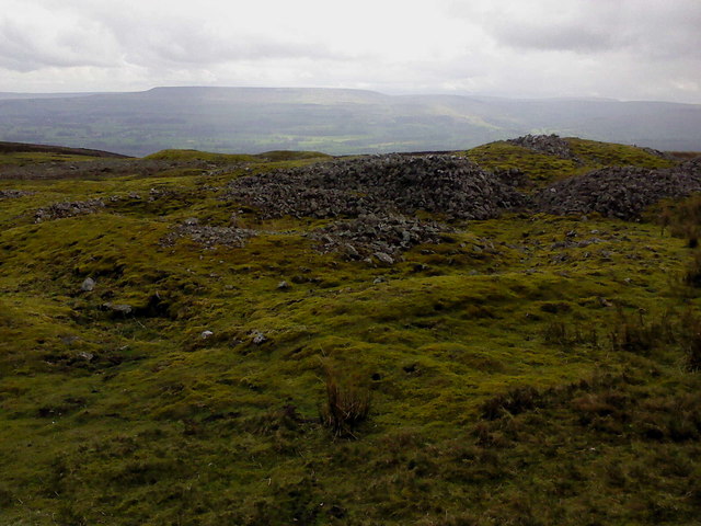
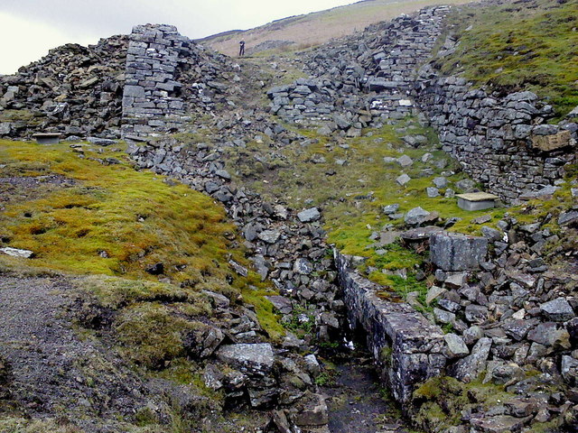
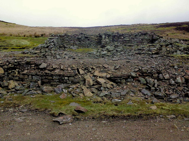
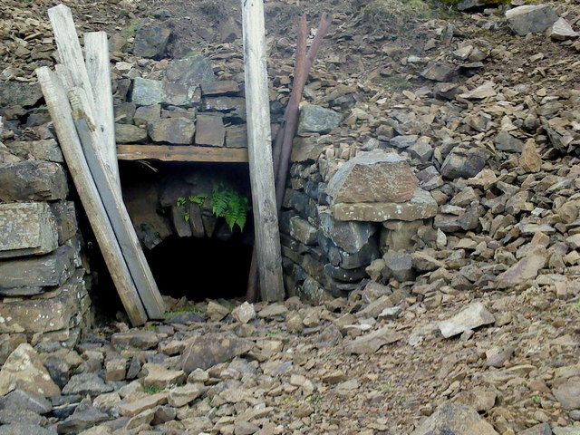
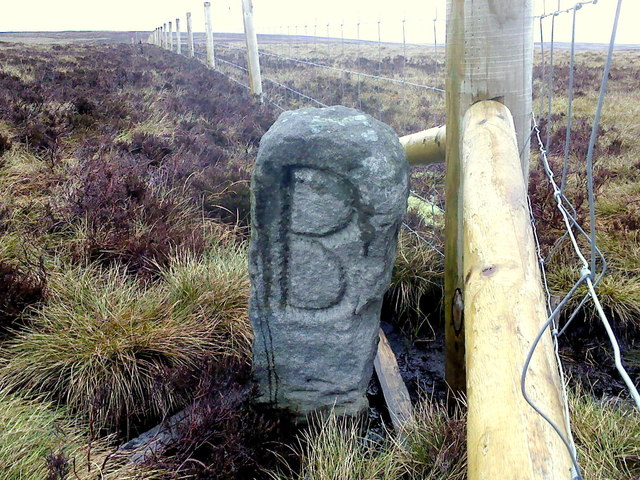
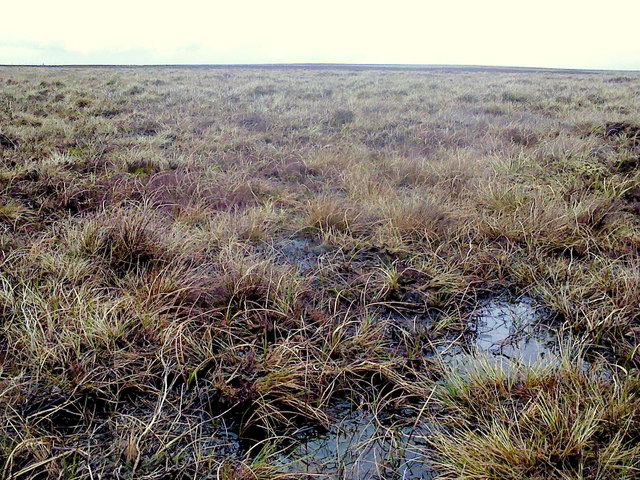
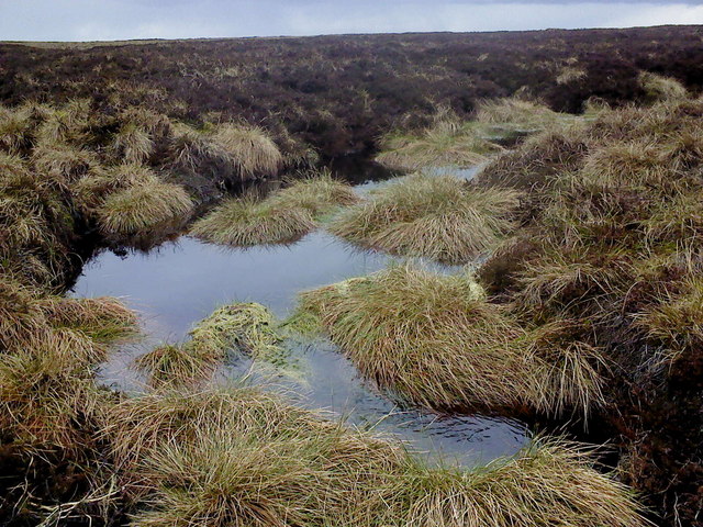
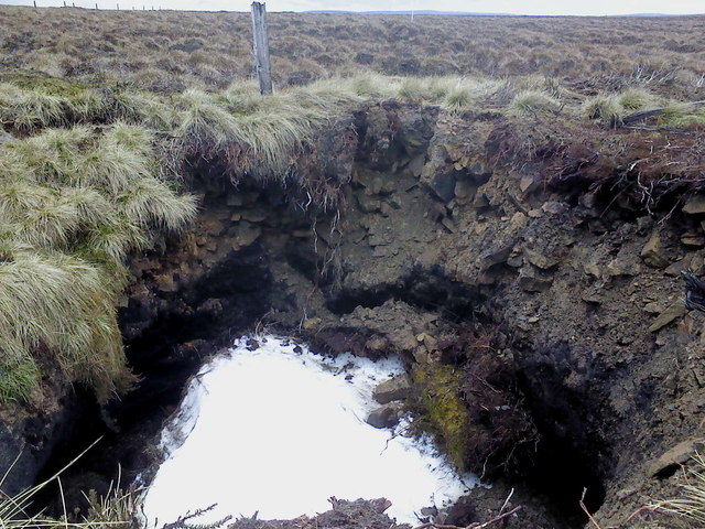
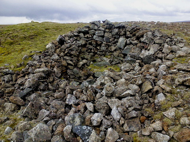
The site itself consists of vast stretches of open land, marked by old mining shafts, abandoned machinery, and remnants of the infrastructure that once supported the mining operations. These remnants serve as a tangible connection to the past, reminding visitors of the area's industrial heritage.

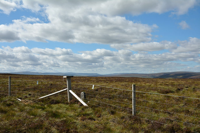
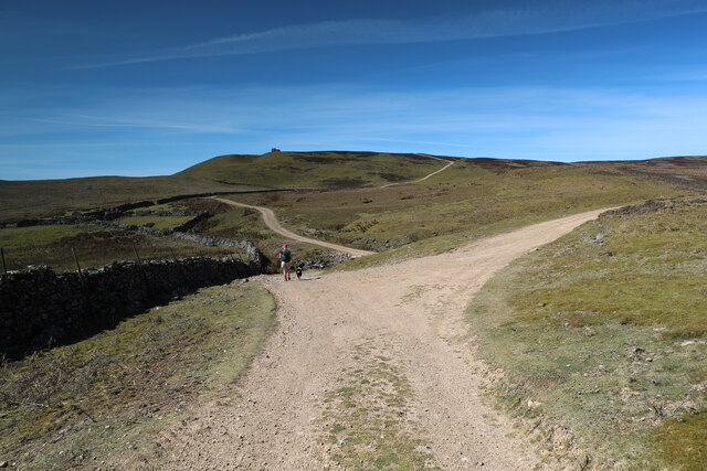
Today, Cleavers Mining Ground is a popular destination for history enthusiasts, geologists, and nature lovers alike. The surrounding Yorkshire Downs and Moorland offer stunning views and opportunities for outdoor activities such as hiking and birdwatching. Visitors can also explore the mining heritage through guided tours and educational exhibits, gaining insights into the challenges and triumphs of the mining industry in this region.

In conclusion, Cleavers Mining Ground in Yorkshire is a historically significant site, known for its rich coal reserves and the important role it played in the industrial revolution. Its picturesque location amidst the Yorkshire Downs and Moorland adds to its appeal, making it a fascinating destination for those interested in history, geology, and natural beauty.

If you have any feedback on the listing, please let us know in the comments section below.

Cleavers Mining Ground Images

Images are sourced within 2km of 54.3421/-1.9922291 or Grid Reference SE0094. Thanks to Geograph Open Source API. All images are credited.

Above Carperby One of several Landrover tracks which make for easy walking over bleak moorlands.
Above Carperby
One of several Landrover tracks which make for easy walking over bleak moorlands.
Bell Pits on Bobscar Rake One of several old lead mine shafts on East Bolton Moor, part of the Bobscar Mine which stretches over the moor on a North-South axis.
Bell Pits on Bobscar Rake
One of several old lead mine shafts on East Bolton Moor, part of the Bobscar Mine which stretches over the moor on a North-South axis.
Shafts and Spoil More old shafts on Bobscar Rake where the vein cuts Rowantree Scar. This mine was recorded by Leland in 1546 for Lord Scrope, of Castle Bolton. In the distance, on the farside of Wensleydale is Penhill.
Shafts and Spoil
More old shafts on Bobscar Rake where the vein cuts Rowantree Scar. This mine was recorded by Leland in 1546 for Lord Scrope, of Castle Bolton. In the distance, on the farside of Wensleydale is Penhill.
Apedale Mine The wheelpit from the new crushing mill, built in 1870 following the sinking of a new shaft at Apedale Mine.
Apedale Mine
The wheelpit from the new crushing mill, built in 1870 following the sinking of a new shaft at Apedale Mine.
Dressing Floor & Bouse Teams Part of the Apedale Lead Mine.
Dressing Floor & Bouse Teams
Part of the Apedale Lead Mine.
Mine Level near Apedale Beck The level was covered over by these wooden posts and has recently been dug out, judging by the colour of the spoil around the entrance.
Mine Level near Apedale Beck
The level was covered over by these wooden posts and has recently been dug out, judging by the colour of the spoil around the entrance.
Old Hush, Apedale Head Mine Apedale Head Mine had its own community of houses for the miners working around here. The mine was begun in the 1760's and worked continuously until 1883.
Old Hush, Apedale Head Mine
Apedale Head Mine had its own community of houses for the miners working around here. The mine was begun in the 1760's and worked continuously until 1883.
Summit area of High Carl High Carl is a moorland hill top near to Apedale Head. The fence crosses close to the hill's highest point which may well be just beyond the fence line - OS mapping gives a spot height in that direction, west of the fence angle, at 555m. The low boundary stone is cut with a 'B' on the south side which is in view; there's the letter 'F' on the other side.
Summit area of High Carl
High Carl is a moorland hill top near to Apedale Head. The fence crosses close to the hill's highest point which may well be just beyond the fence line - OS mapping gives a spot height in that direction, west of the fence angle, at 555m. The low boundary stone is cut with a 'B' on the south side which is in view; there's the letter 'F' on the other side.
South Grain With evidence of former lead mining activities.
South Grain
With evidence of former lead mining activities.
Pond, Apedale Head A former pit shaft I think.
Pond, Apedale Head
A former pit shaft I think.
Disused Leat, East Bolton Moor Apedale Lead Mine, abandoned in 1902.
Disused Leat, East Bolton Moor
Apedale Lead Mine, abandoned in 1902.
The Big "B" Boundary stone on Apedale Head. The "B" is for Bolton. Although it could quite easily be for bog!
The Big "B"
Boundary stone on Apedale Head. The "B" is for Bolton. Although it could quite easily be for bog!
Across the bog A whole lot of splashing & squelching in this area of Virgin Moss.
Across the bog
A whole lot of splashing & squelching in this area of Virgin Moss.
Beginning to flow downhill A small stream begins in the boggy waste of Virgin Moss at the head of Apedale.
Beginning to flow downhill
A small stream begins in the boggy waste of Virgin Moss at the head of Apedale.
Snow! A disused mine shaft on Virgin Moss hides a patch of snow from last winter. This mine shaft seems to be actively collapsing in on itself and has the remains of a very old fence around it.
Snow!
A disused mine shaft on Virgin Moss hides a patch of snow from last winter. This mine shaft seems to be actively collapsing in on itself and has the remains of a very old fence around it.
Lunch spot A stone shelter has been built into the side of this old lead mine; with a flat stone utilised as a seat it was quite pleasant.
Lunch spot
A stone shelter has been built into the side of this old lead mine; with a flat stone utilised as a seat it was quite pleasant.
Peat exposures near Apedale Head The location is to the west of Apedale Head where stream grooves begin to gather water that will become Birks Gill which drains into Swaledale, the valley ahead in the image.
Peat exposures near Apedale Head
The location is to the west of Apedale Head where stream grooves begin to gather water that will become Birks Gill which drains into Swaledale, the valley ahead in the image.
Estate track dropping to cross Beldon Beck The track turning right here heads for old lead mining workings, the original reason for the existence of these ways. Ahead, the track drops to cross Beldon Beck before climbing to Carperby Moor on its way down to Carperby in Wensleydale. Unlike many of the lead mine access routes in Swaledale, these in Wensleydale (where lead mining failed earlier) have not become public rights of way under the Countryside Act 1949, but the area is all Access Land under the more recent CROW Act, so walkers are free to roam. They are kept in good condition to facilitate access supporting the grouse shooting interests on the moor, which enable the nineteenth century industrial scars on the landscape to be supplemented by ugly burn scars in the heather moorland.
Estate track dropping to cross Beldon Beck
The track turning right here heads for old lead mining workings, the original reason for the existence of these ways. Ahead, the track drops to cross Beldon Beck before climbing to Carperby Moor on its way down to Carperby in Wensleydale. Unlike many of the lead mine access routes in Swaledale, these in Wensleydale (where lead mining failed earlier) have not become public rights of way under the Countryside Act 1949, but the area is all Access Land under the more recent CROW Act, so walkers are free to roam. They are kept in good condition to facilitate access supporting the grouse shooting interests on the moor, which enable the nineteenth century industrial scars on the landscape to be supplemented by ugly burn scars in the heather moorland.
Show me another place!

Cleavers Mining Ground is located at Grid Ref: SE0094 (Lat: 54.3421, Lng: -1.9922291)

Division: North Riding

Administrative County: North Yorkshire

District: Richmondshire

Police Authority: North Yorkshire

What 3 Words

///cuddled.scarcely.using. Near Leyburn, North Yorkshire

Nearby Locations

Cleavers Mining Ground

Related Wikis

Richmondshire

Richmondshire was a local government district of North Yorkshire, England, from 1974 to 2023. It covered a large northern area of the Yorkshire Dales including...

St Oswald's Church, Castle Bolton

St Oswald's Church, Castle Bolton is a Grade II* listed parish church in the Church of England: 106  located in Castle Bolton, North Yorkshire. == History... ==

Castle Bolton

Castle Bolton is a village in North Yorkshire, England. It is in Wensleydale, one of the Yorkshire Dales. The village takes its name from Bolton Castle...

Bolton Castle

Bolton Castle is a 14th-century castle located in Wensleydale, Yorkshire, England (grid reference SE03379183). The nearby village of Castle Bolton takes...

Crackpot, North Yorkshire

Crackpot is a village in Swaledale, North Yorkshire, England. Its name derives from the Old English kraka (crow) and the Viking word pot (usually a pit...

Carperby-cum-Thoresby

Carperby-cum-Thoresby is a civil parish in the Richmondshire district of North Yorkshire, England. The parish contains the village of Carperby and the...

Maiden Castle, North Yorkshire

Maiden Castle is a settlement in Grinton, North Yorkshire (grid reference SE02189808) which probably dates from the Iron Age. It is listed as a Scheduled...

Carperby

Carperby is a village in the Yorkshire Dales, North Yorkshire, England. It lies 7 miles (11 km) west of Leyburn. == Etymology == The derivation of the...

Nearby Amenities

Located within 500m of 54.3421,-1.9922291
Cleaver's Mining Ground
Natural: fell
Source: NPE
Lat/Long: 54.3425551/-1.9870978
Disused: yes
Historic: mine_shaft
Man Made: mineshaft
Source: NPE
Lat/Long: 54.3385772/-1.9941788
The data included in this document is from www.openstreetmap.org. The data is made available under ODbL.

Have you been to Cleavers Mining Ground?

Leave your review of Cleavers Mining Ground below (or comments, questions and feedback).