Scargill High Moor

Downs, Moorland in Yorkshire

England

Scargill High Moor

Shooting hut beside East Black Sike East Black Sike drains part of Scargill High Moor. The hut is set into a gouge into the slope on the west side of the stream; it can be approached by an estate road from the north.
Shooting hut beside East Black Sike Credit: Trevor Littlewood

Scargill High Moor is a vast expanse of rugged and captivating landscape situated in Yorkshire, England. Stretching across an area of approximately 10 square miles, it is located in the northern part of the county and forms part of the Yorkshire Dales National Park.

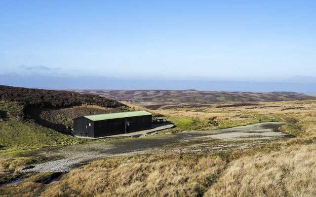
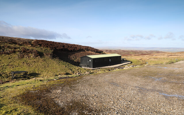
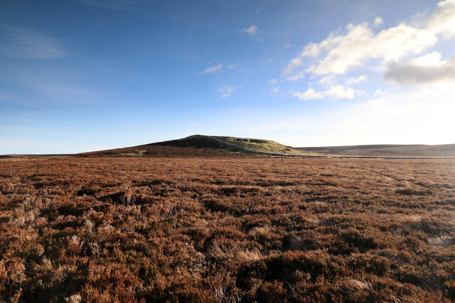
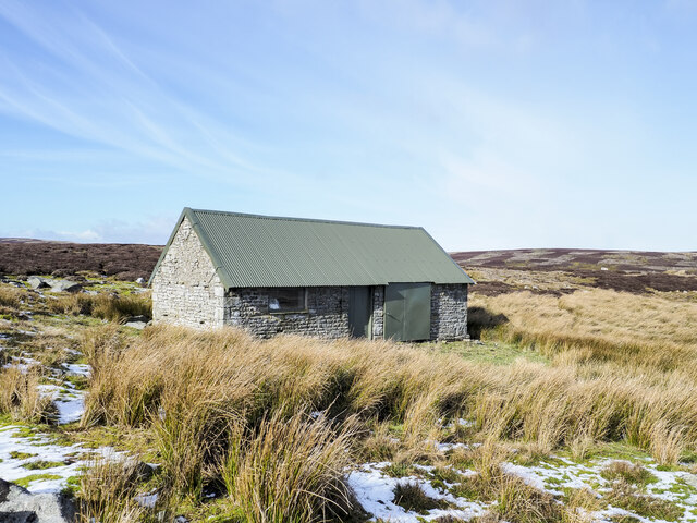
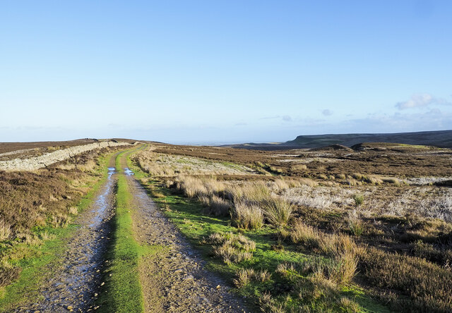
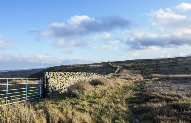
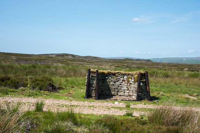
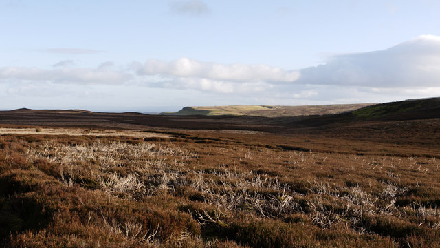
The moorland is characterized by its rolling hills, heather-covered slopes, and expansive open spaces. The terrain is predominantly composed of peat, providing a unique and distinct ecosystem. Scargill High Moor boasts an impressive array of flora and fauna, including various species of birds, such as curlews, lapwings, and red grouse, which thrive in this natural habitat.

The moorland is intersected by several streams and rivers, which add to its scenic beauty. These water bodies are essential for the survival of numerous aquatic species and contribute to the overall biodiversity of the region.

Walking and hiking enthusiasts flock to Scargill High Moor to enjoy its breathtaking views and tranquil atmosphere. The moorland offers a network of footpaths and trails that cater to both casual strollers and serious hikers, allowing visitors to explore its diverse landscapes at their own pace.

Additionally, Scargill High Moor serves as a vital carbon sink, absorbing carbon dioxide from the atmosphere and playing a crucial role in the fight against climate change. Conservation efforts are in place to protect this remarkable ecosystem and maintain its ecological balance.

Overall, Scargill High Moor is a captivating natural wonder that showcases the beauty and diversity of Yorkshire's countryside. It provides an idyllic escape for nature lovers and offers a glimpse into the rich tapestry of the region's natural heritage.

If you have any feedback on the listing, please let us know in the comments section below.

Scargill High Moor Images

Images are sourced within 2km of 54.480267/-2.011619 or Grid Reference NY9909. Thanks to Geograph Open Source API. All images are credited.

Shooting hut beside East Black Sike East Black Sike drains part of Scargill High Moor. The hut is set into a gouge into the slope on the west side of the stream; it can be approached by an estate road from the north.
Shooting hut beside East Black Sike
East Black Sike drains part of Scargill High Moor. The hut is set into a gouge into the slope on the west side of the stream; it can be approached by an estate road from the north.
Grouse butt at rock band White Crag is a discontinuous rock band mainly broken into large numbers of angular boulders overlooking Scargill High Moor. A number of grouse butts has been built into the rock band using the material obviously available. A thin path runs along the crag.
Grouse butt at rock band
White Crag is a discontinuous rock band mainly broken into large numbers of angular boulders overlooking Scargill High Moor. A number of grouse butts has been built into the rock band using the material obviously available. A thin path runs along the crag.
Cuboid boulders along White Crag White Crag is a discontinuous rock band broken mainly into angular boulders overlooking Scargill High Moor. The continuing rocks can be seen running into the distance.
Further into the distance, beyond the moorland is Stang Forest.
Cuboid boulders along White Crag
White Crag is a discontinuous rock band broken mainly into angular boulders overlooking Scargill High Moor. The continuing rocks can be seen running into the distance. Further into the distance, beyond the moorland is Stang Forest.
Cuboid boulders along White Crag - 2 White Crag is a discontinuous rock band broken into angular boulders overlooking Scargill High Moor. More rocks can be seen running into the distance.
In the far distance, beyond the moorland, can be seen the coniferous trees of Stang Forest.
Cuboid boulders along White Crag - 2
White Crag is a discontinuous rock band broken into angular boulders overlooking Scargill High Moor. More rocks can be seen running into the distance. In the far distance, beyond the moorland, can be seen the coniferous trees of Stang Forest.
High Moor Lunch Hut As well as lots of Covid-related signage and hand-sanitiser at every door, the shooting hut also has a prominent sign announcing its identity to anyone coming up the track from lower down in the drainage of East Black Sike, though it seems likely that anyone with need to know would be accompanied by drivers, beaters and others who could just as easily tell them (if they hadn't already been briefed when paying out the exorbitant sums to come and shoot things). Presumably it also becomes obvious when, on Scargill High Moor, they get provided with lunch...
High Moor Lunch Hut
As well as lots of Covid-related signage and hand-sanitiser at every door, the shooting hut also has a prominent sign announcing its identity to anyone coming up the track from lower down in the drainage of East Black Sike, though it seems likely that anyone with need to know would be accompanied by drivers, beaters and others who could just as easily tell them (if they hadn't already been briefed when paying out the exorbitant sums to come and shoot things). Presumably it also becomes obvious when, on Scargill High Moor, they get provided with lunch...
Eroding sandstone on Scargill High Moor The prominent escarpment  at the top of Scargill High Moor is formed in the unnamed sandstone that lies just below the Little Limestone, towards the bottom of the Stainmore Group, of Pendleian age in the Carboniferous. It's part of what older ones among us will remember as being the Millstone Grit series. At the top of the slope, blocks of sandstone are weathering out, and have little or no peat drift covering them. Just back from the edge, a path links lines of grouse butts, making for surprisingly easy and pleasant walking. Even beyond the last grouse butt (some way to the west) the path continues as a gamekeeper's access, somewhat narrower but still giving mostly easy footing.
Eroding sandstone on Scargill High Moor
The prominent escarpment at the top of Scargill High Moor is formed in the unnamed sandstone that lies just below the Little Limestone, towards the bottom of the Stainmore Group, of Pendleian age in the Carboniferous. It's part of what older ones among us will remember as being the Millstone Grit series. At the top of the slope, blocks of sandstone are weathering out, and have little or no peat drift covering them. Just back from the edge, a path links lines of grouse butts, making for surprisingly easy and pleasant walking. Even beyond the last grouse butt (some way to the west) the path continues as a gamekeeper's access, somewhat narrower but still giving mostly easy footing.
North towards Citron Seat From the Gilmonby road, a bridleway heads south as a good track, and where it splits, the branch to Citron Seat (the small dark-topped hill right on centre in this view) continues very clear, though, like the southern branch, it ends very abruptly at no particularly obvious destination (just at a change of local authority administering the definitive rights of way map). The southern branch passes through this view just at the foot of the slope, though you'd hardly know it. Since it terminates abruptly at the boundary wall and fails to enter the Yorkshire Dales National park, its original destination is unclear, but somewhere in upper Arkengarthdale seems likely, perhaps joining the public footpath which also started life as a bridleway until it hit the National Park frontier. One suspects some severe laxity in recording the rights of way after the 1949 Countryside Act.
North towards Citron Seat
From the Gilmonby road, a bridleway heads south as a good track, and where it splits, the branch to Citron Seat (the small dark-topped hill right on centre in this view) continues very clear, though, like the southern branch, it ends very abruptly at no particularly obvious destination (just at a change of local authority administering the definitive rights of way map). The southern branch passes through this view just at the foot of the slope, though you'd hardly know it. Since it terminates abruptly at the boundary wall and fails to enter the Yorkshire Dales National park, its original destination is unclear, but somewhere in upper Arkengarthdale seems likely, perhaps joining the public footpath which also started life as a bridleway until it hit the National Park frontier. One suspects some severe laxity in recording the rights of way after the 1949 Countryside Act.
Tarnhow Hill Although apparently a very minor eminence on the map, Tarnhow Hill seems quite prominent across the otherwise rather flat bit of moorland above Bleakhow Edge (itself a rather over-grandiose name for a short steep slope with a few sandstone boulders). There's a small crag or perhaps a quarry, which I would have guessed was formed in the Little Limestone, but BGS sheet 41 (Kirkby Stephen) shows it as Richmond Chert, a little above the limestone. It also shows Tarnhow Hill covered in drift with no actual bedrock showing, which is clearly not the case, so I withhold judgement on which bed is outcropping, as I suspect that the mappers, like myself today, may not have trekked over to the hill and examined it in detail. The drystone wall which crosses its shoulder, marks the post-1974 border between North Yorkshire and County Durham (prior to that, the boundary was along the River Tees, further north) and is also the frontier of the Yorkshire Dales National Park. A number of rights of way either change status to lesser rights, or terminate abruptly on that border, suggesting that within the Park (in 1949 it was all the North Riding) recording of existing paths was far more lax than outside on the definitive map. Given the time it took for the 1949 Act to result in these definitive maps, it is possible that the discrepancy lay between the post-1974 county authorities.
Tarnhow Hill
Although apparently a very minor eminence on the map, Tarnhow Hill seems quite prominent across the otherwise rather flat bit of moorland above Bleakhow Edge (itself a rather over-grandiose name for a short steep slope with a few sandstone boulders). There's a small crag or perhaps a quarry, which I would have guessed was formed in the Little Limestone, but BGS sheet 41 (Kirkby Stephen) shows it as Richmond Chert, a little above the limestone. It also shows Tarnhow Hill covered in drift with no actual bedrock showing, which is clearly not the case, so I withhold judgement on which bed is outcropping, as I suspect that the mappers, like myself today, may not have trekked over to the hill and examined it in detail. The drystone wall which crosses its shoulder, marks the post-1974 border between North Yorkshire and County Durham (prior to that, the boundary was along the River Tees, further north) and is also the frontier of the Yorkshire Dales National Park. A number of rights of way either change status to lesser rights, or terminate abruptly on that border, suggesting that within the Park (in 1949 it was all the North Riding) recording of existing paths was far more lax than outside on the definitive map. Given the time it took for the 1949 Act to result in these definitive maps, it is possible that the discrepancy lay between the post-1974 county authorities.
Gamekeeper's path on White Crag Moss Beyond the last grouse butt on Scargill High Moor, the broad footpath serving those butts (used by off-road vehicles, one suspects) shrinks to just a footpath, though the occasional fat tyre track does suggest something motorised occasionally passes this way. Lots of predator traps and grouse medication trays imply the primary purpose is for gamekeeper's access, but being along the top of the sandstone outcrop where the peat is shallow or absent, the path is surprisingly easy underfoot and the views north over the Greta valley are rather fine.
Gamekeeper's path on White Crag Moss
Beyond the last grouse butt on Scargill High Moor, the broad footpath serving those butts (used by off-road vehicles, one suspects) shrinks to just a footpath, though the occasional fat tyre track does suggest something motorised occasionally passes this way. Lots of predator traps and grouse medication trays imply the primary purpose is for gamekeeper's access, but being along the top of the sandstone outcrop where the peat is shallow or absent, the path is surprisingly easy underfoot and the views north over the Greta valley are rather fine.
Repurposed hut on Scargill High Moor The building is on the northern side of the moor and is surely no longer used as the shooting box that it is named on OS maps. The building was found to be unlocked, its door secured by string and the left side as viewed filled with rubbish. A short distance south there's a new shooting hut - <a title="https://www.geograph.org.uk/photo/7079267" href="https://www.geograph.org.uk/photo/7079267">Link</a> - and it's assumed that it has replaced the one in the image.
Repurposed hut on Scargill High Moor
The building is on the northern side of the moor and is surely no longer used as the shooting box that it is named on OS maps. The building was found to be unlocked, its door secured by string and the left side as viewed filled with rubbish. A short distance south there's a new shooting hut - Link - and it's assumed that it has replaced the one in the image.
Citron Seat Citron Seat is a modest moorland hill with a distinctively pointed summit. The view is from the north-west, over a bog, across which runs a collapsing wooden fence.
Citron Seat
Citron Seat is a modest moorland hill with a distinctively pointed summit. The view is from the north-west, over a bog, across which runs a collapsing wooden fence.
Hill road east of Citron Seat The road runs alongside the wall following the ridge connecting Citron Seat and Hazel Bush Hill; both features are behind the camera position. Its purpose is to allow easy access for grouse shooting parties.
Hill road east of Citron Seat
The road runs alongside the wall following the ridge connecting Citron Seat and Hazel Bush Hill; both features are behind the camera position. Its purpose is to allow easy access for grouse shooting parties.
Wall rising on heather moorland The wall rises to the south-east on a gentle moorland slope from the vicinity of Low Green Fell.
Wall rising on heather moorland
The wall rises to the south-east on a gentle moorland slope from the vicinity of Low Green Fell.
Cotron Seat Citron Seat near Bowes
Cotron Seat
Citron Seat near Bowes
Citron Seat Citron Seat is a minor but abrupt rise along a moorland ridge above Gilmonby Moor on the south side of the valley of the River Greta.
Citron Seat
Citron Seat is a minor but abrupt rise along a moorland ridge above Gilmonby Moor on the south side of the valley of the River Greta.
Grouse butt beside estate road The grouse butt is one of a line on Gilmonby Moor, and also north of the minor hill, Citron Seat. The road passing butt No. 8 is not currently shown on OS maps at any scale at this location but is, as far as the shooting hut further north.
In the distance there's a series of minor rises named collectively as Seven Hills but only six can be discerned from this location.
Grouse butt beside estate road
The grouse butt is one of a line on Gilmonby Moor, and also north of the minor hill, Citron Seat. The road passing butt No. 8 is not currently shown on OS maps at any scale at this location but is, as far as the shooting hut further north. In the distance there's a series of minor rises named collectively as Seven Hills but only six can be discerned from this location.
Heather moorland on north side of Hazel Bush Hill Hazel Bush Hill is an insignificant eminence of heather moorland to the east of the minor rise of Citron Seat; land on the north side of the hill is seen here, the view being eastwards.
Heather moorland on north side of Hazel Bush Hill
Hazel Bush Hill is an insignificant eminence of heather moorland to the east of the minor rise of Citron Seat; land on the north side of the hill is seen here, the view being eastwards.
Show me another place!

Scargill High Moor is located at Grid Ref: NY9909 (Lat: 54.480267, Lng: -2.011619)

Division: North Riding

Unitary Authority: County Durham

Police Authority: Durham

What 3 Words

///ascendant.contexts.drummers. Near Bowes, Co. Durham

Nearby Locations

Scargill High Moor

Related Wikis

Hoove

Hoove is a hill in the northern Yorkshire Dales in North Yorkshire, England, near the town of Barnard Castle in County Durham. Its elevation is 554 metres...

Arkengarthdale

Arkengarthdale is a dale, or valley, on the east side of the Pennines in North Yorkshire, England. Running roughly north-west to south-east, it is the...

Sleightholme Beck Gorge – The Troughs

Sleightholme Beck Gorge – The Troughs is a Site of Special Scientific Interest in the County Durham district of south-west County Durham, England. The...

Gilmonby

Gilmonby is a village in the Pennines in County Durham, England. it is situated a short distance to the south of Bowes, in the vicinity of Barnard Castle...

Sleightholme

Sleightholme is a secluded hamlet on a dead end road in County Durham, England. It lies beside Sleightholme Beck, a tributary of the River Greta. The...

Bowes

Bowes is a village in the historic county of Yorkshire and, since 1974, in the ceremonial county of County Durham, England. Located in the Pennine hills...

Bowes Castle

Bowes Castle is a medieval castle in the village of Bowes in County Durham, England. Built within the perimeter of the former Roman fort of Lavatrae, on...

Bowes railway station

Bowes railway station was situated on the South Durham & Lancashire Union Railway between Barnard Castle and Kirkby Stephen East. == History == The line...

Nearby Amenities

Located within 500m of 54.480267,-2.011619
Middle Bend
Place: locality
Lat/Long: 54.4780547/-2.0177714
Hunting Stand
Hunting Stand: grouse_butt
Lat/Long: 54.4841057/-2.0081431
Hunting Stand
Hunting Stand: grouse_butt
Lat/Long: 54.4837333/-2.0079124
Hunting Stand
Hunting Stand: grouse_butt
Lat/Long: 54.4833608/-2.0077005
Hunting Stand
Hunting Stand: grouse_butt
Lat/Long: 54.4829775/-2.0074591
Hunting Stand
Hunting Stand: grouse_butt
Lat/Long: 54.4826628/-2.0072714
Hunting Stand
Hunting Stand: grouse_butt
Lat/Long: 54.4822576/-2.0071748
Hunting Stand
Hunting Stand: grouse_butt
Lat/Long: 54.481879/-2.0070863
Hunting Stand
Hunting Stand: grouse_butt
Lat/Long: 54.4794355/-2.0042646
Hunting Stand
Hunting Stand: grouse_butt
Lat/Long: 54.4799498/-2.0043504
Hunting Stand
Hunting Stand: grouse_butt
Lat/Long: 54.4804625/-2.0043397
Hunting Stand
Hunting Stand: grouse_butt
Lat/Long: 54.4809502/-2.0043021
Hunting Stand
Hunting Stand: grouse_butt
Lat/Long: 54.4814021/-2.0043021
The data included in this document is from www.openstreetmap.org. The data is made available under ODbL.

Have you been to Scargill High Moor?

Leave your review of Scargill High Moor below (or comments, questions and feedback).