Harmston

Settlement in Lincolnshire North Kesteven

England

Harmston

Ivy House, Coleby Early nineteenth century house <span class="nowrap"><a title="https://historicengland.org.uk/listing/the-list/list-entry/1164872?section=official-list-entry" rel="nofollow ugc noopener" href="https://historicengland.org.uk/listing/the-list/list-entry/1164872?section=official-list-entry">Link</a><img style="margin-left:2px;" alt="External link" title="External link - shift click to open in new window" src="https://s1.geograph.org.uk/img/external.png" width="10" height="10"/></span>
Ivy House, Coleby Credit: Jonathan Thacker

Harmston is a small village located in the North Kesteven district of Lincolnshire, England. Situated approximately 6 miles southwest of the city of Lincoln, Harmston is nestled amidst picturesque countryside and offers its inhabitants a peaceful and rural setting.

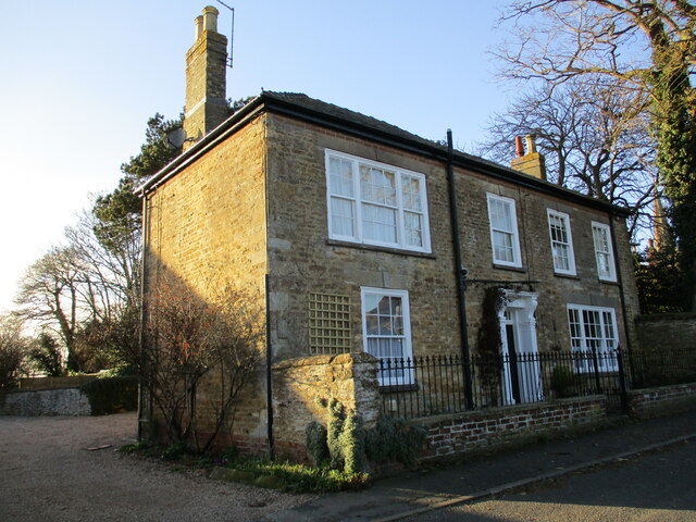
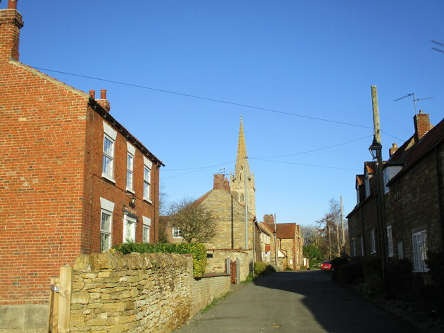
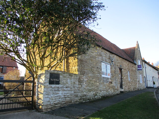
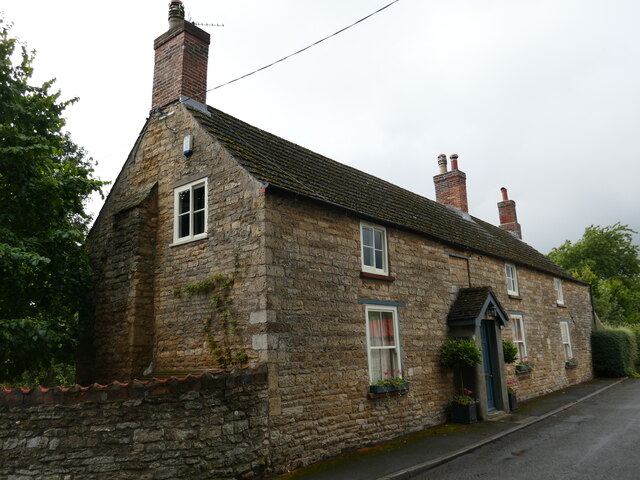
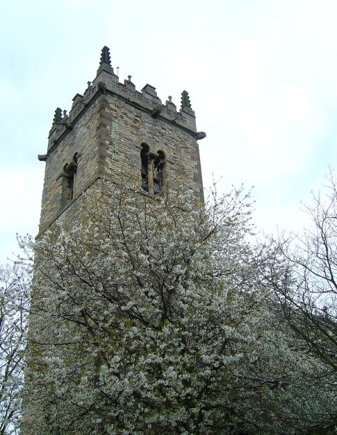
The village has a long history, with records dating back to the Domesday Book of 1086. Throughout the years, it has retained its charming and traditional character, evident in its quintessential English cottages, well-maintained gardens, and leafy lanes.

Harmston is home to a close-knit community, with a population of around 500 residents. The village boasts a range of amenities to cater to its inhabitants' needs, including a village hall, a local pub, and a primary school. Additionally, the nearby city of Lincoln provides further amenities, such as supermarkets, shops, and healthcare facilities.

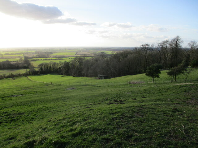
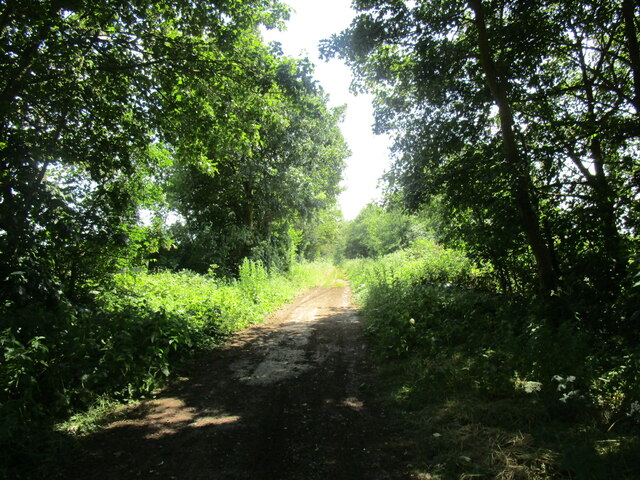
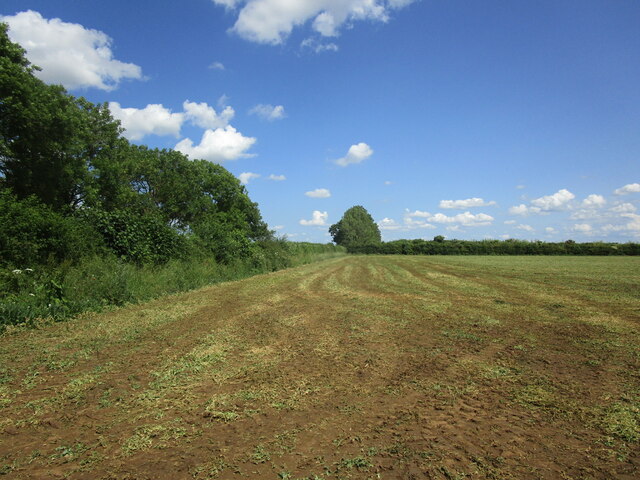
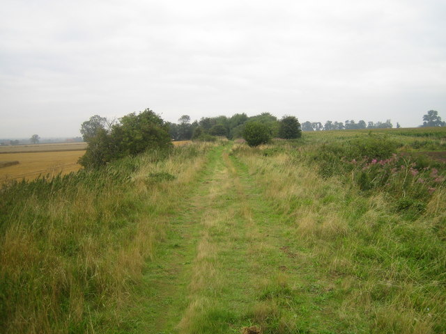
For nature enthusiasts, Harmston offers easy access to the surrounding countryside, with ample opportunities for walking, cycling, and exploring the nearby woodlands. The village is also located near the River Witham, providing opportunities for boating and fishing.

Transport links in Harmston are convenient, with regular bus services connecting to Lincoln and other nearby towns. The A46 road runs close to the village, providing easy access to major cities such as Nottingham and Leicester.

Overall, Harmston is a charming and idyllic village, offering a peaceful and rural lifestyle while still providing easy access to nearby amenities and attractions.

If you have any feedback on the listing, please let us know in the comments section below.
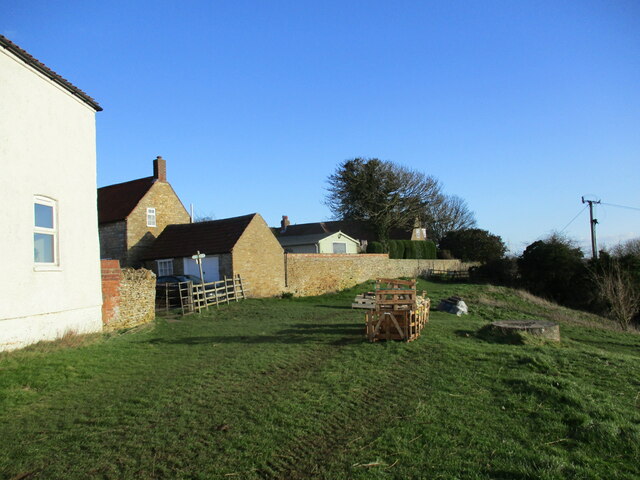
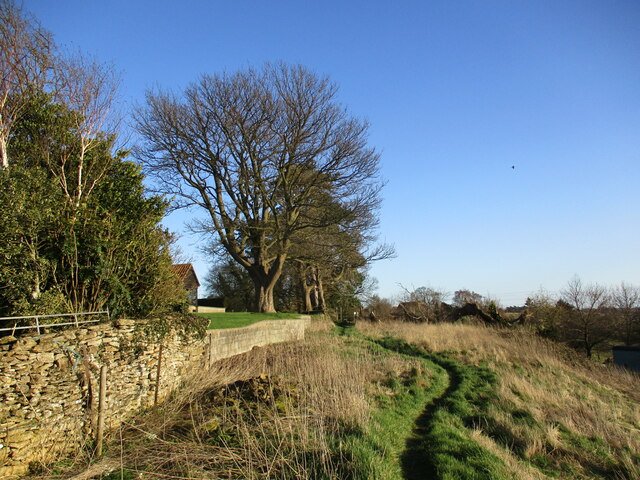
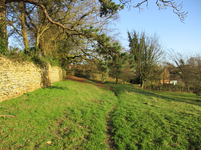
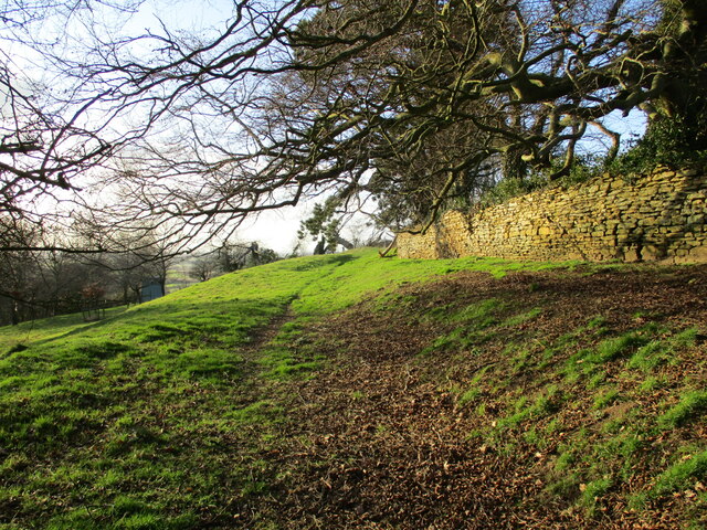
Harmston Images

Images are sourced within 2km of 53.149028/-0.55041 or Grid Reference SK9762. Thanks to Geograph Open Source API. All images are credited.

Ivy House, Coleby Early nineteenth century house <span class="nowrap"><a title="https://historicengland.org.uk/listing/the-list/list-entry/1164872?section=official-list-entry" rel="nofollow ugc noopener" href="https://historicengland.org.uk/listing/the-list/list-entry/1164872?section=official-list-entry">Link</a><img style="margin-left:2px;" alt="External link" title="External link - shift click to open in new window" src="https://s1.geograph.org.uk/img/external.png" width="10" height="10"/></span>
Ivy House, Coleby
Early nineteenth century house LinkExternal link
The Manor House, Coleby Early nineteenth century house <span class="nowrap"><a title="https://historicengland.org.uk/listing/the-list/list-entry/1317557?section=official-list-entry" rel="nofollow ugc noopener" href="https://historicengland.org.uk/listing/the-list/list-entry/1317557?section=official-list-entry">Link</a><img style="margin-left:2px;" alt="External link" title="External link - shift click to open in new window" src="https://s1.geograph.org.uk/img/external.png" width="10" height="10"/></span>
The Manor House, Coleby
Early nineteenth century house LinkExternal link
Entrance to the Cemetery, Coleby Commemorates the Diamond Jubilee of Queen Victoria,
Entrance to the Cemetery, Coleby
Commemorates the Diamond Jubilee of Queen Victoria,
Scarp at Coleby Looking into the Witham Vallay.
Scarp at Coleby
Looking into the Witham Vallay.
Footpath at Coleby The crates contain block of finished stone. It is not obvious why they are here.
Footpath at Coleby
The crates contain block of finished stone. It is not obvious why they are here.
Church Lane, Coleby
Church Lane, Coleby
Footpath at Coleby Runs along the top of the scarp.
Footpath at Coleby
Runs along the top of the scarp.
This is my field! As it turned out, a rather timid ram,
This is my field!
As it turned out, a rather timid ram,
Footpath at Coleby Runs along the top of the scarp.
Footpath at Coleby
Runs along the top of the scarp.
Footpath at Coleby Runs along the top of the scarp.
Footpath at Coleby
Runs along the top of the scarp.
The Old House, Coleby Cottage dating from the seventeenth and eighteenth centuries <span class="nowrap"><a title="https://historicengland.org.uk/listing/the-list/list-entry/1061981?section=official-list-entry" rel="nofollow ugc noopener" href="https://historicengland.org.uk/listing/the-list/list-entry/1061981?section=official-list-entry">Link</a><img style="margin-left:2px;" alt="External link" title="External link - shift click to open in new window" src="https://s1.geograph.org.uk/img/external.png" width="10" height="10"/></span>
The Old House, Coleby
Cottage dating from the seventeenth and eighteenth centuries LinkExternal link
All Saints' church, Coleby The lower parts of the tower are pre-Conquest <span class="nowrap"><a title="https://historicengland.org.uk/listing/the-list/list-entry/1164829?section=official-list-entry" rel="nofollow ugc noopener" href="https://historicengland.org.uk/listing/the-list/list-entry/1164829?section=official-list-entry">Link</a><img style="margin-left:2px;" alt="External link" title="External link - shift click to open in new window" src="https://s1.geograph.org.uk/img/external.png" width="10" height="10"/></span>
All Saints' church, Coleby
The lower parts of the tower are pre-Conquest LinkExternal link
High Dyke The Roman Ermine Street.
High Dyke
The Roman Ermine Street.
Recently harvested field This field has produced a crop of peas.
Recently harvested field
This field has produced a crop of peas.
Wheat field near Waddington
Barley field near Waddington On the scarp of the Lincoln Edge.
Barley field near Waddington
On the scarp of the Lincoln Edge.
Allotments near Waddington Caught in a rain shower.
Allotments near Waddington
Caught in a rain shower.
School House, Harmston Dates from the early nineteenth century <span class="nowrap"><a title="https://historicengland.org.uk/listing/the-list/list-entry/1061988?section=official-list-entry" rel="nofollow ugc noopener" href="https://historicengland.org.uk/listing/the-list/list-entry/1061988?section=official-list-entry">Link</a><img style="margin-left:2px;" alt="External link" title="External link - shift click to open in new window" src="https://s1.geograph.org.uk/img/external.png" width="10" height="10"/></span>
School House, Harmston
Dates from the early nineteenth century LinkExternal link
Show me another place!

Harmston is located at Grid Ref: SK9762 (Lat: 53.149028, Lng: -0.55041)

Division: Parts of Kesteven

Administrative County: Lincolnshire

District: North Kesteven

Police Authority: Lincolnshire

What 3 Words

///supper.remaking.defeated. Near Waddington, Lincolnshire

Related Wikis

North Kesteven Rural District

North Kesteven was a rural district in Kesteven, Lincolnshire from 1931 to 1974. It was created in 1931 under a County Review Order, and was formed from...

Harmston

Harmston is a village and civil parish in the North Kesteven district of Lincolnshire, England. It is situated just west off the A607, and 5 miles (8 km...

Harmston railway station

Harmston railway station was a station in Harmston, Lincolnshire on the Grantham and Lincoln railway line. It closed in 1962 but the line remained open...

Ermine Street

Ermine Street is a major Roman road in England that ran from London (Londinium) to Lincoln (Lindum Colonia) and York (Eboracum). The Old English name...

Coleby, North Kesteven

Coleby is a village and civil parish in the North Kesteven district of Lincolnshire, England. It is situated on the A607, and approximately 6 miles (10...

Waddington, Lincolnshire

Waddington is a village and civil parish in the North Kesteven district of Lincolnshire, England, situated approximately 4 miles (6 km) south of Lincoln...

River Brant

The River Brant is a 14 mi-long (23 km) tributary of the River Witham that flows entirely in the county of Lincolnshire, in the east of England. In 1855...

RAF Waddington

Royal Air Force Waddington otherwise known as RAF Waddington (IATA: WTN, ICAO: EGXW) is a Royal Air Force station located beside the village of Waddington...

Nearby Amenities

Located within 500m of 53.149028,-0.55041
Harmston
Is In: Lincolnshire, England, UK
Place: village
Lat/Long: 53.1485656/-0.547871
Bus Stop
Vicarage Lane Telephone Box
Naptan AtcoCode: 270000014431
Naptan Bearing: W
Naptan CommonName: Vicarage Lane Telephone Box
Naptan Indicator: W - bound
Naptan Landmark: Telephone Box
Naptan NaptanCode: linjpmwa
Naptan Street: Vicarage Lane
Naptan Verified: no
Source: naptan_import
Lat/Long: 53.1512442/-0.5471119
Bus Stop
Vicarage Lane Telephone Box
Naptan AtcoCode: 270000014432
Naptan Bearing: E
Naptan CommonName: Vicarage Lane Telephone Box
Naptan Indicator: E - bound
Naptan Landmark: Telephone Box
Naptan NaptanCode: linjpmwd
Naptan Street: Vicarage Lane
Naptan Verified: no
Source: naptan_import
Lat/Long: 53.1513379/-0.54669
Bus Stop
All Saint's Church
Naptan AtcoCode: 270000014434
Naptan Bearing: E
Naptan CommonName: All Saint's Church
Naptan Indicator: adj
Naptan Landmark: All Saint's Church
Naptan NaptanCode: linjpmwg
Naptan Street: Church Lane
Naptan Verified: no
Source: naptan_import
Lat/Long: 53.1485279/-0.5470092
Bus Stop
All Saint's Church
Naptan AtcoCode: 270000014435
Naptan Bearing: W
Naptan CommonName: All Saint's Church
Naptan Indicator: opp
Naptan Landmark: All Saint's Church
Naptan NaptanCode: linjpmwj
Naptan Street: Church Lane
Naptan Verified: no
Source: naptan_import
Lat/Long: 53.148456/-0.5470116
Barrier: stile
Steps: 1
Stile: stepover
Lat/Long: 53.1484908/-0.5447362
Barrier: stile
Steps: 2
Stile: stepover
Lat/Long: 53.1501946/-0.5451736
Barrier: kissing_gate
Lat/Long: 53.1501765/-0.5451653
Bench
Lat/Long: 53.1513123/-0.545316
Barrier: stile
Steps: 2
Stile: stepover
Lat/Long: 53.1513096/-0.5453549
Bottom Park
Place: locality
Source: Bing
Lat/Long: 53.1459218/-0.5538648
Harmston Park
Place: locality
Source: Bing
Lat/Long: 53.1477328/-0.5550372
Hill Top Farm
Place: farm
Source: Bing
Lat/Long: 53.1509505/-0.5504837
Milton House Farm
Place: farm
Source: Bing
Lat/Long: 53.1508875/-0.547497
Generator Method: photovoltaic
Generator Output Electricity: yes
Generator Source: solar
Generator Type: solar_photovoltaic_panel
Location: roof
Power: generator
Lat/Long: 53.1483726/-0.5461326
Generator Method: photovoltaic
Generator Output Electricity: yes
Generator Source: solar
Generator Type: solar_photovoltaic_panel
Location: roof
Power: generator
Lat/Long: 53.1467542/-0.5491072
Generator Method: photovoltaic
Generator Output Electricity: yes
Generator Source: solar
Generator Type: solar_photovoltaic_panel
Location: roof
Power: generator
Lat/Long: 53.1514653/-0.5475721
Generator Method: photovoltaic
Generator Output Electricity: yes
Generator Source: solar
Generator Type: solar_photovoltaic_panel
Location: roof
Power: generator
Lat/Long: 53.1503898/-0.5503169
Barrier: bollard
Bollard: removable
Lat/Long: 53.1477425/-0.5472112
Shelter
Lat/Long: 53.1497702/-0.5506084
Advertising: board
Lat/Long: 53.1498313/-0.5501542
Bench
Lat/Long: 53.1474932/-0.5448873
Bench
Lat/Long: 53.1474428/-0.5449016
Generator Method: photovoltaic
Generator Output Electricity: yes
Generator Source: solar
Generator Type: solar_photovoltaic_panel
Location: roof
Power: generator
Lat/Long: 53.1515635/-0.5456377
Generator Method: photovoltaic
Generator Output Electricity: yes
Generator Source: solar
Generator Type: solar_photovoltaic_panel
Location: roof
Power: generator
Lat/Long: 53.1515421/-0.5455783
The data included in this document is from www.openstreetmap.org. The data is made available under ODbL.

Have you been to Harmston?

Leave your review of Harmston below (or comments, questions and feedback).