Beldon Peat Moor

Downs, Moorland in Yorkshire Richmondshire

England

Beldon Peat Moor

Greets Shooting House ruin
Greets Shooting House ruin Credit: Colin Grice

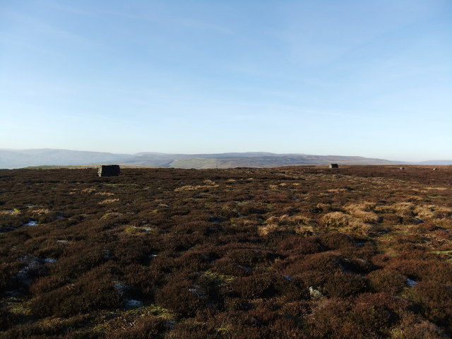
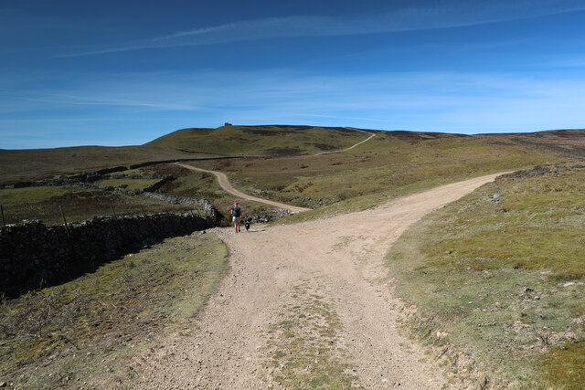
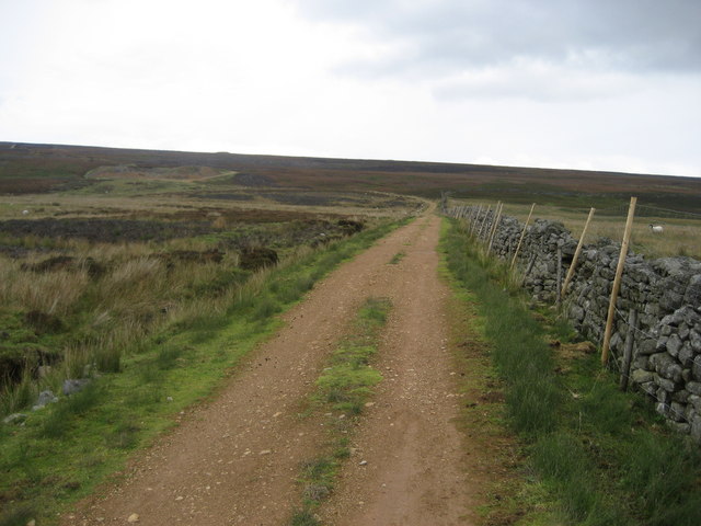
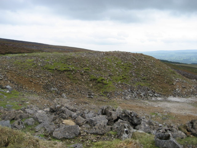
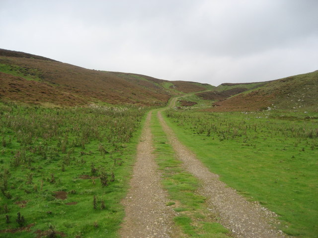
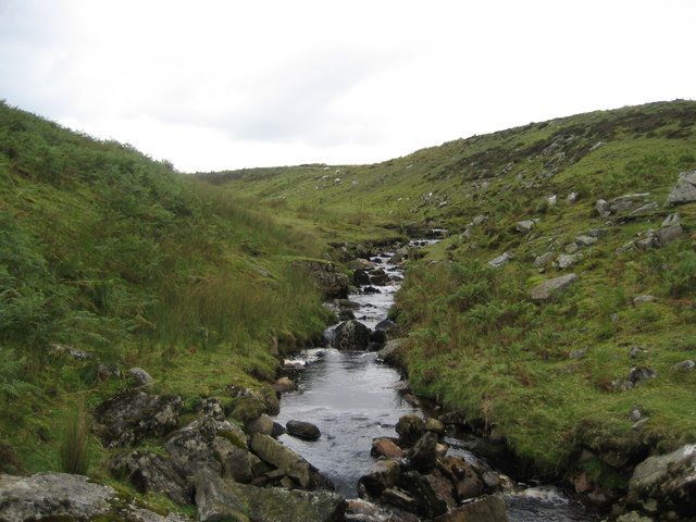
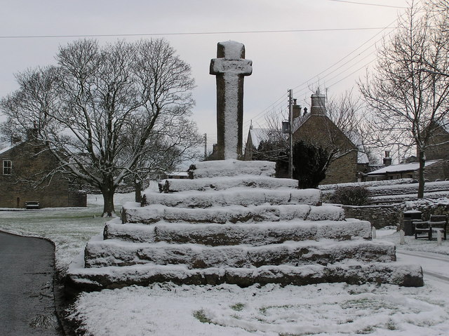
Beldon Peat Moor is a vast expanse of picturesque moorland located in the county of Yorkshire, England. Situated in the heart of the Yorkshire Downs, this moorland is known for its stunning natural beauty and diverse ecosystem. Spanning over hundreds of acres, Beldon Peat Moor is characterized by its rolling hills, heather-covered landscapes, and numerous peat bogs.

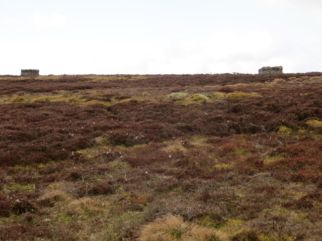
One of the defining features of Beldon Peat Moor is its unique flora and fauna. The moorland is home to a wide array of plant species, including heather, bilberry, cotton grass, and sphagnum moss, which thrive in the acidic soil and damp conditions. This rich vegetation provides a habitat for various wildlife species, such as grouse, curlews, lapwings, and snipes, making Beldon Peat Moor a popular destination for birdwatchers and nature enthusiasts.

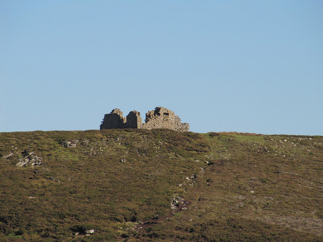
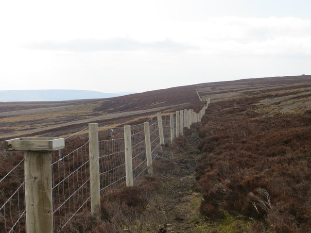
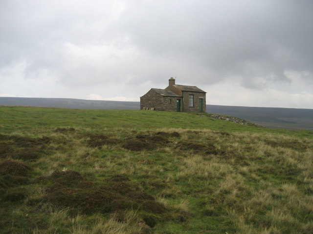
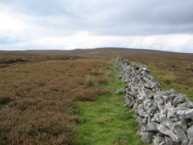
The moorland also offers breathtaking views, with its open expanses and panoramic vistas. Visitors can enjoy long walks or hikes along the well-maintained trails, taking in the serene beauty of the surrounding countryside. The area is dotted with scattered stone walls and ancient ruins, adding a touch of history and intrigue to the landscape.

Beldon Peat Moor is not only a haven for wildlife and nature lovers but also a significant conservation area. Efforts are made to manage and preserve the delicate ecosystem, including controlled burning of heather to encourage new growth and prevent wildfires. Additionally, the moorland serves as a crucial carbon sink, helping to mitigate climate change by absorbing and storing carbon dioxide.

In conclusion, Beldon Peat Moor is a captivating and ecologically important moorland in Yorkshire that offers a glimpse into the region's natural wonders. With its diverse flora and fauna, stunning views, and commitment to conservation, it is a must-visit destination for anyone seeking tranquility and a deeper connection with the natural world.

If you have any feedback on the listing, please let us know in the comments section below.

Beldon Peat Moor Images

Images are sourced within 2km of 54.331592/-2.0268615 or Grid Reference SD9892. Thanks to Geograph Open Source API. All images are credited.

Greets Shooting House ruin
Grouse butts above Ellerkin Scar
Fence Line Looking south-east along the edge of Woodhall Greets.
Fence Line
Looking south-east along the edge of Woodhall Greets.
Grouse Butts Looking west from the path along the edge of Woodhall Greets.
Grouse Butts
Looking west from the path along the edge of Woodhall Greets.
Moles at Work Looking east towards Ellerkin Scar.
Moles at Work
Looking east towards Ellerkin Scar.
Bell pits below Beldhaw Hill Marked as Shafts (dis) on the map, this is a series of bell pits alongside the bridleway from above Newbiggin to Woodhall. Characterised by the circular upcast with a hollow in the middle bell pits are a form of small mine. Beldhaw Hill is the prominent knoll in the background.
Bell pits below Beldhaw Hill
Marked as Shafts (dis) on the map, this is a series of bell pits alongside the bridleway from above Newbiggin to Woodhall. Characterised by the circular upcast with a hollow in the middle bell pits are a form of small mine. Beldhaw Hill is the prominent knoll in the background.
Estate track dropping to cross Beldon Beck The track turning right here heads for old lead mining workings, the original reason for the existence of these ways. Ahead, the track drops to cross Beldon Beck before climbing to Carperby Moor on its way down to Carperby in Wensleydale. Unlike many of the lead mine access routes in Swaledale, these in Wensleydale (where lead mining failed earlier) have not become public rights of way under the Countryside Act 1949, but the area is all Access Land under the more recent CROW Act, so walkers are free to roam. They are kept in good condition to facilitate access supporting the grouse shooting interests on the moor, which enable the nineteenth century industrial scars on the landscape to be supplemented by ugly burn scars in the heather moorland.
Estate track dropping to cross Beldon Beck
The track turning right here heads for old lead mining workings, the original reason for the existence of these ways. Ahead, the track drops to cross Beldon Beck before climbing to Carperby Moor on its way down to Carperby in Wensleydale. Unlike many of the lead mine access routes in Swaledale, these in Wensleydale (where lead mining failed earlier) have not become public rights of way under the Countryside Act 1949, but the area is all Access Land under the more recent CROW Act, so walkers are free to roam. They are kept in good condition to facilitate access supporting the grouse shooting interests on the moor, which enable the nineteenth century industrial scars on the landscape to be supplemented by ugly burn scars in the heather moorland.
Estate track dropping into dry valley below Wegber Scar The route from Carperby Moor down to Carperby drops into a dry valley, with Wegber Scar on its left. Unlike most of the lead mine access tracks in Swaledale, the ones on the Bolton Castle estate in Wensleydale did not become public rights of Way under the Countryside Act 1949. At this point, the track is on CROW Access Land, but as it leaves that, and becomes Peatmoor Lane, the right to walk is far from clear from the map. In practice, there seems to be no issue with access, and the lane eventually develops into a byway after being crossed by bridleways. The telecoms mast seen on the horizon serves mobile phone signals to Carperby, Thornton Rust and the tourist mecca of Aysgarth in Wensleydale.
Estate track dropping into dry valley below Wegber Scar
The route from Carperby Moor down to Carperby drops into a dry valley, with Wegber Scar on its left. Unlike most of the lead mine access tracks in Swaledale, the ones on the Bolton Castle estate in Wensleydale did not become public rights of Way under the Countryside Act 1949. At this point, the track is on CROW Access Land, but as it leaves that, and becomes Peatmoor Lane, the right to walk is far from clear from the map. In practice, there seems to be no issue with access, and the lane eventually develops into a byway after being crossed by bridleways. The telecoms mast seen on the horizon serves mobile phone signals to Carperby, Thornton Rust and the tourist mecca of Aysgarth in Wensleydale.
Track near Tewfit Mires This good track - not marked on my map - I presume is maintained by the shooting fraternity.  It connects Greenhaw Hut to the vast expanse of moorland that separates Wensleydale from Swaledale.
Track near Tewfit Mires
This good track - not marked on my map - I presume is maintained by the shooting fraternity. It connects Greenhaw Hut to the vast expanse of moorland that separates Wensleydale from Swaledale.
Collier Gate Spoil Heaps from mining activities in this remote part of Bolton Moor
Collier Gate
Spoil Heaps from mining activities in this remote part of Bolton Moor
The path between Askrigg and Carperby Heading north west with Ellerkin Scar in the distance.
The path between Askrigg and Carperby
Heading north west with Ellerkin Scar in the distance.
Track beneath Great Wegber Lonely track that climbs up to Bolton Moor giving access to the shooting activities available in the locality.
Track beneath Great Wegber
Lonely track that climbs up to Bolton Moor giving access to the shooting activities available in the locality.
Blue Scar Part of a long series of limestone outcrops below Swinehaw
Blue Scar
Part of a long series of limestone outcrops below Swinehaw
Swinehaw Bottom Dry stone wall arrow straight across moorland
Swinehaw Bottom
Dry stone wall arrow straight across moorland
Greenhaw Hut At an elevation of about 1500ft on an exposed hilltop, this stands in a truly bleak and wild location on moors high above Wensleydale - there is beauty in this hopeless environment
Greenhaw Hut
At an elevation of about 1500ft on an exposed hilltop, this stands in a truly bleak and wild location on moors high above Wensleydale - there is beauty in this hopeless environment
Carperby Moor This is west of the dominant feature on these moors - namely the Greenhaw Hut.  Lines of shooting butts cover this moor, until recently their exclusive preserve.  Now walkers are slowly beginning to discover this wild area due to the new Access Agreements
Carperby Moor
This is west of the dominant feature on these moors - namely the Greenhaw Hut. Lines of shooting butts cover this moor, until recently their exclusive preserve. Now walkers are slowly beginning to discover this wild area due to the new Access Agreements
Wall on Carperby Moor One of the few features on this wild but beautiful landscape
Wall on Carperby Moor
One of the few features on this wild but beautiful landscape
Upper Reaches of Beldon Beck Rising on West Bolton Moor it tumbles down into Wensleydale to reach the River Ure near Redmire Force
Upper Reaches of Beldon Beck
Rising on West Bolton Moor it tumbles down into Wensleydale to reach the River Ure near Redmire Force
Show me another place!

Beldon Peat Moor is located at Grid Ref: SD9892 (Lat: 54.331592, Lng: -2.0268615)

Division: North Riding

Administrative County: North Yorkshire

District: Richmondshire

Police Authority: North Yorkshire

What 3 Words

///packages.scream.remover. Near Leyburn, North Yorkshire

Related Wikis

Woodhall, North Yorkshire

Woodhall is a small hamlet in Wensleydale, North Yorkshire, England. It is about 2 miles (3 km) away from Askrigg and 3 miles (5 km) north west of Aysgarth...

Nappa Hall

Nappa Hall is a fortified manor house in Wensleydale, North Yorkshire, England, described by English Heritage as "probably the finest and least-spoilt...

Newbiggin, Askrigg

Newbiggin is a hamlet very close to Askrigg, North Yorkshire, England. Another Newbiggin is only about 7 miles (11 km) away. The hamlet consists of eight...

Crackpot, North Yorkshire

Crackpot is a village in Swaledale, North Yorkshire, England. Its name derives from the Old English kraka (crow) and the Viking word pot (usually a pit...

Carperby-cum-Thoresby

Carperby-cum-Thoresby is a civil parish in the Richmondshire district of North Yorkshire, England. The parish contains the village of Carperby and the...

Carperby

Carperby is a village in the Yorkshire Dales, North Yorkshire, England. It lies 7 miles (11 km) west of Leyburn. == Etymology == The derivation of the...
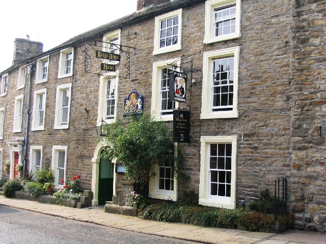
Kings Arms Hotel

The Kings Arms Hotel is a public house and inn in the English village of Askrigg, North Yorkshire. A Grade II listed building, standing on the northern...

Askrigg

Askrigg is a small village and civil parish in Wensleydale in the Yorkshire Dales National Park. It was formerly a part of the Richmondshire district of...

Nearby Amenities

Located within 500m of 54.331592,-2.0268615
Historic: mine_shaft
Source: NPE
Lat/Long: 54.3309456/-2.0344334
Historic: mine_shaft
Source: NPE
Lat/Long: 54.3302699/-2.0342188
Historic: mine_shaft
Source: NPE
Lat/Long: 54.3296193/-2.0334034
Historic: mine_shaft
Source: NPE
Lat/Long: 54.3287434/-2.0313864
Historic: mine_shaft
Source: NPE
Lat/Long: 54.3288435/-2.0323735
Historic: mine_shaft
Source: NPE
Lat/Long: 54.3284181/-2.0320302
The data included in this document is from www.openstreetmap.org. The data is made available under ODbL.

Have you been to Beldon Peat Moor?

Leave your review of Beldon Peat Moor below (or comments, questions and feedback).