Aysgarth Moor

Downs, Moorland in Yorkshire Richmondshire

England

Aysgarth Moor

Looking towards Ivy Scar Looking towards Ivy Scar from The Straights.
Looking towards Ivy Scar Credit: T Eyre

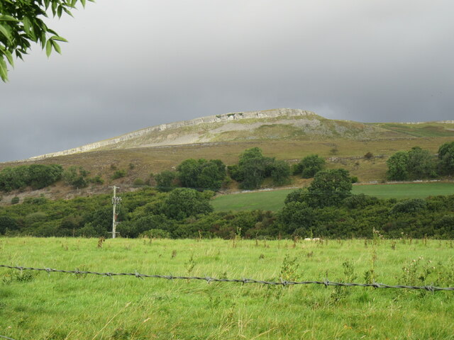
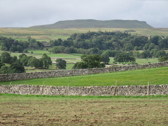
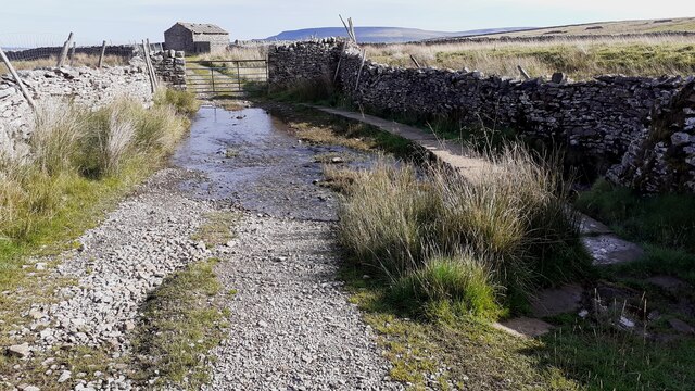
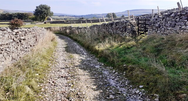
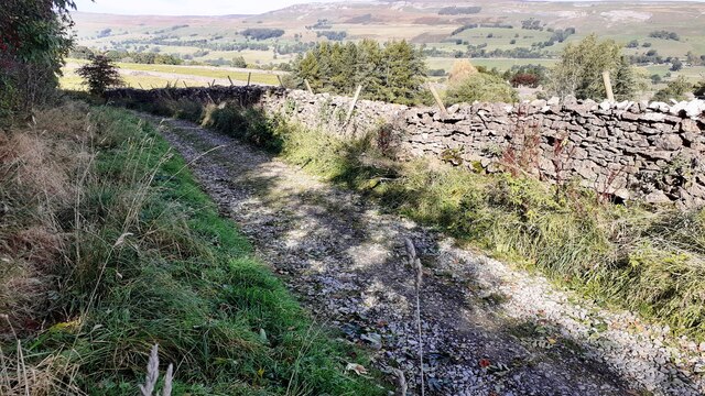
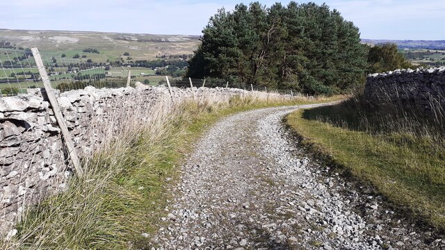
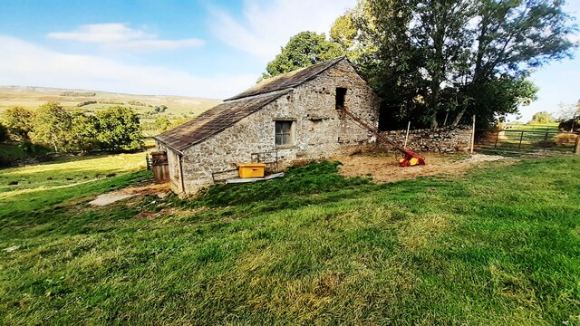
Aysgarth Moor, located in Yorkshire, England, is a captivating and scenic area characterized by its rolling downs and vast moorland. Spanning over a considerable expanse, the moor is a haven for nature enthusiasts, hikers, and those seeking solace in the tranquility of the countryside.

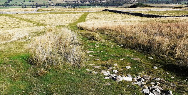
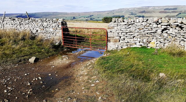
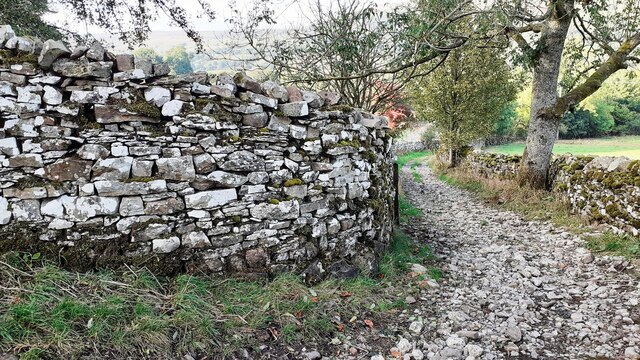
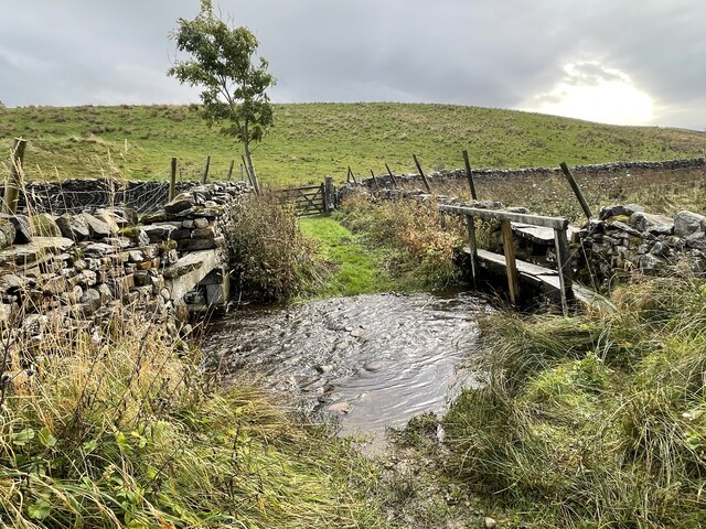
The moorland of Aysgarth is known for its breathtaking beauty, with its heather-covered hills, expansive grasslands, and scattered rocky outcrops. The diverse flora and fauna found here make it an ideal habitat for a variety of wildlife, including birds of prey, such as kestrels and buzzards, as well as wild deer and rabbits.

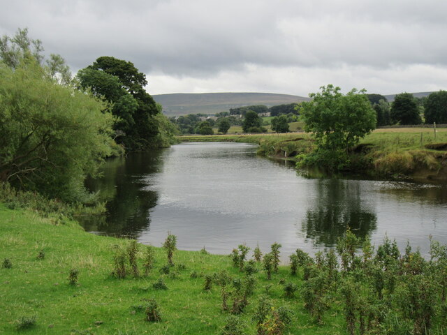
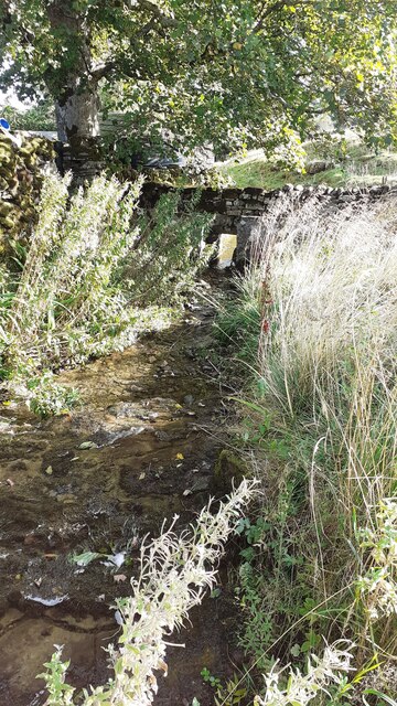
The landscape of Aysgarth Moor is further enhanced by the presence of several picturesque waterfalls. The Aysgarth Falls, in particular, are a sight to behold, with cascading waters cutting through the limestone rock formations. These falls have served as a popular attraction for visitors for many years, drawing crowds who come to witness the sheer power and beauty of nature.

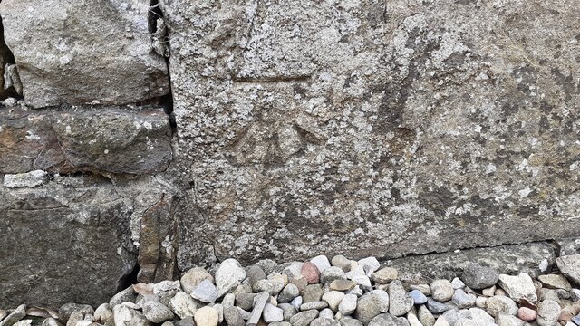
Aside from its natural wonders, Aysgarth Moor also holds historical significance. The area is home to ancient burial mounds, evidence of human occupation dating back thousands of years. These archaeological remnants offer a glimpse into the rich heritage of the region and provide an opportunity for exploration and discovery.

Overall, Aysgarth Moor, with its captivating downs, moorland, and waterfalls, offers a serene and enchanting escape from the bustling modern world, providing visitors with a chance to reconnect with nature and experience the beauty of rural Yorkshire.

If you have any feedback on the listing, please let us know in the comments section below.

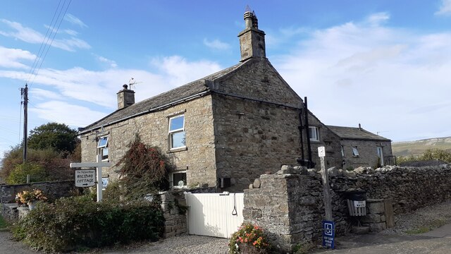
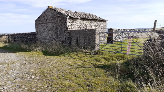
Aysgarth Moor Images

Images are sourced within 2km of 54.286026/-2.0284905 or Grid Reference SD9887. Thanks to Geograph Open Source API. All images are credited.

Looking towards Ivy Scar Looking towards Ivy Scar from The Straights.
Looking towards Ivy Scar
Looking towards Ivy Scar from The Straights.
Woodhall Park Looking towards Addleborough.
Woodhall Park
Looking towards Addleborough.
River Ure near Aysgarth Looking downstream with Penhill in the distance.
River Ure near Aysgarth
Looking downstream with Penhill in the distance.
Footbridge over the River Ure Footbridge over the River Ure near Aysgarth.
Footbridge over the River Ure
Footbridge over the River Ure near Aysgarth.
Benchmark on The Old Goat House Ordnance Survey cut mark benchmark described on the Bench Mark Database at <span class="nowrap"><a title="www.bench-marks.org.uk/bm31142" rel="nofollow ugc noopener" href="http://www.bench-marks.org.uk/bm31142">Link</a><img style="margin-left:2px;" alt="External link" title="External link - shift click to open in new window" src="https://s1.geograph.org.uk/img/external.png" width="10" height="10"/></span>
Benchmark on The Old Goat House
Ordnance Survey cut mark benchmark described on the Bench Mark Database at LinkExternal link
The Old Goat House There is an Ordnance Survey benchmark <a href="https://www.geograph.org.uk/photo/6985668">SD9788 : Benchmark on The Old Goat House</a> on the near corner, right hand face (behind the white gates), of the house
The Old Goat House
There is an Ordnance Survey benchmark SD9788 : Benchmark on The Old Goat House on the near corner, right hand face (behind the white gates), of the house
Barn beside track SW of Thornton Rust The 1893 1:2500 Map indicates an Ordnance Survey benchmark levelled at 1045.9 feet above Liverpool Datum on the front of the barn at its far corner
Barn beside track SW of Thornton Rust
The 1893 1:2500 Map indicates an Ordnance Survey benchmark levelled at 1045.9 feet above Liverpool Datum on the front of the barn at its far corner
West Beck beside the Thornton Rust sheepfold 'Here sheep wash and clipping was undertaken to wash out lanolin and ticks (and salve) from sheep fleeces before clipping. The stream was blocked at the lower end of the sheep dip site by inserting a wooden slab between the two large stone slabs (which can be seen in the photo in front of the hole in the dry stone wall) set in the stream. This created a large pool into which the sheep were driven and individually washed. This practice stopped in the early 1900s. One reason was that the wool processors realised that lanolin was a valuable product which they preferred to be left in the fleeces to process themselves'.
West Beck beside the Thornton Rust sheepfold
'Here sheep wash and clipping was undertaken to wash out lanolin and ticks (and salve) from sheep fleeces before clipping. The stream was blocked at the lower end of the sheep dip site by inserting a wooden slab between the two large stone slabs (which can be seen in the photo in front of the hole in the dry stone wall) set in the stream. This created a large pool into which the sheep were driven and individually washed. This practice stopped in the early 1900s. One reason was that the wool processors realised that lanolin was a valuable product which they preferred to be left in the fleeces to process themselves'.
Ford and raised footpath over West Beck on track towards Thornton Rusk The track passes an old stone barn <a href="https://www.geograph.org.uk/photo/6985769">SD9688 : Barn beside track SW of Thornton Rust</a> about 50m past the gate.
Ford and raised footpath over West Beck on track towards Thornton Rusk
The track passes an old stone barn SD9688 : Barn beside track SW of Thornton Rust about 50m past the gate.
Track towards Thornton Rust Ordnance Survey records indicate that a benchmark levelled at 274.774m above Newlyn Datum was verified in 1954 on a stone in the dry stone wall on the left hand side of the track 4.6m past the junction of walls on the right hand side of the track.
Track towards Thornton Rust
Ordnance Survey records indicate that a benchmark levelled at 274.774m above Newlyn Datum was verified in 1954 on a stone in the dry stone wall on the left hand side of the track 4.6m past the junction of walls on the right hand side of the track.
Track descending to Thornton Rust The 1893 Map shows a  benchmark at 946.3 feet on a rock beside the left hand side of the track at this location
Track descending to Thornton Rust
The 1893 Map shows a benchmark at 946.3 feet on a rock beside the left hand side of the track at this location
Track on Thornton Rust Moor heading towards Thornton Rust Ordnance Survey records describe a benchmark levelled at 305.684m above Newlyn Datum verified in 1954 on a boulder on the left hand side of the track here
Track on Thornton Rust Moor heading towards Thornton Rust
Ordnance Survey records describe a benchmark levelled at 305.684m above Newlyn Datum verified in 1954 on a boulder on the left hand side of the track here
Paths on Thornton Rust Moor The 1893 Map shows a benchmark 1094.6 feet probably on a rock here
Paths on Thornton Rust Moor
The 1893 Map shows a benchmark 1094.6 feet probably on a rock here
Gate in wall across track on Thornton Rust Moor Ordnance Survey records indicate that a benchmark levelled at 347.423m above Newlyn Datum was verified in 1954 on the wall on the left hand side of the gate
Gate in wall across track on Thornton Rust Moor
Ordnance Survey records indicate that a benchmark levelled at 347.423m above Newlyn Datum was verified in 1954 on the wall on the left hand side of the gate
Barn in field on west side of Nipe Lane There is an Ordnance Survey benchmark <a href="https://www.geograph.org.uk/photo/5213892">SD9789 : Benchmark on stone at base of barn in Thornton Rust</a> on a rock at the base of the barn at the junction of its two sections
Barn in field on west side of Nipe Lane
There is an Ordnance Survey benchmark SD9789 : Benchmark on stone at base of barn in Thornton Rust on a rock at the base of the barn at the junction of its two sections
Benchmark on stone at base of wall corner at NW side of footpath at Nipe End Ordnance Survey pivot benchmark shown as levelled at 243.51m above Newlyn Datum on 1978-1979 1:2500 Map
Benchmark on stone at base of wall corner at NW side of footpath at Nipe End
Ordnance Survey pivot benchmark shown as levelled at 243.51m above Newlyn Datum on 1978-1979 1:2500 Map
Bend in Nipe Lane at  Nipe End There is an Ordnance Survey benchmark <a href="https://www.geograph.org.uk/photo/6995779">SD9789 : Benchmark on stone at base of wall corner at NW side of footpath at Nipe End</a> on a stone at the base of the wall at its corner  in the middle of the image
Bend in Nipe Lane at Nipe End
There is an Ordnance Survey benchmark SD9789 : Benchmark on stone at base of wall corner at NW side of footpath at Nipe End on a stone at the base of the wall at its corner in the middle of the image
Folly Lane Ford This ford is found on Folly Lane.
Folly Lane Ford
This ford is found on Folly Lane.
Show me another place!

Aysgarth Moor is located at Grid Ref: SD9887 (Lat: 54.286026, Lng: -2.0284905)

Division: North Riding

Administrative County: North Yorkshire

District: Richmondshire

Police Authority: North Yorkshire

What 3 Words

///dummy.rollover.plugged. Near Leyburn, North Yorkshire

Nearby Locations

Aysgarth Moor

Related Wikis

Castle Dykes Henge

Castle Dykes Henge is a Class I Neolithic henge earthwork in the Yorkshire Dales National Park in North Yorkshire, England, situated between the villages...

A684 road

The A684 is an A road that runs through Cumbria and North Yorkshire, starting at Kendal, Cumbria and ending at Ellerbeck and the A19 road in North Yorkshire...

Thornton Rust

Thornton Rust is a village and civil parish in North Yorkshire, England. It lies in the Yorkshire Dales about 2 miles (3.2 km) west of Aysgarth, high on...

Thoralby

Thoralby is a village and civil parish in the Richmondshire district of North Yorkshire, England. It lies south of Aysgarth, is within a mile of both Newbiggin...
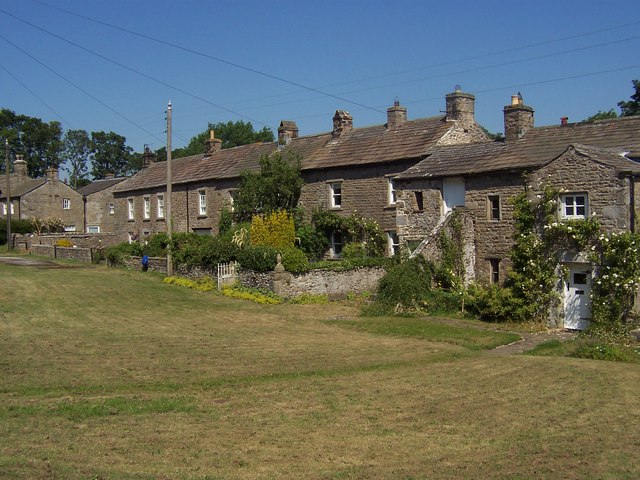
Aysgarth

Aysgarth is a village and civil parish in Wensleydale, in North Yorkshire, England. The village is in the Yorkshire Dales National Park, about 16 miles...

Newbiggin, south Wensleydale

Newbiggin is a village and civil parish in Bishopdale, a side dale on the south side of Wensleydale, in the Yorkshire Dales in North Yorkshire, England...

Woodhall, North Yorkshire

Woodhall is a small hamlet in Wensleydale, North Yorkshire, England. It is about 2 miles (3 km) away from Askrigg and 3 miles (5 km) north west of Aysgarth...

Carperby

Carperby is a village in the Yorkshire Dales, North Yorkshire, England. It lies 7 miles (11 km) west of Leyburn. == Etymology == The derivation of the...

Nearby Amenities

Located within 500m of 54.286026,-2.0284905
Aysgarth Moor
Natural: moor
Source: NPE
Lat/Long: 54.283511/-2.0281484
The data included in this document is from www.openstreetmap.org. The data is made available under ODbL.

Have you been to Aysgarth Moor?

Leave your review of Aysgarth Moor below (or comments, questions and feedback).