Ingestre Park

Downs, Moorland in Staffordshire Stafford

England

Ingestre Park

Ingestre Hall Chetwynd's Jacobean masterpiece is owned by Sandwell Borough Council, who use it as a residential arts centre. <span class="nowrap"><a title="http://pages.britishlibrary.net/tixandrews/ingestre/inghall.html" rel="nofollow ugc noopener" href="http://pages.britishlibrary.net/tixandrews/ingestre/inghall.html">Link</a><img style="margin-left:2px;" alt="External link" title="External link - shift click to open in new window" src="https://s1.geograph.org.uk/img/external.png" width="10" height="10"/></span>
Ingestre Hall Credit: Adrian Bailey

Ingestre Park is a picturesque estate located in Staffordshire, England. Spread across acres of rolling downs and moorland, it offers visitors a serene and natural setting to explore and enjoy. The park is situated near the village of Ingestre, nestled within the beautiful Staffordshire countryside.

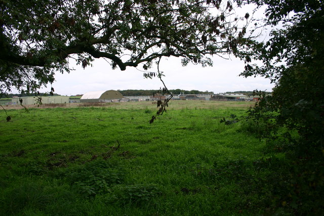
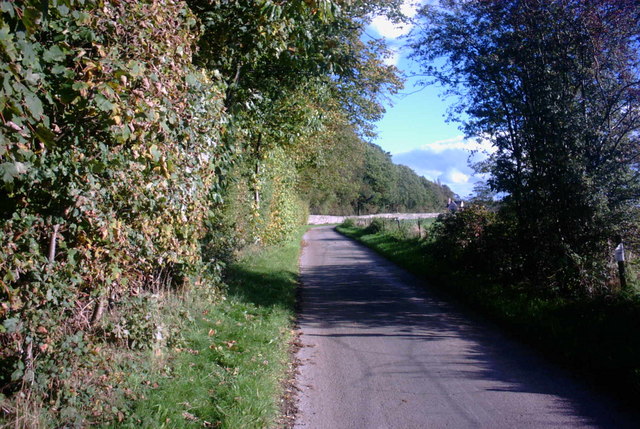
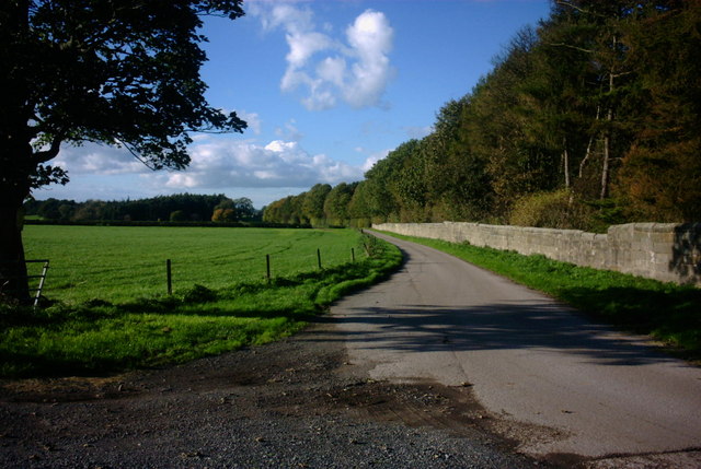
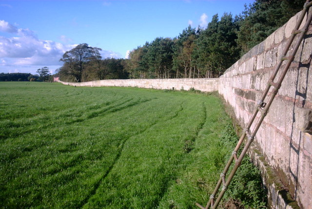
The parkland at Ingestre is known for its diverse landscapes, featuring both downs and moorland. The downs are characterized by gently sloping hills covered in lush grass, providing a perfect spot for picnics or leisurely walks. Visitors can take in the stunning panoramic views of the surrounding countryside from these elevated areas.

The moorland found within the park offers a contrasting experience, with its rugged and wild terrain. Covered in heather and bracken, the moorland provides a habitat for various species of birds and small mammals. Nature enthusiasts can enjoy exploring the moorland trails, immersing themselves in the tranquility of this untouched landscape.

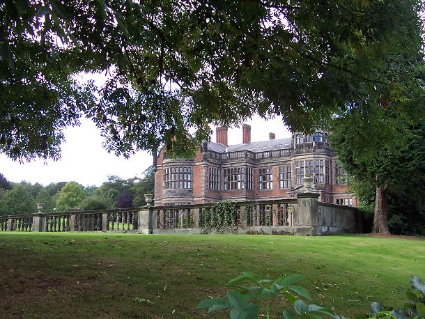
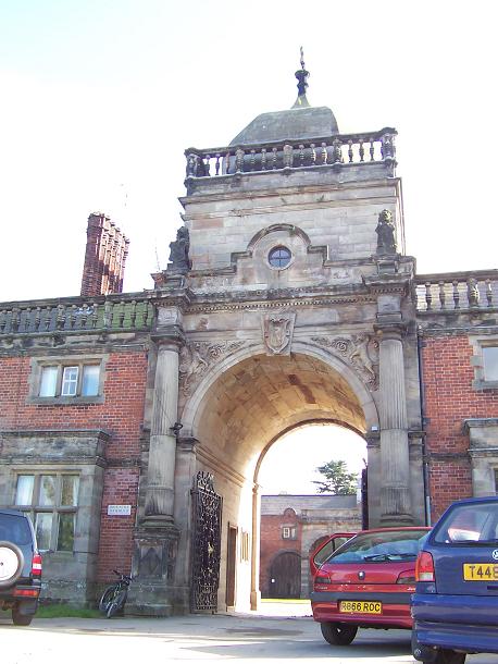
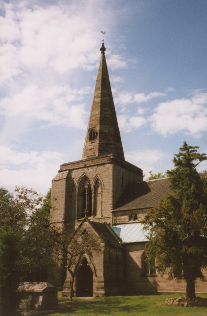
Ingestre Park is not only a haven for nature lovers but also boasts a rich history. The estate features a magnificent Jacobean mansion, built in the early 17th century. This impressive architectural gem adds to the allure of the park, offering a glimpse into the past.

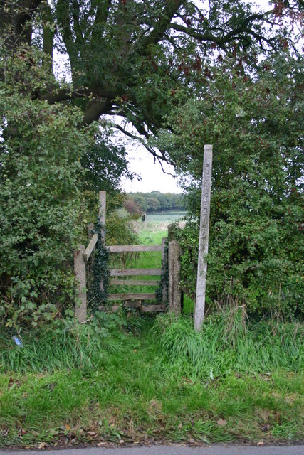
Visitors to Ingestre Park can take advantage of the numerous walking paths and trails that wind through the estate, allowing them to fully appreciate the natural beauty of the downs and moorland. Whether it's a leisurely stroll, a family outing, or a chance to reconnect with nature, Ingestre Park is a destination that offers something for everyone.

If you have any feedback on the listing, please let us know in the comments section below.

Ingestre Park Images

Images are sourced within 2km of 52.827125/-2.0496165 or Grid Reference SJ9625. Thanks to Geograph Open Source API. All images are credited.

Ingestre Hall Chetwynd's Jacobean masterpiece is owned by Sandwell Borough Council, who use it as a residential arts centre. <span class="nowrap"><a title="http://pages.britishlibrary.net/tixandrews/ingestre/inghall.html" rel="nofollow ugc noopener" href="http://pages.britishlibrary.net/tixandrews/ingestre/inghall.html">Link</a><img style="margin-left:2px;" alt="External link" title="External link - shift click to open in new window" src="https://s1.geograph.org.uk/img/external.png" width="10" height="10"/></span>
Ingestre Hall
Chetwynd's Jacobean masterpiece is owned by Sandwell Borough Council, who use it as a residential arts centre. LinkExternal link
St Mary the Virgin, Ingestre Built 1676. <span class="nowrap"><a title="http://pages.britishlibrary.net/tixandrews/ingestre/ingchrch.html" rel="nofollow ugc noopener" href="http://pages.britishlibrary.net/tixandrews/ingestre/ingchrch.html">Link</a><img style="margin-left:2px;" alt="External link" title="External link - shift click to open in new window" src="https://s1.geograph.org.uk/img/external.png" width="10" height="10"/></span>
St Mary the Virgin, Ingestre
Built 1676. LinkExternal link
Ingestre This odd little place viewed from the stables.
Ingestre
This odd little place viewed from the stables.
Ingestre Stables <span class="nowrap"><a title="http://www.ingestre.com/" rel="nofollow ugc noopener" href="http://www.ingestre.com/">Link</a><img style="margin-left:2px;" alt="External link" title="External link - shift click to open in new window" src="https://s1.geograph.org.uk/img/external.png" width="10" height="10"/></span>
Ingestre is quite a surprise. The village is at the end of a no-through road, so you'll only arrive here by choice or by accident. Your reward is not only a magnificent hall and church, but these amazing stables, which look to me more like an Oxford college. Hmm...
Ingestre Stables
LinkExternal link Ingestre is quite a surprise. The village is at the end of a no-through road, so you'll only arrive here by choice or by accident. Your reward is not only a magnificent hall and church, but these amazing stables, which look to me more like an Oxford college. Hmm...
Weston upon Trent Church St Andrew's Church has an very broad tower in Early English style, and there is other early 13C work inside, but the remainder of the exterior is Victorian, of 1860 and 1872.
Weston upon Trent Church
St Andrew's Church has an very broad tower in Early English style, and there is other early 13C work inside, but the remainder of the exterior is Victorian, of 1860 and 1872.
County Showground Taken during the Staffordshire Show
County Showground
Taken during the Staffordshire Show
Battle Field, Stafford Here is a view of the site of the Battle of Hopton Heath on 19th March 1643 during the English Civil War. The Royalists for King Charles I were led by Spencer Compton, Earl of Northampton, killed in action during the battle. The Parliamentarians were led by Sir John Gel. The battle started at 3p.m. and lasted until dark. The outcome of this battle was indecisive. The buildings in the background are storage units for the RAF.
Battle Field, Stafford
Here is a view of the site of the Battle of Hopton Heath on 19th March 1643 during the English Civil War. The Royalists for King Charles I were led by Spencer Compton, Earl of Northampton, killed in action during the battle. The Parliamentarians were led by Sir John Gel. The battle started at 3p.m. and lasted until dark. The outcome of this battle was indecisive. The buildings in the background are storage units for the RAF.
Stile on Within Lane, Stafford This stile is on within Lane, Hopton near to Stafford. It gives access to the field where the Battle of Hopton Heath happened on 19th March 1643.
Stile on Within Lane, Stafford
This stile is on within Lane, Hopton near to Stafford. It gives access to the field where the Battle of Hopton Heath happened on 19th March 1643.
Farm Track and Bridleway This track leads to a pink painted farmhouse and a bridleway that leads across beautiful countryside to Tixall near stafford.
Farm Track and Bridleway
This track leads to a pink painted farmhouse and a bridleway that leads across beautiful countryside to Tixall near stafford.
Farm Track and Bridleway This track leads to the A518, it is a continuation of a bridleway from Tixall near Stafford. The woodland on the right is called Pool covert.
Farm Track and Bridleway
This track leads to the A518, it is a continuation of a bridleway from Tixall near Stafford. The woodland on the right is called Pool covert.
Bridleway in a Field This bridleway runs alongside a tall stone-walled wooded area (Lamberts Coppice) on the right and a very large open field on the left. I guess that at one time there used to be deer kept behind the wall looking at the names on the map.
Bridleway in a Field
This bridleway runs alongside a tall stone-walled wooded area (Lamberts Coppice) on the right and a very large open field on the left. I guess that at one time there used to be deer kept behind the wall looking at the names on the map.
A518, Weston Bank This is the A518 looking towards the direction of Weston near Stafford.
A518, Weston Bank
This is the A518 looking towards the direction of Weston near Stafford.
Woodland Bridleway This is a beautiful countryside area just off the A518 near to Weston Bank.
Woodland Bridleway
This is a beautiful countryside area just off the A518 near to Weston Bank.
Tinkerborough Cottages Cottages in a lovely off road area called Tinkerborough, near Stafford
Tinkerborough Cottages
Cottages in a lovely off road area called Tinkerborough, near Stafford
Lane and Bridleway This lane and Bridleway leads to Barn House, seen in the mid-distance. The bridleway continues to Salt.
Lane and Bridleway
This lane and Bridleway leads to Barn House, seen in the mid-distance. The bridleway continues to Salt.
Beautiful Staffordshire Countryside This is a view of beautiful Staffordshire countryside from a lane and bridleway just off the A518 near to Stafford.
Beautiful Staffordshire Countryside
This is a view of beautiful Staffordshire countryside from a lane and bridleway just off the A518 near to Stafford.
A518 Weston Bank This is a view of the A518 leading to Weston. The road drops steeply downhill here to the village of Weston. Glorious views of the Trent Valley and surrounding countryside can be seen from here.
A518 Weston Bank
This is a view of the A518 leading to Weston. The road drops steeply downhill here to the village of Weston. Glorious views of the Trent Valley and surrounding countryside can be seen from here.
Weston Hall, Weston, Stafford A fantastic building on Weston Bank, this building is owned by a local businessman who holds weddings, parties and other events here.
Weston Hall, Weston, Stafford
A fantastic building on Weston Bank, this building is owned by a local businessman who holds weddings, parties and other events here.
Show me another place!

Ingestre Park is located at Grid Ref: SJ9625 (Lat: 52.827125, Lng: -2.0496165)

Administrative County: Staffordshire

District: Stafford

Police Authority: Staffordshire

What 3 Words

///rider.keeps.drew. Near Great Haywood, Staffordshire

Related Wikis

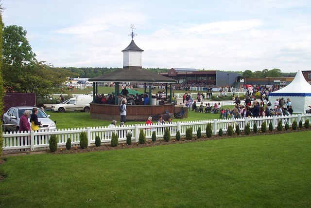
Bingley Hall, Stafford

Bingley Hall (also known as New Bingley Hall to distinguish itself from the Bingley Hall in Birmingham) is an exhibition hall located in Stafford, England...

Ingestre Hall

Ingestre Hall is a Grade II* 17th-century Jacobean mansion situated at Ingestre, near Stafford, Staffordshire, England. Formerly the seat of the Earls...

Ingestre

Ingestre is a village and civil parish in the Stafford district, in the county of Staffordshire, England. The population of the civil parish taken at the...

Battle of Hopton Heath

The battle of Hopton Heath was a battle of the First English Civil War, fought on Sunday 19 March 1643 between Parliamentarian forces led by Sir John Gell...

Ingestre railway station

Ingestre and Weston railway station was a former British railway station to serve the village of Ingestre in Staffordshire.It was opened by the Stafford...

Weston, Staffordshire

Weston is a village and civil parish. within the English county of Staffordshire. The parish is in the local authority of Stafford (non-metropolitan district...

Weston and Ingestre railway station

Weston and Ingestre railway station was a former British railway station opened by the North Staffordshire Railway to serve the village of Ingestre in...

Weston Road Academy

The Weston Road Academy (formerly Weston Road High School) is an academy school in Stafford, England. It provides secondary and further education for pupils...

Nearby Amenities

Located within 500m of 52.827125,-2.0496165
The data included in this document is from www.openstreetmap.org. The data is made available under ODbL.

Have you been to Ingestre Park?

Leave your review of Ingestre Park below (or comments, questions and feedback).