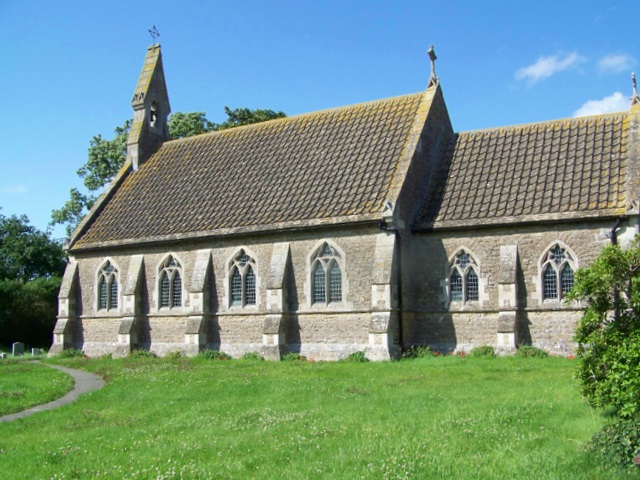
Marston Green

Downs, Moorland in Wiltshire

England

Marston Green

Pastures near Newtown Farm Much of this area is arable, but here there are cattle pastures.
This photo was taken from the 1158 Penzance to London Paddington train, having left Castle Cary at 1550.
Pastures near Newtown Farm Credit: Graham Horn

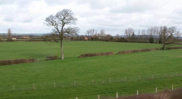
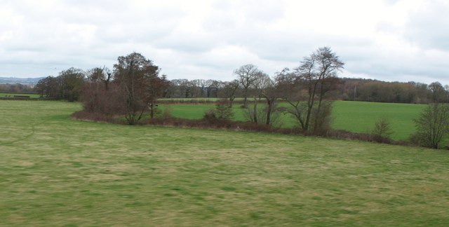
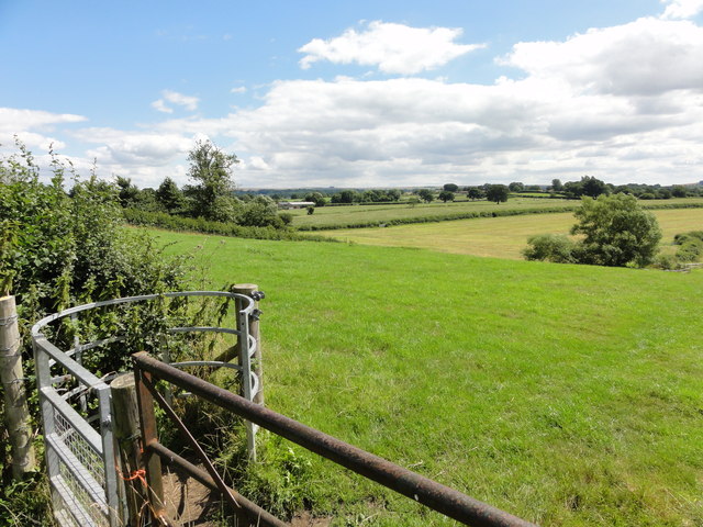
Marston Green is a picturesque village located in the heart of Wiltshire, England. Situated on the edge of the Salisbury Plain, the village is surrounded by breathtaking downs and moorland landscapes, making it an idyllic location for nature enthusiasts.

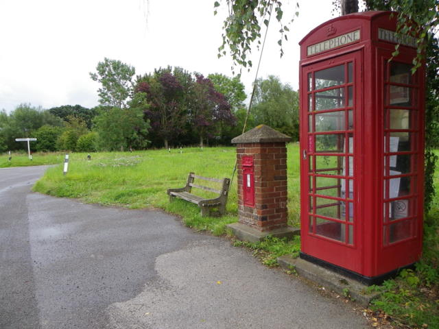
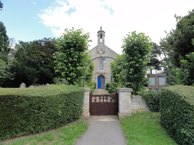
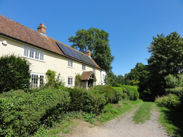
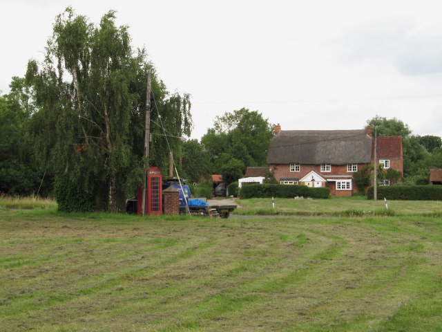
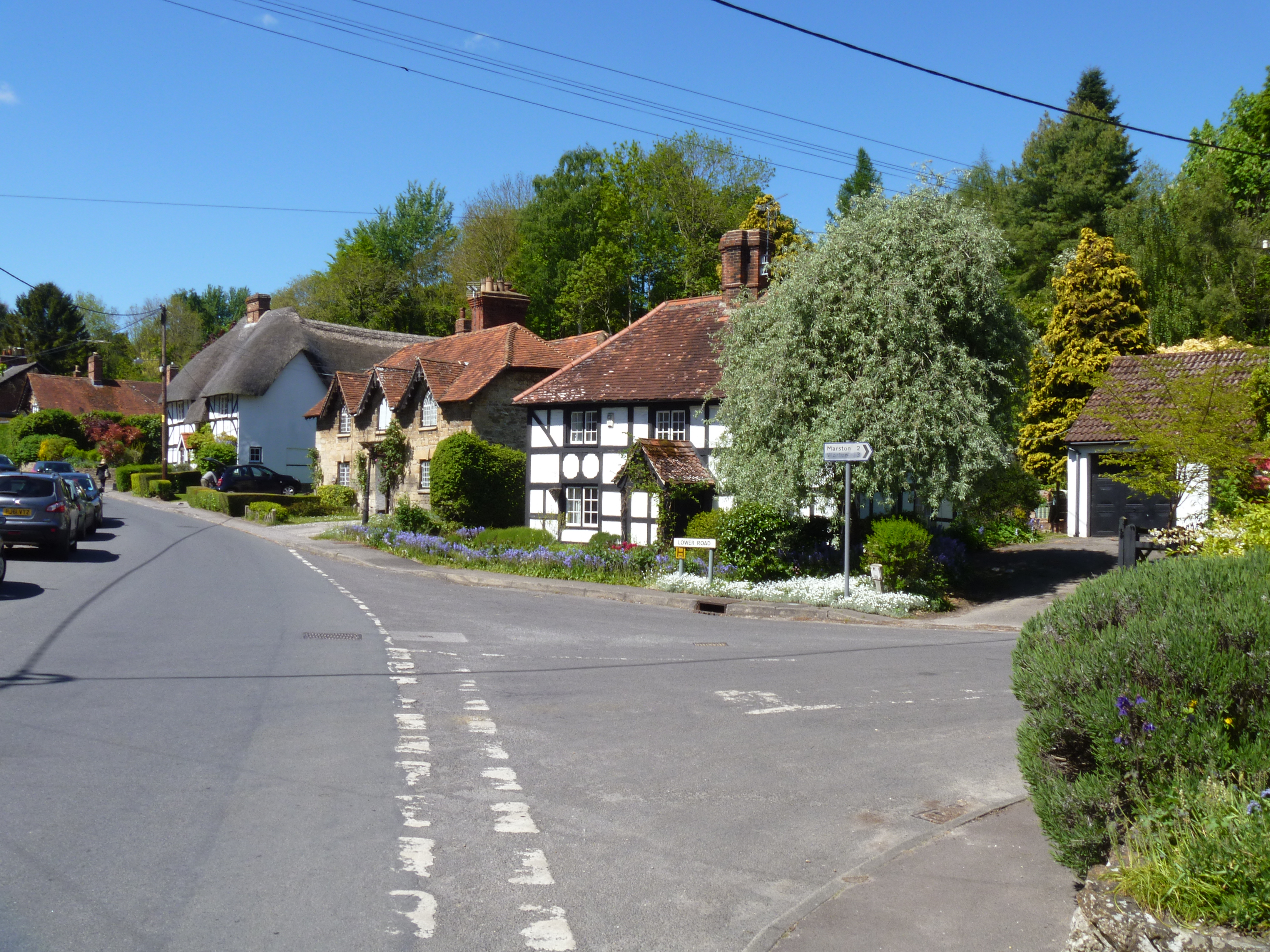
The village itself is small, with a tight-knit community of friendly locals. It offers a peaceful and tranquil atmosphere, perfect for those seeking a rural retreat away from the hustle and bustle of city life. The village is dotted with charming cottages and traditional houses, giving it a quintessentially English feel.

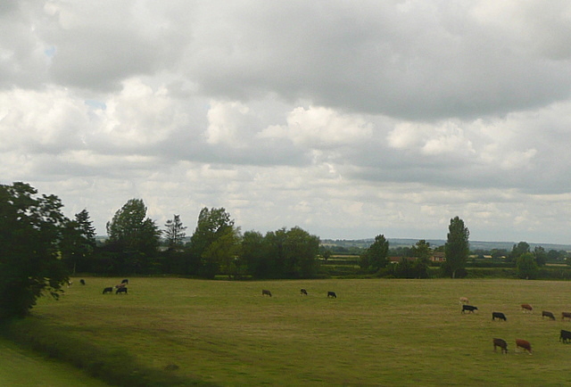
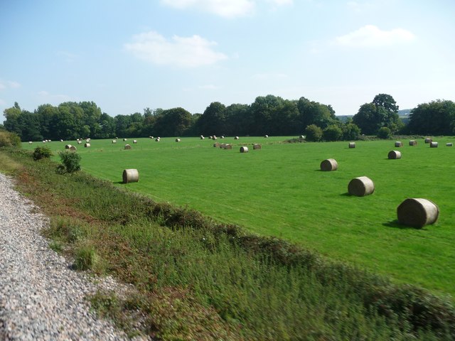
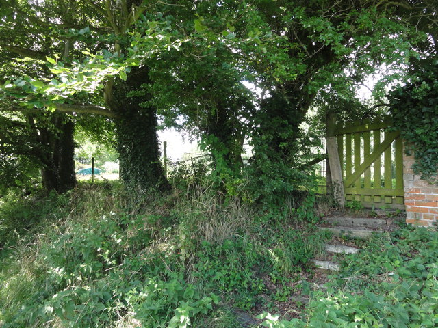
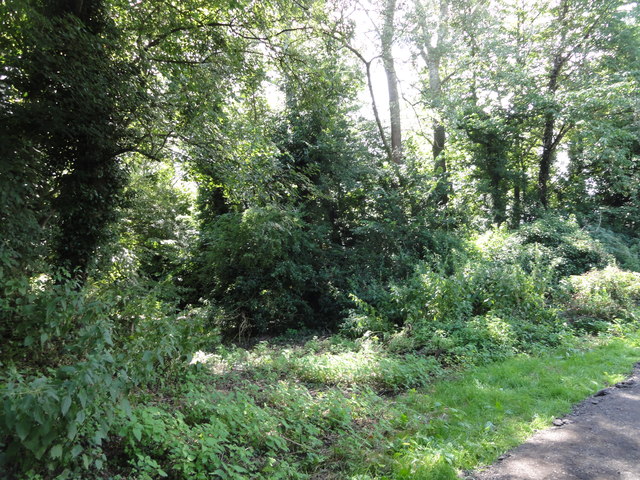
Marston Green is known for its stunning natural beauty and diverse wildlife. The downs and moorland that surround the village are home to a variety of flora and fauna, including wildflowers, rabbits, deer, and a wide range of bird species. The area is a haven for birdwatchers and hikers, who can explore the numerous walking trails that crisscross the countryside.

Despite its rural setting, Marston Green is conveniently located close to larger towns and cities. The historic city of Salisbury is just a short drive away, offering a range of amenities including shops, restaurants, and cultural attractions. Additionally, the village is well-connected by road and public transport, making it easily accessible for residents and visitors alike.

In conclusion, Marston Green is a charming village nestled amidst the stunning downs and moorland of Wiltshire. With its natural beauty, friendly community, and convenient location, it is a hidden gem for those seeking a peaceful and picturesque slice of English countryside.

If you have any feedback on the listing, please let us know in the comments section below.

Marston Green Images

Images are sourced within 2km of 51.309639/-2.0494746 or Grid Reference ST9656. Thanks to Geograph Open Source API. All images are credited.

Pastures near Newtown Farm Much of this area is arable, but here there are cattle pastures.
This photo was taken from the 1158 Penzance to London Paddington train, having left Castle Cary at 1550.
Pastures near Newtown Farm
Much of this area is arable, but here there are cattle pastures. This photo was taken from the 1158 Penzance to London Paddington train, having left Castle Cary at 1550.
West Wiltshire : grassy field A grassy field with hay bales in the sun.
West Wiltshire : grassy field
A grassy field with hay bales in the sun.
Village communications, Norney Road The K6 telephone box stands beside a Victorian reign postbox.

In 1935, the Post Office commissioned a new kiosk from Sir Giles Gilbert Scott to celebrate the Jubilee of King George V.  The K6 Jubilee Kiosk, as it is known, was similar to the K2 box, being made of cast iron and painted red but was 25% lighter in weight.  By the end of the 1930s there were 20,000 K6 telephone boxes in use all over the UK.

There is an Ordnance Survey bench mark on the side of the postbox.
Village communications, Norney Road
The K6 telephone box stands beside a Victorian reign postbox. In 1935, the Post Office commissioned a new kiosk from Sir Giles Gilbert Scott to celebrate the Jubilee of King George V. The K6 Jubilee Kiosk, as it is known, was similar to the K2 box, being made of cast iron and painted red but was 25% lighter in weight. By the end of the 1930s there were 20,000 K6 telephone boxes in use all over the UK. There is an Ordnance Survey bench mark on the side of the postbox.
Bench Mark, Norney Road On the south face of the letter box is an Ordnance Survey bench mark.  For a wider view of the box <a href="https://www.geograph.org.uk/photo/1009191">ST9656 : Victorian postbox, Marston</a> and for further information on the cut mark and others in the area <span class="nowrap"><a title="http://www.bench-marks.org.uk/bm39638" rel="nofollow ugc noopener" href="http://www.bench-marks.org.uk/bm39638">Link</a><img style="margin-left:2px;" alt="External link" title="External link - shift click to open in new window" src="https://s1.geograph.org.uk/img/external.png" width="10" height="10"/></span>
Bench Mark, Norney Road
On the south face of the letter box is an Ordnance Survey bench mark. For a wider view of the box ST9656 : Victorian postbox, Marston and for further information on the cut mark and others in the area LinkExternal link
Farmland, Newtown Farm Trees along an intermittent hedge reinforced with a fence. Newtown Farm is in the centre background. On the left are buildings at South Farm. View from a passing train on the line from Westbury to Pewsey.
Farmland, Newtown Farm
Trees along an intermittent hedge reinforced with a fence. Newtown Farm is in the centre background. On the left are buildings at South Farm. View from a passing train on the line from Westbury to Pewsey.
Farmland near Great Cheverell Seen from a train on the Westbury - Pewsey main line. The nearer trees are following a small drainage channel. Cheverell Wood is in the background on the right.
Farmland near Great Cheverell
Seen from a train on the Westbury - Pewsey main line. The nearer trees are following a small drainage channel. Cheverell Wood is in the background on the right.
Roadside standing stone A roadside standing stone, possibly a boundary marker or a defaced mile stone in the village of Worton opposite the Library Hall (Village Hall).
Roadside standing stone
A roadside standing stone, possibly a boundary marker or a defaced mile stone in the village of Worton opposite the Library Hall (Village Hall).
Christ Church Christ Church, Worton.  Entrance gate and pathway.
Christ Church
Christ Church, Worton. Entrance gate and pathway.
Footpath, Worton Footpath running from the Church to Back Lane.
Footpath, Worton
Footpath running from the Church to Back Lane.
Footpath to the rear of Cedar Close Footpath running behind Cedar Close
Footpath to the rear of Cedar Close
Footpath running behind Cedar Close
Entrance to Cedar Close from the footpath Footpath runs from the Church behind Cedar Close.
Entrance to Cedar Close from the footpath
Footpath runs from the Church behind Cedar Close.
Old sheds and look out post View from the public footpath
Old sheds and look out post
View from the public footpath
Iron gates and fencing Iron gates and fencing, probably from the elegant days of the Prince Hill Estate.
Iron gates and fencing
Iron gates and fencing, probably from the elegant days of the Prince Hill Estate.
Back Lane, Worton An unsurfaced track running from opposite the Public House to fields and dwellings.
Back Lane, Worton
An unsurfaced track running from opposite the Public House to fields and dwellings.
Dwellings in Back Lane, Worton Dwellings in Back Lane
Dwellings in Back Lane, Worton
Dwellings in Back Lane
Back Lane, steps to the orchard Old gate and stone steps lead to the orchard which would possibly be to the rear of Worton House.
Back Lane, steps to the orchard
Old gate and stone steps lead to the orchard which would possibly be to the rear of Worton House.
Entrance to a small piece of land disused View from Back Lane of the wide entrance to piece of land in a hollow which runs in a narrow length from the lane down to the stream.  Old local people call this 'Bill Bantams'.  Now overgrown the land has had various uses including keeping horses.  At the top of the banked land to the right of the image, is an area which years ago was used as a burial ground for horses.
Entrance to a small piece of land disused
View from Back Lane of the wide entrance to piece of land in a hollow which runs in a narrow length from the lane down to the stream. Old local people call this 'Bill Bantams'. Now overgrown the land has had various uses including keeping horses. At the top of the banked land to the right of the image, is an area which years ago was used as a burial ground for horses.
Gooseberry Hill Known locally as Gooseberry Hill or "Goos-gog" Hill, the field enclose over the years has been made smaller to provide a fenced in footpath (left of image).  The steepness of the hill gave people a sledging spot in snowy weather.  Towards the right of the image the clump of trees marks a cattle watering spot in the stream and a footbridge.
Gooseberry Hill
Known locally as Gooseberry Hill or "Goos-gog" Hill, the field enclose over the years has been made smaller to provide a fenced in footpath (left of image). The steepness of the hill gave people a sledging spot in snowy weather. Towards the right of the image the clump of trees marks a cattle watering spot in the stream and a footbridge.
Show me another place!

Marston Green is located at Grid Ref: ST9656 (Lat: 51.309639, Lng: -2.0494746)

Unitary Authority: Wiltshire

Police Authority: Wiltshire

What 3 Words

///campus.force.prompting. Near Marston, Wiltshire

Related Wikis

Marston, Wiltshire

Marston is a small village and civil parish 4 miles (6.4 km) southwest of Devizes in Wiltshire, England. The parish lies south of Worton, away from main...

Worton, Wiltshire

Worton is a village and civil parish about 3 miles (5 km) southwest of Devizes in Wiltshire. It is near the northern edge of Salisbury Plain in central...

Bulkington, Wiltshire

Bulkington is a village and civil parish in the county of Wiltshire, England. The village is about 4.5 miles (7.2 km) west of Devizes and a similar distance...

Erlestoke

Erlestoke is a village and civil parish in Wiltshire, England, on the northern edge of Salisbury Plain. The village lies about 6 miles (10 km) east of...

Nearby Amenities

Located within 500m of 51.309639,-2.0494746
Marston
Is In: Wiltshire, England, UK
Place: village
Lat/Long: 51.3109928/-2.0521683
Bus Stop
The Green
Bus: yes
Naptan AtcoCode: 4600WIA10432
Naptan Bearing: NW
Naptan CommonName: The Green
Naptan Indicator: NW-bound
Naptan NaptanCode: wilapmdt
Naptan Street: Plough Lane
Naptan Verified: no
Public Transport: platform
Shelter: yes
Lat/Long: 51.30974/-2.0495246
Waste Basket
Colour: black
Lat/Long: 51.3097966/-2.0495158
Public Bookcase
Booth: K6
Disused Amenity: telephone
Man Made: telephone_box
Public Bookcase Type: phone_box
Lat/Long: 51.3097719/-2.0495004
Post Box
Brand: Royal Mail
Brand Wikidata: Q638098
Collection Times: Mo-Fr 16:00; Sa 10:15
Drive Through: no
Operator: Royal Mail
Operator Wikidata: Q638098
Post Box Mounting: brick_pillar
Post Box Type: wall
Ref: SN10 10
Royal Cypher: VR
Royal Cypher Wikidata: Q33102356
Lat/Long: 51.3097538/-2.0494903
Power: pole
Lat/Long: 51.3114704/-2.0552051
Power: pole
Lat/Long: 51.3107008/-2.054143
Power: pole
Lat/Long: 51.3118703/-2.0510222
Power: pole
Lat/Long: 51.3113555/-2.0514071
Power: pole
Lat/Long: 51.3104091/-2.0515023
Power: pole
Lat/Long: 51.3083426/-2.0508854
Power: pole
Lat/Long: 51.3087492/-2.0509632
Power: pole
Lat/Long: 51.30959/-2.0515707
Power: pole
Lat/Long: 51.3097652/-2.0527348
Power: pole
Lat/Long: 51.3086335/-2.0511174
Power: pole
Lat/Long: 51.3082797/-2.0496261
Power: pole
Lat/Long: 51.3079108/-2.0483279
Power: pole
Lat/Long: 51.3075361/-2.0469841
Power: pole
Lat/Long: 51.3070842/-2.0454271
The data included in this document is from www.openstreetmap.org. The data is made available under ODbL.

Have you been to Marston Green?

Leave your review of Marston Green below (or comments, questions and feedback).