Cowbyers Fell

Downs, Moorland in Northumberland

England

Cowbyers Fell

Trig point at Warlaw Pike The trig point at Warlaw Pike at 402 m.; it lies to the north of the local high point on Bulbeck Common at 413 m.
The view beyond is to the west, across the valley of Devil's Water.
Trig point at Warlaw Pike Credit: Trevor Littlewood

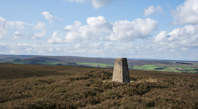
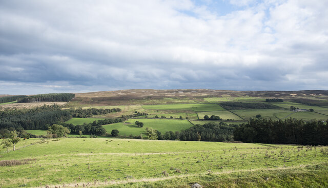
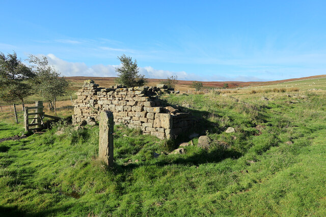
Cowbyers Fell is a prominent landscape feature located in the county of Northumberland, England. Situated amidst the enchanting Northumberland National Park, it is part of the larger Cheviot Hills range. The Fell, also known as a downs or moorland, boasts stunning vistas, rich biodiversity, and a tranquil atmosphere that attracts nature enthusiasts and hikers alike.

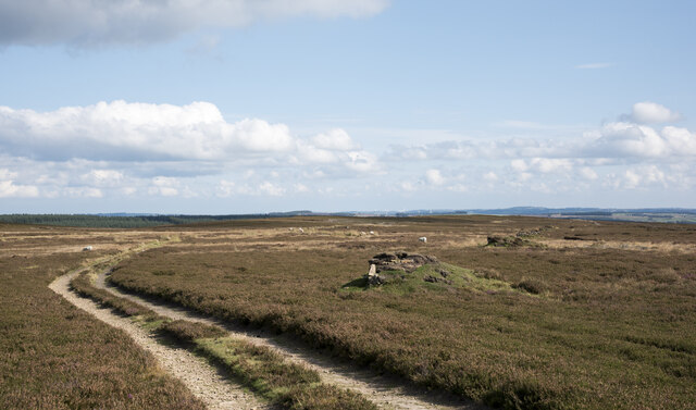
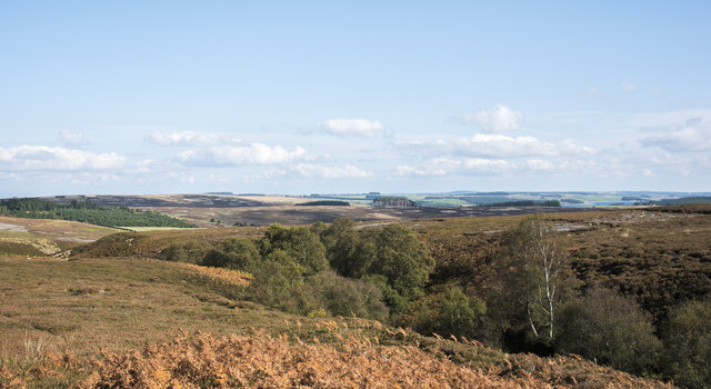
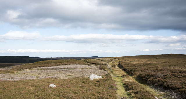
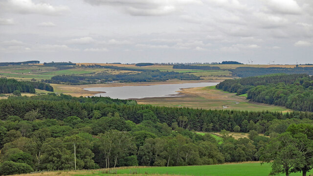
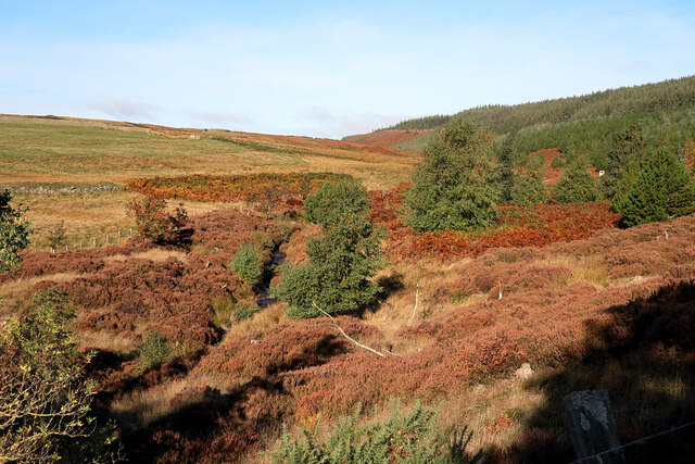
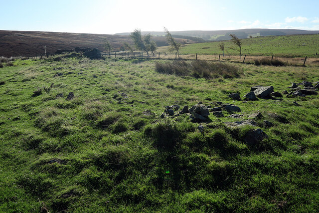
Covering an area of approximately 10 square kilometers, Cowbyers Fell is characterized by its rolling hills and expansive open spaces. The terrain is predominantly rugged and rocky, with heather and grasses covering the slopes. The Fell reaches an elevation of around 500 meters, offering breathtaking panoramic views of the surrounding countryside, including the nearby Simonside Hills and the Cheviot Hills.

The area is home to a diverse range of flora and fauna, with numerous species of birds, mammals, and plants thriving in this natural habitat. Visitors may encounter iconic British wildlife such as red grouse, curlews, and skylarks, as well as the occasional sighting of deer or wild ponies.

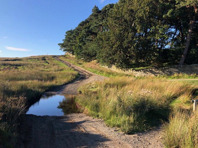
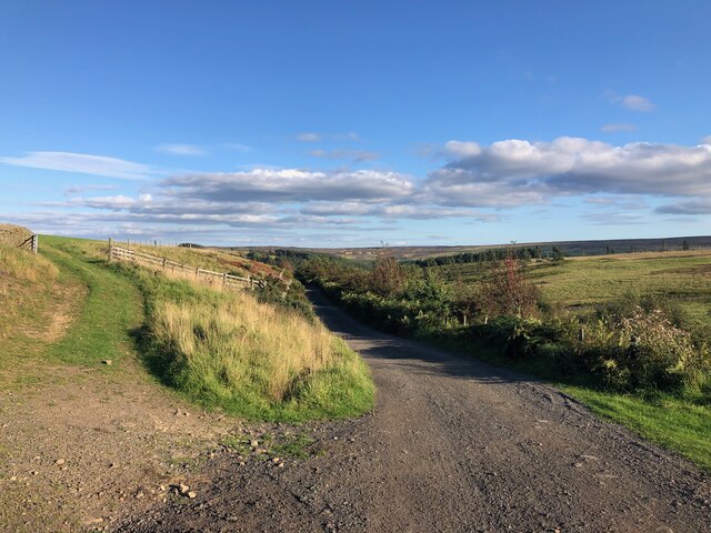
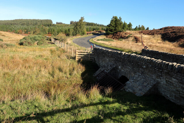
Cowbyers Fell provides an idyllic setting for outdoor activities such as walking, hiking, and birdwatching. Several well-marked trails crisscross the landscape, catering to different skill levels and interests. The tranquility and remoteness of the Fell make it an ideal spot for those seeking respite from the hustle and bustle of everyday life.

Overall, Cowbyers Fell in Northumberland is a captivating destination for nature lovers, offering stunning vistas, abundant wildlife, and a serene environment to explore and appreciate the beauty of the English countryside.

If you have any feedback on the listing, please let us know in the comments section below.

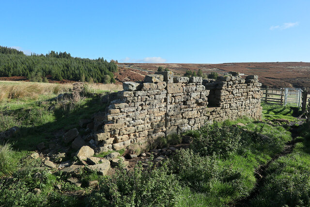
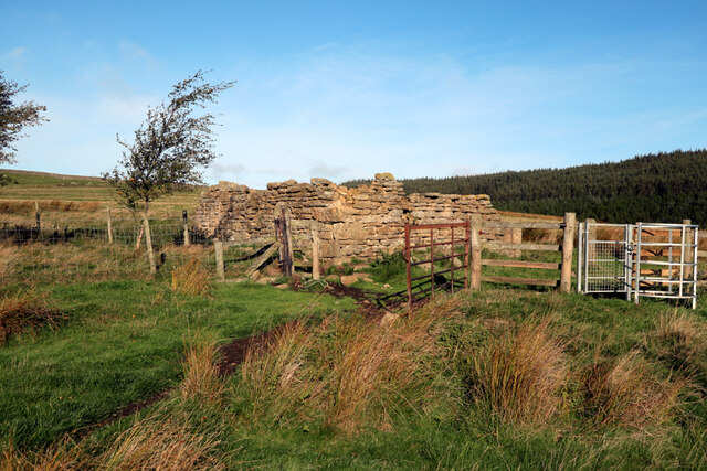
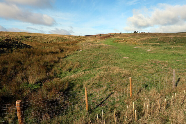
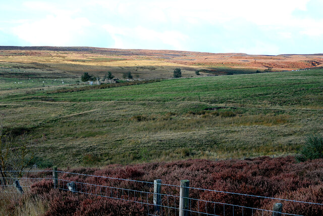
Cowbyers Fell Images

Images are sourced within 2km of 54.86888/-2.0583059 or Grid Reference NY9652. Thanks to Geograph Open Source API. All images are credited.

Trig point at Warlaw Pike The trig point at Warlaw Pike at 402 m.; it lies to the north of the local high point on Bulbeck Common at 413 m.
The view beyond is to the west, across the valley of Devil's Water.
Trig point at Warlaw Pike
The trig point at Warlaw Pike at 402 m.; it lies to the north of the local high point on Bulbeck Common at 413 m. The view beyond is to the west, across the valley of Devil's Water.
Line of grouse butts on Blanchland Moor An estate road alongside the grouse butt line heading east over the flat heather moor.
Line of grouse butts on Blanchland Moor
An estate road alongside the grouse butt line heading east over the flat heather moor.
Tree tops showing in valley of Potter Burn Potter Burn is a stream of little note draining Blanchland Moor, but the short stretch in view where Ravens Crags are located is quite incised with the sides broken by rock exposures.
Tree tops showing in valley of Potter Burn
Potter Burn is a stream of little note draining Blanchland Moor, but the short stretch in view where Ravens Crags are located is quite incised with the sides broken by rock exposures.
Track crossing heather moor on Dean Rigg Dean Rigg is a minor ridge of ground on Cowbyers Moor to the south of Potter Burn; the estate road or track follows the ridge before moving to the north side of Acton Dean.
Track crossing heather moor on Dean Rigg
Dean Rigg is a minor ridge of ground on Cowbyers Moor to the south of Potter Burn; the estate road or track follows the ridge before moving to the north side of Acton Dean.
Field on east side of B6306 The field descends towards the River Derwent south-west of the Derwent Reservoir.
The ground beyond the valley rises to the moorland of Bainbridge Hill and Ruffside Moor.
Field on east side of B6306
The field descends towards the River Derwent south-west of the Derwent Reservoir. The ground beyond the valley rises to the moorland of Bainbridge Hill and Ruffside Moor.
Ford on Byway near Pennypie House The Byway crosses the Shildon Burn at this point before joining another Byway (which is part of "A Pennine Journey")
Ford on Byway near Pennypie House
The Byway crosses the Shildon Burn at this point before joining another Byway (which is part of "A Pennine Journey")
Byway near Pennypie House This track connects Pennypie House to Blanchland and follows the valley containing the Shildon Burn. It forms part of the "A Pennine Journey" LDP
Byway near Pennypie House
This track connects Pennypie House to Blanchland and follows the valley containing the Shildon Burn. It forms part of the "A Pennine Journey" LDP
Cottages at Shildon In September 1938, A. Wainwright made a solitary walk through the Pennines. The following year he wrote up an account of this walk, which was eventually published in 1986 and is still available.
This new route, developed by David Pitt of the Wainwright Society, is a recreation of this walk adapted for today's roads and rights-of-way, taking a route that Wainwright might have chosen if he was planning it today. Called 'A Pennine Journey' it is a challenging circular walk, 247 miles long divided into 18 stages, passing through the wonderful variety of terrain and scenery that the north of England offers and touching on all the major rivers in the region.
Starting in Settle the route heads north on the eastern side of the Pennines through the delightful Yorkshire Dales and moorland stretches of Co. Durham before arriving at Hadrian’s Wall. This World Heritage site, in the Northumberland National Park, is followed for 21 miles until the route heads south on the western side of the Pennines. After traversing the Pennines just below the highest point of Cross Fell, it enters and travels down the Eden valley before skirting the Howgills Fells then arrives back in Settle.
The walk is divided into 18 daily stages of varying length and offers a choice of possibilities. It can be undertaken as one continuous walk; split at Housesteads on Hadrian’s Wall (Alfred Wainwright’s primary objective) into two stages of roughly 120 miles each; or divided into three stages – eastern, northern and western – of around 80 miles each.
Cottages at Shildon
In September 1938, A. Wainwright made a solitary walk through the Pennines. The following year he wrote up an account of this walk, which was eventually published in 1986 and is still available. This new route, developed by David Pitt of the Wainwright Society, is a recreation of this walk adapted for today's roads and rights-of-way, taking a route that Wainwright might have chosen if he was planning it today. Called 'A Pennine Journey' it is a challenging circular walk, 247 miles long divided into 18 stages, passing through the wonderful variety of terrain and scenery that the north of England offers and touching on all the major rivers in the region. Starting in Settle the route heads north on the eastern side of the Pennines through the delightful Yorkshire Dales and moorland stretches of Co. Durham before arriving at Hadrian’s Wall. This World Heritage site, in the Northumberland National Park, is followed for 21 miles until the route heads south on the western side of the Pennines. After traversing the Pennines just below the highest point of Cross Fell, it enters and travels down the Eden valley before skirting the Howgills Fells then arrives back in Settle. The walk is divided into 18 daily stages of varying length and offers a choice of possibilities. It can be undertaken as one continuous walk; split at Housesteads on Hadrian’s Wall (Alfred Wainwright’s primary objective) into two stages of roughly 120 miles each; or divided into three stages – eastern, northern and western – of around 80 miles each.
Off-road vehicles near Pennypie House The eroded road being used by a number of 4X4 vehicles is a byway but restricted in the time of year that the public may motor over it. At this location and elsewhere there's serious erosion to the ground along the route.
Off-road vehicles near Pennypie House
The eroded road being used by a number of 4X4 vehicles is a byway but restricted in the time of year that the public may motor over it. At this location and elsewhere there's serious erosion to the ground along the route.
Farmland and woodland between Cowbyers and the Derwent Reservoir I took this photo (coincidentally) from more or less the same place as <a href="https://www.geograph.org.uk/photo/3310112">NY9751 : Farmland and woodland between Cowbyers and the Derwent Reservoir (January 2013)</a> which shows what the reservoir looks like when it's full.
Farmland and woodland between Cowbyers and the Derwent Reservoir
I took this photo (coincidentally) from more or less the same place as NY9751 : Farmland and woodland between Cowbyers and the Derwent Reservoir (January 2013) which shows what the reservoir looks like when it's full.
Acton Burn
Acton Burn
Actonmill Bridge
Actonmill Bridge
Ruin near site of Acton High Mill The ruin is named as Acton Mill on the first edition OS map (1865).

The OS Name Book (c.1860) describes "A cottage and garden so called from the Smelting Mill which formerly stood near here" <span class="nowrap"><a title="http://namebooks.org.uk/browse/main/?OSref=411&Page=35.0" rel="nofollow ugc noopener" href="http://namebooks.org.uk/browse/main/?OSref=411&Page=35.0">Link</a><img style="margin-left:2px;" alt="External link" title="External link - shift click to open in new window" src="https://s1.geograph.org.uk/img/external.png" width="10" height="10"/></span> <span class="nowrap"><a title="https://web.archive.org/web/20221009161928/http://namebooks.org.uk/browse/main/?OSref=411&Page=35.0" rel="nofollow ugc noopener" href="https://web.archive.org/web/20221009161928/http://namebooks.org.uk/browse/main/?OSref=411&Page=35.0">Archive Link</a><img style="margin-left:2px;" alt="External link" title="External link - shift click to open in new window" src="https://s1.geograph.org.uk/img/external.png" width="10" height="10"/></span>

A property shown as High Actonmill, about 250m to the north-east, is described in the Name Books as "A small cottage with garden attached occupying a very bleak situation. It derives its name from a Smelting Mill which formerly stood South East of this cottage". <span class="nowrap"><a title="http://namebooks.org.uk/browse/main/?OSref=411&Page=17.0" rel="nofollow ugc noopener" href="http://namebooks.org.uk/browse/main/?OSref=411&Page=17.0">Link</a><img style="margin-left:2px;" alt="External link" title="External link - shift click to open in new window" src="https://s1.geograph.org.uk/img/external.png" width="10" height="10"/></span> <span class="nowrap"><a title="https://web.archive.org/web/20221009162706/http://namebooks.org.uk/browse/main/?OSref=411&Page=17.0" rel="nofollow ugc noopener" href="https://web.archive.org/web/20221009162706/http://namebooks.org.uk/browse/main/?OSref=411&Page=17.0">Archive Link</a><img style="margin-left:2px;" alt="External link" title="External link - shift click to open in new window" src="https://s1.geograph.org.uk/img/external.png" width="10" height="10"/></span>
Ruin near site of Acton High Mill
The ruin is named as Acton Mill on the first edition OS map (1865). The OS Name Book (c.1860) describes "A cottage and garden so called from the Smelting Mill which formerly stood near here" LinkExternal link Archive LinkExternal link A property shown as High Actonmill, about 250m to the north-east, is described in the Name Books as "A small cottage with garden attached occupying a very bleak situation. It derives its name from a Smelting Mill which formerly stood South East of this cottage". LinkExternal link Archive LinkExternal link
Ruin near site of Acton High Mill The ruin is named as Acton Mill on the first edition OS map (1865).

The OS Name Book (c.1860) describes "A cottage and garden so called from the Smelting Mill which formerly stood near here" <span class="nowrap"><a title="http://namebooks.org.uk/browse/main/?OSref=411&Page=35.0" rel="nofollow ugc noopener" href="http://namebooks.org.uk/browse/main/?OSref=411&Page=35.0">Link</a><img style="margin-left:2px;" alt="External link" title="External link - shift click to open in new window" src="https://s1.geograph.org.uk/img/external.png" width="10" height="10"/></span> <span class="nowrap"><a title="https://web.archive.org/web/20221009161928/http://namebooks.org.uk/browse/main/?OSref=411&Page=35.0" rel="nofollow ugc noopener" href="https://web.archive.org/web/20221009161928/http://namebooks.org.uk/browse/main/?OSref=411&Page=35.0">Archive Link</a><img style="margin-left:2px;" alt="External link" title="External link - shift click to open in new window" src="https://s1.geograph.org.uk/img/external.png" width="10" height="10"/></span>

A property shown as High Actonmill, about 250m to the north-east, is described in the Name Books as "A small cottage with garden attached occupying a very bleak situation. It derives its name from a Smelting Mill which formerly stood South East of this cottage". <span class="nowrap"><a title="http://namebooks.org.uk/browse/main/?OSref=411&Page=17.0" rel="nofollow ugc noopener" href="http://namebooks.org.uk/browse/main/?OSref=411&Page=17.0">Link</a><img style="margin-left:2px;" alt="External link" title="External link - shift click to open in new window" src="https://s1.geograph.org.uk/img/external.png" width="10" height="10"/></span> <span class="nowrap"><a title="https://web.archive.org/web/20221009162706/http://namebooks.org.uk/browse/main/?OSref=411&Page=17.0" rel="nofollow ugc noopener" href="https://web.archive.org/web/20221009162706/http://namebooks.org.uk/browse/main/?OSref=411&Page=17.0">Archive Link</a><img style="margin-left:2px;" alt="External link" title="External link - shift click to open in new window" src="https://s1.geograph.org.uk/img/external.png" width="10" height="10"/></span>

An interesting feature of the building are the deep depressions apparently carved into the face of many of the stones. These have the appearance of weathered prehistoric cup-marks but perhaps more likely to the decorative work of a more recent stonemason.
Ruin near site of Acton High Mill
The ruin is named as Acton Mill on the first edition OS map (1865). The OS Name Book (c.1860) describes "A cottage and garden so called from the Smelting Mill which formerly stood near here" LinkExternal link Archive LinkExternal link A property shown as High Actonmill, about 250m to the north-east, is described in the Name Books as "A small cottage with garden attached occupying a very bleak situation. It derives its name from a Smelting Mill which formerly stood South East of this cottage". LinkExternal link Archive LinkExternal link An interesting feature of the building are the deep depressions apparently carved into the face of many of the stones. These have the appearance of weathered prehistoric cup-marks but perhaps more likely to the decorative work of a more recent stonemason.
Ruin near site of Acton High Mill The ruin is named as Acton Mill on the first edition OS map (1865).

The OS Name Book (c.1860) describes "A cottage and garden so called from the Smelting Mill which formerly stood near here" <span class="nowrap"><a title="http://namebooks.org.uk/browse/main/?OSref=411&Page=35.0" rel="nofollow ugc noopener" href="http://namebooks.org.uk/browse/main/?OSref=411&Page=35.0">Link</a><img style="margin-left:2px;" alt="External link" title="External link - shift click to open in new window" src="https://s1.geograph.org.uk/img/external.png" width="10" height="10"/></span> <span class="nowrap"><a title="https://web.archive.org/web/20221009161928/http://namebooks.org.uk/browse/main/?OSref=411&Page=35.0" rel="nofollow ugc noopener" href="https://web.archive.org/web/20221009161928/http://namebooks.org.uk/browse/main/?OSref=411&Page=35.0">Archive Link</a><img style="margin-left:2px;" alt="External link" title="External link - shift click to open in new window" src="https://s1.geograph.org.uk/img/external.png" width="10" height="10"/></span>

A property shown as High Actonmill, about 250m to the north-east, is described in the Name Books as "A small cottage with garden attached occupying a very bleak situation. It derives its name from a Smelting Mill which formerly stood South East of this cottage". <span class="nowrap"><a title="http://namebooks.org.uk/browse/main/?OSref=411&Page=17.0" rel="nofollow ugc noopener" href="http://namebooks.org.uk/browse/main/?OSref=411&Page=17.0">Link</a><img style="margin-left:2px;" alt="External link" title="External link - shift click to open in new window" src="https://s1.geograph.org.uk/img/external.png" width="10" height="10"/></span> <span class="nowrap"><a title="https://web.archive.org/web/20221009162706/http://namebooks.org.uk/browse/main/?OSref=411&Page=17.0" rel="nofollow ugc noopener" href="https://web.archive.org/web/20221009162706/http://namebooks.org.uk/browse/main/?OSref=411&Page=17.0">Archive Link</a><img style="margin-left:2px;" alt="External link" title="External link - shift click to open in new window" src="https://s1.geograph.org.uk/img/external.png" width="10" height="10"/></span>
Ruin near site of Acton High Mill
The ruin is named as Acton Mill on the first edition OS map (1865). The OS Name Book (c.1860) describes "A cottage and garden so called from the Smelting Mill which formerly stood near here" LinkExternal link Archive LinkExternal link A property shown as High Actonmill, about 250m to the north-east, is described in the Name Books as "A small cottage with garden attached occupying a very bleak situation. It derives its name from a Smelting Mill which formerly stood South East of this cottage". LinkExternal link Archive LinkExternal link
Field north of Potter Burn This field at the confluence of Potter Burn and Acton Burn shows signs of much disturbance and/or possible spoil heaps. The ruin I have called, Acton Mill <a href="https://www.geograph.org.uk/photo/7305517">NY9753 : Ruin near site of Acton High Mill</a> is on the skyline, right of centre. Another ruin, High Actonmill, is even higher uphill, well out of sight.

A plan by J.M. Dodds in Pirt & Dodds (2002), page 152, shows the location of both the Old and New smelt mills (both marked 'in ruins'). Acton High Mill (Old) is located in the confluence of the Potter & Acton Burns (NY 981 534) approximately 140m SE of the Acton Mill ruin.

Also see here <a href="https://www.geograph.org.uk/photo/7305736">NY9853 : Field north of Potter Burn</a>
Field north of Potter Burn
This field at the confluence of Potter Burn and Acton Burn shows signs of much disturbance and/or possible spoil heaps. The ruin I have called, Acton Mill NY9753 : Ruin near site of Acton High Mill is on the skyline, right of centre. Another ruin, High Actonmill, is even higher uphill, well out of sight. A plan by J.M. Dodds in Pirt & Dodds (2002), page 152, shows the location of both the Old and New smelt mills (both marked 'in ruins'). Acton High Mill (Old) is located in the confluence of the Potter & Acton Burns (NY 981 534) approximately 140m SE of the Acton Mill ruin. Also see here NY9853 : Field north of Potter Burn
View to ruin of Acton Mill from north-east The ruin is shown here: <a href="https://www.geograph.org.uk/photo/7305474">NY9753 : Ruin near site of Acton High Mill</a>

The line running from left to right on the land directly below the ruin are likely the course of a water leat supplying the original Acton High Smelt Mill located approximately 140m SE of the Acton Mill ruin.
View to ruin of Acton Mill from north-east
The ruin is shown here: NY9753 : Ruin near site of Acton High Mill The line running from left to right on the land directly below the ruin are likely the course of a water leat supplying the original Acton High Smelt Mill located approximately 140m SE of the Acton Mill ruin.
Show me another place!

Cowbyers Fell is located at Grid Ref: NY9652 (Lat: 54.86888, Lng: -2.0583059)

Unitary Authority: Northumberland

Police Authority: Northumbria

What 3 Words

///mooring.elsewhere.traders. Near Slaley, Northumberland

Nearby Locations

Cowbyers Fell

Related Wikis

Blanchland Abbey

Blanchland Abbey at Blanchland, in the English county of Northumberland, was founded as a premonstratensian priory in 1165 by Walter de Bolbec II, and...

Blanchland

Blanchland is a village in Northumberland, England, on the County Durham boundary. The population of the civil parish at the 2011 census was 135.Set beside...

Baybridge, Northumberland

Baybridge is a small village in Northumberland, England, just to the west of Blanchland and on the border with County Durham. It is situated to the west...

Colpitts Grange

Colpitts Grange is a hamlet in Northumberland, England. It is about 7 miles (11 km) to the south-east of Hexham. == Governance == Colpitts Grange is in...

Nearby Amenities

Located within 500m of 54.86888,-2.0583059
Cowbyers Fell
Place: locality
Lat/Long: 54.869041/-2.0647361
Hunting Stand
Hunting Stand: grouse_butt
Lat/Long: 54.8680161/-2.0546398
Hunting Stand
Hunting Stand: grouse_butt
Lat/Long: 54.8683892/-2.0541221
Hunting Stand
Hunting Stand: grouse_butt
Lat/Long: 54.8687675/-2.0536028
Hunting Stand
Hunting Stand: grouse_butt
Lat/Long: 54.8691636/-2.0530702
Hunting Stand
Hunting Stand: grouse_butt
Lat/Long: 54.8695486/-2.052542
Hunting Stand
Hunting Stand: grouse_butt
Lat/Long: 54.8699311/-2.0520168
Hunting Stand
Hunting Stand: grouse_butt
Lat/Long: 54.8703085/-2.0515064
The data included in this document is from www.openstreetmap.org. The data is made available under ODbL.

Have you been to Cowbyers Fell?

Leave your review of Cowbyers Fell below (or comments, questions and feedback).