Broad Moss

Downs, Moorland in Northumberland

England

Broad Moss

Open country once again The site of the former Threestoneburn Wood with Hedgehope Hill in the distance.

This photograph was taken during the Coronavirus (COVID-19) pandemic of 2020/21/22.
Open country once again Credit: James T M Towill

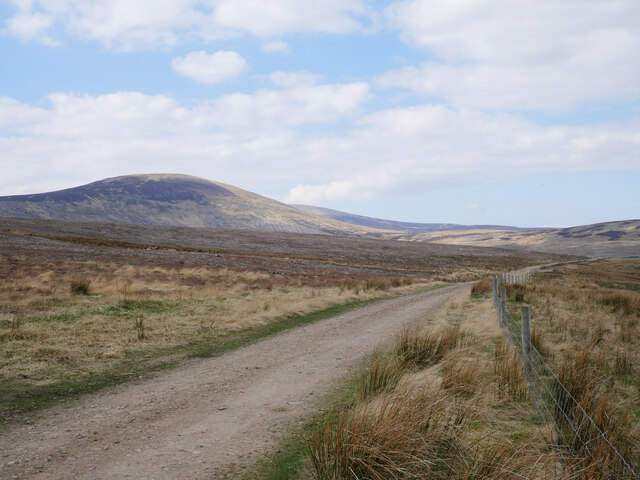
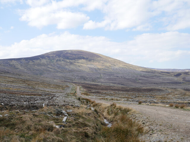
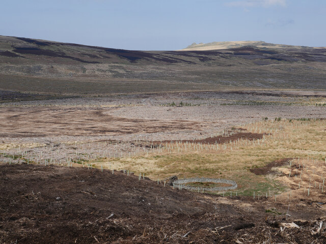
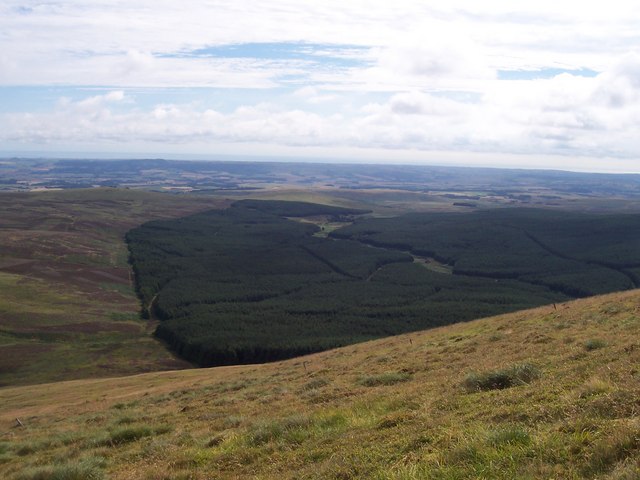
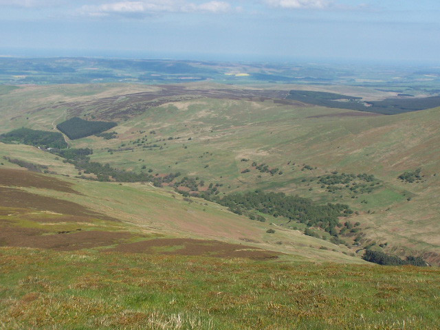
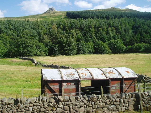
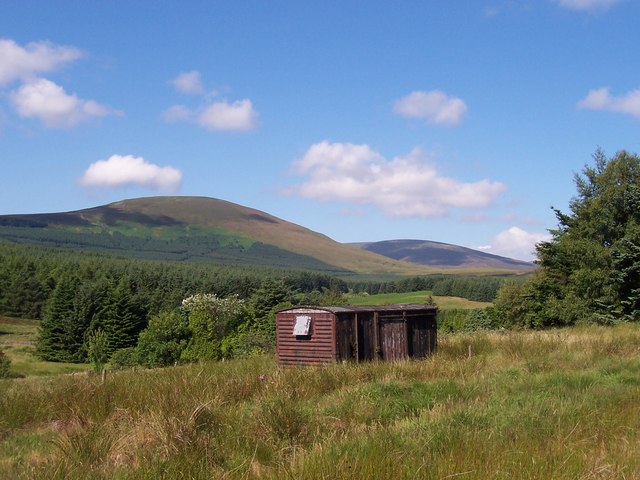
Broad Moss is a picturesque area located in Northumberland, England, known for its expansive downs and captivating moorland landscapes. Spanning over several miles, this region offers a diverse range of natural features and is a popular destination for nature enthusiasts and hikers.

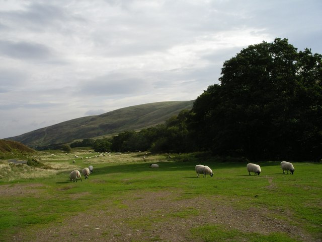
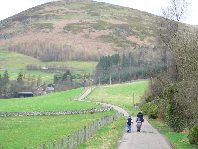
The downs of Broad Moss are characterized by their gently rolling hills and lush green meadows. These open spaces provide ample opportunities for outdoor activities such as picnicking, kite flying, and leisurely walks. The downs are also home to a variety of flora and fauna, including wildflowers, rabbits, and numerous bird species. Visitors can enjoy breathtaking views of the surrounding countryside from the higher points of the downs.

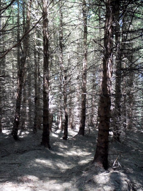
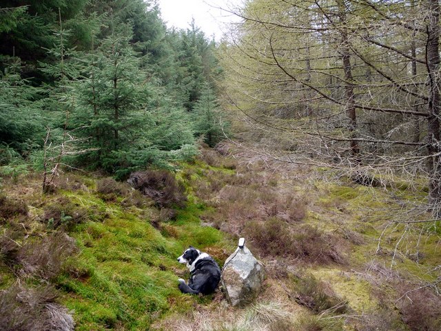
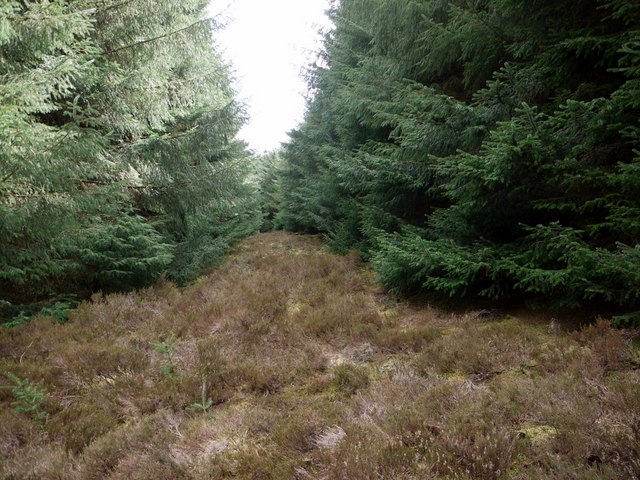
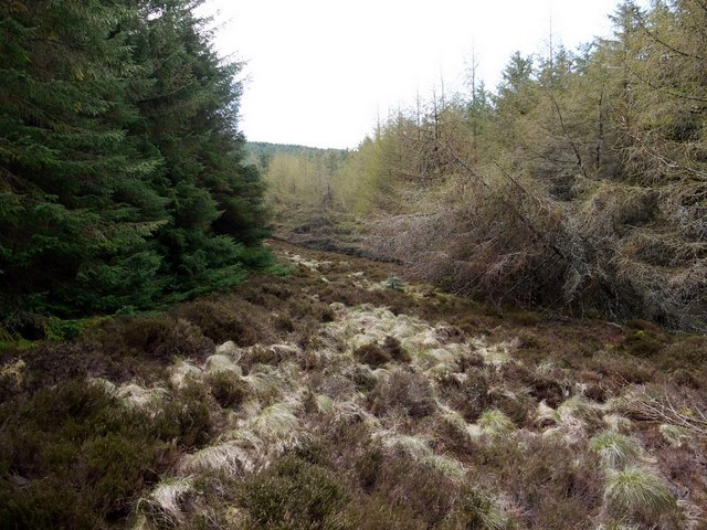
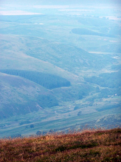
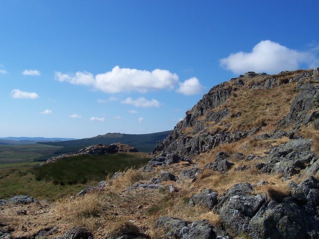
The moorland in Broad Moss showcases a different aspect of the area's natural beauty. With its rugged terrain and sweeping vistas, it offers a more dramatic and untamed landscape. Moorland plants such as heather and bracken dominate the scenery, creating a vibrant tapestry of colors throughout the year. The moors are also home to some rare bird species, including the elusive black grouse and merlin.

The climate in Broad Moss is typically mild, with cool summers and relatively mild winters. However, the area can experience sudden changes in weather, so it is advisable for visitors to come prepared for unpredictable conditions.

Overall, Broad Moss is a captivating destination for those seeking to immerse themselves in the natural beauty of Northumberland. Whether exploring the gentle downs or venturing into the wild moorland, visitors are sure to be enchanted by the tranquility and splendor of this remarkable area.

If you have any feedback on the listing, please let us know in the comments section below.

Broad Moss Images

Images are sourced within 2km of 55.483595/-2.0610497 or Grid Reference NT9621. Thanks to Geograph Open Source API. All images are credited.

Open country once again The site of the former Threestoneburn Wood with Hedgehope Hill in the distance.

This photograph was taken during the Coronavirus (COVID-19) pandemic of 2020/21/22.
Open country once again
The site of the former Threestoneburn Wood with Hedgehope Hill in the distance. This photograph was taken during the Coronavirus (COVID-19) pandemic of 2020/21/22.
A bleak landscape at the former Threestoneburn Wood The site of the former Threestoneburn Wood with Hedgehope Hill looming large in the distance.  Moorland and upland bog restoration works are in progress in the area.

This photograph was taken during the Coronavirus (COVID-19) pandemic of 2020/21/22.
A bleak landscape at the former Threestoneburn Wood
The site of the former Threestoneburn Wood with Hedgehope Hill looming large in the distance. Moorland and upland bog restoration works are in progress in the area. This photograph was taken during the Coronavirus (COVID-19) pandemic of 2020/21/22.
An old sheepfold by Threestone Burn With the removal of Threestoneburn Wood over the past decade, old features of former open moorland are once again evident such as this sheepfold.  Plantings of native tree species shrouded by tree protectors are evident beside the Threestone Burn.

This photograph was taken during the Coronavirus (COVID-19) pandemic of 2020/21/22.
An old sheepfold by Threestone Burn
With the removal of Threestoneburn Wood over the past decade, old features of former open moorland are once again evident such as this sheepfold. Plantings of native tree species shrouded by tree protectors are evident beside the Threestone Burn. This photograph was taken during the Coronavirus (COVID-19) pandemic of 2020/21/22.
From the end of the track The western end of a timber extraction track in the former Threestoneburn Wood offers a bleak view across tree debris to Hedgehope Hill.

This photograph was taken during the Coronavirus (COVID-19) pandemic of 2020/21/22.
From the end of the track
The western end of a timber extraction track in the former Threestoneburn Wood offers a bleak view across tree debris to Hedgehope Hill. This photograph was taken during the Coronavirus (COVID-19) pandemic of 2020/21/22.
Threestoneburn Wood Threestoneburn Wood from the slopes of Hedgehope Hill. The obvious clearing in the wood is the location of Threestoneburn House a Grade II Listed building. For free detailed walking routes in the area visit <span class="nowrap"><a title="www.cheviotwalks.co.uk" rel="nofollow ugc noopener" href="http://www.cheviotwalks.co.uk">Link</a><img style="margin-left:2px;" alt="External link" title="External link - shift click to open in new window" src="https://s1.geograph.org.uk/img/external.png" width="10" height="10"/></span>
Threestoneburn Wood
Threestoneburn Wood from the slopes of Hedgehope Hill. The obvious clearing in the wood is the location of Threestoneburn House a Grade II Listed building. For free detailed walking routes in the area visit LinkExternal link
Path through Threestoneburn Wood This photo is part of a virtual walk; go here for the start <a href="https://www.geograph.org.uk/photo/1833301">NU0120 : Track to Ilderton</a> or here to continue <a href="https://www.geograph.org.uk/photo/1838469">NT9720 : Forest ride / track junction, Threestoneburn Wood</a>

Best not linger in here too long. Press on for the safety of the forest track. If you are on the right line you should come to a small footbridge over a ditch surrounded by bog. If you get to the track (and we can't guarantee that in here), turn right (north-west). We are heading for <a href="https://www.geograph.org.uk/gridref/NT9619">NT9619</a>, still a unclaimed (green) square in April 2010. George hasn't noticed our strange route back to the car yet. Hopefully, we'll bag the square, then return back this way and head south through the wood on the route we came in 2009 <a href="https://www.geograph.org.uk/photo/1102591">NT9719 : Threestoneburn Wood</a>
Path through Threestoneburn Wood
This photo is part of a virtual walk; go here for the start NU0120 : Track to Ilderton or here to continue NT9720 : Forest ride / track junction, Threestoneburn Wood Best not linger in here too long. Press on for the safety of the forest track. If you are on the right line you should come to a small footbridge over a ditch surrounded by bog. If you get to the track (and we can't guarantee that in here), turn right (north-west). We are heading for NT9619, still a unclaimed (green) square in April 2010. George hasn't noticed our strange route back to the car yet. Hopefully, we'll bag the square, then return back this way and head south through the wood on the route we came in 2009 NT9719 : Threestoneburn Wood
Overgrown ride, Threestoneburn Wood This photo is the end of a virtual walk; go here for the start <a href="https://www.geograph.org.uk/photo/1833301">NU0120 : Track to Ilderton</a>

So here we are. George is not impressed, and quite tired. It was a long walk. This small boulder with my GPS on top is just within the square. In case the ride gets better further in (a hidden woodland glade with burbling stream, rustic, ruined cottage and frolicking deer would be nice), or the GPS is lying, we did go on just a bit further to snap some more photos.
Just got to get back to the car now before night sets in.
But that's another story....
Overgrown ride, Threestoneburn Wood
This photo is the end of a virtual walk; go here for the start NU0120 : Track to Ilderton So here we are. George is not impressed, and quite tired. It was a long walk. This small boulder with my GPS on top is just within the square. In case the ride gets better further in (a hidden woodland glade with burbling stream, rustic, ruined cottage and frolicking deer would be nice), or the GPS is lying, we did go on just a bit further to snap some more photos. Just got to get back to the car now before night sets in. But that's another story....
Another ride in Threestoneburn Wood This narrow ride is just east of the one marked on the OS map.
Another ride in Threestoneburn Wood
This narrow ride is just east of the one marked on the OS map.
Bend in ride, Threestoneburn Wood The ride marked on the 1:50000 OS map which heads east is very overgrown at this point and only someone slightly deranged would try to follow it. This wider, heather-filled ride takes a path to the south. Aerial photos show that going south to Dunmoor Hill is not impossible, but also that the ride system was designed by someone not quite of this world.
Bend in ride, Threestoneburn Wood
The ride marked on the 1:50000 OS map which heads east is very overgrown at this point and only someone slightly deranged would try to follow it. This wider, heather-filled ride takes a path to the south. Aerial photos show that going south to Dunmoor Hill is not impossible, but also that the ride system was designed by someone not quite of this world.
Langleeford Vale View of valley looking east (coast in distance) from  the side of The Cheviot.
Langleeford Vale
View of valley looking east (coast in distance) from the side of The Cheviot.
Bridge over Harthope Burn Hill below Langlee and Housey Crags in background
Bridge over Harthope Burn
Hill below Langlee and Housey Crags in background
Langleeford Vale From the side of Hedgehope Hill looking north.
Langleeford Vale
From the side of Hedgehope Hill looking north.
Housey Crags Viewed from across the Harthope Burn.
Housey Crags
Viewed from across the Harthope Burn.
Harthope Burn Taken near the road to Langleeford.  The hill in the far distance is Hedgehope Hill.
Harthope Burn
Taken near the road to Langleeford. The hill in the far distance is Hedgehope Hill.
Harthope Valley near Langleeford View over an old railway wagon toward Langlee Crags.
Harthope Valley near Langleeford
View over an old railway wagon toward Langlee Crags.
Harthope Burn, near Langleeford
Middleton Crags Middleton Crags looking towards the distant Cunyan Crags and Threestoneburn Wood. For free detailed walking routes in the area visit <span class="nowrap"><a title="www.cheviotwalks.co.uk" rel="nofollow ugc noopener" href="http://www.cheviotwalks.co.uk">Link</a><img style="margin-left:2px;" alt="External link" title="External link - shift click to open in new window" src="https://s1.geograph.org.uk/img/external.png" width="10" height="10"/></span>
Middleton Crags
Middleton Crags looking towards the distant Cunyan Crags and Threestoneburn Wood. For free detailed walking routes in the area visit LinkExternal link
A clearing in Threestoneburn Wood An old railway carriage with Hedgehope Hill and The Cheviot in the distance. For free detailed walking routes in the area visit <span class="nowrap"><a title="www.cheviotwalks.co.uk" rel="nofollow ugc noopener" href="http://www.cheviotwalks.co.uk">Link</a><img style="margin-left:2px;" alt="External link" title="External link - shift click to open in new window" src="https://s1.geograph.org.uk/img/external.png" width="10" height="10"/></span>
A clearing in Threestoneburn Wood
An old railway carriage with Hedgehope Hill and The Cheviot in the distance. For free detailed walking routes in the area visit LinkExternal link
Show me another place!

Broad Moss is located at Grid Ref: NT9621 (Lat: 55.483595, Lng: -2.0610497)

Unitary Authority: Northumberland

Police Authority: Northumbria

What 3 Words

///doses.watchdogs.regretted. Near Wooler, Northumberland

Nearby Locations

Broad Moss

Related Wikis

Threestoneburn Stone Circle

Threestoneburn Stone Circle is an archaeological site, a stone circle near the village of Ilderton and about 5 miles (8 km) south of Wooler, in Northumberland...

Hedgehope Hill

Hedgehope Hill is a mountain in the Cheviot Hills of north Northumberland in northeast England, and categorised as a Hewitt. At a height of 714 metres...

Linhope

Linhope is a small village in Northumberland, England. It is located in the Cheviots on the River Breamish, and within Northumberland National Park. Linhope...

Ilderton, Northumberland

Ilderton is a small village in Northumberland, England. It is located on the edge of the Northumberland National Park, between Lilburn, Northumberland...

The Cheviot

The Cheviot () is an extinct volcano and the highest summit in the Cheviot Hills and in the county of Northumberland. Located in the extreme north of England...

Ilderton Hall

Ilderton Hall is a modest 18th-century country house at Ilderton, Northumberland.(grid reference NU01662177). It is a Grade II listed building.The house...

Cheviot Hills

The Cheviot Hills (), or sometimes The Cheviots, are a range of uplands straddling the Anglo-Scottish border between Northumberland and the Scottish Borders...

Earle, Northumberland

Earle is a village and civil parish in county of Northumberland, England. It has around 20 inhabitants and is about 2 miles (3 km) from Wooler (where from...

Nearby Amenities

Located within 500m of 55.483595,-2.0610497
Broad Moss
Place: locality
Lat/Long: 55.4852285/-2.0636926
Tathey Crags
Place: locality
Lat/Long: 55.4841307/-2.0587498
The data included in this document is from www.openstreetmap.org. The data is made available under ODbL.

Have you been to Broad Moss?

Leave your review of Broad Moss below (or comments, questions and feedback).