Cheverell Down

Downs, Moorland in Wiltshire

England

Cheverell Down

St Giles Church, Imber, Wiltshire Viewed in August 2022. The Visit Churches website records "This lovely thirteenth century church stands in rolling downland deep inside the military training area of Salisbury Plain. It is all that remains of the ghost village of Imber (now just abandoned houses), which was evacuated for military training purposes in 1943."

The Grade I listed building is now a redundant church in the care of the Churches Conservation Trust. It was declared redundant on November 1st 2002 and was vested in the Trust on September 14th 2005.
St Giles Church, Imber, Wiltshire Credit: Shell Grayson

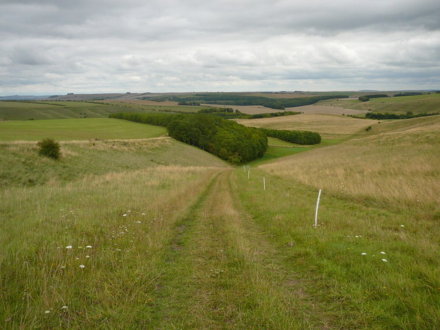
Cheverell Down is a prominent area of downs and moorland located in Wiltshire, England. It covers an expansive area of approximately 1,200 hectares and is part of the Salisbury Plain, a vast chalk plateau in southern England. The down is situated near the villages of Market Lavington and Erlestoke.

Characterized by its rolling hills, Cheverell Down offers breathtaking panoramic views of the surrounding countryside. The landscape is predominantly comprised of chalk grassland, scattered with diverse wildflowers, including orchids and cowslips, which add vibrant colors to the area during the spring and summer months. Additionally, the down is home to a range of wildlife, such as rabbits, hares, and various bird species, making it an ideal spot for nature enthusiasts.

The historical significance of Cheverell Down is also noteworthy. It is believed to have been inhabited since prehistoric times, with evidence of ancient burial mounds and earthworks scattered throughout the area. Furthermore, the down served as an important training ground for the military during World War II and still sees occasional military exercises today.

Cheverell Down is a popular destination for outdoor activities, including walking, hiking, and birdwatching. Numerous footpaths and trails crisscross the area, allowing visitors to explore its natural beauty at their leisure. The down is also a designated Site of Special Scientific Interest (SSSI), ensuring its conservation and protection for future generations to enjoy.

If you have any feedback on the listing, please let us know in the comments section below.

Cheverell Down Images

Images are sourced within 2km of 51.251746/-2.0568342 or Grid Reference ST9650. Thanks to Geograph Open Source API. All images are credited.

St Giles Church, Imber, Wiltshire Viewed in August 2022. The Visit Churches website records "This lovely thirteenth century church stands in rolling downland deep inside the military training area of Salisbury Plain. It is all that remains of the ghost village of Imber (now just abandoned houses), which was evacuated for military training purposes in 1943."

The Grade I listed building is now a redundant church in the care of the Churches Conservation Trust. It was declared redundant on November 1st 2002 and was vested in the Trust on September 14th 2005.
St Giles Church, Imber, Wiltshire
Viewed in August 2022. The Visit Churches website records "This lovely thirteenth century church stands in rolling downland deep inside the military training area of Salisbury Plain. It is all that remains of the ghost village of Imber (now just abandoned houses), which was evacuated for military training purposes in 1943." The Grade I listed building is now a redundant church in the care of the Churches Conservation Trust. It was declared redundant on November 1st 2002 and was vested in the Trust on September 14th 2005.
Urban warfare training area, Imber Village Seen from the top of the churchyard. This view of <a href="https://www.geograph.org.uk/photo/7681089">ST9648 : St Giles Church, Imber</a> was taken from the same spot during a public open day.
Urban warfare training area, Imber Village
Seen from the top of the churchyard. This view of ST9648 : St Giles Church, Imber was taken from the same spot during a public open day.
St Giles Church, Imber Taken from the same spot as <a href="https://www.geograph.org.uk/photo/7681087">ST9648 : Urban warfare training area, Imber Village</a>, looking in a slightly different direction, on one of the few days when Imber was open to the public.
St Giles Church, Imber
Taken from the same spot as ST9648 : Urban warfare training area, Imber Village, looking in a slightly different direction, on one of the few days when Imber was open to the public.
St Giles Church, Imber The village remains abandoned within the Imber Range. Taken on one of the few days when the roads and village were open to the public.
St Giles Church, Imber
The village remains abandoned within the Imber Range. Taken on one of the few days when the roads and village were open to the public.
Imber Court Within the village of Imber, this is one of the principal buildings abandoned when the military took over in 1943. The notice is addressed to troops and reminds them, among other things, to ensure that rooms are swept, toilets are clean and "all ammunition and pyrotechnics are collected" at the end of each training exercise.
Imber Court
Within the village of Imber, this is one of the principal buildings abandoned when the military took over in 1943. The notice is addressed to troops and reminds them, among other things, to ensure that rooms are swept, toilets are clean and "all ammunition and pyrotechnics are collected" at the end of each training exercise.
Nag's Head Cottages, Imber These are among the houses that were taken over by the military in 1943 and to which the villagers were never allowed to return. Public access on New Year's Day 2024, with many visitors no doubt prompted by this BBC News story 2 days earlier "Eighty years since families left 'ghost village' on Salisbury Plain" <span class="nowrap"><a title="https://www.bbc.co.uk/news/uk-england-wiltshire-67750589" rel="nofollow ugc noopener" href="https://www.bbc.co.uk/news/uk-england-wiltshire-67750589">Link</a><img style="margin-left:2px;" alt="External link" title="External link - shift click to open in new window" src="https://s1.geograph.org.uk/img/external.png" width="10" height="10"/></span>
Nag's Head Cottages, Imber
These are among the houses that were taken over by the military in 1943 and to which the villagers were never allowed to return. Public access on New Year's Day 2024, with many visitors no doubt prompted by this BBC News story 2 days earlier "Eighty years since families left 'ghost village' on Salisbury Plain" LinkExternal link
Along the edge of the Urban warfare training area, Imber Village
Looking into the Urban warfare training area, Imber Village On a day when the public were allowed to visit, although access is restricted to the road and church, due to the risk of unexploded military ordnance...
Looking into the Urban warfare training area, Imber Village
On a day when the public were allowed to visit, although access is restricted to the road and church, due to the risk of unexploded military ordnance...
Ancient and modern at Imber Modern structures built for urban warfare training, with St Giles Church in the distance. This is close to being a reverse view from <a href="https://www.geograph.org.uk/photo/7681087">ST9648 : Urban warfare training area, Imber Village</a>.
Ancient and modern at Imber
Modern structures built for urban warfare training, with St Giles Church in the distance. This is close to being a reverse view from ST9648 : Urban warfare training area, Imber Village.
You wait for ages then..... The 1653 bus from Brazen Bottom approaches New Zealand Farm Camp followed by the 1659 from Imber. A busy place at 1719 on this Saturday!
You wait for ages then.....
The 1653 bus from Brazen Bottom approaches New Zealand Farm Camp followed by the 1659 from Imber. A busy place at 1719 on this Saturday!
On the Wessex Ridgeway Path, Littleton Down
Imber - The 'Lost' Village Military "houses" erected for training purposes in Imber, the village commandeered and evacuated by the MoD in 1943 and never given back to its residents.  The road through the village is permanently closed except for two or three occasions each year when access is permitted and the church, the only remaining complete structure of the original village, is open to visitors.
Imber - The 'Lost' Village
Military "houses" erected for training purposes in Imber, the village commandeered and evacuated by the MoD in 1943 and never given back to its residents. The road through the village is permanently closed except for two or three occasions each year when access is permitted and the church, the only remaining complete structure of the original village, is open to visitors.
Well, near Imber The well, which is under the rusted grating between the RH and middle post, is in what may have been a village site, possibly Medieval. <span class="nowrap"><a title="http://www.wiltshire.gov.uk/artsheritageandlibraries/museumhistoryheritage/wiltshireandswindonhistoricenvironmentrecord/wshermap.htm?a=d&id=14310" rel="nofollow ugc noopener" href="http://www.wiltshire.gov.uk/artsheritageandlibraries/museumhistoryheritage/wiltshireandswindonhistoricenvironmentrecord/wshermap.htm?a=d&id=14310">Link</a><img style="margin-left:2px;" alt="External link" title="External link - shift click to open in new window" src="https://s1.geograph.org.uk/img/external.png" width="10" height="10"/></span>
Well, near Imber
The well, which is under the rusted grating between the RH and middle post, is in what may have been a village site, possibly Medieval. LinkExternal link
Tank on ridge, near Imber This derelict tank, perhaps the same as in <a title="https://www.geograph.org.uk/photo/3190807" href="https://www.geograph.org.uk/photo/3190807">Link</a> sits on the ridge possibly for use as target practice by soldiers during training exercises. (Photo taken on zoom.)
Tank on ridge, near Imber
This derelict tank, perhaps the same as in Link sits on the ridge possibly for use as target practice by soldiers during training exercises. (Photo taken on zoom.)
The Church of St. Giles, Imber Written by Brian Robert Marshall

The church is on the site of an earlier mid 12th century building. The church as seen today is the result of building work carried out in the 13th and 15th centuries, and restorations dating from 1849 and 1895. It continued to serve its parishioners until 1943 when the entire village was depopulated to aid the war effort. The villagers were never allowed back and the village today is, most of the time, used for military training. An unusual feature of the exterior is the top of the tower which has five pinnacles. Many of the interior fittings have been removed to other churches. The font is now in Brixton Deverill <a title="https://www.geograph.org.uk/photo/333747" href="https://www.geograph.org.uk/photo/333747">Link</a> whilst  the altar, communion rails and some pews are in Bratton <a title="https://www.geograph.org.uk/photo/463594" href="https://www.geograph.org.uk/photo/463594">Link</a> Other pews made it as far as Churchdown in Gloucestershire <a title="https://www.geograph.org.uk/photo/1300567" href="https://www.geograph.org.uk/photo/1300567">Link</a> The interior still has much of interest. The church is listed Grade I <span class="nowrap"><a title="https://historicengland.org.uk/listing/the-list/list-entry/1036472" rel="nofollow ugc noopener" href="https://historicengland.org.uk/listing/the-list/list-entry/1036472">Link</a><img style="margin-left:2px;" alt="External link" title="External link - shift click to open in new window" src="https://s1.geograph.org.uk/img/external.png" width="10" height="10"/></span> From 1943 until 2002 the church was maintained by the War Department and its successor the Ministry of Defence. Following being declared redundant, the church passed into the care of the Churches Conservation Trust in 2005. Much work spanning the years 2005 to 2009 has been carried out to conserve the building and its features. The church remains consecrated as a place of worship and services are held on certain days each year.
The Church of St. Giles, Imber
Written by Brian Robert Marshall The church is on the site of an earlier mid 12th century building. The church as seen today is the result of building work carried out in the 13th and 15th centuries, and restorations dating from 1849 and 1895. It continued to serve its parishioners until 1943 when the entire village was depopulated to aid the war effort. The villagers were never allowed back and the village today is, most of the time, used for military training. An unusual feature of the exterior is the top of the tower which has five pinnacles. Many of the interior fittings have been removed to other churches. The font is now in Brixton Deverill Link whilst the altar, communion rails and some pews are in Bratton Link Other pews made it as far as Churchdown in Gloucestershire Link The interior still has much of interest. The church is listed Grade I LinkExternal link From 1943 until 2002 the church was maintained by the War Department and its successor the Ministry of Defence. Following being declared redundant, the church passed into the care of the Churches Conservation Trust in 2005. Much work spanning the years 2005 to 2009 has been carried out to conserve the building and its features. The church remains consecrated as a place of worship and services are held on certain days each year.
Imber tank ranges The white-topped posts mark tank crossing points of the sometimes public road to Imber.
Imber tank ranges
The white-topped posts mark tank crossing points of the sometimes public road to Imber.
Building 43, Imber One of the very few original buildings left standing in the village requisitioned by the army for training purposes. It was once the Bell Inn. Nearly all of the present buildings here (glimpsed at the left) are modern shells, built presumably for urban warfare training. This old building is dated something like 1769 on the stone at the top. It appears to be modified, with some windows reduced to slits, and with additional slits.
Building 43, Imber
One of the very few original buildings left standing in the village requisitioned by the army for training purposes. It was once the Bell Inn. Nearly all of the present buildings here (glimpsed at the left) are modern shells, built presumably for urban warfare training. This old building is dated something like 1769 on the stone at the top. It appears to be modified, with some windows reduced to slits, and with additional slits.
Imber, St. Giles' Former parish church in a village occupied by MoD; dating from C13, listed by Historic England (grade II*): <span class="nowrap"><a title="http://www.imagesofengland.org.uk/Details/Default.aspx?id=313552&mode=adv" rel="nofollow ugc noopener" href="http://www.imagesofengland.org.uk/Details/Default.aspx?id=313552&mode=adv">Link</a><img style="margin-left:2px;" alt="External link" title="External link - shift click to open in new window" src="https://s1.geograph.org.uk/img/external.png" width="10" height="10"/></span> Now looked after by the Churches Conservation Trust: <span class="nowrap"><a title="https://www.visitchurches.org.uk/visit/church-listing/st-giles-imber.html" rel="nofollow ugc noopener" href="https://www.visitchurches.org.uk/visit/church-listing/st-giles-imber.html">Link</a><img style="margin-left:2px;" alt="External link" title="External link - shift click to open in new window" src="https://s1.geograph.org.uk/img/external.png" width="10" height="10"/></span>
Imber, St. Giles'
Former parish church in a village occupied by MoD; dating from C13, listed by Historic England (grade II*): LinkExternal link Now looked after by the Churches Conservation Trust: LinkExternal link
Show me another place!

Cheverell Down is located at Grid Ref: ST9650 (Lat: 51.251746, Lng: -2.0568342)

Unitary Authority: Wiltshire

Police Authority: Wiltshire

What 3 Words

///appeal.correct.discussed. Near Erlestoke, Wiltshire

Related Wikis

Wessex Ridgeway

The Wessex Ridgeway is a long-distance footpath in southwest England. It runs 136 miles (219 km) from Marlborough in Wiltshire to Lyme Regis in Dorset...

Great Cheverell Hill

Great Cheverell Hill (grid reference ST966520) is a 33.2 hectare biological Site of Special Scientific Interest at Great Cheverell in Wiltshire, notified...

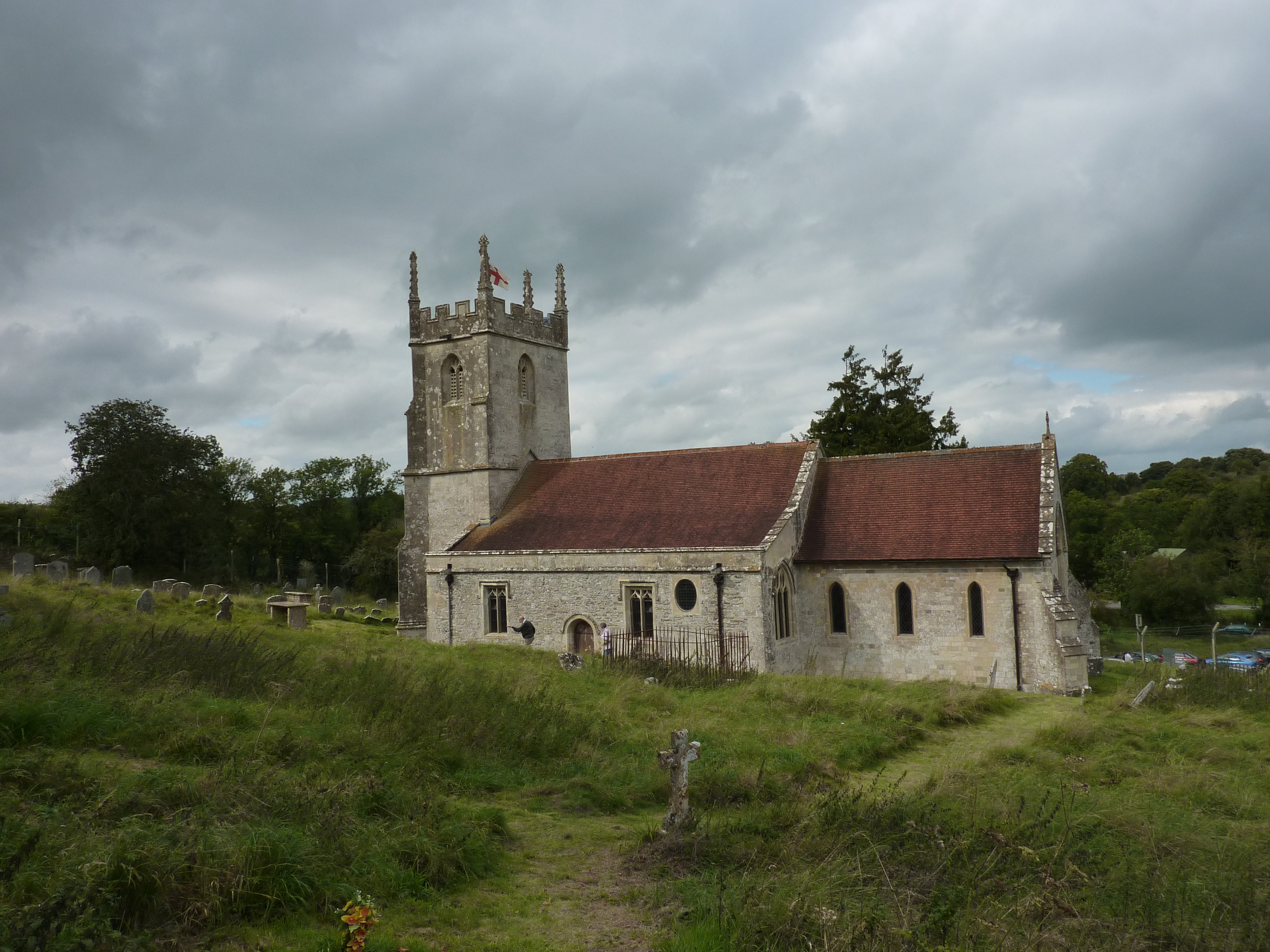
St Giles' Church, Imber

St Giles' Church is in the deserted village of Imber, Wiltshire, England, which since 1943 has been within the British Army's training area on Salisbury...

Imber

Imber is an uninhabited village and former civil parish within the British Army's training area, now in the parish of Heytesbury, on Salisbury Plain, Wiltshire...

Nearby Amenities

Located within 500m of 51.251746,-2.0568342
Brouncker's Down
Place: locality
Lat/Long: 51.2550796/-2.0610452
Cheverell Down
Place: locality
Lat/Long: 51.2544618/-2.0533634
The data included in this document is from www.openstreetmap.org. The data is made available under ODbL.

Have you been to Cheverell Down?

Leave your review of Cheverell Down below (or comments, questions and feedback).