Harlaxton

Settlement in Lincolnshire South Kesteven

England

Harlaxton

The Gatehouse The gatehouse for Denton Manor.  These are a grade II listed building - see <span class="nowrap"><a title="https://historicengland.org.uk/listing/the-list/list-entry/1147559" rel="nofollow ugc noopener" href="https://historicengland.org.uk/listing/the-list/list-entry/1147559">Link</a><img style="margin-left:2px;" alt="External link" title="External link - shift click to open in new window" src="https://s1.geograph.org.uk/img/external.png" width="10" height="10"/></span>
The Gatehouse Credit: Bob Harvey

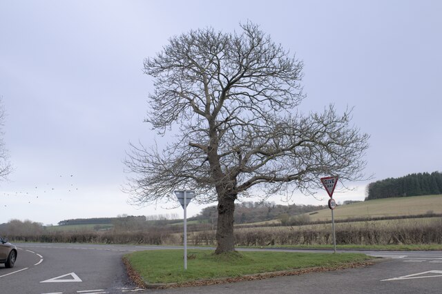
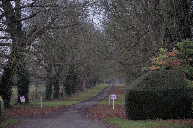
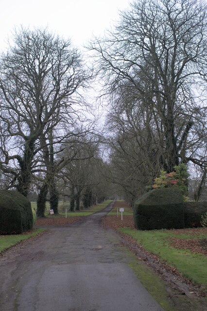
Harlaxton is a picturesque village located in the county of Lincolnshire, England. Situated approximately 3 miles northwest of Grantham, the village is renowned for its stunning architecture and idyllic countryside setting. Harlaxton is most famous for Harlaxton Manor, an impressive Victorian country house that dominates the village.

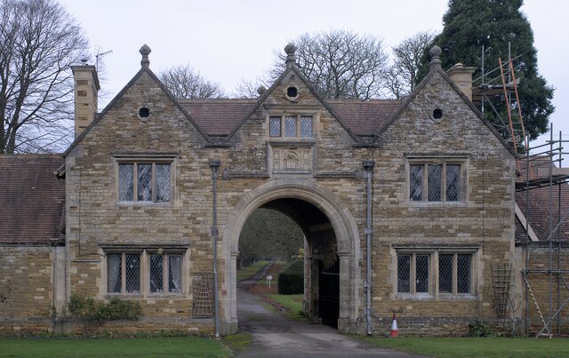
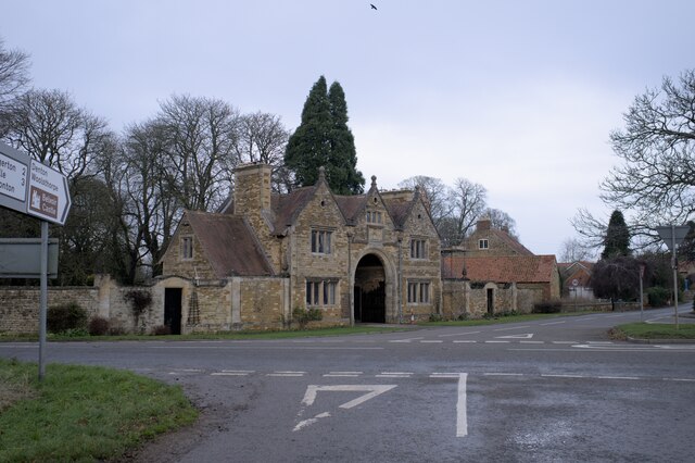
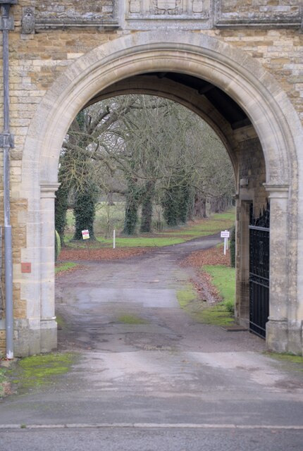
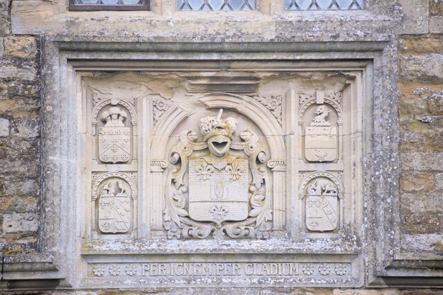
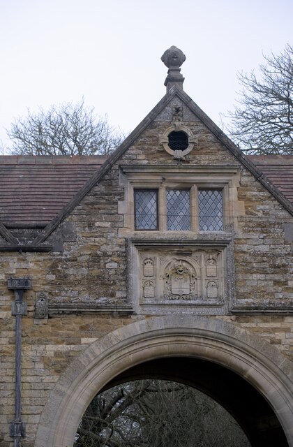
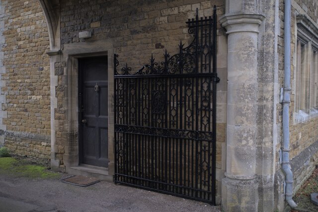
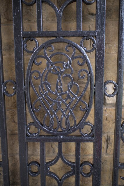
Harlaxton Manor, also known as Gregory House, was built in the 19th century by architect Anthony Salvin in the Jacobean Revival style. The manor boasts intricate stonework, turrets, and a magnificent entrance hall, making it a prime example of Victorian opulence. Today, Harlaxton Manor is home to Harlaxton College, an American study abroad program affiliated with the University of Evansville.

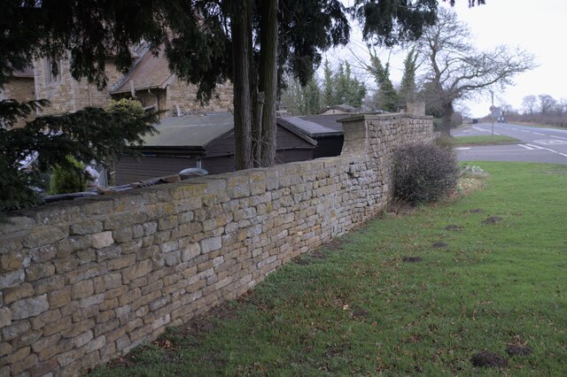
Besides Harlaxton Manor, the village itself is charming and tranquil, with a small population of around 300 residents. The village offers a peaceful escape from the hustle and bustle of city life, with its quaint cottages, well-maintained gardens, and a sense of community.

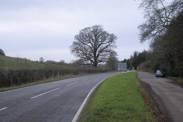
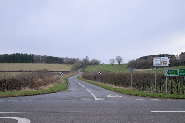
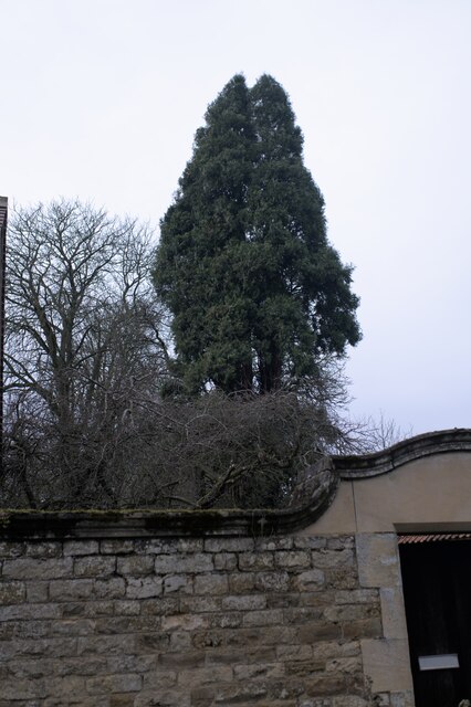
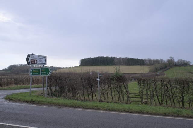
Surrounded by rolling hills and lush green fields, Harlaxton is a haven for nature enthusiasts. The village is located in the heart of the Lincolnshire countryside, offering ample opportunities for walks, cycling, and exploring the great outdoors. The nearby Belton House, a stunning Grade I listed country house, is a popular attraction for visitors to Harlaxton, with its beautiful gardens and parkland.

Overall, Harlaxton is a picturesque and historic village, known for its stunning architecture, tranquil atmosphere, and natural beauty. It is a place where visitors can immerse themselves in the charm of rural England and experience a true sense of tranquility.

If you have any feedback on the listing, please let us know in the comments section below.

Harlaxton Images

Images are sourced within 2km of 52.884239/-0.686984 or Grid Reference SK8832. Thanks to Geograph Open Source API. All images are credited.

The Gatehouse The gatehouse for Denton Manor.  These are a grade II listed building - see <span class="nowrap"><a title="https://historicengland.org.uk/listing/the-list/list-entry/1147559" rel="nofollow ugc noopener" href="https://historicengland.org.uk/listing/the-list/list-entry/1147559">Link</a><img style="margin-left:2px;" alt="External link" title="External link - shift click to open in new window" src="https://s1.geograph.org.uk/img/external.png" width="10" height="10"/></span>
The Gatehouse
The gatehouse for Denton Manor. These are a grade II listed building - see LinkExternal link
The gatehouse at the crossroads Under the arch is the road to Denton Manor.  A grade II listed building - see <span class="nowrap"><a title="https://historicengland.org.uk/listing/the-list/list-entry/1147559" rel="nofollow ugc noopener" href="https://historicengland.org.uk/listing/the-list/list-entry/1147559">Link</a><img style="margin-left:2px;" alt="External link" title="External link - shift click to open in new window" src="https://s1.geograph.org.uk/img/external.png" width="10" height="10"/></span>
The gatehouse at the crossroads
Under the arch is the road to Denton Manor. A grade II listed building - see LinkExternal link
The A607 road The A607 is an A road which runs for 54 miles between Leicester and Bracebridge Heath, a village on the outskirts of Lincoln. It crosses the A1 at Grantham. Beyond Grantham, the A607 forms the "villages" route between the A1 and Lincoln, not as direct as the High Dyke route (B6403) and not as fast as the Newark route (A1/A46), but is probably the most scenic of the three.
The A607 road
The A607 is an A road which runs for 54 miles between Leicester and Bracebridge Heath, a village on the outskirts of Lincoln. It crosses the A1 at Grantham. Beyond Grantham, the A607 forms the "villages" route between the A1 and Lincoln, not as direct as the High Dyke route (B6403) and not as fast as the Newark route (A1/A46), but is probably the most scenic of the three.
A Hill In the foreground is the A607, the Grantham to Melton road.  Joining it at the crossroads at Denton is country lane to Hungerton.
A Hill
In the foreground is the A607, the Grantham to Melton road. Joining it at the crossroads at Denton is country lane to Hungerton.
 Castanea sativa Sweet chestnut tree on the green triangle at Denton, on the crossroads on the A607.
Castanea sativa
Sweet chestnut tree on the green triangle at Denton, on the crossroads on the A607.
Spring in field There is a spring in this field, in a little fold in the rising ground.
Spring in field
There is a spring in this field, in a little fold in the rising ground.
The drive to the Manor Through the arch at <a href="https://www.geograph.org.uk/photo/7057862">SK8632 : The gatehouse at the crossroads</a>.
The drive to the Manor
Ashlar panel Described in the listing at <span class="nowrap"><a title="https://historicengland.org.uk/listing/the-list/list-entry/1147559" rel="nofollow ugc noopener" href="https://historicengland.org.uk/listing/the-list/list-entry/1147559">Link</a><img style="margin-left:2px;" alt="External link" title="External link - shift click to open in new window" src="https://s1.geograph.org.uk/img/external.png" width="10" height="10"/></span> as "an ashlar panel containing coat of arms and inscription "Per ignem per gladium"".  This is the motto of the Welby family  - the rather alarming "By Fire By Sword".
Ashlar panel
Described in the listing at LinkExternal link as "an ashlar panel containing coat of arms and inscription "Per ignem per gladium"". This is the motto of the Welby family - the rather alarming "By Fire By Sword".
Architectural detail Features of the gatehouse described in the listing at a grade II listed building - see <span class="nowrap"><a title="https://historicengland.org.uk/listing/the-list/list-entry/1147559" rel="nofollow ugc noopener" href="https://historicengland.org.uk/listing/the-list/list-entry/1147559">Link</a><img style="margin-left:2px;" alt="External link" title="External link - shift click to open in new window" src="https://s1.geograph.org.uk/img/external.png" width="10" height="10"/></span> . "All windows have stone ovolo moulded mullions, diamond leaded casements and cornices. In the 3 gables are small keyed oculi."
Architectural detail
Features of the gatehouse described in the listing at a grade II listed building - see LinkExternal link . "All windows have stone ovolo moulded mullions, diamond leaded casements and cornices. In the 3 gables are small keyed oculi."
One of the gates The gatehouse in <a href="https://www.geograph.org.uk/photo/7057860">SK8632 : The Gatehouse</a> has two of these, as described in the listing at a grade II listed building - see <span class="nowrap"><a title="https://historicengland.org.uk/listing/the-list/list-entry/1147559" rel="nofollow ugc noopener" href="https://historicengland.org.uk/listing/the-list/list-entry/1147559">Link</a><img style="margin-left:2px;" alt="External link" title="External link - shift click to open in new window" src="https://s1.geograph.org.uk/img/external.png" width="10" height="10"/></span> .
One of the gates
The gatehouse in SK8632 : The Gatehouse has two of these, as described in the listing at a grade II listed building - see LinkExternal link .
Knot motif At the centre of the gates seen in <a href="https://www.geograph.org.uk/photo/7057944">SK8632 : One of the gates</a> is this complex motif
Knot motif
At the centre of the gates seen in SK8632 : One of the gates is this complex motif
found art I liked the appearance of these tiles, removed during the work at <a href="https://www.geograph.org.uk/photo/7057860">SK8632 : The Gatehouse</a> which necessitates the scaffolding seen there.
found art
I liked the appearance of these tiles, removed during the work at SK8632 : The Gatehouse which necessitates the scaffolding seen there.
Tall tree A pine behind the gatehouse at Denton Manor
Tall tree
A pine behind the gatehouse at Denton Manor
The drive to the Manor
A tree-lined drive
A tree-lined drive
The Manor Wall The wall around Denton Manor
The Manor Wall
The wall around Denton Manor
Seedhead I was impressed by the skeletal beauty of this seedhead, whose function has long since passed.
Seedhead
I was impressed by the skeletal beauty of this seedhead, whose function has long since passed.
Signs on the A607 The A607 is an A road which runs for 54 miles between Leicester and Bracebridge Heath, a village on the outskirts of Lincoln. It crosses the A1 at Grantham. Beyond Grantham, the A607 forms the "villages" route between the A1 and Lincoln, not as direct as the High Dyke route (B6403) and not as fast as the Newark route (A1/A46), but is probably the most scenic of the three.
Signs on the A607
The A607 is an A road which runs for 54 miles between Leicester and Bracebridge Heath, a village on the outskirts of Lincoln. It crosses the A1 at Grantham. Beyond Grantham, the A607 forms the "villages" route between the A1 and Lincoln, not as direct as the High Dyke route (B6403) and not as fast as the Newark route (A1/A46), but is probably the most scenic of the three.
Show me another place!

Harlaxton is located at Grid Ref: SK8832 (Lat: 52.884239, Lng: -0.686984)

Division: Parts of Kesteven

Administrative County: Lincolnshire

District: South Kesteven

Police Authority: Lincolnshire

What 3 Words

///drums.punctuate.detail. Near Barrowby, Lincolnshire

Related Wikis

Harlaxton

Harlaxton is a village and civil parish in the South Kesteven district of Lincolnshire, England. It lies on the edge of the Vale of Belvoir and just off...

St Mary and St Peter's Church, Harlaxton

St Mary and St Peter's Church is a Grade I listed Church of England parish church dedicated to Saint Mary and Saint Peter in Harlaxton, Lincolnshire, England...

Harlaxton Manor

Harlaxton Manor is a Victorian country house in Harlaxton, Lincolnshire, England. It was built for Gregory Gregory, a local squire and businessman. Gregory...

Denton, Lincolnshire

Denton is a village and civil parish in the South Kesteven district of Lincolnshire, England. The population of the civil parish was 273 at the 2011 census...

Nearby Amenities

Located within 500m of 52.884239,-0.686984
Harlaxton
Is In: Lincolnshire, England, UK
Place: village
Source: NPE
Lat/Long: 52.8840417/-0.686898
Bus Stop
Gregory Arms PH
Bus: yes
Naptan AtcoCode: 270000008547
Naptan Bearing: SW
Naptan CommonName: Gregory Arms PH
Naptan Indicator: opp
Naptan Landmark: Gregory Arms PH
Naptan NaptanCode: lingtgdg
Naptan Street: A607
Naptan Verified: no
Public Transport: platform
Source: naptan_import
Lat/Long: 52.887258/-0.6886245
Bus Stop
Rectory Lane
Bus: yes
Naptan AtcoCode: 2700LHC01704
Naptan Bearing: SW
Naptan CommonName: Rectory Lane
Naptan Indicator: SW - bound
Naptan Landmark: Rectory Lane
Naptan NaptanCode: linamjdm
Naptan Street: A607
Naptan Verified: no
Public Transport: platform
Source: naptan_import
Lat/Long: 52.8848511/-0.6937503
Bus Stop
Gregory Arms PH
Bus: yes
Naptan AtcoCode: 2700LHGAP342
Naptan Bearing: NE
Naptan CommonName: Gregory Arms PH
Naptan Indicator: adj
Naptan Landmark: Gregory Arms PH
Naptan NaptanCode: linadmga
Naptan Street: A607
Naptan Verified: no
Public Transport: platform
Source: naptan_import
Lat/Long: 52.887941/-0.6873831
Bus Stop
Trotter's Lane
Bus: yes
Naptan AtcoCode: 2700LHO00956
Naptan Bearing: SW
Naptan CommonName: Trotter's Lane
Naptan Indicator: opp
Naptan Landmark: Trotter's Lane
Naptan NaptanCode: linagtgj
Naptan Street: High Street
Naptan Verified: no
Public Transport: platform
Source: naptan_import
Lat/Long: 52.8843883/-0.6868384
Crossing
Crossing Island: yes
Lat/Long: 52.8875952/-0.6877305
Turning Circle
Lat/Long: 52.8849341/-0.6844462
Turning Circle
Lat/Long: 52.8837769/-0.6835343
Turning Circle
Lat/Long: 52.8845522/-0.6837354
Post Office
Harlaxton Post Office
Brand: Post Office
Brand Wikidata: Q1783168
Check Date: 2023-09-27
Opening Hours: Mo-Tu,Th-Fr 09:00-13:00,14:00-17:30; We,Sa 09:00-13:00; Su off
Ref Pol Id: 91468
Lat/Long: 52.8846023/-0.6870153
Oak Farm
Place: farm
Source: Bing
Lat/Long: 52.8833063/-0.6898125
Poultry Farm
Place: farm
Source: Bing
Lat/Long: 52.8834706/-0.6914104
Harlaxton / 2000
Man Made: village_sign
Lat/Long: 52.8875195/-0.6879553
Crossing
Crossing Island: yes
Lat/Long: 52.8877985/-0.6878741
Harlaxton Parish Notices
Board Type: notice
Information: board
Tourism: information
Lat/Long: 52.884591/-0.6868112
Grit Bin
LCC Grit
Lat/Long: 52.8857102/-0.6864436
Bus Stop
Trotter's Lane
Bus: yes
Naptan AtcoCode: 270000008549
Naptan Bearing: NE
Naptan CommonName: Trotter's Lane
Naptan Indicator: adj
Naptan Landmark: Trotter's Lane
Naptan NaptanCode: lingtgdm
Naptan Street: High Street
Naptan Verified: no
Public Transport: platform
Source: naptan_import
Lat/Long: 52.8845856/-0.6868
Bench
Backrest: yes
Colour: brown
Material: wood
Lat/Long: 52.8830307/-0.6928231
Barrier: stile
Material: wood
Step Count: 1
Stile: stepover
Lat/Long: 52.8839262/-0.6902677
Bench
Backrest: yes
Colour: grey
Inscription: In loving memory of Allan Barry Norton 1935 - 2009
Material: wood
Lat/Long: 52.8839611/-0.6897144
Bench
Backrest: yes
Colour: grey
Inscription: In memory of June Jefferis 1934-2001
Material: wood
Lat/Long: 52.8839731/-0.6896306
Public Bookcase
Booth: K6
Disused Amenity: telephone
Information: kiosk
Listed Status: Grade II
Man Made: telephone_box
Public Bookcase Type: phone_box
Tourism: information
Lat/Long: 52.8840781/-0.6871031
Waste Basket
Lat/Long: 52.8840901/-0.6871353
Historic: memorial
Material: stone
Memorial: obelisk
Lat/Long: 52.8841553/-0.6870636
Bench
Backrest: yes
Colour: white
Inscription: In loving memory of Maud Jean Bray
Material: wood
Lat/Long: 52.8841995/-0.6892205
Man Made: water_well
Pump: manual
Lat/Long: 52.8846421/-0.6868162
Barrier: bollard
Lat/Long: 52.8862154/-0.6901313
Turning Circle
Lat/Long: 52.8865304/-0.69023
Crossing
Crossing: unmarked
Lat/Long: 52.8886507/-0.6884215
Post Box
Brand: Royal Mail
Brand Wikidata: Q638098
Brand Wikipedia: en:Royal Mail
Collection Times: Mo-Fr 17:00; Sa 10:00
Operator: Royal Mail
Operator Wikidata: Q638098
Post Box Design: type_n
Post Box Type: lamp
Ref: NG32 73
Royal Cypher: EIIR
Royal Cypher Wikidata: Q33102113
Lat/Long: 52.8832424/-0.6863494
Defibrillator
Defibrillator Location: on exterior wall of Harlaxton Village Hall, under the porch just to the left of the main entrance.
Emergency: defibrillator
Indoor: no
Lat/Long: 52.8837266/-0.687745
Entrance: main
Lat/Long: 52.883712/-0.6877513
Bench
Lat/Long: 52.8841003/-0.6871654
Generator Method: photovoltaic
Generator Output Electricity: yes
Generator Source: solar
Generator Type: solar_photovoltaic_panel
Location: roof
Power: generator
Lat/Long: 52.8885072/-0.6871385
Generator Method: photovoltaic
Generator Output Electricity: yes
Generator Source: solar
Generator Type: solar_photovoltaic_panel
Location: roof
Power: generator
Lat/Long: 52.885395/-0.68808
Generator Method: photovoltaic
Generator Output Electricity: yes
Generator Source: solar
Generator Type: solar_photovoltaic_panel
Location: roof
Power: generator
Lat/Long: 52.8854824/-0.6865618
Generator Method: photovoltaic
Generator Output Electricity: yes
Generator Source: solar
Generator Type: solar_photovoltaic_panel
Location: roof
Power: generator
Lat/Long: 52.8846505/-0.6847218
Generator Method: photovoltaic
Generator Output Electricity: yes
Generator Source: solar
Generator Type: solar_photovoltaic_panel
Location: roof
Power: generator
Lat/Long: 52.8846877/-0.6846467
Generator Method: photovoltaic
Generator Output Electricity: yes
Generator Source: solar
Generator Type: solar_photovoltaic_panel
Location: roof
Power: generator
Lat/Long: 52.8849661/-0.6849606
Generator Method: photovoltaic
Generator Output Electricity: yes
Generator Source: solar
Generator Type: solar_photovoltaic_panel
Location: roof
Power: generator
Lat/Long: 52.8849645/-0.6850088
Generator Method: photovoltaic
Generator Output Electricity: yes
Generator Source: solar
Generator Type: solar_photovoltaic_panel
Location: roof
Power: generator
Lat/Long: 52.8834345/-0.6844617
Generator Method: photovoltaic
Generator Output Electricity: yes
Generator Source: solar
Generator Type: solar_photovoltaic_panel
Location: roof
Power: generator
Lat/Long: 52.8828356/-0.6837697
Generator Method: photovoltaic
Generator Output Electricity: yes
Generator Source: solar
Generator Type: solar_photovoltaic_panel
Location: roof
Note: possible hot water (solar thermal)
Power: generator
Lat/Long: 52.8824285/-0.6835785
Generator Method: photovoltaic
Generator Output Electricity: yes
Generator Source: solar
Generator Type: solar_photovoltaic_panel
Location: roof
Note: possible hot water (solar thermal)
Power: generator
Lat/Long: 52.8824103/-0.6838468
Generator Method: photovoltaic
Generator Output Electricity: yes
Generator Source: solar
Generator Type: solar_photovoltaic_panel
Location: roof
Note: possible hot water (solar thermal)
Power: generator
Lat/Long: 52.8823873/-0.6839997
Generator Method: photovoltaic
Generator Output Electricity: yes
Generator Source: solar
Generator Type: solar_photovoltaic_panel
Location: roof
Power: generator
Lat/Long: 52.8822906/-0.6864317
Generator Method: photovoltaic
Generator Output Electricity: yes
Generator Source: solar
Generator Type: solar_photovoltaic_panel
Location: roof
Power: generator
Lat/Long: 52.882268/-0.6864747
Generator Method: photovoltaic
Generator Output Electricity: yes
Generator Source: solar
Generator Type: solar_photovoltaic_panel
Location: roof
Power: generator
Lat/Long: 52.8820835/-0.6871399
Generator Method: photovoltaic
Generator Output Electricity: yes
Generator Source: solar
Generator Type: solar_photovoltaic_panel
Location: roof
Power: generator
Lat/Long: 52.8805247/-0.6859892
Generator Method: photovoltaic
Generator Output Electricity: yes
Generator Source: solar
Generator Type: solar_photovoltaic_panel
Location: roof
Power: generator
Lat/Long: 52.8803434/-0.6858899
Generator Method: photovoltaic
Generator Output Electricity: yes
Generator Source: solar
Generator Type: solar_photovoltaic_panel
Location: roof
Power: generator
Lat/Long: 52.8829808/-0.6895431
Generator Method: photovoltaic
Generator Output Electricity: yes
Generator Source: solar
Generator Type: solar_photovoltaic_panel
Location: roof
Power: generator
Lat/Long: 52.8832916/-0.6894224
Generator Method: photovoltaic
Generator Output Electricity: yes
Generator Source: solar
Generator Type: solar_photovoltaic_panel
Location: roof
Power: generator
Lat/Long: 52.8825276/-0.6913241
Generator Method: photovoltaic
Generator Output Electricity: yes
Generator Source: solar
Generator Type: solar_photovoltaic_panel
Location: roof
Power: generator
Lat/Long: 52.8825907/-0.6921824
Generator Method: photovoltaic
Generator Output Electricity: yes
Generator Source: solar
Generator Type: solar_photovoltaic_panel
Location: roof
Power: generator
Lat/Long: 52.8829047/-0.6931641
Generator Method: photovoltaic
Generator Output Electricity: yes
Generator Source: solar
Generator Type: solar_photovoltaic_panel
Location: roof
Power: generator
Lat/Long: 52.8834113/-0.6933371
Generator Method: photovoltaic
Generator Output Electricity: yes
Generator Source: solar
Generator Type: solar_photovoltaic_panel
Location: roof
Power: generator
Lat/Long: 52.8833992/-0.6933317
Generator Method: photovoltaic
Generator Output Electricity: yes
Generator Source: solar
Generator Type: solar_photovoltaic_panel
Location: roof
Power: generator
Lat/Long: 52.8830535/-0.6871264
Generator Method: photovoltaic
Generator Output Electricity: yes
Generator Source: solar
Generator Type: solar_photovoltaic_panel
Location: roof
Power: generator
Lat/Long: 52.8854354/-0.6864827
Advertising: board
Lat/Long: 52.8838599/-0.6876297
Give Way
Direction: forward
Lat/Long: 52.887754/-0.6878412
Give Way
Direction: forward
Lat/Long: 52.8876781/-0.6877869
The data included in this document is from www.openstreetmap.org. The data is made available under ODbL.

Have you been to Harlaxton?

Leave your review of Harlaxton below (or comments, questions and feedback).