Slepe Heath

Downs, Moorland in Dorset

England

Slepe Heath

New Road A finger post indicates the route of the Purbeck Way.
New Road Credit: Trevor Harris

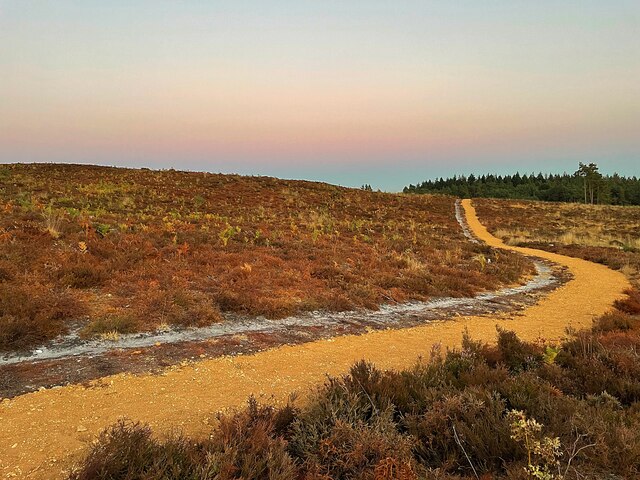
Slepe Heath, located in the county of Dorset, England, is a vast expanse of open heathland characterized by its idyllic downs and moorland. Covering an area of approximately 200 hectares, Slepe Heath is a designated Site of Special Scientific Interest (SSSI) due to its rich biodiversity and unique landscape.

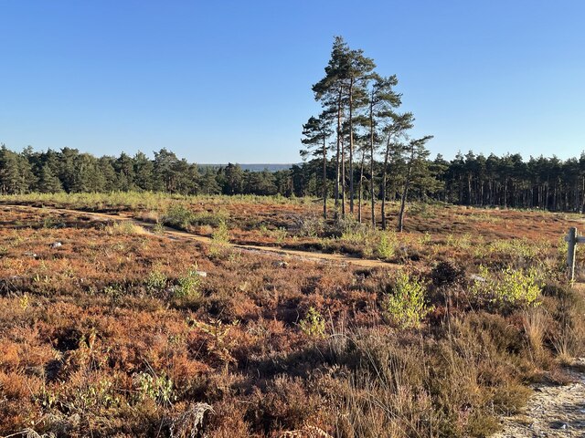
The heath is primarily composed of heather, gorse, and grasses, which create a striking mosaic of colors throughout the year. During the summer months, the heather blooms, painting the landscape in hues of purple and pink. The gorse, with its bright yellow flowers, adds further vibrancy to the scene.

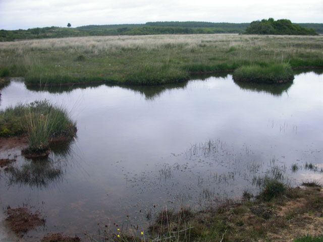
Slepe Heath is home to a wide array of flora and fauna, including several rare and protected species. Heathland birds such as the Dartford warbler and the nightjar can be spotted, along with reptiles like the sand lizard and the smooth snake. The area also supports a diverse population of insects and butterflies.

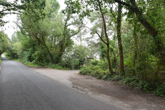
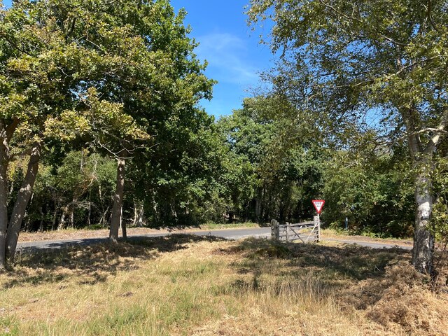
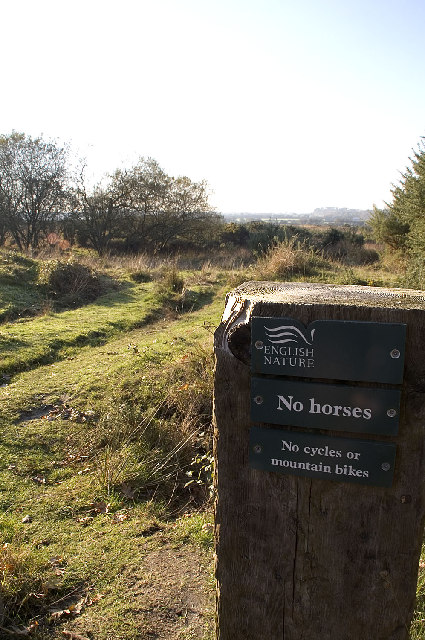
Visitors to Slepe Heath can explore the various walking trails that wind through the heathland, offering stunning views of the surrounding countryside. The tranquility and natural beauty of the area make it a popular spot for nature enthusiasts and photographers alike.

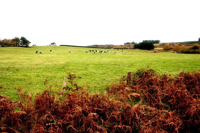
Managed by the National Trust, the heath is carefully maintained to preserve its unique ecosystem. Conservation efforts include controlled grazing and regular heather cutting to maintain the heathland's health and diversity.

Slepe Heath offers a serene escape from the bustle of everyday life, providing a chance to connect with nature and immerse oneself in the picturesque landscapes of Dorset.

If you have any feedback on the listing, please let us know in the comments section below.

Slepe Heath Images

Images are sourced within 2km of 50.672701/-2.0789268 or Grid Reference SY9485. Thanks to Geograph Open Source API. All images are credited.

New Road A finger post indicates the route of the Purbeck Way.
New Road
A finger post indicates the route of the Purbeck Way.
Pasture Field on the Arne Peninsula The bracken round this field of dairy cows had already died back to a golden brown.
Pasture Field on the Arne Peninsula
The bracken round this field of dairy cows had already died back to a golden brown.
Bank Gate Cottages On Arne Road on the Arne peninsula
Bank Gate Cottages
On Arne Road on the Arne peninsula
Minor road junction on the Arne Peninsula  Where Soldiers Road meets Arne Road
Minor road junction on the Arne Peninsula
Where Soldiers Road meets Arne Road
Rustic seating  Beside a car park providing access to the Purbeck Heaths Nature Reserve
Rustic seating
Beside a car park providing access to the Purbeck Heaths Nature Reserve
Hyde’s Heath Part of the RSPB’s Arne Nature Reserve
Hyde’s Heath
Part of the RSPB’s Arne Nature Reserve
Wild horse on Soldier’s Road A minor road crossing Slepe Heath
Wild horse on Soldier’s Road
A minor road crossing Slepe Heath
Conifer trees in Salterns Copse Heathland on the Arne peninsula
Conifer trees in Salterns Copse
Heathland on the Arne peninsula
Halfway Inn Public house and restaurant on the A531. Located approximately halfway between Wareham and Corfe Castle.
Halfway Inn
Public house and restaurant on the A531. Located approximately halfway between Wareham and Corfe Castle.
Path on Hyde's Heath On RSPB's Arne nature reserve
Path on Hyde's Heath
On RSPB's Arne nature reserve
River Frome Boats moored on the river near Wareham.
River Frome
Boats moored on the river near Wareham.
River Frome Boats moored on the River Frome.
River Frome
Boats moored on the River Frome.
Old Milestone by the A351, south of Stoborough Green Carved stone post by the A351, in parish of ARNE (PURBECK District), by bus stop and path to Blue Pool, opposite sign 'RVP No 5' at entrance to Hartland Nature reserve, on West side of road. Dorset 2 (limestone), erected by the Wareham (North, South & West Branches) turnpike trust in the 19th century.

Inscription reads:-
II
MILES FROM
WAREHAM
Carved benchmark bottom centre of front face. 

Grade II Listed. List Entry Number:1120342 <span class="nowrap"><a title="https://historicengland.org.uk/listing/the-list/list-entry/1120342" rel="nofollow ugc noopener" href="https://historicengland.org.uk/listing/the-list/list-entry/1120342">Link</a><img style="margin-left:2px;" alt="External link" title="External link - shift click to open in new window" src="https://s1.geograph.org.uk/img/external.png" width="10" height="10"/></span>

Milestone Society National ID: DO_WASW02
Old Milestone by the A351, south of Stoborough Green
Carved stone post by the A351, in parish of ARNE (PURBECK District), by bus stop and path to Blue Pool, opposite sign 'RVP No 5' at entrance to Hartland Nature reserve, on West side of road. Dorset 2 (limestone), erected by the Wareham (North, South & West Branches) turnpike trust in the 19th century. Inscription reads:- II MILES FROM WAREHAM Carved benchmark bottom centre of front face. Grade II Listed. List Entry Number:1120342 LinkExternal link Milestone Society National ID: DO_WASW02
Slepe Heath A sunset across Slepe Heath
Slepe Heath
A sunset across Slepe Heath
Pond at Hartland Moor
Redcliffe, Dorset The River Frome is still tidal at this point and is navigable up-river (ahead) as far as Wareham Bridge. The sea is reached via Poole Harbour. The Redcliffe Yacht Club headquarters can just be seen in the centre of the picture.
Redcliffe, Dorset
The River Frome is still tidal at this point and is navigable up-river (ahead) as far as Wareham Bridge. The sea is reached via Poole Harbour. The Redcliffe Yacht Club headquarters can just be seen in the centre of the picture.
Lookout Holiday Park, Stoborough, Wareham, Dorset One of the many caravan parks catering for the multitude of summer visitors to the Isle of Purbeck.
Lookout Holiday Park, Stoborough, Wareham, Dorset
One of the many caravan parks catering for the multitude of summer visitors to the Isle of Purbeck.
Stoborough Heath NNR, Dorset Stoborough Heath NNR (National Nature Reserve) is a heathland reserve adjacent to Hartland Moor NNR. The habitat is made up of dry heath, mire and acid grassland reverting to heath. The grassland was heath until the 1950s when it started to be used for agriculture. The area was declared a NNR in 1985 to reinstate the heathland. The photograph is taken from the eastern edge of the Reserve, looking towards Stoborough.
<span class="nowrap"><a title="http://www.english-nature.org.uk/about/teams/team_photo/StoboroughHeathmap.pdf" rel="nofollow ugc noopener" href="http://www.english-nature.org.uk/about/teams/team_photo/StoboroughHeathmap.pdf">Link</a><img style="margin-left:2px;" alt="External link" title="External link - shift click to open in new window" src="https://s1.geograph.org.uk/img/external.png" width="10" height="10"/></span>
Stoborough Heath NNR, Dorset
Stoborough Heath NNR (National Nature Reserve) is a heathland reserve adjacent to Hartland Moor NNR. The habitat is made up of dry heath, mire and acid grassland reverting to heath. The grassland was heath until the 1950s when it started to be used for agriculture. The area was declared a NNR in 1985 to reinstate the heathland. The photograph is taken from the eastern edge of the Reserve, looking towards Stoborough. LinkExternal link
Show me another place!

Slepe Heath is located at Grid Ref: SY9485 (Lat: 50.672701, Lng: -2.0789268)

Unitary Authority: Dorset

Police Authority: Dorset

What 3 Words

///they.fishery.even. Near Wareham, Dorset

Nearby Locations

Slepe Heath Hartland Moor

Related Wikis

Hartland Moor

Hartland Moor is a Site of Special Scientific Interest (SSSI) on the south side of Poole Harbour near the town of Wareham in Dorset, England. It consists...

Ridge, Dorset

Ridge is a village in the English county of Dorset. It is situated on the south bank of the River Frome, about half a mile due south east of the town of...

Stoborough Green

Stoborough Green is a village in the English county of Dorset. It is situated to the south of the village of Stoborough and about 2 kilometres south of...

Gigger's Island

Gigger's Island is an island in Poole Harbour in the English county of Dorset. The island is situated near to the Frome and Piddle rivers, near to the...

Stoborough

Stoborough () is a village in the English county of Dorset. It is situated one mile to the south of the town of Wareham, and separated from it by the River...

River Piddle

The River Piddle or Trent or North River is a small rural Dorset river which rises in the Dorset Downs and flows into Poole Harbour near Wareham. ��2...

Wareham Priory

Wareham Priory was a monastery in Wareham, Dorset, England. A nunnery was founded on the site by the Saxons, possibly in 672, and dispersed during the...

Lady St Mary Church, Wareham

The parish church of Lady St. Mary, Wareham is a church of Anglo-Saxon origin in the town of Wareham, Dorset, in England. The church is notable as the...

Nearby Amenities

Located within 500m of 50.672701,-2.0789268
Material: wood
Power: pole
Source: bing
Lat/Long: 50.6724372/-2.083752
Material: wood
Power: pole
Source: bing
Lat/Long: 50.6725522/-2.0837171
Material: wood
Power: pole
Source: bing
Lat/Long: 50.6725946/-2.0849469
Material: wood
Power: pole
Source: bing
Lat/Long: 50.6726965/-2.085196
Location Transition: yes
Material: wood
Power: pole
Source: survey
Switch: mechanical
Lat/Long: 50.6765531/-2.0780779
Material: wood
Power: pole
Source: survey;bing
Lat/Long: 50.6766612/-2.0768937
Marker: post
Note: S E B 132 kV CABLES;32 JB-11/12 3M
Ref: 32
Source: survey
Utility: power
Lat/Long: 50.6770402/-2.0773959
Give Way
Direction: forward
Lat/Long: 50.6770631/-2.0772253
Barrier: cattle_grid
Lat/Long: 50.6768371/-2.0807177
The data included in this document is from www.openstreetmap.org. The data is made available under ODbL.

Have you been to Slepe Heath?

Leave your review of Slepe Heath below (or comments, questions and feedback).