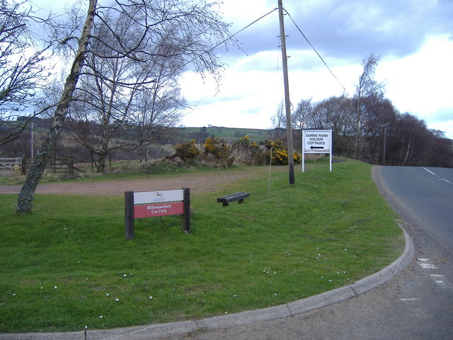
Billsmoor Park

Downs, Moorland in Northumberland

England

Billsmoor Park

Welcome sign A change from the usual 'Keep Out' sign.
This is a convenient parking area with fine views - even better in summer or winter!
<span class="nowrap"><a title="https://neilcarmichael.info/" rel="nofollow ugc noopener" href="https://neilcarmichael.info/">Link</a><img style="margin-left:2px;" alt="External link" title="External link - shift click to open in new window" src="https://s1.geograph.org.uk/img/external.png" width="10" height="10"/></span>   <span class="nowrap"><a title="https://neilcarmichael.info/dunshiel/camping/" rel="nofollow ugc noopener" href="https://neilcarmichael.info/dunshiel/camping/">Link</a><img style="margin-left:2px;" alt="External link" title="External link - shift click to open in new window" src="https://s1.geograph.org.uk/img/external.png" width="10" height="10"/></span>
Welcome sign Credit: Russel Wills

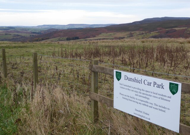
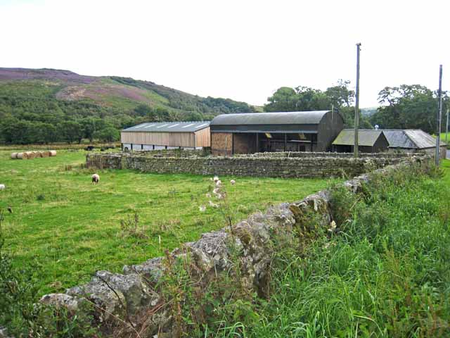
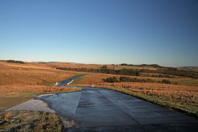
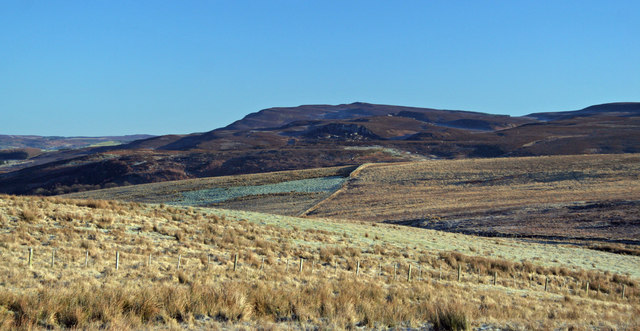
Billsmoor Park, located in Northumberland, England, is a picturesque area encompassing downs and moorland. Covering a vast expanse, the park offers visitors a stunning natural landscape with its rolling hills, heather-covered moors, and panoramic views.

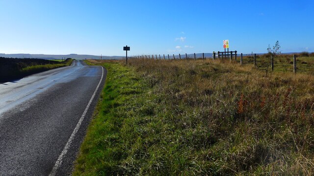
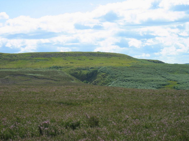
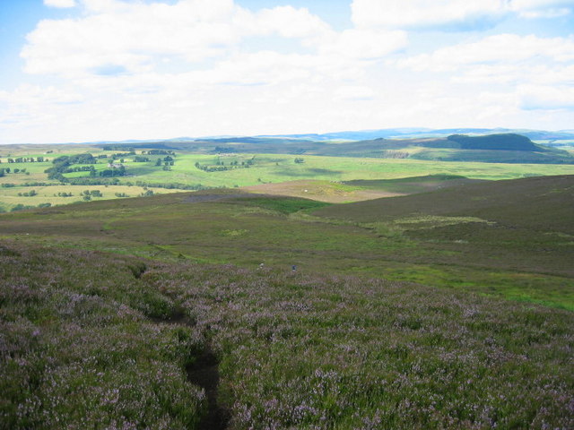
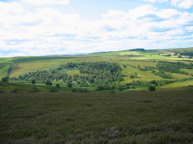
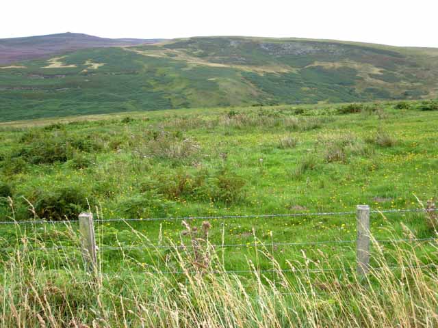
The downs in Billsmoor Park are characterized by gently sloping hills, covered in lush green grass and interspersed with vibrant wildflowers during the summer months. These open spaces provide ample opportunities for outdoor activities such as picnicking, walking, or simply enjoying the tranquility of the surroundings. The downs also serve as a habitat for various species of wildlife, including rabbits, hares, and a variety of bird species.

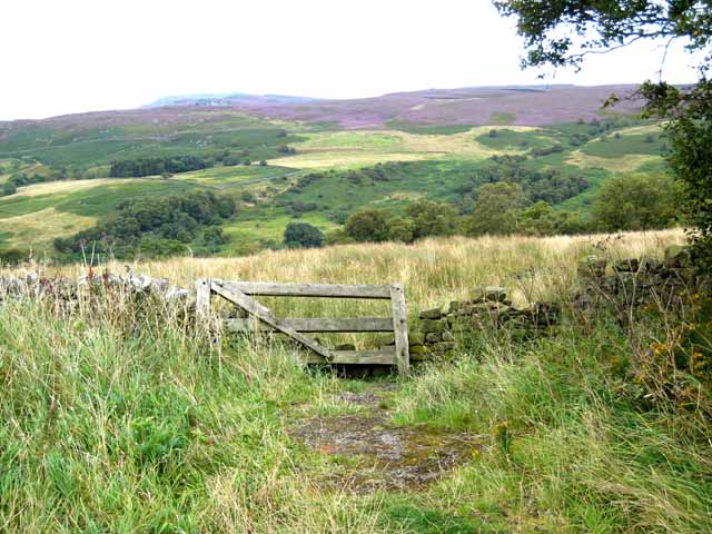
The moorland in Billsmoor Park showcases a distinct landscape, featuring heather-clad hillsides that transform into a beautiful purple hue during late summer. The moors are dotted with scattered trees and rocky outcrops, adding to the area's charm and providing shelter for diverse plant and animal species. Visitors can explore the moorland through well-maintained walking trails, allowing them to immerse themselves in the raw beauty of the surroundings.

Billsmoor Park offers a peaceful retreat for nature enthusiasts and those seeking a break from the hustle and bustle of city life. Whether it is capturing breathtaking views, indulging in outdoor activities, or simply enjoying the serenity of the moorland, this Northumberland gem promises a memorable experience for all who visit.

If you have any feedback on the listing, please let us know in the comments section below.

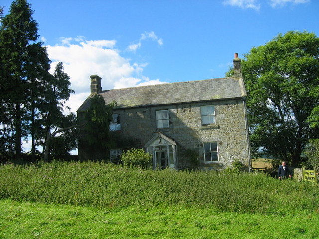
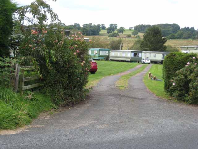
Billsmoor Park Images

Images are sourced within 2km of 55.260933/-2.0879428 or Grid Reference NY9496. Thanks to Geograph Open Source API. All images are credited.

Welcome sign A change from the usual 'Keep Out' sign.
This is a convenient parking area with fine views - even better in summer or winter!
<span class="nowrap"><a title="https://neilcarmichael.info/" rel="nofollow ugc noopener" href="https://neilcarmichael.info/">Link</a><img style="margin-left:2px;" alt="External link" title="External link - shift click to open in new window" src="https://s1.geograph.org.uk/img/external.png" width="10" height="10"/></span>   <span class="nowrap"><a title="https://neilcarmichael.info/dunshiel/camping/" rel="nofollow ugc noopener" href="https://neilcarmichael.info/dunshiel/camping/">Link</a><img style="margin-left:2px;" alt="External link" title="External link - shift click to open in new window" src="https://s1.geograph.org.uk/img/external.png" width="10" height="10"/></span>
Welcome sign
A change from the usual 'Keep Out' sign. This is a convenient parking area with fine views - even better in summer or winter! LinkExternal link LinkExternal link
The B6341 approaching Elsdon
Roadside, Grasslees Wood
High Shaw Farm There are quite a few farms within the MOD ranges. How do they get in and out when the red flags are flying?
High Shaw Farm
There are quite a few farms within the MOD ranges. How do they get in and out when the red flags are flying?
Billsmoorfoot Car Park Northumberland National Park small car park with a few small benches where occasionally you can find people having a picnic.
Billsmoorfoot Car Park
Northumberland National Park small car park with a few small benches where occasionally you can find people having a picnic.
Even your camouflage won't help you. If you are in a military vehicle you must turn right at this point at this entrance to the MOD ranges to the north of Elsdon
Even your camouflage won't help you.
If you are in a military vehicle you must turn right at this point at this entrance to the MOD ranges to the north of Elsdon
Darden Cleugh
Darden Cleugh
Footpath leading to Cloven Crag
Billsmoor Park
Billsmoor Park
North Riding Farm
North Riding Farm
Bend in the Road. The Boundary of Otterburn Range Danger Area Dunns Hide Woods to the right.
Bend in the Road. The Boundary of Otterburn Range Danger Area
Dunns Hide Woods to the right.
Looking across the valley of the Park Burn Seen from the B6341 Otterburn to Rothbury road. The cliffs on the far side of the valley are Leech-hope Crag <a href="https://www.geograph.org.uk/gridref/NY9595">NY9595</a>.
Looking across the valley of the Park Burn
Seen from the B6341 Otterburn to Rothbury road. The cliffs on the far side of the valley are Leech-hope Crag NY9595.
Billsmoor Park Seen from the B6341 Otterburn to Rothbury road. Simonside <a href="https://www.geograph.org.uk/gridref/NZ0298">NZ0298</a> can be seen on the skyline.
Billsmoor Park
Seen from the B6341 Otterburn to Rothbury road. Simonside NZ0298 can be seen on the skyline.
Dunns Farm Caravan Park
Barn at Grasslees On the B6341 Otterburn to Rothbury road which at this point also forms part of the Pennine Cycleway.
Barn at Grasslees
On the B6341 Otterburn to Rothbury road which at this point also forms part of the Pennine Cycleway.
Hogger's Cleugh View from MOD range road looking across Loaning Burn towards Hogger's Cleugh.
Hogger's Cleugh
View from MOD range road looking across Loaning Burn towards Hogger's Cleugh.
Laingshill Laingshill Farm near Otterburn.
Laingshill
Laingshill Farm near Otterburn.
Jock's Cleugh View looking across Jock's Cleugh towards Billsmoor Park.  The Simonside Hills are in the background.
Jock's Cleugh
View looking across Jock's Cleugh towards Billsmoor Park. The Simonside Hills are in the background.
Show me another place!

Billsmoor Park is located at Grid Ref: NY9496 (Lat: 55.260933, Lng: -2.0879428)

Unitary Authority: Northumberland

Police Authority: Northumbria

What 3 Words

///puppy.clenching.control. Near Otterburn, Northumberland

Related Wikis

Billsmoor Park and Grasslees Wood

Billsmoor Park and Grasslees Wood is the name given to a Site of Special Scientific Interest (SSSI) in Northumberland, North East England, designated in...

High Cove

High Cove is a major slip feature to the west of Grasslees Burn in the Simonside Hills, Northumberland, England. It contains several small rifts and caves...

Elsdon Castle

Elsdon Castle is a castle in the village of Elsdon about 10 miles (16 km) to the southwest of Rothbury, in Northumberland, England, and also known as Mote...

Elsdon Tower

Elsdon Tower is a Grade I listed medieval tower house converted for use as a Rectory situated at Elsdon, Northumberland. Originally part of the estate...

Redesdale Studios

Redesdale Studios was a Northumberland recording studio founded in 1996. It was situated in Elsdon in North Northumberland. It began as a partnership between...

St Cuthbert's Church, Elsdon

St Cuthbert's Church is located in Elsdon, Alnwick, northeast England. The church was one of the resting places of St. Cuthbert's body in the wanderings...

Elsdon, Northumberland

Elsdon is a village and civil parish in the English county of Northumberland about 10 miles (16 km) to the southwest of Rothbury. The name is derived from...

Harwood Forest

Harwood Forest is a 3,527 hectares (8,720 acres) conifer plantation located to the south of Rothbury in North Northumberland, England, and managed by Forestry...

Nearby Amenities

Located within 500m of 55.260933,-2.0879428
Billsmoor Park
Place: locality
Lat/Long: 55.2620008/-2.0861208
The data included in this document is from www.openstreetmap.org. The data is made available under ODbL.

Have you been to Billsmoor Park?

Leave your review of Billsmoor Park below (or comments, questions and feedback).