Boltslaw Flat

Downs, Moorland in Durham

England

Boltslaw Flat

Gate in fence on Bolt's Law A public footpath passes through the gate. The trig point might be thought to be at the highest point of the hill but at 540 m it is in fact one metre lower than another location on Bolt's Law, roughly half a kilometre to the south-west, behind the camera position.
Gate in fence on Bolt's Law Credit: Trevor Littlewood

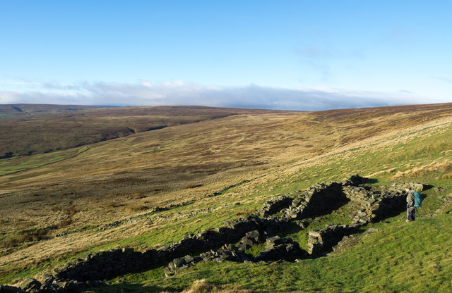
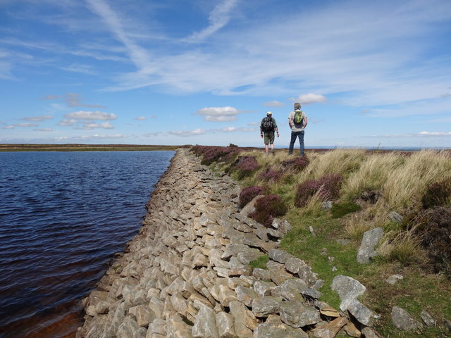
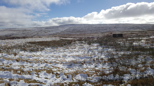
Boltslaw Flat is a picturesque area located in Durham, England. Situated in the Downs and Moorland region, it offers stunning natural beauty and a tranquil atmosphere. The flat is surrounded by rolling hills, lush green meadows, and scattered woodlands, creating a perfect getaway for nature enthusiasts and those seeking peace and serenity.

The area is known for its diverse wildlife, including various species of birds, butterflies, and small mammals. It serves as a haven for birdwatchers and wildlife photographers, as it offers numerous opportunities to observe and capture these creatures in their natural habitat. The flat is also home to several rare and protected plant species, adding to its ecological significance.

Boltslaw Flat is a popular destination for recreational activities such as walking, hiking, and cycling. The flat offers several well-maintained trails that allow visitors to explore the surrounding countryside and enjoy breathtaking views. Whether it's a leisurely stroll or a challenging hike, there is something for everyone to enjoy.

The flat is easily accessible, with ample parking facilities and nearby public transportation options. It is a short distance from Durham city center, making it an ideal day trip for locals and tourists alike. Additionally, the area boasts a few picnic spots, perfect for enjoying a packed lunch while soaking in the beauty of the surroundings.

Overall, Boltslaw Flat in Durham is a nature lover's paradise. Its stunning landscapes, diverse wildlife, and recreational opportunities make it an ideal destination for those seeking a peaceful retreat in the heart of nature.

If you have any feedback on the listing, please let us know in the comments section below.

Boltslaw Flat Images

Images are sourced within 2km of 54.80576/-2.0877577 or Grid Reference NY9445. Thanks to Geograph Open Source API. All images are credited.

Gate in fence on Bolt's Law A public footpath passes through the gate. The trig point might be thought to be at the highest point of the hill but at 540 m it is in fact one metre lower than another location on Bolt's Law, roughly half a kilometre to the south-west, behind the camera position.
Gate in fence on Bolt's Law
A public footpath passes through the gate. The trig point might be thought to be at the highest point of the hill but at 540 m it is in fact one metre lower than another location on Bolt's Law, roughly half a kilometre to the south-west, behind the camera position.
Heather moorland south of Bolt's Law trig point The foreground moorland runs away towards the valley and slopes of the Stanhope Burn. The distant hill is Collier Law.
Heather moorland south of Bolt's Law trig point
The foreground moorland runs away towards the valley and slopes of the Stanhope Burn. The distant hill is Collier Law.
Moorland descending towards Stanhope Burn The area of heather moorland immediately below the camera position is apparently known as Hope Head; a stream groove there and others join to form the Stanhope Burn beyond which lies the sunlit Collier Law.
Moorland descending towards Stanhope Burn
The area of heather moorland immediately below the camera position is apparently known as Hope Head; a stream groove there and others join to form the Stanhope Burn beyond which lies the sunlit Collier Law.
Narrow walled enclosure beside Boltslaw Incline The enclosure surely has no current use. The slope beyond it descends to the fields and village of Rookhope. The flattish area above the break of slope rises gradually to the summit area of Bolt's Law. Boltslaw Incline is just out of view to the right of the image.
Narrow walled enclosure beside Boltslaw Incline
The enclosure surely has no current use. The slope beyond it descends to the fields and village of Rookhope. The flattish area above the break of slope rises gradually to the summit area of Bolt's Law. Boltslaw Incline is just out of view to the right of the image.
Grouse Butt and Moorland
Sikehead Dam
Sikehead Dam
Sikehead reservoir and Bolt's Law
Valley of Stogel Cleugh Stogel Cleugh is a feeding stream to Rookhope Burn, itself a tributary valley of the River Wear. The image was recorded from the minor road crossing between Rook Hope in County Durham and Hunstanworth in Northumberland.
Valley of Stogel Cleugh
Stogel Cleugh is a feeding stream to Rookhope Burn, itself a tributary valley of the River Wear. The image was recorded from the minor road crossing between Rook Hope in County Durham and Hunstanworth in Northumberland.
View from the road over fields of Boltshope Park These fields are amongst the last cultivated land before the road ascends onto Moorland
View from the road over fields of Boltshope Park
These fields are amongst the last cultivated land before the road ascends onto Moorland
Footpath to Cuthbert's Hill crossing the moor road
Road over Hunstanworth Moor
Sheep grazing at Boltshope Park
Sheep grazing at Boltshope Park Although clearly not in the same grid square, Bolt's Law hill and the chimneys from the old mine workings on the opposite side of the valley can be seen.
Sheep grazing at Boltshope Park
Although clearly not in the same grid square, Bolt's Law hill and the chimneys from the old mine workings on the opposite side of the valley can be seen.
Grouse butt on Hunstanworth Moor
Grouse butt on Hunstanworth Moor This peak of Bolt's Law is on the horizon
Grouse butt on Hunstanworth Moor
This peak of Bolt's Law is on the horizon
Road near St. Cuthberts Hill on Hunstanworth Moor
Road near Ramshawsike Plantation Looking southward.
Road near Ramshawsike Plantation
Looking southward.
Moorland Road crossing Hunstanworth Moor near White Hill Looking south-westward.
Moorland Road crossing Hunstanworth Moor near White Hill
Looking south-westward.
Show me another place!

Boltslaw Flat is located at Grid Ref: NY9445 (Lat: 54.80576, Lng: -2.0877577)

Unitary Authority: County Durham

Police Authority: Durham

What 3 Words

///shower.plugs.lawns. Near Stanhope, Co. Durham

Nearby Locations

Bolt's Law Boltslaw Flat

Related Wikis

Ramshaw, Consett

Ramshaw is a small village in County Durham, in England. It is situated to the south of Hunstanworth, a few miles west of Consett. Lead mining was an important...

Townfield

Townfield is a village in County Durham, in England. It is situated just to the south of Hunstanworth and part of that parish, about 10 miles (16 km) west...

Hunstanworth

Hunstanworth is a village in County Durham, England. It is situated approximately 10 miles to the west of Consett, south-west of the village of Blanchland...

Lintzgarth

Lintzgarth is a village in the civil parish of Stanhope, in County Durham, England. It is situated to the west of Rookhope. The Lintzgarth smeltmill was...

Beldon Burn

Beldon Burn is a headwater stream of the River Derwent in Northumberland and County Durham, England.It rises at Quickcleugh Moss as the Quickcleugh Burn...

Rookhope

Rookhope is a village in the civil parish of Stanhope, in County Durham, England. A former lead and fluorspar mining community, it first existed as a group...

Baybridge, Northumberland

Baybridge is a small village in Northumberland, England, just to the west of Blanchland and on the border with County Durham. It is situated to the west...

Blanchland

Blanchland is a village in Northumberland, England, on the County Durham boundary. The population of the civil parish at the 2011 census was 135.Set beside...

Have you been to Boltslaw Flat?

Leave your review of Boltslaw Flat below (or comments, questions and feedback).