High Cote Moor

Downs, Moorland in Yorkshire Craven

England

High Cote Moor

Blue Scar View from the road to Arncliffe
Blue Scar Credit: Kevin Waterhouse

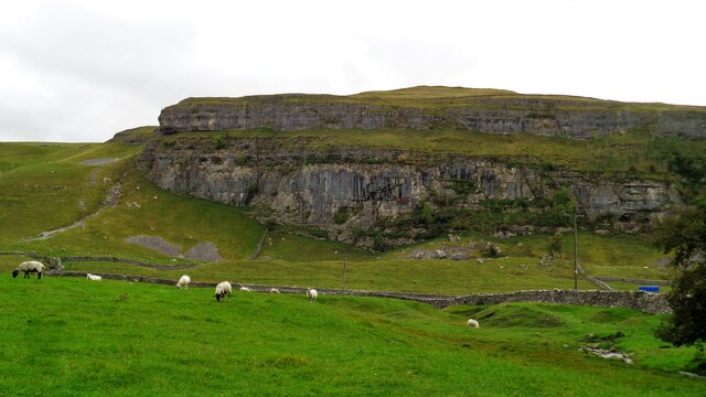
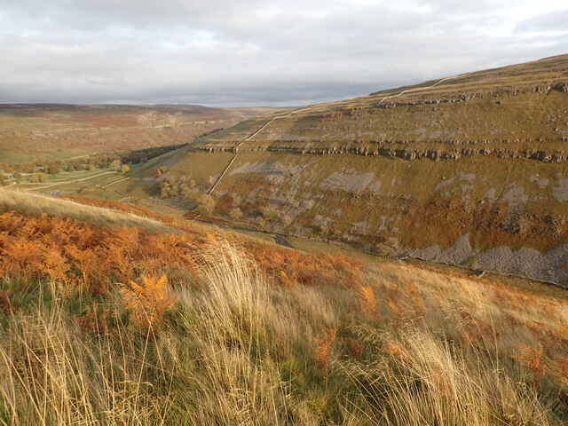
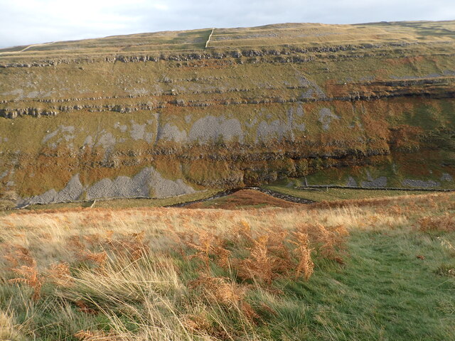
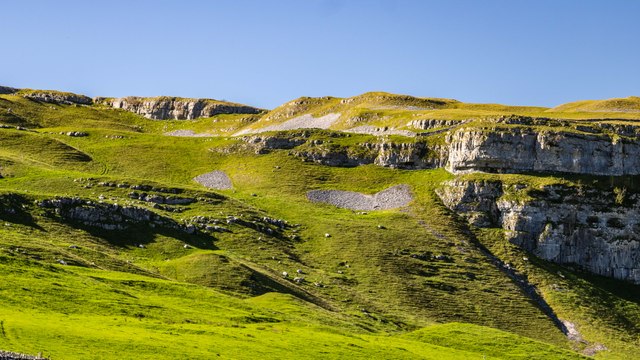
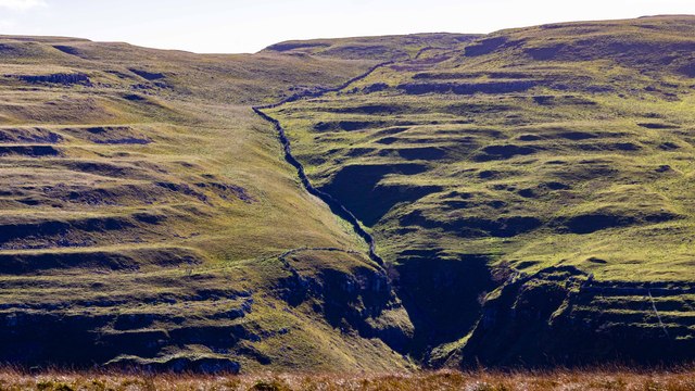
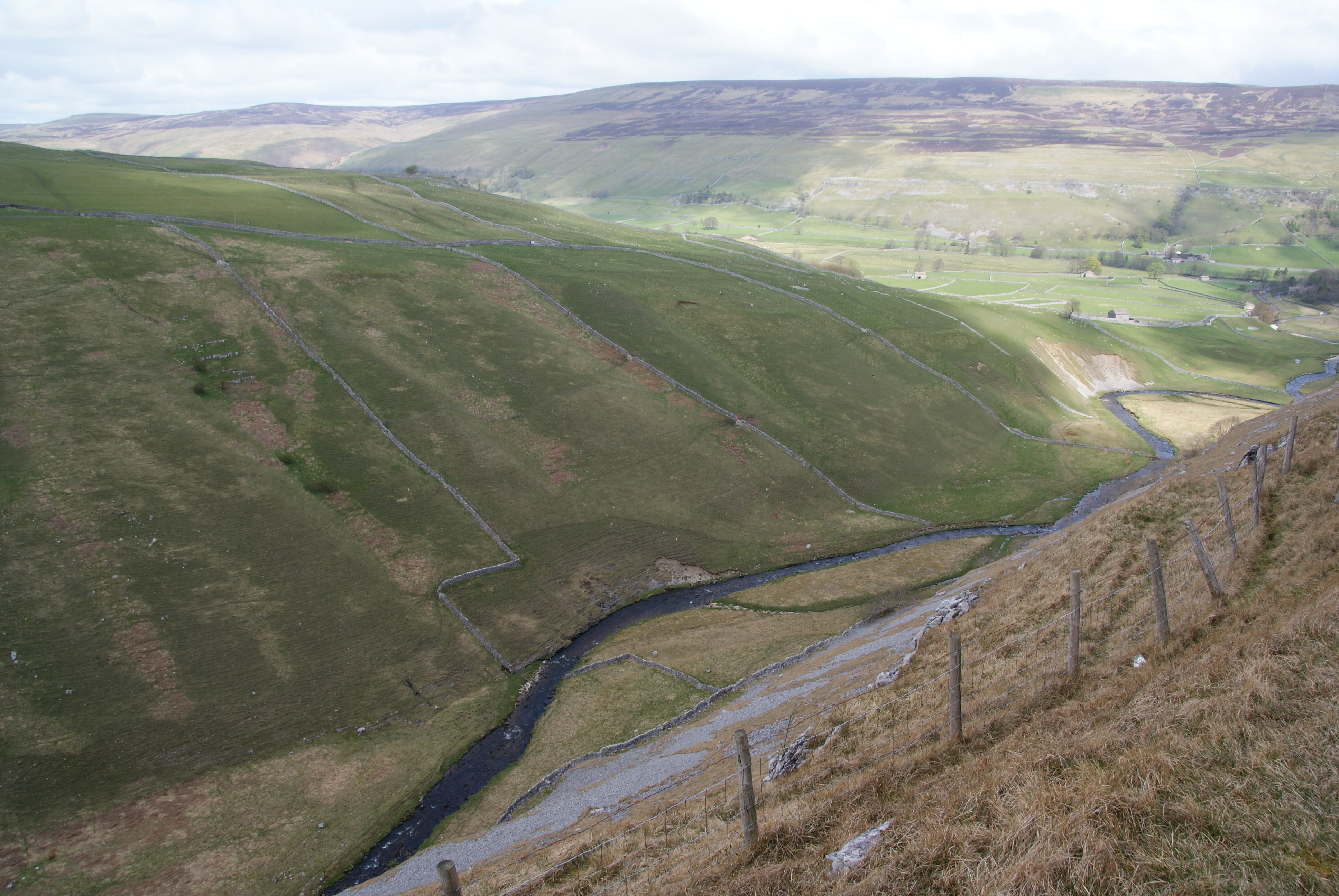
High Cote Moor is a picturesque area located in the county of Yorkshire, England. Situated on the edge of the North York Moors National Park, it encompasses a combination of downs and moorland landscapes. The moorland stretches across vast expanses, characterized by undulating hills covered in heather and bracken, providing a rich habitat for a variety of wildlife.

At an elevation of approximately 400 meters, High Cote Moor offers breathtaking views of the surrounding countryside. On a clear day, visitors can enjoy panoramic vistas of rolling hills, deep valleys, and distant villages. The area is known for its rugged beauty and untouched wilderness, attracting hikers, nature enthusiasts, and photographers.

The moorland is home to an array of flora and fauna, including heather, bilberry, and cotton grass. It provides a haven for numerous bird species, such as skylarks, curlews, and merlins. The moorland is also inhabited by native wildlife, including red grouse, mountain hares, and adders.

The landscape of High Cote Moor is dotted with ancient archaeological sites, including burial mounds and standing stones, bearing witness to its rich history. These remnants of the past add an air of mystery and intrigue to the area, attracting history buffs and archaeology enthusiasts.

High Cote Moor offers a tranquil escape from the bustling city life, providing visitors with an opportunity to immerse themselves in the beauty of nature and explore the rich cultural heritage of Yorkshire. Whether it's a leisurely walk, a challenging hike, or simply a moment of serenity, High Cote Moor has something to offer to all who venture into its stunning landscapes.

If you have any feedback on the listing, please let us know in the comments section below.

High Cote Moor Images

Images are sourced within 2km of 54.119272/-2.1105303 or Grid Reference SD9269. Thanks to Geograph Open Source API. All images are credited.

Blue Scar View from the road to Arncliffe
Blue Scar
View from the road to Arncliffe
The valley of Cowside Beck This is on the moors between Malham and Littondale looking down to the valley of Cowside Beck with Yew Cogar Scar on the other side. Arncliffe is reached down in the valley.
The valley of Cowside Beck
This is on the moors between Malham and Littondale looking down to the valley of Cowside Beck with Yew Cogar Scar on the other side. Arncliffe is reached down in the valley.
The valley of Cowside Beck This is on the moors between Malham and Littondale looking down to the valley of Cowside Beck with Yew Cogar Scar on the other side.
The valley of Cowside Beck
This is on the moors between Malham and Littondale looking down to the valley of Cowside Beck with Yew Cogar Scar on the other side.
Blue Scar The eastern end of Blue Scar.
Blue Scar
The eastern end of Blue Scar.
Yew Cogar Scar Drystone wall running up Yew Cogar Scar.
Yew Cogar Scar
Drystone wall running up Yew Cogar Scar.
Dew Bottoms
Dew Bottoms
Path high above Cowside
Cowside from Monk's Road
Cote Gill tributary
Cote Gill tributary
Yew Cogar Scar Remarkable limestone buttresses and scree in the valley of Cowside Beck.
Yew Cogar Scar
Remarkable limestone buttresses and scree in the valley of Cowside Beck.
Dry stone wall above Cowside Beck It continues into the valley and up the other side. Many walls are falling into disrepair.
Dry stone wall above Cowside Beck
It continues into the valley and up the other side. Many walls are falling into disrepair.
Small cairn by the Monk's Road There aren't many cairns, but I think this was made just because there were some suitable rocks nearby.
Small cairn by the Monk's Road
There aren't many cairns, but I think this was made just because there were some suitable rocks nearby.
Monk's Road Heading towards Arncliffe. This is a very pleasant open route through limestone country. Littondale can be seen ahead.
Monk's Road
Heading towards Arncliffe. This is a very pleasant open route through limestone country. Littondale can be seen ahead.
Cowside Beck from Monk's Road There is grass at the top of the slope on this side but it descends into scree.
Cowside Beck from Monk's Road
There is grass at the top of the slope on this side but it descends into scree.
Monk's Road descending towards Arncliffe Littondale is laid out below, with Cowside Beck joining from the left.
Monk's Road descending towards Arncliffe
Littondale is laid out below, with Cowside Beck joining from the left.
Monks' Road Heading for the open hills, with Cowside Beck on the right.
Monks' Road
Heading for the open hills, with Cowside Beck on the right.
Beck which runs down to Arncliffe Cote A small stream running off the open hillside.
Beck which runs down to Arncliffe Cote
A small stream running off the open hillside.
Small river crossing You hardly get your feet wet. The beck runs down the hillside to join the Skirfare by Arncliffe Cote.
Small river crossing
You hardly get your feet wet. The beck runs down the hillside to join the Skirfare by Arncliffe Cote.
Show me another place!

High Cote Moor is located at Grid Ref: SD9269 (Lat: 54.119272, Lng: -2.1105303)

Division: West Riding

Administrative County: North Yorkshire

District: Craven

Police Authority: North Yorkshire

What 3 Words

///lookout.brilliant.intestine. Near Grassington, North Yorkshire

Nearby Locations

High Cote Moor

Related Wikis

Cowside

Cowside is a side dale of Littondale in North Yorkshire, England. The valley, which faces in a north east direction, carries the waters of Cowside Beck...

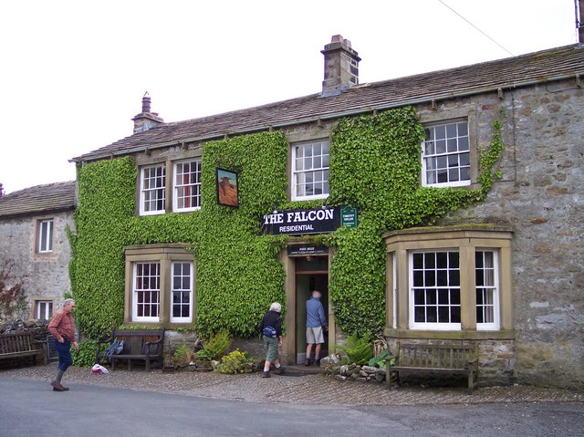
The Falcon Inn, Arncliffe

The Falcon Inn is a historic public house in Arncliffe, North Yorkshire, in England. The pub was built in the 18th century, and its windows were altered...

Arncliffe, North Yorkshire

Arncliffe is a small village and civil parish in Littondale, one of the Yorkshire Dales in England. Littondale is a small valley beside Upper Wharfedale...

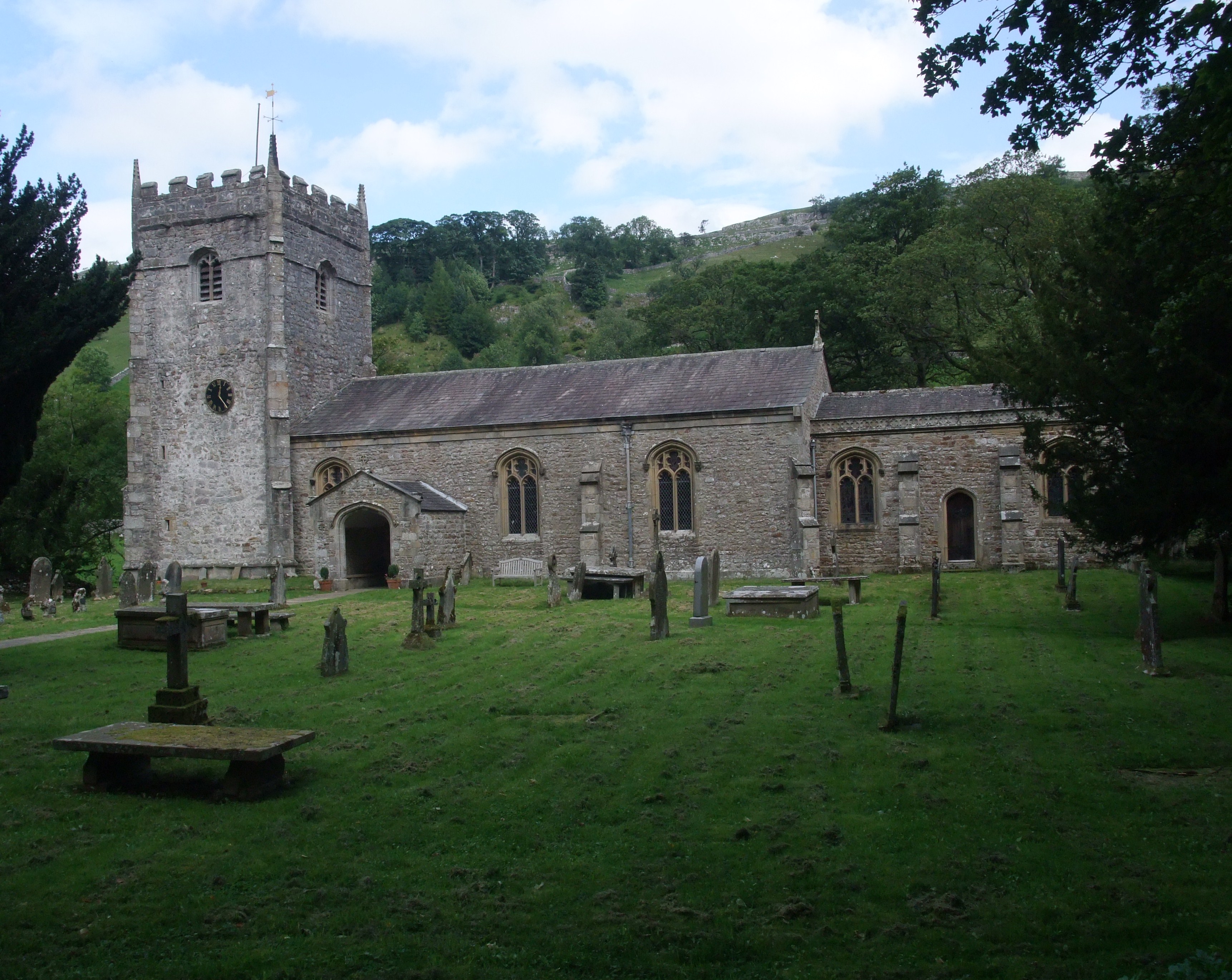
St Oswald's Church, Arncliffe

St Oswald's Church is the parish church of Arncliffe, North Yorkshire, in England. The oldest part of the church is the tower, which was constructed in...

Nearby Amenities

Located within 500m of 54.119272,-2.1105303
Barrier: entrance
Lat/Long: 54.118423/-2.1070266
Description: embouchement (enterss)
Natural: cave_entrance
Source: OS 1851 Yorkshire 115
Lat/Long: 54.1214195/-2.1140089
Description: debouchement (issues)
Natural: cave_entrance
Source: OS 1851 Yorkshire 115
Lat/Long: 54.1209705/-2.1132691
Ford: yes
Lat/Long: 54.1200646/-2.1123204
Historic: mine_shaft
Source: DigitalGlobe-Premium
Lat/Long: 54.1234091/-2.1105909
Historic: mine_shaft
Mineral: lead
Source: OS 1851
Lat/Long: 54.1234468/-2.1104354
Historic: mine_shaft
Source: DigitalGlobe-Premium
Lat/Long: 54.1229344/-2.1135253
Historic: mine_shaft
Source: DigitalGlobe-Premium
Lat/Long: 54.123299/-2.1111756
The data included in this document is from www.openstreetmap.org. The data is made available under ODbL.

Have you been to High Cote Moor?

Leave your review of High Cote Moor below (or comments, questions and feedback).