Great Moor

Downs, Moorland in Northumberland

England

Great Moor

High Moorland Looking south east over this grid square. The tor'd hill directly in front does not appear to be named and could be best described as the eastern top of Great Moor. Beyond and to the right is Cold Law.
High Moorland Credit: Hill Walker

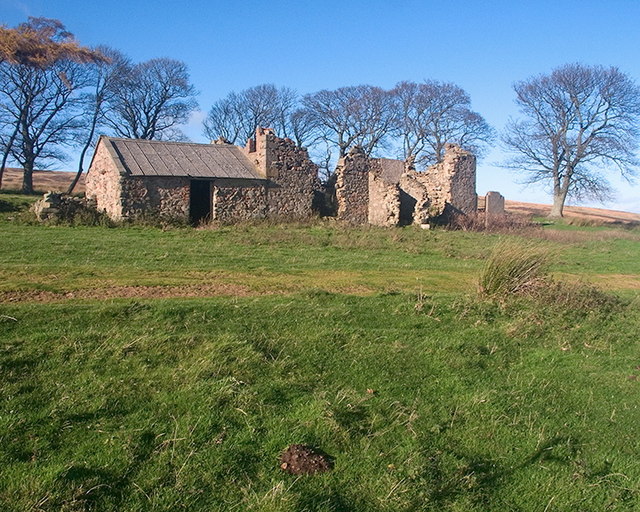
Great Moor is a picturesque area located in Northumberland, England. Nestled within the beautiful Northumberland National Park, it is known for its stunning downs and expansive moorland landscapes. The area is characterized by rolling hills, wide open spaces, and a diverse range of flora and fauna.

The downs of Great Moor offer breathtaking panoramic views, with vast stretches of green meadows and scattered trees dotting the landscape. These downs provide habitat for a variety of wildlife, including birds such as lapwings, curlews, and skylarks, which can often be spotted soaring above.

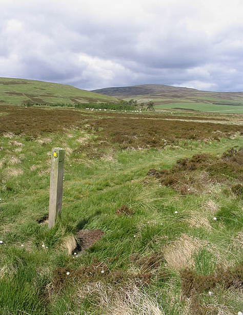
The moorland in Great Moor is a haven for nature enthusiasts. It is covered with heather, grasses, and scattered patches of gorse, creating a vibrant and colorful scenery. The moorland is also home to several species of birds, including merlins and short-eared owls, which make it a popular spot for birdwatching.

Walking trails and footpaths crisscross the area, allowing visitors to explore and take in the natural beauty of Great Moor. The landscape changes dramatically with the seasons, from the vibrant hues of purple heather in the summer to the golden tones of the grasses in the autumn.

Great Moor offers a peaceful and tranquil escape from the hustle and bustle of daily life. It is a haven for outdoor activities such as hiking, picnicking, and photography. Whether you are a nature lover, a keen walker, or simply seeking a serene getaway, Great Moor is a place that promises to captivate and inspire.

If you have any feedback on the listing, please let us know in the comments section below.

Great Moor Images

Images are sourced within 2km of 55.52298/-2.1195723 or Grid Reference NT9225. Thanks to Geograph Open Source API. All images are credited.

High Moorland Looking south east over this grid square. The tor'd hill directly in front does not appear to be named and could be best described as the eastern top of Great Moor. Beyond and to the right is Cold Law.
High Moorland
Looking south east over this grid square. The tor'd hill directly in front does not appear to be named and could be best described as the eastern top of Great Moor. Beyond and to the right is Cold Law.
Commonburn House
Commonburn House
Eastern slopes of Newton Tors
High Moorland Looking south east over this muir burned landscape towards Foulburn Gair and Preston Hill.
High Moorland
Looking south east over this muir burned landscape towards Foulburn Gair and Preston Hill.
Rebuilding Broadstruther Was a totally derelict farm, the main building had no roof and the walls were in a state of collapse. On completion the new building will be used as a luncheon facility for shooters on the Lilburn Estate
Rebuilding Broadstruther
Was a totally derelict farm, the main building had no roof and the walls were in a state of collapse. On completion the new building will be used as a luncheon facility for shooters on the Lilburn Estate
Broadstruther in dereliction The roofed section was a handy refuge for walkers during inclement weather.
Broadstruther in dereliction
The roofed section was a handy refuge for walkers during inclement weather.
Preston Hill Cairn to the northwest of the actual summit of Preston Hill with Braydon Crag just visible in the distance. For free detailed walking routes in the area visit <span class="nowrap"><a title="www.cheviotwalks.co.uk" rel="nofollow ugc noopener" href="http://www.cheviotwalks.co.uk">Link</a><img style="margin-left:2px;" alt="External link" title="External link - shift click to open in new window" src="https://s1.geograph.org.uk/img/external.png" width="10" height="10"/></span>
Preston Hill
Cairn to the northwest of the actual summit of Preston Hill with Braydon Crag just visible in the distance. For free detailed walking routes in the area visit LinkExternal link
Public footpath to Commonburn House
Craggy summit A view from the stony outcrop summit area of the 353m top to the east-southeast of Commonburn House.
Craggy summit
A view from the stony outcrop summit area of the 353m top to the east-southeast of Commonburn House.
Public footpath to Commonburn House A grass track in a moorland setting.
Public footpath to Commonburn House
A grass track in a moorland setting.
Broadstruthers restoration completed and in use Must have cost a lot to restore this building.  Being used by grouse shooters on the day we walked past.  Men laying out tables for lunch for shooters and beaters.  Wonder who was sitting inside for lunch?
Broadstruthers restoration completed and in use
Must have cost a lot to restore this building. Being used by grouse shooters on the day we walked past. Men laying out tables for lunch for shooters and beaters. Wonder who was sitting inside for lunch?
Commonburn House
Commonburn House
Rough grazing and heather at Rushy Gair To the south-southwest of Broadstruther.
Rough grazing and heather at Rushy Gair
To the south-southwest of Broadstruther.
Rough grazing and heather on Great Moor A managed grouse moor area.
Rough grazing and heather on Great Moor
A managed grouse moor area.
A track and fence on Preston Hill Looking along to Foulburn Gair with Hare Law on the left and Newton Tors to the right in the distance.
A track and fence on Preston Hill
Looking along to Foulburn Gair with Hare Law on the left and Newton Tors to the right in the distance.
A grass access track through a grouse moor A managed grouse moor to the north-northeast of Preston Hill.
A grass access track through a grouse moor
A managed grouse moor to the north-northeast of Preston Hill.
Rough grazing near Broadstruther A managed grouse moor area is ahead on Great Moor.
Rough grazing near Broadstruther
A managed grouse moor area is ahead on Great Moor.
Grouse moorland in the Cheviot Hills A shooting butt with a grass access track to the left running up from Broadstruthers.
Grouse moorland in the Cheviot Hills
A shooting butt with a grass access track to the left running up from Broadstruthers.
Show me another place!

Great Moor is located at Grid Ref: NT9225 (Lat: 55.52298, Lng: -2.1195723)

Unitary Authority: Northumberland

Police Authority: Northumbria

What 3 Words

///winner.jotting.unguarded. Near Kirknewton, Northumberland

Nearby Locations

Great Moor

Related Wikis

Newton Tors

The Newton Tors are large, free-standing residual masses (rock outcrop) that form the western rim of the Great Moor which runs from the market town of...

Yeavering Bell

Yeavering Bell is a twin-peaked hill near the River Glen in north Northumberland, England, to the west of Wooler, and forming part of the Cheviot Hills...
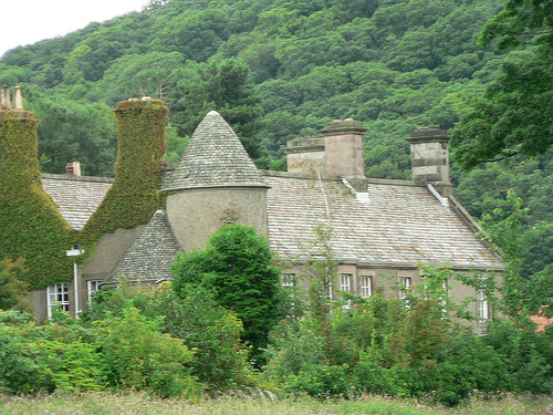
Hethpool House

Hethpool House is an Edwardian house in Hethpool, in the civil parish of Kirknewton, near Wooler, Northumberland, England which has Grade II listed building...

College Valley

The College Valley is one of five cuttings into the Cheviot Hills. The valley is owned by College Valley Estates which in turn is funded by a trust created...

Nearby Amenities

Located within 500m of 55.52298,-2.1195723
Great Moor
Ele: 446
Natural: peak
Lat/Long: 55.5235059/-2.117357
The data included in this document is from www.openstreetmap.org. The data is made available under ODbL.

Have you been to Great Moor?

Leave your review of Great Moor below (or comments, questions and feedback).