Stiddlehill Common
Downs, Moorland in Northumberland
England
Stiddlehill Common

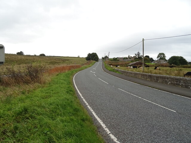
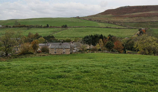
Stiddlehill Common is a vast expanse of moorland located in Northumberland, England. Covering an area of approximately 1,500 acres, it is a prominent feature of the local landscape. Situated in the heart of the Northumberland Downs, the common is characterized by its undulating terrain, heather-covered hills, and expansive views.
The common is primarily composed of acidic soil, which supports a diverse range of plant and animal species adapted to the harsh moorland environment. Heather dominates the landscape, creating a vibrant purple hue during the summer months. Other common vegetation includes cotton grass, bilberry, and bracken.
The area is renowned for its rich biodiversity, attracting numerous species of birds, insects, and mammals. Birdwatchers can spot species such as curlews, lapwings, and skylarks, while mammals like hares, deer, and foxes can also be observed throughout the common.
Stiddlehill Common offers a variety of recreational opportunities for visitors. Walking trails crisscross the area, providing stunning views and opportunities to immerse oneself in nature. The rugged terrain also makes it a popular destination for mountain biking and horse riding enthusiasts.
In addition to its natural beauty, Stiddlehill Common holds historical significance. The remains of ancient settlements, including Bronze Age burial mounds and stone circles, can still be found scattered across the landscape, offering glimpses into the region's past.
Overall, Stiddlehill Common is a cherished natural and historical treasure within the Northumberland Downs, offering visitors a chance to explore and appreciate the unique beauty of the moorland ecosystem.
If you have any feedback on the listing, please let us know in the comments section below.
Stiddlehill Common Images
Images are sourced within 2km of 55.158773/-2.1288048 or Grid Reference NY9184. Thanks to Geograph Open Source API. All images are credited.


Stiddlehill Common is located at Grid Ref: NY9184 (Lat: 55.158773, Lng: -2.1288048)
Unitary Authority: Northumberland
Police Authority: Northumbria
What 3 Words
///glows.skins.natural. Near Corsenside, Northumberland
Nearby Locations
Related Wikis
East Woodburn
East Woodburn is a village located in Northumberland, England. Located on the A68 road just south of Darney Crag, it was created in conjunction with the...

Woodburn railway station
Woodburn was a stone-built railway station with substantial goods sidings in Northumberland, on the Wansbeck Railway between Morpeth and Reedsmouth. It...

West Woodburn
West Woodburn is a village in north-western Northumberland, England. The 2001 census recorded a population of 492 in the Parish Council area of Corsenside...

Sweethope Loughs
Sweethope Loughs are two freshwater lakes almost 1 mile (1.6 km) in length, the smaller one just east of the larger, in the southern part of Northumberland...

Great Northumberland Forest
The Great Northumberland Forest is a proposed new forest in the north of England. Announced in September 2019, it is intended that up to a million trees...
Corsenside
Corsenside is one of the largest parishes in Northumberland, however the area is mainly a vast expanse of rolling hills and farmland, with three tiny villages...
Redesmouth
Redesmouth is a village in Northumberland, England, just over 1 mile (1.6 km) to the south-east of Bellingham. == Governance == Redesmouth is in the parliamentary...

Reedsmouth railway station
Reedsmouth is a closed railway station in Northumberland, England. It was a junction station where the Wansbeck Railway (Morpeth to Reedsmouth) joined...
Nearby Amenities
Located within 500m of 55.158773,-2.1288048Have you been to Stiddlehill Common?
Leave your review of Stiddlehill Common below (or comments, questions and feedback).