Campmeeting Allotment

Downs, Moorland in Durham

England

Campmeeting Allotment

Pine trees in Swin Hope Swin Hope is a tributary valley of the River Wear; it's seen here looking downhill towards the parent valley.
Pine trees in Swin Hope Credit: Trevor Littlewood

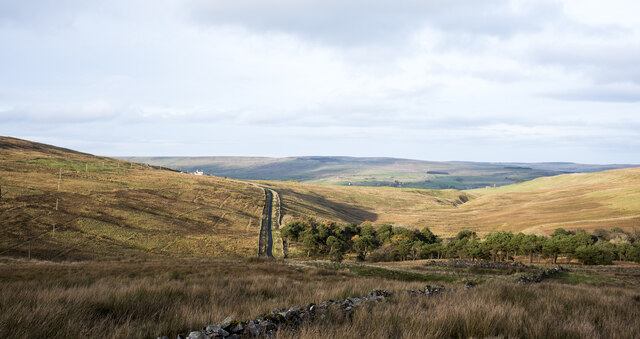
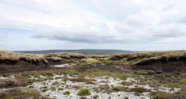
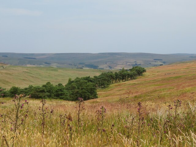
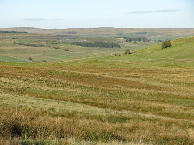
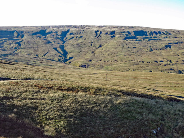
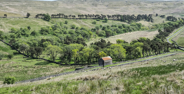
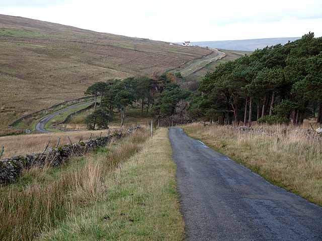
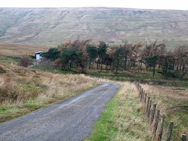
Campmeeting Allotment, located in Durham (Downs, Moorland), is a historic area known for its unique cultural and religious significance. The allotment is situated on a picturesque site surrounded by lush greenery and rolling hills.

The origins of Campmeeting Allotment date back to the early 19th century when it was established as a religious gathering place for the Methodist community. It served as a venue for annual camp meetings, where people from far and wide would come together for spiritual revival and fellowship. These camp meetings were characterized by fervent worship, passionate sermons, and communal activities.

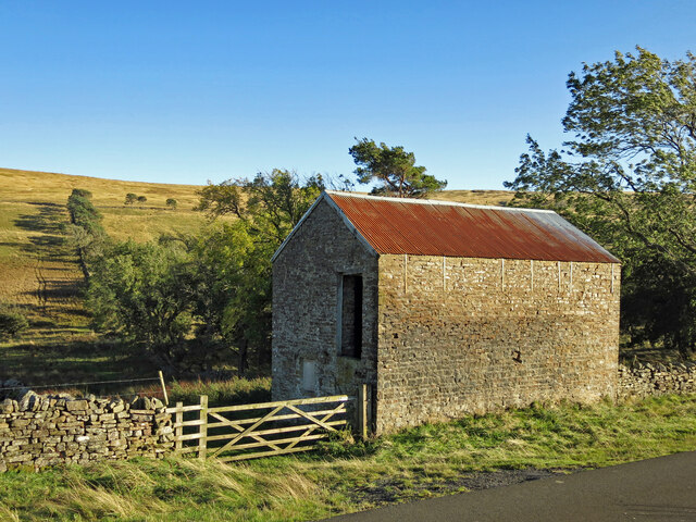
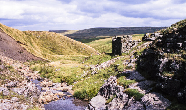
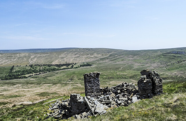
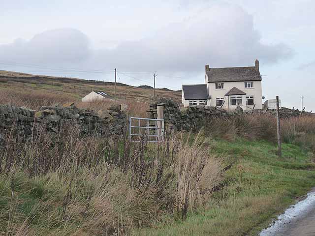
Today, Campmeeting Allotment remains a cherished location for both religious and community events. The site features several well-preserved historic buildings, including a chapel that serves as a focal point for religious services and events. The chapel's architecture reflects the traditional Methodist style, with its simple yet elegant design.

The allotment also offers a serene and tranquil atmosphere, making it an ideal destination for retreats and nature lovers. Visitors can explore the surrounding countryside, take scenic walks, or simply relax and enjoy the peaceful surroundings.

Campmeeting Allotment continues to be a place of religious significance, with regular worship services and gatherings for the local Methodist community. It also serves as a testament to the rich history and cultural heritage of Durham, attracting visitors from near and far who are interested in experiencing its unique ambiance and historical value.

If you have any feedback on the listing, please let us know in the comments section below.

Campmeeting Allotment Images

Images are sourced within 2km of 54.715411/-2.1704213 or Grid Reference NY8935. Thanks to Geograph Open Source API. All images are credited.

Pine trees in Swin Hope Swin Hope is a tributary valley of the River Wear; it's seen here looking downhill towards the parent valley.
Pine trees in Swin Hope
Swin Hope is a tributary valley of the River Wear; it's seen here looking downhill towards the parent valley.
Moorland with parked vehicle The 4x4 vehicle close to the centre of the image had been driven there by the owner of a property lower on the slope who was investigating a problem with his water supply.
The valley below is Weardale.
Moorland with parked vehicle
The 4x4 vehicle close to the centre of the image had been driven there by the owner of a property lower on the slope who was investigating a problem with his water supply. The valley below is Weardale.
Rock outcrop on north side of Chapel Fell The northern side of Chapel Fell is very largely grassy but there are scattered rocks and in places more significant outcrops such as the broken band here.
The three, far-distant hills on the horizon, left of centre, are the Dun Fells and Cross Fell. Right of centre, and nearer are High Field and Burnhope Seat.
Rock outcrop on north side of Chapel Fell
The northern side of Chapel Fell is very largely grassy but there are scattered rocks and in places more significant outcrops such as the broken band here. The three, far-distant hills on the horizon, left of centre, are the Dun Fells and Cross Fell. Right of centre, and nearer are High Field and Burnhope Seat.
Bare ground and peat banks close to summit of Chapel Fell The summit area of Chapel Fell is an extensive area of peat banks with bare peat exposures and some shattered, scattered rocks. The actual summit location is impossible to judge by observation and various positions have been considered over time. But from 09/02/2021 the authoritative 'Database of British and Irish Hills' has accepted, based on a LIDAR survey, that the best estimate for the summit should be at NY 87577 34605. That position is on a peat bank just out of view in the image, to the right of and slightly behind the camera.
In the distance is the moorland hill, Westernhope Moor.
Bare ground and peat banks close to summit of Chapel Fell
The summit area of Chapel Fell is an extensive area of peat banks with bare peat exposures and some shattered, scattered rocks. The actual summit location is impossible to judge by observation and various positions have been considered over time. But from 09/02/2021 the authoritative 'Database of British and Irish Hills' has accepted, based on a LIDAR survey, that the best estimate for the summit should be at NY 87577 34605. That position is on a peat bank just out of view in the image, to the right of and slightly behind the camera. In the distance is the moorland hill, Westernhope Moor.
Wall rising on north side of Chapel Fell The wall here is at around 570 metres above sea level on the grassy northern side of Chapel Fell; it reaches a corner just out of the image to the left about ten metres higher. Dead Stones is the moorland hill in the distance at the centre of the image. Burnhope Seat, once the highest hill in County Durham, is to the left of it.
Wall rising on north side of Chapel Fell
The wall here is at around 570 metres above sea level on the grassy northern side of Chapel Fell; it reaches a corner just out of the image to the left about ten metres higher. Dead Stones is the moorland hill in the distance at the centre of the image. Burnhope Seat, once the highest hill in County Durham, is to the left of it.
Swinhope Plantation First edition OS maps of the 1850's show an extensive area of trees around the upper reaches of the Swinhope Burn. This view shows the eastern edge of the wooded area with plenty of Scots pine in evidence. If the old OS map is accurate, then the wooded area is in decline as there are areas now without trees, but the question is, why was this area planted in the first place?
Swinhope Plantation
First edition OS maps of the 1850's show an extensive area of trees around the upper reaches of the Swinhope Burn. This view shows the eastern edge of the wooded area with plenty of Scots pine in evidence. If the old OS map is accurate, then the wooded area is in decline as there are areas now without trees, but the question is, why was this area planted in the first place?
Groove at summit area of Chapel Fell The groove, (surely one artificially created), is seen looking north passing the currently accepted summit location of the hill; it's on a peat bank a few metres ahead to the right. The 703 m. spot height shown on OS Explorer map OL31, is on the groove's left side and a little further on.
(The actual summit location is impossible to judge by observation on the ground and various positions have been considered over time. But from 09/02/2021 the authoritative 'Database of British and Irish Hills' has accepted, based on a LIDAR survey, that the best estimate for the summit should be at NY 87577 34605.)
Groove at summit area of Chapel Fell
The groove, (surely one artificially created), is seen looking north passing the currently accepted summit location of the hill; it's on a peat bank a few metres ahead to the right. The 703 m. spot height shown on OS Explorer map OL31, is on the groove's left side and a little further on. (The actual summit location is impossible to judge by observation on the ground and various positions have been considered over time. But from 09/02/2021 the authoritative 'Database of British and Irish Hills' has accepted, based on a LIDAR survey, that the best estimate for the summit should be at NY 87577 34605.)
Swin Hope below Swinside House Looking north east from just to the south of <a href="https://www.geograph.org.uk/photo/2691160">NY8935 : Swinside House</a> (photographed by Oliver Dixon) across the valley towards the ruined farmhouse at <a href="https://www.geograph.org.uk/photo/6217773">NY9036 : Far New Close (3)</a>.
Swin Hope below Swinside House
Looking north east from just to the south of NY8935 : Swinside House (photographed by Oliver Dixon) across the valley towards the ruined farmhouse at NY9036 : Far New Close (3).
Swinhope Moor below Chapelfell Top
New House
New House
Ruined building at Swinhopehead mine in 1994 The building is in the valley of the Swinhope Burn below the moorland summits, Chapel Fell and Fendrith Hill. The image was made from the water outflow of the actual mine level.
The distant shadowed ridge is Black Fell.
Ruined building at Swinhopehead mine in 1994
The building is in the valley of the Swinhope Burn below the moorland summits, Chapel Fell and Fendrith Hill. The image was made from the water outflow of the actual mine level. The distant shadowed ridge is Black Fell.
Bouseteams at Daddryshield Burn There are extensive surface remains in the valley of the Daddryshield Burn and the adjacent Greenlaws Hush. The collapsing bays seen here on both sides of the stream are bouseteams which were used to store mined ore, every mining partnership having is own bay.
Bouseteams at Daddryshield Burn
There are extensive surface remains in the valley of the Daddryshield Burn and the adjacent Greenlaws Hush. The collapsing bays seen here on both sides of the stream are bouseteams which were used to store mined ore, every mining partnership having is own bay.
Ruins of Cockran's Cabin The tiny, remote building is now a total ruin. It's at an altitude of 620 metres and lies on the eastern side of Chapel Fell overlooking Swindale. The slopes on which it stands descend into Swindale, beyond which is Westernhope Moor.
Ruins of Cockran's Cabin
The tiny, remote building is now a total ruin. It's at an altitude of 620 metres and lies on the eastern side of Chapel Fell overlooking Swindale. The slopes on which it stands descend into Swindale, beyond which is Westernhope Moor.
Swinhope Plantation The plantation is in the upper valley of Swin Hope, a tributary to the River Wear. The trees are well scattered and give the impression of an open, mixed woodland. The building with the rusting roof is known as New House.
Swinhope Plantation
The plantation is in the upper valley of Swin Hope, a tributary to the River Wear. The trees are well scattered and give the impression of an open, mixed woodland. The building with the rusting roof is known as New House.
Farmhouse at Glenwhelt Glenwhelt is a farm in Weardale, close to Westgate. The road descends to Westgate having crossed from Teesdale via Swindale; it's also the route of the long distance walk, 'A Pennine Journey'.
Farmhouse at Glenwhelt
Glenwhelt is a farm in Weardale, close to Westgate. The road descends to Westgate having crossed from Teesdale via Swindale; it's also the route of the long distance walk, 'A Pennine Journey'.
Descent to Swinhope Bridge On the mountain road between Newbiggin (Teesdale) and Westgate (Weardale). Swinside House <a href="https://www.geograph.org.uk/gridref/NY8935">NY8935</a> stands on the hillside beyond.
Descent to Swinhope Bridge
On the mountain road between Newbiggin (Teesdale) and Westgate (Weardale). Swinside House NY8935 stands on the hillside beyond.
Shelter belt above Swinhopehead House On the mountain road between Newbiggin (Teesdale) and Westgate (Weardale). Swinhopehead House lies at the downhill end of this small patch of woodland. Chapelfell Top <a href="https://www.geograph.org.uk/gridref/NY8734">NY8734</a> on the skyline.
Shelter belt above Swinhopehead House
On the mountain road between Newbiggin (Teesdale) and Westgate (Weardale). Swinhopehead House lies at the downhill end of this small patch of woodland. Chapelfell Top NY8734 on the skyline.
Swinside House Remote house beside the  mountain road between Newbiggin (Teesdale) and Westgate (Weardale).
Swinside House
Remote house beside the mountain road between Newbiggin (Teesdale) and Westgate (Weardale).
Show me another place!

Campmeeting Allotment is located at Grid Ref: NY8935 (Lat: 54.715411, Lng: -2.1704213)

Unitary Authority: County Durham

Police Authority: Durham

What 3 Words

///accent.crispy.protected. Near Newbiggin, Co. Durham

Related Wikis

Daddry Shield

Daddry Shield is a village in the civil parish of Stanhope, in County Durham, England. It is situated on the south side of the River Wear in Weardale,...

St John's Chapel, County Durham

St John's Chapel is a village in the civil parish of Stanhope, in County Durham, England. It is situated in Weardale, on the south side of the River Wear...

St John's Chapel railway station

St John's Chapel railway station served the village of St John's Chapel, County Durham, England, from 1895 to 1965 on the Weardale Railway. == History... ==

Westgate Methodist Chapel

Westgate Methodist Chapel stands on the A689 road in the village of Westgate, some 5 miles (8 km) west of Stanhope, County Durham, England (grid reference...

East Blackdene

East Blackdene is a hamlet in the civil parish of Stanhope, in County Durham, England. It is situated to the north of the River Wear, on the opposite side...

Harthope Moss

Harthope Moss, also known as Chapel Fell (elevation 627 m; 2,057 ft) is a mountain pass in the English Pennines. The pass divides Weardale to the north...

Westgate-in-Weardale railway station

Westgate-in-Weardale railway station served the village of Westgate, County Durham, England, from 1895 to 1965 on the Weardale Railway. == History == The...

Westgate, County Durham

Westgate is a village in the civil parish of Stanhope, in County Durham, England. It is situated in Weardale between St John's Chapel and Eastgate. In...

Nearby Amenities

Located within 500m of 54.715411,-2.1704213
High Pike
Ele: 586.4
Natural: peak
Source: NPE
Lat/Long: 54.7163847/-2.1740505
Power: pole
Lat/Long: 54.7133573/-2.1643669
Low Pike
Natural: peak
Source: NLS-OS-NatGrid-110k-1940-60
Lat/Long: 54.7184854/-2.1701839
Historic: mine_shaft
Note: could also be a shake hole
Source: Bing
Lat/Long: 54.7157957/-2.1654812
Historic: mine_shaft
Note: could also be a shake hole
Source: Bing
Lat/Long: 54.7183677/-2.1652344
Historic: mine_shaft
Note: could also be a shake hole
Source: Bing
Lat/Long: 54.7156161/-2.1654973
Natural: shake_hole
Source: NLS-OS-NatGrid-110k-1940-60
Lat/Long: 54.7166325/-2.1640864
The data included in this document is from www.openstreetmap.org. The data is made available under ODbL.

Have you been to Campmeeting Allotment?

Leave your review of Campmeeting Allotment below (or comments, questions and feedback).