Burtersett High Pasture
Downs, Moorland in Yorkshire Richmondshire
England
Burtersett High Pasture

Burtersett High Pasture is a picturesque area located in the county of Yorkshire, England. Nestled amidst the stunning Yorkshire Dales National Park, it offers breathtaking views of downs and moorland landscapes. Covering a vast expanse, it is a haven for nature enthusiasts, hikers, and outdoor enthusiasts.
The downs of Burtersett High Pasture are characterized by rolling hills covered in lush green grasslands. The undulating terrain provides a serene and peaceful atmosphere, making it a popular spot for leisurely walks and picnics. Visitors can enjoy panoramic views of the surrounding valleys and villages from the higher points.
The moorland of Burtersett High Pasture offers a different experience altogether. Here, visitors will find a rugged and wild landscape, dominated by heather and peat bogs. The moors are home to a diverse range of flora and fauna, including rare bird species like the red grouse and curlew. Exploring the moorland can be a challenging yet rewarding experience, with its vast open spaces and secluded beauty.
Burtersett High Pasture is also known for its rich cultural heritage. The area has a history dating back centuries, with evidence of ancient settlements and farming practices. Ruins of old farmsteads and dry stone walls can still be seen, adding to the charm and historical significance of the area.
In conclusion, Burtersett High Pasture is a captivating destination that showcases the natural beauty and cultural heritage of Yorkshire. Whether it's the rolling downs or the rugged moorland, visitors are sure to be enchanted by the stunning landscapes and tranquility of this remarkable location.
If you have any feedback on the listing, please let us know in the comments section below.
Burtersett High Pasture Images
Images are sourced within 2km of 54.288526/-2.1751649 or Grid Reference SD8888. Thanks to Geograph Open Source API. All images are credited.


![Gayle features [3] A pre-Worboys sign on a building in Gayle.
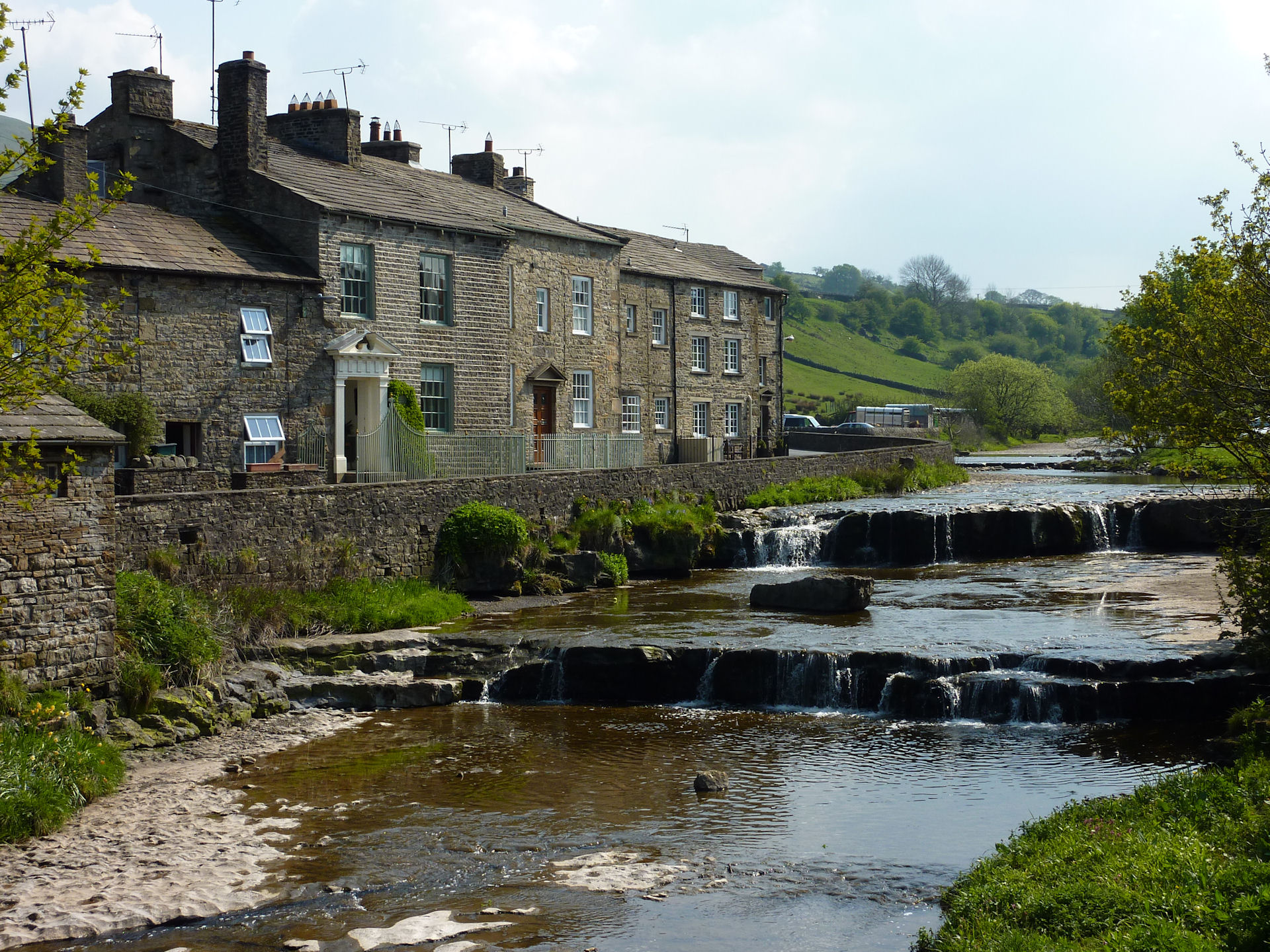
Gayle is a hamlet slightly less than half a mile south of Hawes. Gayle Beck tumbles steeply through the hamlet and formerly fed the water-driven cotton mill. Aysgill Force, a spectacular waterfall, is about one mile upstream.](https://s0.geograph.org.uk/geophotos/07/00/84/7008408_824b8e6b.jpg)
![Gayle features [4] Gayle Beck, looking upstream from the bridge. There is a ford across the beck just beyond the houses on the left bank.
Gayle is a hamlet slightly less than half a mile south of Hawes. Gayle Beck tumbles steeply through the hamlet and formerly fed the water-driven cotton mill. Aysgill Force, a spectacular waterfall, is about one mile upstream.](https://s1.geograph.org.uk/geophotos/07/00/84/7008409_2fc6c866.jpg)
![Gayle features [5] Gayle Bridge carries Gayle Lane over Gayle Beck. The segmental arch bridge was built of rubble stone in the late 18th or early 19th century. Listed, grade II, with details at: <span class="nowrap"><a title="https://historicengland.org.uk/listing/the-list/list-entry/1166665" rel="nofollow ugc noopener" href="https://historicengland.org.uk/listing/the-list/list-entry/1166665">Link</a><img style="margin-left:2px;" alt="External link" title="External link - shift click to open in new window" src="https://s1.geograph.org.uk/img/external.png" width="10" height="10"/></span>
Gayle is a hamlet slightly less than half a mile south of Hawes. Gayle Beck tumbles steeply through the hamlet and formerly fed the water-driven cotton mill. Aysgill Force, a spectacular waterfall, is about one mile upstream.](https://s2.geograph.org.uk/geophotos/07/00/84/7008410_c637d497.jpg)
![Gayle features [6] Alongside Gayle Bridge is this K6 telephone box, designed in 1935 by Sir Giles Gilbert Scott. Listed, grade II, with details at: <span class="nowrap"><a title="https://historicengland.org.uk/listing/the-list/list-entry/1253037" rel="nofollow ugc noopener" href="https://historicengland.org.uk/listing/the-list/list-entry/1253037">Link</a><img style="margin-left:2px;" alt="External link" title="External link - shift click to open in new window" src="https://s1.geograph.org.uk/img/external.png" width="10" height="10"/></span>
Gayle is a hamlet slightly less than half a mile south of Hawes. Gayle Beck tumbles steeply through the hamlet and formerly fed the water-driven cotton mill. Aysgill Force, a spectacular waterfall, is about one mile upstream.](https://s3.geograph.org.uk/geophotos/07/00/84/7008411_2fa53c5a.jpg)
![Gayle houses [5] Old Hall, in Marridales, is dated 1695. Constructed of coursed rubble stone under a stone slate roof. There is a small Venetian window in the gabled porch. Listed, grade II, with details at: <span class="nowrap"><a title="https://historicengland.org.uk/listing/the-list/list-entry/1131999" rel="nofollow ugc noopener" href="https://historicengland.org.uk/listing/the-list/list-entry/1131999">Link</a><img style="margin-left:2px;" alt="External link" title="External link - shift click to open in new window" src="https://s1.geograph.org.uk/img/external.png" width="10" height="10"/></span>
Gayle is a hamlet slightly less than half a mile south of Hawes. Gayle Beck tumbles steeply through the hamlet and formerly fed the water-driven cotton mill. Aysgill Force, a spectacular waterfall, is about one mile upstream.](https://s2.geograph.org.uk/geophotos/07/00/84/7008418_e38d7900.jpg)
Burtersett High Pasture is located at Grid Ref: SD8888 (Lat: 54.288526, Lng: -2.1751649)
Division: North Riding
Administrative County: North Yorkshire
District: Richmondshire
Police Authority: North Yorkshire
What 3 Words
///durations.cookers.ocean. Near Leyburn, North Yorkshire
Nearby Locations
Related Wikis
Burtersett
Burtersett is a small village in the Yorkshire Dales, North Yorkshire, England. It lies approximately 1 mile (1.6 km) east from Hawes and Gayle. The village...

Wether Fell
Wether Fell (archaically Wetherfell), also known as Drumaldrace (the name of its summit), is a mountain in the Yorkshire Dales National Park, in North...

Wensleydale
Wensleydale is the dale or upper valley of the River Ure on the east side of the Pennines, one of the Yorkshire Dales in North Yorkshire, England. It is...
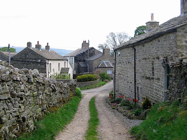
Gayle, North Yorkshire
Gayle is a hamlet 0.4-mile (0.64 km) south of Hawes in Wensleydale, North Yorkshire, England. It is noted for the beck that flows through it and the old...

Gayle Mill, North Yorkshire
Gayle Mill, dating from about 1784, is thought to be the oldest structurally unaltered cotton mill in existence. It is located in the Wensleydale hamlet...
Dales Countryside Museum
The Dales Countryside Museum is a local museum for the Yorkshire Dales National Park in Northern England. Run by the National Park Authority, it tells...
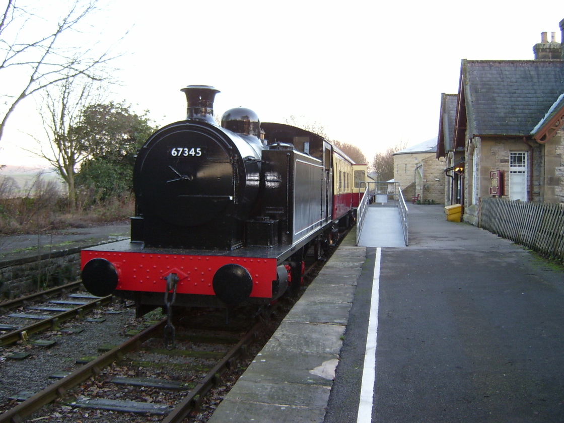
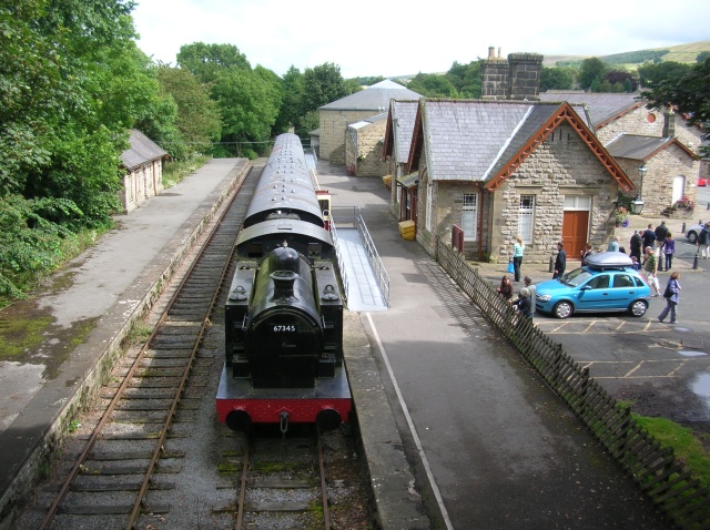
Hawes railway station
Hawes railway station is a disused railway station that served the town of Hawes in North Yorkshire, England. It was closed in 1959 and now forms part...

St Margaret's Church, Hawes
St Margaret's Church is a Grade II listed parish church in the Church of England: 184 in Hawes, North Yorkshire. == History == Also known as Church of...
Nearby Amenities
Located within 500m of 54.288526,-2.1751649Have you been to Burtersett High Pasture?
Leave your review of Burtersett High Pasture below (or comments, questions and feedback).