Beldoo Moss

Downs, Moorland in Westmorland Eden

England

Beldoo Moss

Fence corner, Deepdale Head
Fence corner, Deepdale Head Credit: David Brown

Beldoo Moss is a picturesque area located in Westmorland, a historic county in the northwestern part of England. Situated amidst the stunning Downs and Moorland landscapes, Beldoo Moss offers visitors a unique blend of natural beauty and tranquility.

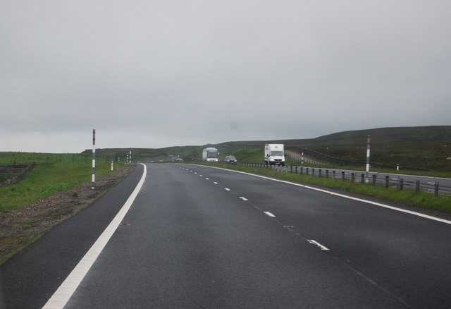
The moss is characterized by its vast expanses of open moorland, covered in a thick carpet of vibrant green mosses and heather. It is nestled within the rolling hills and valleys of the Westmorland countryside, providing breathtaking views of the surrounding landscape.

The area is home to a diverse range of plant and animal species, including rare bird species like the curlew and lapwing. The moss also features an array of boggy areas, which serve as habitats for unique flora such as cotton grass and sundew.

Outdoor enthusiasts flock to Beldoo Moss to indulge in activities like hiking, birdwatching, and photography. The moss is crisscrossed by numerous walking trails and footpaths, allowing visitors to explore its scenic beauty at their own pace. The surrounding moorland provides ample opportunities for adventurous souls to go off the beaten track and discover hidden gems.

Beldoo Moss is also steeped in history and folklore, with numerous ancient burial sites and stone circles scattered throughout the area. These archaeological remnants offer a glimpse into the region's rich past and provide an intriguing backdrop for exploration.

In summary, Beldoo Moss in Westmorland is a captivating destination for nature lovers and history enthusiasts alike. Its stunning landscapes, abundant wildlife, and rich cultural heritage make it a must-visit location for anyone seeking an authentic experience in the heart of the English countryside.

If you have any feedback on the listing, please let us know in the comments section below.

Beldoo Moss Images

Images are sourced within 2km of 54.519563/-2.1827037 or Grid Reference NY8813. Thanks to Geograph Open Source API. All images are credited.

Fence corner, Deepdale Head
Beldoo Hill
Beldoo Hill
Fence and boundary stone, West Mere
Across Yoke Sike from Middle Mere
A66 near Rowtonbridge Sike This area of North Stainmore is featureless and treacherous with deep ditches and soft bog. I passed an area of bog no larger than a bathtub with at least four dead sheep in it.
A66 near Rowtonbridge Sike
This area of North Stainmore is featureless and treacherous with deep ditches and soft bog. I passed an area of bog no larger than a bathtub with at least four dead sheep in it.
View south from the A66
The county border on the A66 at Stainmore
The A66 at Stainmore
A66 passing Palliard
Climbing up to the summit passing Black Riggs A66 east
Climbing up to the summit passing Black Riggs
A66 east
Approaching Stainmore Summit A66 east
Approaching Stainmore Summit
A66 east
Running into County Durham on A66 Large lay by on opposite carriageway straddles the boundary
Running into County Durham on A66
Large lay by on opposite carriageway straddles the boundary
Crossing the border County Durham signs on left
Crossing the border
County Durham signs on left
Layby on the border A layby by the A66 by the Durham, Cumbria border.
Layby on the border
A layby by the A66 by the Durham, Cumbria border.
White Brow Moorland
White Brow Moorland
Approaching the summit, A66 The A66 is a major road in northern England running from near Middlesbrough to Workington. The section between Scotch Corner and Penrith is a Trans-Pennine route between the A1 and M6, following an old Roman Road.
Wikipedia: <span class="nowrap"><a title="http://en.wikipedia.org/wiki/A66_road" rel="nofollow ugc noopener" href="http://en.wikipedia.org/wiki/A66_road">Link</a><img style="margin-left:2px;" alt="External link" title="External link - shift click to open in new window" src="https://s1.geograph.org.uk/img/external.png" width="10" height="10"/></span>
Approaching the summit, A66
The A66 is a major road in northern England running from near Middlesbrough to Workington. The section between Scotch Corner and Penrith is a Trans-Pennine route between the A1 and M6, following an old Roman Road. Wikipedia: LinkExternal link
A66 near Stainmore Summit The A66 is a major road in northern England running from near Middlesbrough to Workington. The section between Scotch Corner and Penrith is a Trans-Pennine route between the A1 and M6, following an old Roman Road.
Wikipedia: <span class="nowrap"><a title="http://en.wikipedia.org/wiki/A66_road" rel="nofollow ugc noopener" href="http://en.wikipedia.org/wiki/A66_road">Link</a><img style="margin-left:2px;" alt="External link" title="External link - shift click to open in new window" src="https://s1.geograph.org.uk/img/external.png" width="10" height="10"/></span>
A66 near Stainmore Summit
The A66 is a major road in northern England running from near Middlesbrough to Workington. The section between Scotch Corner and Penrith is a Trans-Pennine route between the A1 and M6, following an old Roman Road. Wikipedia: LinkExternal link
A66 at Black Riggs The A66 is a major road in northern England running from near Middlesbrough to Workington. The section between Scotch Corner and Penrith is a Trans-Pennine route between the A1 and M6, following an old Roman Road.
Wikipedia: <span class="nowrap"><a title="http://en.wikipedia.org/wiki/A66_road" rel="nofollow ugc noopener" href="http://en.wikipedia.org/wiki/A66_road">Link</a><img style="margin-left:2px;" alt="External link" title="External link - shift click to open in new window" src="https://s1.geograph.org.uk/img/external.png" width="10" height="10"/></span>
A66 at Black Riggs
The A66 is a major road in northern England running from near Middlesbrough to Workington. The section between Scotch Corner and Penrith is a Trans-Pennine route between the A1 and M6, following an old Roman Road. Wikipedia: LinkExternal link
Show me another place!

Beldoo Moss is located at Grid Ref: NY8813 (Lat: 54.519563, Lng: -2.1827037)

Administrative County: Cumbria

District: Eden

Police Authority: Cumbria

What 3 Words

///images.rise.flotation. Near Bowes, Co. Durham

Nearby Locations

Beldoo Moss

Related Wikis

Stainmore Summit

Stainmore Summit is the highest point on the trans-Pennine South Durham & Lancashire Union Railway, also known as the Stainmore Railway in Northern England...

Snowdrift at Bleath Gill

Snowdrift at Bleath Gill is a 1955 British Transport Film documentary directed by Kenneth Fairbairn. The 10-minute-long film presents a first-hand account...

Rey Cross

Rey Cross is the remains of a stone cross at Stainmore. It is also known as Rere Cross and is a Grade II* listed structure and a scheduled monument. It...

Battle of Stainmore

The Battle of Stainmore was probably fought between the Earldom of Bernicia, led by Oswulf, and the forces of the last Norse king of Jórvík (York), Eric...

Barras railway station

Barras railway station was situated on the South Durham & Lancashire Union Railway between Barnard Castle and Kirkby Stephen East. == History == The station...

Barras, Cumbria

Barras is a hamlet close to the River Belah, about 4 miles (6 kilometres) south-east of Brough, Cumbria, England. Until the creation of the new county...

Stainmore

Stainmore is a remote geographic area in the Pennines on the border of Cumbria, County Durham and North Yorkshire. The name is used for a civil parish...

A66 road

The A66 is a major road in Northern England, which in part follows the course of the Roman road from Scotch Corner to Penrith. It runs from east of Middlesbrough...

Have you been to Beldoo Moss?

Leave your review of Beldoo Moss below (or comments, questions and feedback).