Causey Moss

Downs, Moorland in Westmorland Eden

England

Causey Moss

Cattle grid at South Stainmore
Cattle grid at South Stainmore Credit: Ian S

Causey Moss is a vast expanse of moorland located in Westmorland, England. Stretching across an area of approximately 10 square miles, it is nestled within the beautiful region of the Lake District National Park. The moss is characterized by its distinctive peat bogs, heather-covered hills, and numerous small tarns that dot the landscape.

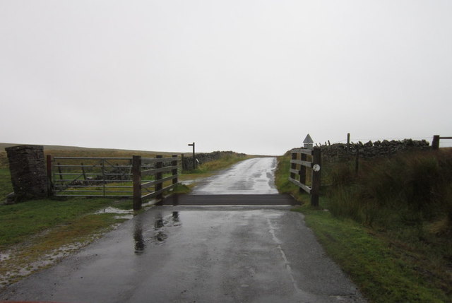
The terrain of Causey Moss is largely flat, making it ideal for leisurely walks and hikes. The moss is crisscrossed with a network of ancient footpaths and causeways, providing visitors with easy access to explore the area. These paths offer breathtaking views of the surrounding fells, including the iconic Helvellyn and Skiddaw mountains.

The moss is home to a rich variety of flora and fauna, with an abundance of heather, cotton grass, and bilberry bushes carpeting the ground. Birdwatchers frequent the area to catch a glimpse of its diverse avian inhabitants, including curlews, lapwings, and red grouse.

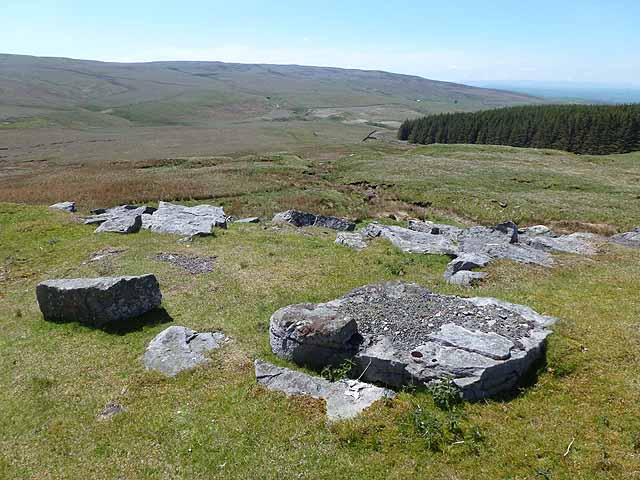
In addition to its natural beauty, Causey Moss has a historical significance. It was once an important route for transporting goods and livestock across the region, with evidence of ancient trackways and packhorse routes still visible today. The moss also contains remnants of prehistoric settlements, including stone circles and burial mounds, which provide insight into the area's ancient past.

Overall, Causey Moss offers visitors an opportunity to immerse themselves in the tranquility of the Lake District's moorland landscape while exploring its rich natural and historical heritage.

If you have any feedback on the listing, please let us know in the comments section below.

Causey Moss Images

Images are sourced within 2km of 54.485372/-2.2026478 or Grid Reference NY8610. Thanks to Geograph Open Source API. All images are credited.

Cattle grid at South Stainmore
Ascending Moudy Mea The telecom tower coming into view
Ascending Moudy Mea
The telecom tower coming into view
Telecommunications Tower, Moudy Mea On a rather dismal morning
Telecommunications Tower, Moudy Mea
On a rather dismal morning
On Moudy Mea Near the top, I think!
On Moudy Mea
Near the top, I think!
Summit area of Moudy Mea The curiously named moorland summit of Moudy Mea is a flat area on which it's hard to determine the highest point. Nearby there's an aerial which can be seen in the image; more distantly at the right side of the image are Little Fell and Mickle Fell.
Summit area of Moudy Mea
The curiously named moorland summit of Moudy Mea is a flat area on which it's hard to determine the highest point. Nearby there's an aerial which can be seen in the image; more distantly at the right side of the image are Little Fell and Mickle Fell.
Ordnance Survey Trig Pillar 10415 This pillar can be found at High Greygrits.
Ordnance Survey Trig Pillar 10415
This pillar can be found at High Greygrits.
Bouldery slopes, High Greygrits On the western flank of this hill, looking towards the headstreams of the River Belah, a tributary of the Eden.
Bouldery slopes, High Greygrits
On the western flank of this hill, looking towards the headstreams of the River Belah, a tributary of the Eden.
On High Greygrits This is a very aptly named hill as it is relatively high at 522m and is well covered in greyish gritstone.
On High Greygrits
This is a very aptly named hill as it is relatively high at 522m and is well covered in greyish gritstone.
Trig point on High Greygrits The trig point on the summit of this 522m hill, looking SE towards the distant lumps of Water Crag and Rogan's Seat.
Trig point on High Greygrits
The trig point on the summit of this 522m hill, looking SE towards the distant lumps of Water Crag and Rogan's Seat.
High Greygrits Gritstone outcrops on the slopes of this hill. Some are natural and others have been exposed due to quarrying. Tan Hill Inn can be seen centre picture, some 2.5 miles away.
High Greygrits
Gritstone outcrops on the slopes of this hill. Some are natural and others have been exposed due to quarrying. Tan Hill Inn can be seen centre picture, some 2.5 miles away.
Boundary stone, High Greygrits The west face of this stone is inscribed 'Township of South Stainmore'.
Boundary stone, High Greygrits
The west face of this stone is inscribed 'Township of South Stainmore'.
Boundary stone, High Greygrits [2] The SE side of this stone is inscribed 'Township of Kaber'.
Boundary stone, High Greygrits [2]
The SE side of this stone is inscribed 'Township of Kaber'.
Ruins near Molds Hill
The bridleway to Woofer Gill
Woofer Moor and beyond Seen from the road to Tan Hill.
Woofer Moor and beyond
Seen from the road to Tan Hill.
Bridge on the Tan Hill road Over a small tributary of the Bleaberry Beck.
Bridge on the Tan Hill road
Over a small tributary of the Bleaberry Beck.
Woofer Moor The track in the middle distance passes through and serve the plantation.
Woofer Moor
The track in the middle distance passes through and serve the plantation.
High Greygrits Trig Point It looks as though the trig point has been recently painted.
High Greygrits Trig Point
It looks as though the trig point has been recently painted.
Show me another place!

Causey Moss is located at Grid Ref: NY8610 (Lat: 54.485372, Lng: -2.2026478)

Administrative County: Cumbria

District: Eden

Police Authority: Cumbria

What 3 Words

///wages.riverboat.enforced. Near Kirkby Stephen, Cumbria

Nearby Locations

Causey Moss Longband Moss

Related Wikis

Nearby Amenities

Located within 500m of 54.485372,-2.2026478
Causey
Place: locality
Lat/Long: 54.4894325/-2.2052957
Causey Moss
Place: locality
Lat/Long: 54.4867545/-2.2024873
Cold Anet
Place: locality
Lat/Long: 54.4816188/-2.2016075
The data included in this document is from www.openstreetmap.org. The data is made available under ODbL.

Have you been to Causey Moss?

Leave your review of Causey Moss below (or comments, questions and feedback).