Fountains Fell
Downs, Moorland in Yorkshire Craven
England
Fountains Fell

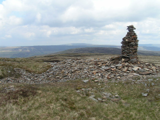
Fountains Fell is a prominent hill located in the Yorkshire Dales National Park in Yorkshire, England. It is part of the Pennine range and is situated in the northern region of the park. With an elevation of 668 meters (2,192 feet), it offers breathtaking views of the surrounding area, including the valleys of Littondale, Malhamdale, and Ribblesdale.
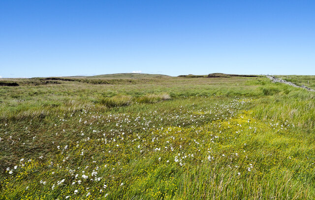
The hill is primarily composed of carboniferous limestone, which gives it a rugged and rocky appearance. Its landscape is characterized by wide open moorland, scattered with limestone outcrops and patches of heather. The summit of Fountains Fell is flat and expansive, making it a popular destination for hikers and nature enthusiasts.
The area surrounding Fountains Fell is known for its rich biodiversity. The moorland habitat supports a variety of plant and animal species, including heather, bilberry, curlew, golden plover, and meadow pipit. It is also home to several species of birds of prey, such as peregrine falcons and kestrels.
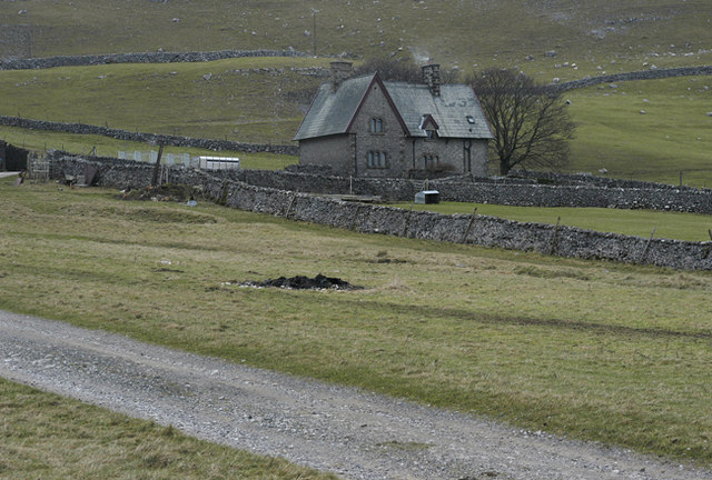
Fountains Fell has a long history of human activity. Remnants of ancient settlements and burial mounds can be found in the vicinity, indicating that the hill has been inhabited for thousands of years. In more recent times, the hill has been used for farming and sheep grazing.
For outdoor enthusiasts, Fountains Fell offers numerous opportunities for walking, hiking, and wildlife spotting. The hill is accessible via several footpaths and trails, allowing visitors to explore its natural beauty and immerse themselves in the tranquil surroundings of the Yorkshire Dales.
If you have any feedback on the listing, please let us know in the comments section below.
Fountains Fell Images
Images are sourced within 2km of 54.12827/-2.2206084 or Grid Reference SD8570. Thanks to Geograph Open Source API. All images are credited.


Fountains Fell is located at Grid Ref: SD8570 (Lat: 54.12827, Lng: -2.2206084)
Division: West Riding
Administrative County: North Yorkshire
District: Craven
Police Authority: North Yorkshire
What 3 Words
///this.pesky.inquest. Near Settle, North Yorkshire
Nearby Locations
Related Wikis
Fountains Fell
Fountains Fell is a mountain in the Yorkshire Dales, England. The main summit (SD864716) has a height of 668 metres (2,192 ft) and a relative height or...

Fountains Fell Tarn
Fountains Fell Tarn, is an upland lake between the two peaks of Fountains Fell, in North Yorkshire, England. The tarn is close to the Pennine Way, some...

Silverdale, North Yorkshire
Silverdale is a minor dale in the Yorkshire Dales in North Yorkshire, England. It is a side dale of Ribblesdale, and lies west of Fountains Fell. The dale...

Pen-y-ghent
Pen-y-ghent or Penyghent is a fell in the Yorkshire Dales, England. It is the lowest of Yorkshire's Three Peaks at 2,277 feet (694 m); the other two being...
Malham Moor
Malham Moor is a civil parish in the Craven district of North Yorkshire, England. Its population was estimated at 70 in 2015.It has a joint parish council...

Brackenbottom
Brackenbottom is a village in Ribblesdale, North Yorkshire, England. == External links == Media related to Brackenbottom at Wikimedia Commons
Stainforth, North Yorkshire
Stainforth is a village and civil parish in the Craven district of North Yorkshire, England. It is situated north of Settle. Nearby there is a waterfall...

St Peter's Church, Stainforth
St Peter's Church is in the village of Stainforth, North Yorkshire, England. It is an active Anglican parish church in the deanery of Bowland, the archdeaconry...
Nearby Amenities
Located within 500m of 54.12827,-2.2206084Have you been to Fountains Fell?
Leave your review of Fountains Fell below (or comments, questions and feedback).