Black Allotment

Downs, Moorland in Northumberland

England

Black Allotment
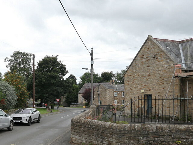
Shilburn Road, Allendale Town On the right side is the former County Primary School, dated 1879, a Grade II Listed Building <a href="https://www.geograph.org.uk/photo/6295629">NY8355 : Twenty years of schoolin' and they put you on the day shift</a>. Below, just over the main road, part of Allendale Library is just visible <a href="https://www.geograph.org.uk/photo/7286204">NY8355 : Allendale Town Library</a>, the rest hidden by a tree and the west end of Leadgate Terrace.

This photo was taken in an attempt to reproduce an old photo which has an old heather-thatched cottage in the right foreground (now the school carpark). 'The Thacky' (or Fosterstead) as it was known, fell down in the 1940s. The view into Allendale Town is now hidden by trees.

Allen Valleys Local History Group: <span class="nowrap"><a title="http://www.allenvalleyslocalhistory.org.uk/photo/allendale-shilburn-0002-168/" rel="nofollow ugc noopener" href="http://www.allenvalleyslocalhistory.org.uk/photo/allendale-shilburn-0002-168/">Link</a><img style="margin-left:2px;" alt="External link" title="External link - shift click to open in new window" src="https://s1.geograph.org.uk/img/external.png" width="10" height="10"/></span>  <span class="nowrap"><a title="https://web.archive.org/web/20220918132529/http://www.allenvalleyslocalhistory.org.uk/photo/allendale-shilburn-0002-168/" rel="nofollow ugc noopener" href="https://web.archive.org/web/20220918132529/http://www.allenvalleyslocalhistory.org.uk/photo/allendale-shilburn-0002-168/">Archive Link</a><img style="margin-left:2px;" alt="External link" title="External link - shift click to open in new window" src="https://s1.geograph.org.uk/img/external.png" width="10" height="10"/></span>
<span class="nowrap"><a title="http://www.allenvalleyslocalhistory.org.uk/photo/allendale-0026-001/" rel="nofollow ugc noopener" href="http://www.allenvalleyslocalhistory.org.uk/photo/allendale-0026-001/">Link</a><img style="margin-left:2px;" alt="External link" title="External link - shift click to open in new window" src="https://s1.geograph.org.uk/img/external.png" width="10" height="10"/></span> <span class="nowrap"><a title="https://web.archive.org/web/20220918132837/http://www.allenvalleyslocalhistory.org.uk/photo/allendale-0026-001/" rel="nofollow ugc noopener" href="https://web.archive.org/web/20220918132837/http://www.allenvalleyslocalhistory.org.uk/photo/allendale-0026-001/">Archive Link</a><img style="margin-left:2px;" alt="External link" title="External link - shift click to open in new window" src="https://s1.geograph.org.uk/img/external.png" width="10" height="10"/></span>
Shilburn Road, Allendale Town Credit: Andrew Curtis

Black Allotment is a vast expanse of land located in Northumberland, England. It is situated in the northern part of the county, encompassing both the Downs and Moorland areas. With its diverse natural landscapes, Black Allotment offers visitors a unique and captivating experience.

The Downs section of Black Allotment is characterized by rolling hills and expansive grasslands. The area is scattered with ancient burial mounds, evidence of its rich history. Visitors can enjoy breathtaking views of the surrounding countryside from the hilltops, with the Northumberland National Park providing a stunning backdrop.

Moving towards the Moorland, the landscape transforms into rugged terrain, covered in heather and peat. This section of Black Allotment is home to a variety of flora and fauna, including deer, grouse, and rare bird species. Walking trails meander through the moorland, giving visitors the opportunity to explore the area and appreciate its natural beauty.

Black Allotment also holds historical significance, with remnants of Bronze Age settlements and Roman forts scattered throughout the land. Archaeological excavations have unearthed artifacts that provide insight into the lives of the people who once inhabited this area.

Access to Black Allotment is provided through designated parking areas, and there are well-marked paths and trails for visitors to explore. It is a popular destination for nature enthusiasts, hikers, and history buffs alike, offering a tranquil escape from the hustle and bustle of everyday life.

In summary, Black Allotment in Northumberland offers a diverse range of natural landscapes, from rolling Downs to rugged Moorland. Its rich history and abundant wildlife make it a fascinating destination for those seeking to explore the beauty of the English countryside.

If you have any feedback on the listing, please let us know in the comments section below.

Black Allotment Images

Images are sourced within 2km of 54.908436/-2.2277596 or Grid Reference NY8557. Thanks to Geograph Open Source API. All images are credited.

Shilburn Road, Allendale Town On the right side is the former County Primary School, dated 1879, a Grade II Listed Building <a href="https://www.geograph.org.uk/photo/6295629">NY8355 : Twenty years of schoolin' and they put you on the day shift</a>. Below, just over the main road, part of Allendale Library is just visible <a href="https://www.geograph.org.uk/photo/7286204">NY8355 : Allendale Town Library</a>, the rest hidden by a tree and the west end of Leadgate Terrace.

This photo was taken in an attempt to reproduce an old photo which has an old heather-thatched cottage in the right foreground (now the school carpark). 'The Thacky' (or Fosterstead) as it was known, fell down in the 1940s. The view into Allendale Town is now hidden by trees.

Allen Valleys Local History Group: <span class="nowrap"><a title="http://www.allenvalleyslocalhistory.org.uk/photo/allendale-shilburn-0002-168/" rel="nofollow ugc noopener" href="http://www.allenvalleyslocalhistory.org.uk/photo/allendale-shilburn-0002-168/">Link</a><img style="margin-left:2px;" alt="External link" title="External link - shift click to open in new window" src="https://s1.geograph.org.uk/img/external.png" width="10" height="10"/></span>  <span class="nowrap"><a title="https://web.archive.org/web/20220918132529/http://www.allenvalleyslocalhistory.org.uk/photo/allendale-shilburn-0002-168/" rel="nofollow ugc noopener" href="https://web.archive.org/web/20220918132529/http://www.allenvalleyslocalhistory.org.uk/photo/allendale-shilburn-0002-168/">Archive Link</a><img style="margin-left:2px;" alt="External link" title="External link - shift click to open in new window" src="https://s1.geograph.org.uk/img/external.png" width="10" height="10"/></span>
<span class="nowrap"><a title="http://www.allenvalleyslocalhistory.org.uk/photo/allendale-0026-001/" rel="nofollow ugc noopener" href="http://www.allenvalleyslocalhistory.org.uk/photo/allendale-0026-001/">Link</a><img style="margin-left:2px;" alt="External link" title="External link - shift click to open in new window" src="https://s1.geograph.org.uk/img/external.png" width="10" height="10"/></span> <span class="nowrap"><a title="https://web.archive.org/web/20220918132837/http://www.allenvalleyslocalhistory.org.uk/photo/allendale-0026-001/" rel="nofollow ugc noopener" href="https://web.archive.org/web/20220918132837/http://www.allenvalleyslocalhistory.org.uk/photo/allendale-0026-001/">Archive Link</a><img style="margin-left:2px;" alt="External link" title="External link - shift click to open in new window" src="https://s1.geograph.org.uk/img/external.png" width="10" height="10"/></span>
Shilburn Road, Allendale Town
On the right side is the former County Primary School, dated 1879, a Grade II Listed Building NY8355 : Twenty years of schoolin' and they put you on the day shift. Below, just over the main road, part of Allendale Library is just visible NY8355 : Allendale Town Library, the rest hidden by a tree and the west end of Leadgate Terrace. This photo was taken in an attempt to reproduce an old photo which has an old heather-thatched cottage in the right foreground (now the school carpark). 'The Thacky' (or Fosterstead) as it was known, fell down in the 1940s. The view into Allendale Town is now hidden by trees. Allen Valleys Local History Group: LinkExternal link Archive LinkExternal link LinkExternal link Archive LinkExternal link
Field with clump of small trees The field lies to the west of a minor road, Leadside Lane, which has risen out of Allendale Town.
Field with clump of small trees
The field lies to the west of a minor road, Leadside Lane, which has risen out of Allendale Town.
Heather moorland on Gaterley Hill Cloud-shadowed moorland south-east of the trig point on Gaterley Hill.
East Allendale and its western slopes are sunlit in the distance.
Heather moorland on Gaterley Hill
Cloud-shadowed moorland south-east of the trig point on Gaterley Hill. East Allendale and its western slopes are sunlit in the distance.
View from the Memorial Seat Looking towards Allendale Town.
View from the Memorial Seat
Looking towards Allendale Town.
End of the Road The last few yards of road before the track across the moorland.
End of the Road
The last few yards of road before the track across the moorland.
Rabbit Warren A mass of rabbit burrows on the hillside.
Rabbit Warren
A mass of rabbit burrows on the hillside.
Road and farms Looking back to Struthers. A couple of very tidy farms and grassland.
Road and farms
Looking back to Struthers. A couple of very tidy farms and grassland.
Lough near the track Lough between the track and woodland on Long Rigg. New hides have been installed.
Lough near the track
Lough between the track and woodland on Long Rigg. New hides have been installed.
Silage bales A stack of bales at the side of the lane.
Silage bales
A stack of bales at the side of the lane.
Grazing sheep Grazing sheep, now looking at the camera.
Grazing sheep
Grazing sheep, now looking at the camera.
Open Countryside The lane leading across to the wood, with large fields either side.
Open Countryside
The lane leading across to the wood, with large fields either side.
Rocky outcrop A few cattle grazing on the rocky outcrop.
Rocky outcrop
A few cattle grazing on the rocky outcrop.
Small outcrop A small rocky outcrop.
Small outcrop
A small rocky outcrop.
Stile and track A well built stile for the path along the track.
Stile and track
A well built stile for the path along the track.
A couple of farms The farms at Bull Hill and Portgate .
A couple of farms
The farms at Bull Hill and Portgate .
Muddy farmyard Crossing the muddy farm.
Muddy farmyard
Crossing the muddy farm.
Awaiting repairs A broken down tractor in the barn ready for repairs.
Awaiting repairs
A broken down tractor in the barn ready for repairs.
Items for sale Lots waiting to be sold at the Portgate farm sale.
Items for sale
Lots waiting to be sold at the Portgate farm sale.
Show me another place!

Black Allotment is located at Grid Ref: NY8557 (Lat: 54.908436, Lng: -2.2277596)

Unitary Authority: Northumberland

Police Authority: Northumbria

What 3 Words

///nurtures.squeezed.belly. Near Haydon Bridge, Northumberland

Nearby Locations

Lough Hill Black Allotment

Related Wikis

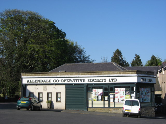
Allendale Co-operative Society

Allendale Co-operative Society is a small consumer co-operative in the village of Allendale, Northumberland, England. Founded in 1874 as the Allendale...

Museum of Classic Sci-Fi

The Museum of Classic Sci-Fi is in Allendale, Northumberland in England. The museum opened in 2018 and houses a collection of more than 200 props, costumes...

Allendale, Northumberland

Allendale, often marked on maps as Allendale Town, is a village and civil parish in south west Northumberland, England. It is located within the North...

Allendale railway station

Allendale railway station was the terminus of the single track branch of the Hexham and Allendale Railway, in north east England. The line connected villages...

Nearby Amenities

Located within 500m of 54.908436,-2.2277596
Lough Hill
Natural: peak
Lat/Long: 54.9114681/-2.232295
Black Allotment
Place: locality
Lat/Long: 54.9092144/-2.2307881
The data included in this document is from www.openstreetmap.org. The data is made available under ODbL.

Have you been to Black Allotment?

Leave your review of Black Allotment below (or comments, questions and feedback).