New Pasture

Downs, Moorland in Yorkshire Craven

England

New Pasture

The Pennine Way near Fountains Fell
The Pennine Way near Fountains Fell Credit: Dave Kelly

New Pasture is a picturesque region located in Yorkshire, England, known for its stunning natural beauty and diverse landscapes. Situated amidst the scenic Yorkshire Downs and Moorland, this area offers a perfect blend of rolling hills, lush pastures, and rugged terrains.

The Yorkshire Downs dominate the western part of New Pasture, presenting a series of gently sloping hills covered in vibrant greenery. With its sweeping panoramic views, this region attracts hikers, nature enthusiasts, and photographers alike. The Downs are also home to a variety of wildlife, including deer, birds, and small mammals.

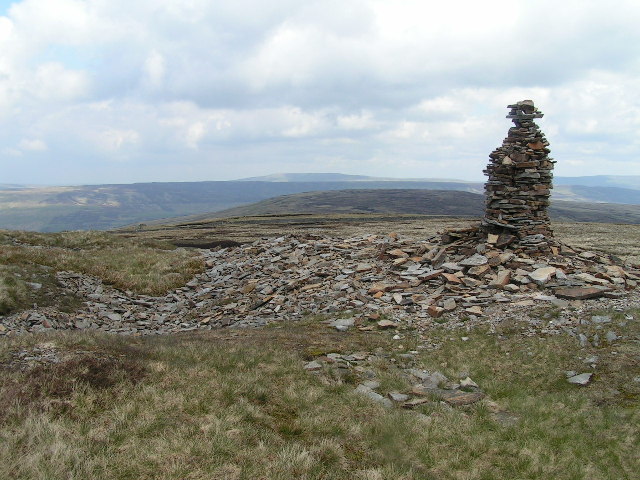
To the east, the Moorland stretches across vast expanses of open land, characterized by rugged and untamed beauty. Covered in heather and gorse, the Moorland provides a unique habitat for a range of plant and animal species, including curlews, grouse, and rare orchids. The stark contrast of the purple heather against the green landscape creates a breathtaking sight during the flowering season.

New Pasture is also dotted with charming villages and small market towns, offering a glimpse into the region's rich history and culture. Visitors can explore ancient churches, traditional pubs, and quaint cottages, all while experiencing the warm hospitality of the locals.

Overall, New Pasture, with its combination of the Yorkshire Downs and Moorland, presents an idyllic setting for those seeking tranquility, natural beauty, and a chance to immerse themselves in the charm of rural Yorkshire.

If you have any feedback on the listing, please let us know in the comments section below.

New Pasture Images

Images are sourced within 2km of 54.136371/-2.2284418 or Grid Reference SD8571. Thanks to Geograph Open Source API. All images are credited.

The Pennine Way near Fountains Fell
The Pennine Way near In Sleets
The Pennine Way near Blishmire House
The Pennine Way near Dale Head
The Pennine Way near Churn Mill Hole
The Pennine Way approaching Pen-y-ghent
Disturbed ground on Fountains Fell The Pennine Way passes close to the summit of Fountains Fell but does not visit it - perhaps due to access issues when the route was being decided. The location here is north-east of the summit where there has been some excavation resulting in the shallow pits and piles of broken rock. OS mapping marks shafts in the area.
Disturbed ground on Fountains Fell
The Pennine Way passes close to the summit of Fountains Fell but does not visit it - perhaps due to access issues when the route was being decided. The location here is north-east of the summit where there has been some excavation resulting in the shallow pits and piles of broken rock. OS mapping marks shafts in the area.
Fountains Fell View from Dale Head on the road to Halton Gill
Fountains Fell
View from Dale Head on the road to Halton Gill
Roadside Parking at Dale Head On the road from Halton Gill. Some maps have a car park marked here on the spot where there is some limestone paving
Roadside Parking at Dale Head
On the road from Halton Gill. Some maps have a car park marked here on the spot where there is some limestone paving
Penyghent, Long Lane track The rivet benchmark is cut into a boulder on the right side of the track as walking north towards Penyghent.
Penyghent, Long Lane track
The rivet benchmark is cut into a boulder on the right side of the track as walking north towards Penyghent.
Penyghent, Long Lane track There is a rivet benchmark cut into a boulder on the right side of the track as walking north towards Penyghent.
Penyghent, Long Lane track
There is a rivet benchmark cut into a boulder on the right side of the track as walking north towards Penyghent.
Penyghent, Long Lane track The benchmark is cut into a right hand gatepost, on the east side of the track as approaching Penyghent to the north.
Penyghent, Long Lane track
The benchmark is cut into a right hand gatepost, on the east side of the track as approaching Penyghent to the north.
Penyghent, Long Lane track There is a benchmark cut into the right hand gatepost, on the east side of the track as approaching Penyghent to the north. The quality of the mark is excellent.
Penyghent, Long Lane track
There is a benchmark cut into the right hand gatepost, on the east side of the track as approaching Penyghent to the north. The quality of the mark is excellent.
Old Wayside Cross beside the Stainforth to Halton Gill road Ulfkil Cross, the base of a wayside cross. Set against the inside of the drystone wall on the west side of the Stainforth to Halton Gill road at Dale Head in Malham Moor parish. Scheduled Monument <span class="nowrap"><a title="https://historicengland.org.uk/listing/the-list/list-entry/1004895" rel="nofollow ugc noopener" href="https://historicengland.org.uk/listing/the-list/list-entry/1004895">Link</a><img style="margin-left:2px;" alt="External link" title="External link - shift click to open in new window" src="https://s1.geograph.org.uk/img/external.png" width="10" height="10"/></span>. 

Milestone Society National ID: YNCR_MAM
Old Wayside Cross beside the Stainforth to Halton Gill road
Ulfkil Cross, the base of a wayside cross. Set against the inside of the drystone wall on the west side of the Stainforth to Halton Gill road at Dale Head in Malham Moor parish. Scheduled Monument LinkExternal link. Milestone Society National ID: YNCR_MAM
Dale Head Road leading to the foot of Pen-y-ghent.
Dale Head
Road leading to the foot of Pen-y-ghent.
Dale Head
Dale Head
Blishmire House Barn above Crooke Gill.
Blishmire House
Barn above Crooke Gill.
Show me another place!

New Pasture is located at Grid Ref: SD8571 (Lat: 54.136371, Lng: -2.2284418)

Division: West Riding

Administrative County: North Yorkshire

District: Craven

Police Authority: North Yorkshire

What 3 Words

///trips.modules.ruffling. Near Settle, North Yorkshire

Nearby Locations

New Pasture

Related Wikis

Silverdale, North Yorkshire

Silverdale is a minor dale in the Yorkshire Dales in North Yorkshire, England. It is a side dale of Ribblesdale, and lies west of Fountains Fell. The dale...

Fountains Fell

Fountains Fell is a mountain in the Yorkshire Dales, England. The main summit (SD864716) has a height of 668 metres (2,192 ft) and a relative height or...

Fountains Fell Tarn

Fountains Fell Tarn, is an upland lake between the two peaks of Fountains Fell, in North Yorkshire, England. The tarn is close to the Pennine Way, some...

Pen-y-ghent

Pen-y-ghent or Penyghent is a fell in the Yorkshire Dales, England. It is the lowest of Yorkshire's Three Peaks at 2,277 feet (694 m); the other two being...

Brackenbottom

Brackenbottom is a village in Ribblesdale, North Yorkshire, England. == External links == Media related to Brackenbottom at Wikimedia Commons

Plover Hill

Plover Hill is an area of moorland lying to the north of Pen-y-ghent in the Yorkshire Dales and connected to it by an unbroken area of high ground. Whilst...

Ribblesdale

Ribblesdale is one of the Yorkshire Dales in England. It is the dale or upper valley of the River Ribble in North Yorkshire. Towns and villages in Ribblesdale...

Ewecross

The historical area of Ewecross or Ewcross is a district in the West Riding of Yorkshire, England. It included the parishes of Bentham, Clapham, Horton...

Nearby Amenities

Located within 500m of 54.136371,-2.2284418
Natural: sinkhole
Source: Bing
Lat/Long: 54.1400024/-2.2267432
Natural: sinkhole
Source: Bing
Lat/Long: 54.1389653/-2.2331751
Natural: sinkhole
Source: Bing
Lat/Long: 54.1399552/-2.2268129
Natural: sinkhole
Source: Bing
Lat/Long: 54.1395748/-2.2269631
Natural: sinkhole
Source: Bing
Lat/Long: 54.1398201/-2.2313083
Natural: sinkhole
Source: Bing
Lat/Long: 54.1376079/-2.2323761
Natural: sinkhole
Source: Bing
Lat/Long: 54.1401218/-2.2267969
Natural: sinkhole
Source: Bing
Lat/Long: 54.1393424/-2.2273548
Natural: sinkhole
Source: Bing
Lat/Long: 54.1400307/-2.2264052
Natural: sinkhole
Source: Bing
Lat/Long: 54.1391071/-2.2305898
Natural: sinkhole
Source: Bing
Lat/Long: 54.1376803/-2.2323171
Natural: sinkhole
Source: Bing
Lat/Long: 54.1390409/-2.2320596
Natural: sinkhole
Source: Bing
Lat/Long: 54.1403447/-2.2265125
Natural: sinkhole
Source: Bing
Lat/Long: 54.1396661/-2.2269363
Natural: sinkhole
Source: Bing
Lat/Long: 54.1400651/-2.2266466
Natural: sinkhole
Source: Bing
Lat/Long: 54.1382743/-2.2279987
Natural: sinkhole
Source: Bing
Lat/Long: 54.1379506/-2.2315715
Natural: sinkhole
Source: Bing
Lat/Long: 54.1397918/-2.2309489
Natural: sinkhole
Source: Bing
Lat/Long: 54.1387358/-2.2328157
Natural: sinkhole
Source: Bing
Lat/Long: 54.1376204/-2.2318987
Natural: sinkhole
Source: Bing
Lat/Long: 54.1391193/-2.2275961
Natural: sinkhole
Source: Bing
Lat/Long: 54.1386982/-2.232746
Natural: sinkhole
Source: Bing
Lat/Long: 54.1391822/-2.2276713
Natural: sinkhole
Source: Bing
Lat/Long: 54.1403858/-2.2317214
Natural: sinkhole
Source: Bing
Lat/Long: 54.1396944/-2.2329659
Natural: sinkhole
Source: Bing
Lat/Long: 54.1392108/-2.2306863
Natural: sinkhole
Source: Bing
Lat/Long: 54.1385947/-2.2309009
Natural: sinkhole
Source: Bing
Lat/Long: 54.1401531/-2.226593
Natural: sinkhole
Source: Bing
Lat/Long: 54.1399207/-2.2323222
Natural: sinkhole
Source: Bing
Lat/Long: 54.1380857/-2.2278164
Natural: sinkhole
Source: Bing
Lat/Long: 54.1390536/-2.2306595
Natural: sinkhole
Source: Bing
Lat/Long: 54.1394241/-2.2269685
Natural: sinkhole
Source: Bing
Lat/Long: 54.1379536/-2.227473
Natural: sinkhole
Source: Bing
Lat/Long: 54.1402569/-2.2266681
Natural: sinkhole
Source: Bing
Lat/Long: 54.1404863/-2.2263731
Natural: sinkhole
Source: Bing
Lat/Long: 54.1397382/-2.2269149
Natural: sinkhole
Source: Bing
Lat/Long: 54.1398577/-2.2314156
Natural: sinkhole
Source: Bing
Lat/Long: 54.1383652/-2.2320167
Natural: sinkhole
Source: Bing
Lat/Long: 54.1390851/-2.232301
Natural: sinkhole
Source: Bing
Lat/Long: 54.1383434/-2.2282723
Natural: sinkhole
Source: Bing
Lat/Long: 54.1391572/-2.2307078
Natural: sinkhole
Source: Bing
Lat/Long: 54.1396345/-2.2307451
Natural: sinkhole
Source: Bing
Lat/Long: 54.1395058/-2.2306324
Natural: sinkhole
Source: Bing
Lat/Long: 54.1381893/-2.227929
Natural: sinkhole
Source: Bing
Lat/Long: 54.1402192/-2.2317053
Natural: sinkhole
Source: Bing
Lat/Long: 54.1399364/-2.2315658
Natural: sinkhole
Source: Bing
Lat/Long: 54.1352696/-2.2211591
Natural: sinkhole
Source: Bing
Lat/Long: 54.1375888/-2.2222478
Natural: sinkhole
Source: Bing
Lat/Long: 54.1378277/-2.2226233
Natural: sinkhole
Source: Bing
Lat/Long: 54.1345878/-2.2219262
Natural: sinkhole
Source: Bing
Lat/Long: 54.1388332/-2.2221244
Natural: sinkhole
Source: Bing
Lat/Long: 54.1379377/-2.2217972
Natural: sinkhole
Source: Bing
Lat/Long: 54.1378528/-2.2228862
Natural: sinkhole
Source: Bing
Lat/Long: 54.1352635/-2.2210411
Natural: sinkhole
Source: Bing
Lat/Long: 54.1386102/-2.2223819
Natural: sinkhole
Source: Bing
Lat/Long: 54.1375229/-2.2217007
Natural: sinkhole
Source: Bing
Lat/Long: 54.1375763/-2.2216631
Natural: sinkhole
Source: Bing
Lat/Long: 54.1387169/-2.2222746
Natural: sinkhole
Source: Bing
Lat/Long: 54.1377458/-2.2220815
Natural: sinkhole
Source: Bing
Lat/Long: 54.1378654/-2.2213144
Natural: sinkhole
Source: Bing
Lat/Long: 54.1376643/-2.2218777
Natural: sinkhole
Source: Bing
Lat/Long: 54.137658/-2.2223497
Natural: sinkhole
Source: Bing
Lat/Long: 54.1378183/-2.2229023
Natural: sinkhole
Source: Bing
Lat/Long: 54.1384782/-2.2225107
Natural: sinkhole
Source: Bing
Lat/Long: 54.1355085/-2.2209928
Natural: sinkhole
Source: Bing
Lat/Long: 54.1379/-2.2220118
Natural: sinkhole
Source: Bing
Lat/Long: 54.1384246/-2.222516
Natural: sinkhole
Source: Bing
Lat/Long: 54.1377364/-2.2216041
Natural: sinkhole
Source: Bing
Lat/Long: 54.1382488/-2.2228057
Natural: sinkhole
Source: Bing
Lat/Long: 54.1387735/-2.2222425
Natural: sinkhole
Source: Bing
Lat/Long: 54.1379061/-2.2228594
Natural: sinkhole
Source: Bing
Lat/Long: 54.137661/-2.2216416
Natural: sinkhole
Source: Bing
Lat/Long: 54.1359266/-2.2208319
Natural: sinkhole
Source: Bing
Lat/Long: 54.1378841/-2.2215558
Natural: sinkhole
Source: Bing
Lat/Long: 54.1378685/-2.2221298
Natural: sinkhole
Source: Bing
Lat/Long: 54.1374569/-2.2221405
Natural: sinkhole
Source: Bing
Lat/Long: 54.1385065/-2.2223712
Natural: sinkhole
Source: Bing
Lat/Long: 54.1374317/-2.221647
Natural: sinkhole
Source: Bing
Lat/Long: 54.1380632/-2.2227521
The data included in this document is from www.openstreetmap.org. The data is made available under ODbL.

Have you been to New Pasture?

Leave your review of New Pasture below (or comments, questions and feedback).