Troughend Common
Downs, Moorland in Northumberland
England
Troughend Common

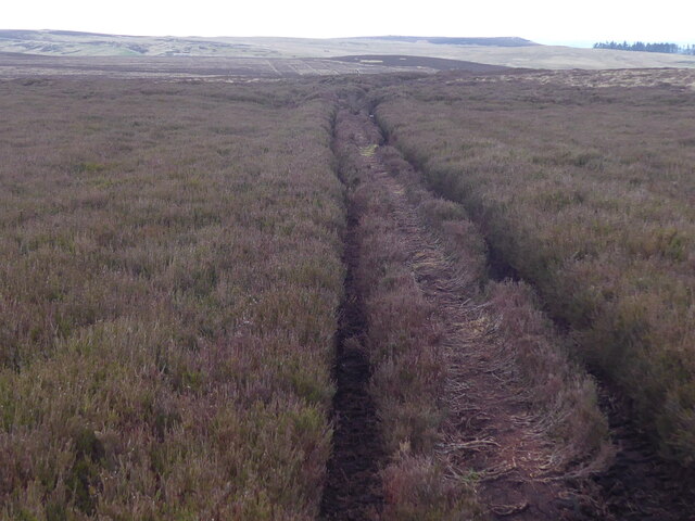
Troughend Common is a vast expanse of open land situated in the county of Northumberland, England. Spread across an area of approximately 3,000 acres, this common land offers breathtaking views of the surrounding countryside, comprising downs and moorland.
The common is characterized by its undulating terrain, with gentle slopes and rolling hills that provide a peaceful and serene atmosphere to visitors. The landscape is dominated by heather-clad moorland, interspersed with patches of grassland, scattered trees, and shrubs. The heather blossoms into a vibrant purple hue during the late summer months, creating a picturesque sight for nature enthusiasts and photographers.
Nestled within the common are several natural features, including small streams and ponds that further enhance the beauty of the area. Wildlife is abundant on Troughend Common, with a variety of bird species, such as curlews, lapwings, and skylarks, making it an ideal location for birdwatching. Visitors may also catch glimpses of hares, rabbits, and other small mammals that inhabit the common.
Troughend Common is a popular destination for outdoor activities, with numerous footpaths and trails that cater to walkers, hikers, and runners. The extensive network of paths allows visitors to explore the common's diverse landscape and take in the panoramic views of the Northumberland countryside. Additionally, the common is a designated Site of Special Scientific Interest (SSSI), highlighting its ecological and environmental importance.
Overall, Troughend Common offers a tranquil escape from the hustle and bustle of everyday life, providing a haven for nature lovers and outdoor enthusiasts alike.
If you have any feedback on the listing, please let us know in the comments section below.
Troughend Common Images
Images are sourced within 2km of 55.208012/-2.238661 or Grid Reference NY8490. Thanks to Geograph Open Source API. All images are credited.


Troughend Common is located at Grid Ref: NY8490 (Lat: 55.208012, Lng: -2.238661)
Unitary Authority: Northumberland
Police Authority: Northumbria
What 3 Words
///thin.needed.fools. Near Otterburn, Northumberland
Nearby Locations
Related Wikis

Corsenside
Corsenside is one of the largest parishes in Northumberland, however the area is mainly a vast expanse of rolling hills and farmland, with three tiny villages...

Redesdale
Redesdale is a valley in western Northumberland, England. It is formed by the River Rede, which rises in the Cheviots and flows down to join the North...

Battle of Otterburn
The Battle of Otterburn took place according to Scottish sources on 5 August 1388, or 19 August according to English sources, as part of the continuing...
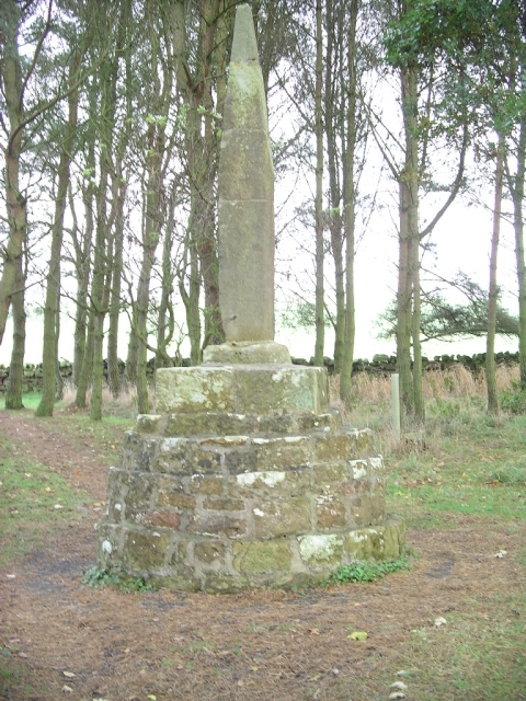
Percy Cross
The Percy Cross (also Battle Stone) is located just off the A696, 1 kilometre (0.62 mi) from Otterburn, Northumberland, England. It was erected before...
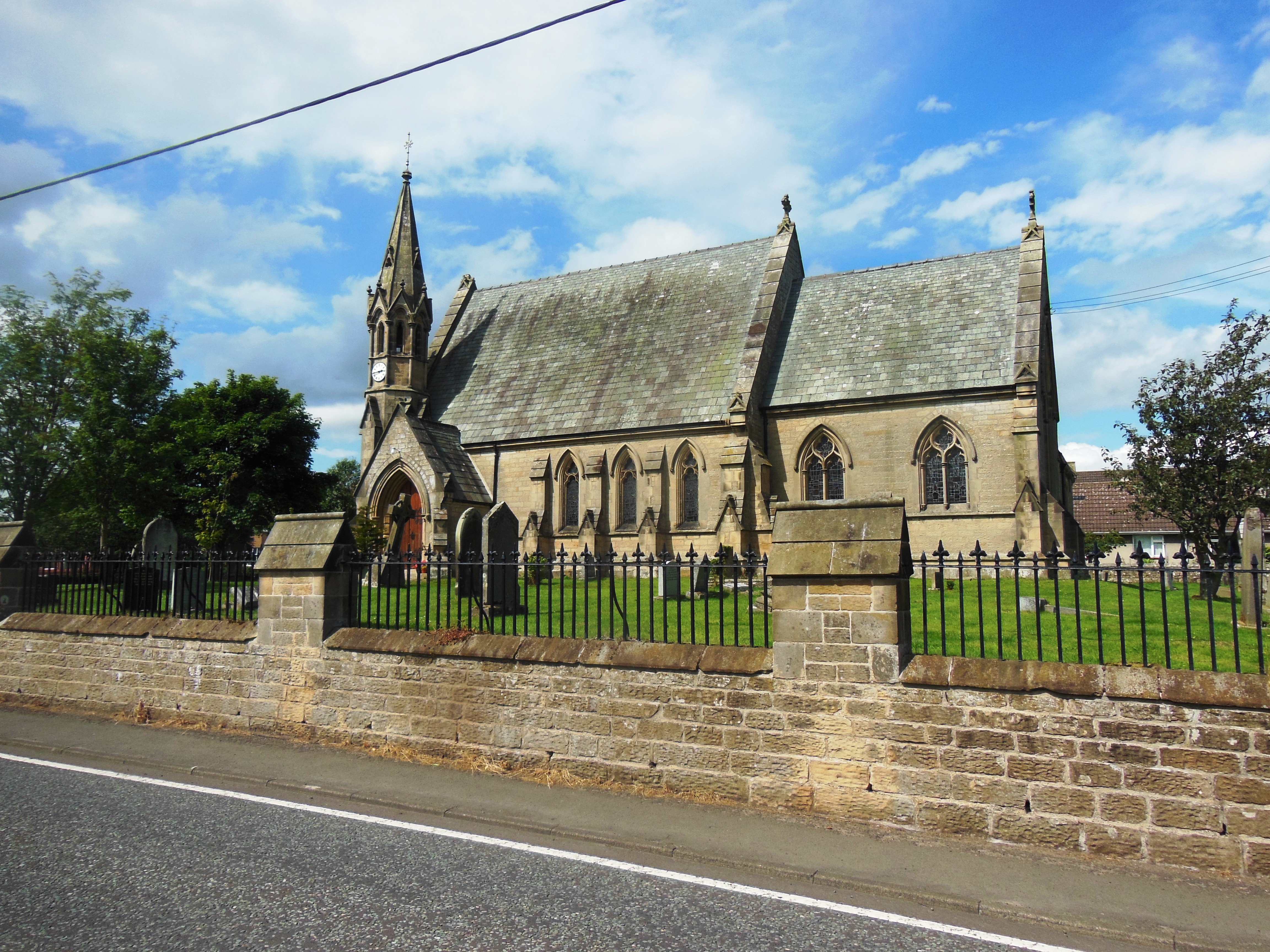
St John the Evangelist's Church, Otterburn
St John the Evangelist's Church is a church in Otterburn, Northumberland, northeast England, located off the A696 road. == History == The foundation stone...

Otterburn Mill
Otterburn Mill is a former textile mill in Otterburn, Northumberland, northeast England. It lies just south of the Otterburn Tower along the A696 road...
Otterburn Tower
Otterburn Tower (sometimes spelled Otiburne; originally Otterburn Castle; currently Otterburn Tower Hotel) is a Grade II listed castellated, three star...

Otterburn, Northumberland
Otterburn is a small village in Northumberland, England, 31 miles (50 km) northwest of Newcastle upon Tyne on the banks of the River Rede, near the confluence...
Have you been to Troughend Common?
Leave your review of Troughend Common below (or comments, questions and feedback).