Ashworth Moor

Downs, Moorland in Lancashire

England

Ashworth Moor

Valve House At Ashworth Moor Reservoir providing shade for the sheep
Valve House Credit: Kevin Waterhouse

Ashworth Moor is a picturesque area located in Lancashire, England. Situated in the Rossendale Valley, it is known for its breathtaking downs and moorland landscapes. The moor covers an area of approximately 5 square miles, offering visitors a tranquil and serene environment to explore.

The moorland of Ashworth Moor is characterized by its vast expanses of heather, creating a vibrant purple carpet during the summer months. The terrain is undulating, with gentle slopes and occasional rocky outcrops, providing stunning panoramic views of the surrounding countryside.

The area is home to a rich variety of flora and fauna, including several rare and protected species. It is a haven for birdwatchers, with numerous species of birds making their homes in the moorland, including the elusive hen harrier and short-eared owl. The moorland also supports a diverse range of plant life, such as bilberry, cotton grass, and bog rosemary.

Ashworth Moor is a popular destination for outdoor enthusiasts, offering ample opportunities for walking, hiking, and cycling. The area is crisscrossed by a network of well-maintained footpaths and bridleways, allowing visitors to explore its beauty at their own pace. Additionally, there are designated picnic areas and viewpoints where visitors can stop and admire the stunning vistas.

The moorland is also of historical significance, with remnants of ancient settlements and stone circles scattered throughout the area. These archaeological sites provide a glimpse into the rich history and cultural heritage of the region.

Overall, Ashworth Moor is a haven of natural beauty, offering visitors a chance to escape the hustle and bustle of everyday life and immerse themselves in the tranquility of the Lancashire countryside.

If you have any feedback on the listing, please let us know in the comments section below.

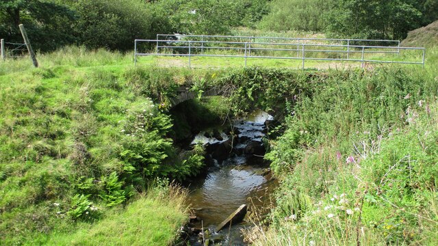
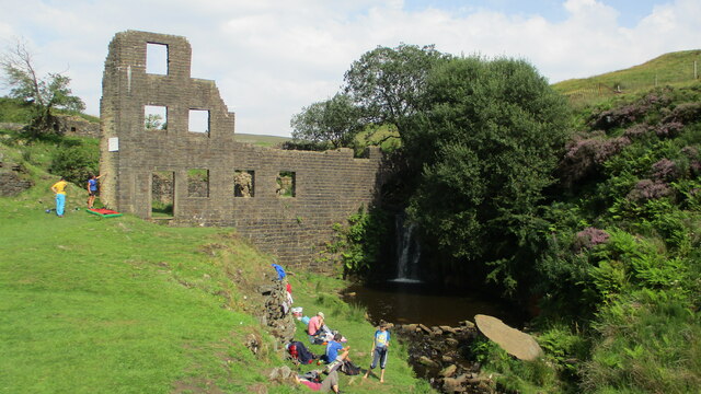
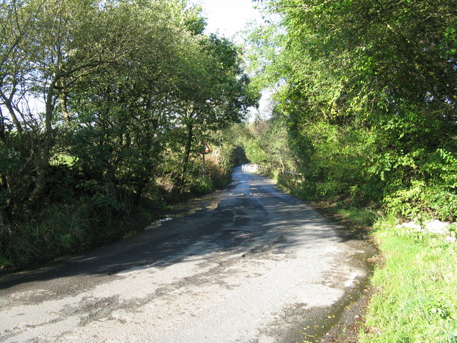
Ashworth Moor Images

Images are sourced within 2km of 53.640007/-2.2514759 or Grid Reference SD8315. Thanks to Geograph Open Source API. All images are credited.

Valve House At Ashworth Moor Reservoir providing shade for the sheep
Valve House
At Ashworth Moor Reservoir providing shade for the sheep
Longland Mill Bridge There is little left on the mill site apart from the mill pond
Longland Mill Bridge
There is little left on the mill site apart from the mill pond
Lumb Mill Remains
Lumb Mill Remains
Cheesden Fold remains With the wind turbines on Knowl Hill (part of the Scout Moor wind farm) beyond
Cheesden Fold remains
With the wind turbines on Knowl Hill (part of the Scout Moor wind farm) beyond
Barn Brook remains Has some well dressed masonry
Barn Brook remains
Has some well dressed masonry
Four Acre Mill remains Most of the masonry remains are around the wheel pit with the mill pond embankment above
Four Acre Mill remains
Most of the masonry remains are around the wheel pit with the mill pond embankment above
Edenfield Road Butty Wagon I can recommend the grilled cheese barm
Edenfield Road Butty Wagon
I can recommend the grilled cheese barm
Track to Knowl More
Track to Knowl More
Knowl Moor Trig Point Flush Bracket 11121
Wind turbines on Knowl Hill from the access track
Track to Top o'th Hill Farm Just having left Edenfield Road
Track to Top o'th Hill Farm
Just having left Edenfield Road
Old Milestone by the A680, north west of Wolstenholme Carved stone post by the A680, in parish of ROCHDALE (ROCHDALE District), Wolstenholme, on South side of road, in 'V' shaped space in dry stone wall. East of, and opposite 1220 Haslingden Road. Haslingden stone, erected by the Rochdale & Edenfield turnpike trust in the 19th century. 

Inscription once read:- : (Haslingden 6¾) : : (Rochdale 4) :
Carved bench mark and pivot on top.

Milestone Society National ID: LA_RDHS04.
Old Milestone by the A680, north west of Wolstenholme
Carved stone post by the A680, in parish of ROCHDALE (ROCHDALE District), Wolstenholme, on South side of road, in 'V' shaped space in dry stone wall. East of, and opposite 1220 Haslingden Road. Haslingden stone, erected by the Rochdale & Edenfield turnpike trust in the 19th century. Inscription once read:- : (Haslingden 6¾) : : (Rochdale 4) : Carved bench mark and pivot on top. Milestone Society National ID: LA_RDHS04.
Deeply Vale former bleach works chimney View from Scotland Lane
Deeply Vale former bleach works chimney
View from Scotland Lane
Cheesden Lumb Mill, ruin
Lancashire:  House near Ashworth Moor Reservoir The house was guarded by two ferocious-looking dogs.
Lancashire: House near Ashworth Moor Reservoir
The house was guarded by two ferocious-looking dogs.
Lancashire:  House near Ashworth Moor Reservoir
Lancashire: House near Ashworth Moor Reservoir
Lancashire:  Ashworth Road This minor road is a connection between the A680 at Cheesden and the B6222, Rochdale to Bury Old Road.  Ashworth Road is narrow and tortuous and the surface is atrocious.  Seen here around the middle and looking northwest towards Cheesden.
Lancashire: Ashworth Road
This minor road is a connection between the A680 at Cheesden and the B6222, Rochdale to Bury Old Road. Ashworth Road is narrow and tortuous and the surface is atrocious. Seen here around the middle and looking northwest towards Cheesden.
Ashworth Moor Reservoir & Holcombe Hill A view towards Bury from the northern edge of Ashworth Moor Reservoir in the Metropolitan Borough of Rochdale, Greater Manchester, England. Holcombe Hill can be seen in the distance on the left.
Ashworth Moor Reservoir & Holcombe Hill
A view towards Bury from the northern edge of Ashworth Moor Reservoir in the Metropolitan Borough of Rochdale, Greater Manchester, England. Holcombe Hill can be seen in the distance on the left.
Show me another place!

Ashworth Moor is located at Grid Ref: SD8315 (Lat: 53.640007, Lng: -2.2514759)

Unitary Authority: Rochdale

Police Authority: Greater Manchester

What 3 Words

///intention.climbing.remit. Near Ramsbottom, Manchester

Related Wikis

Ashworth Moor Reservoir

Ashworth Moor Reservoir is an upland water supply reservoir amongst the Pennines in Greater Manchester, England close to the A680 road between Rochdale...

Cheesden Valley

The Cheesden Valley is a valley in the Heywood area of Greater Manchester, England. It runs on a north–south alignment between Bury and Rochdale in the...

Scout Moor Wind Farm

Scout Moor Wind Farm is the second largest onshore wind farm in England. The wind farm, which was built for Peel Wind Power Ltd, produces electricity from...

Greenbooth Reservoir

Greenbooth Reservoir is a reservoir to the north of Heywood and close to Norden in the Metropolitan Borough of Rochdale, within Greater Manchester, England...

Related Videos

Scout Moor Rochdale/Rossendale Lancashire

Part of Scout Moor is Knowle Hill, visible from our location. Unfortunately prevailing weather conditions and time constraints, ...

Naden Valley/Ashworth Valley, Rochdale.

Starting from The Jubilee Car Park Norden, which is close to The Bridge Cafe for our circular walk. There was various scenery we ...

Scoutmoor: 3 Reservoirs, Rochdale 06/20

Greater Manchester UK Hike In the usual Greater Manchester weather, grim grey skies and of course rain.

Nearby Amenities

Located within 500m of 53.640007,-2.2514759
Created By: YahooApplet 1.0
Lat/Long: 53.6387097/-2.2554623
Created By: YahooApplet 1.0
Lat/Long: 53.638557/-2.2550009
Created By: YahooApplet 1.0
Lat/Long: 53.63794/-2.252544
Entrance: yes
Lat/Long: 53.6405196/-2.2588466
Barrier: stile
Lat/Long: 53.6440598/-2.2523138
Barrier: swing_gate
Lat/Long: 53.6436189/-2.2482886
The data included in this document is from www.openstreetmap.org. The data is made available under ODbL.

Have you been to Ashworth Moor?

Leave your review of Ashworth Moor below (or comments, questions and feedback).