Criggie Belt
Downs, Moorland in Kincardineshire
Scotland
Criggie Belt
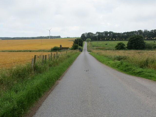
Criggie Belt is a charming area located in Kincardineshire, Scotland. Situated amidst the beautiful countryside, it is renowned for its stunning downs and moorland landscapes. Spanning over a vast area, Criggie Belt offers an idyllic retreat for nature enthusiasts and outdoor adventurers.
The downs of Criggie Belt display rolling hills covered in vibrant green grasses, creating a picturesque setting. These undulating landscapes provide breathtaking views and are perfect for leisurely walks, picnics, or simply enjoying the tranquility of the surroundings. The moorland, on the other hand, offers a unique ecosystem filled with heather and various flora and fauna species. It is a haven for birdwatchers and wildlife lovers, as it is home to a diverse range of species such as red grouse, curlews, and golden eagles.
The region also boasts a network of walking trails, allowing visitors to explore the area's natural beauty further. Hiking enthusiasts can venture on these paths, which cater to different skill levels, to immerse themselves in the serene ambiance and relish the breathtaking views.
Criggie Belt is a rural area, and as such, it offers a peaceful escape from the hustle and bustle of city life. The tranquility and natural beauty of the downs and moorland make it a popular destination for those seeking relaxation and rejuvenation. Whether it's a leisurely stroll, an adventurous hike, or simply reveling in the wonders of nature, Criggie Belt is sure to captivate visitors with its serene charm and breathtaking landscapes.
If you have any feedback on the listing, please let us know in the comments section below.
Criggie Belt Images
Images are sourced within 2km of 56.941247/-2.2823535 or Grid Reference NO8283. Thanks to Geograph Open Source API. All images are credited.


Criggie Belt is located at Grid Ref: NO8283 (Lat: 56.941247, Lng: -2.2823535)
Unitary Authority: Aberdeenshire
Police Authority: North East
What 3 Words
///clasping.aviation.amends. Near Stonehaven, Aberdeenshire
Nearby Locations
Related Wikis

Tewel
Tewel is a hamlet located approximately two miles west of Stonehaven, Kincardineshire on the Auchenblae Road in Northeast Scotland. It consists of: Tewel...

Castle of Fiddes
The Castle of Fiddes is a 16th-century tower house in Aberdeenshire, Scotland, located around 6 kilometres (3.7 mi) south-west of Stonehaven. It is dated...
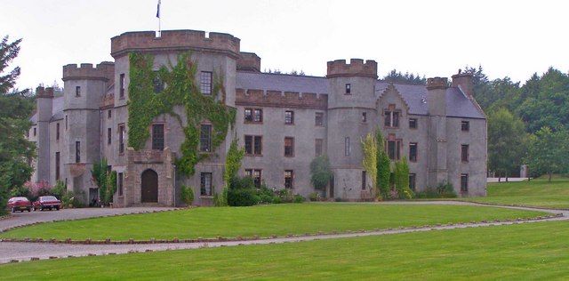
Fetteresso Castle
Fetteresso Castle is a 14th-century tower house, rebuilt in 1761 as a Scottish Gothic style Palladian manor, with clear evidence of prehistoric use of...
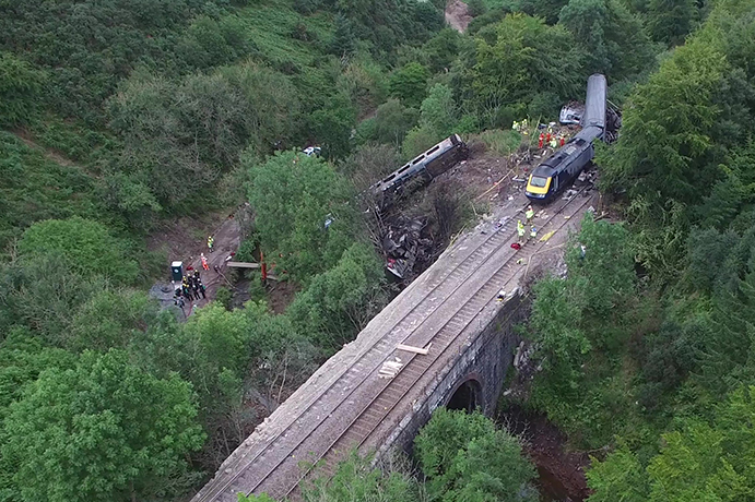
Stonehaven derailment
The Stonehaven derailment was a fatal railway accident that occurred at 09:38 BST on 12 August 2020, when a passenger train returning to Aberdeen hit a...
Nearby Amenities
Located within 500m of 56.941247,-2.2823535Have you been to Criggie Belt?
Leave your review of Criggie Belt below (or comments, questions and feedback).