Calroust Common

Downs, Moorland in Roxburghshire

Scotland

Calroust Common

Cheviot feral goat kid on Blackbrough Hill A loose herd of approximately 30 Cheviot feral goats including 10 kids were encountered from Blackbrough Hill to Heatherhope Reservoir, this being a shot of one of the more obliging youngsters.

This photograph was taken during the Coronavirus (COVID-19) pandemic of 2020/21/22.
Cheviot feral goat kid on Blackbrough Hill Credit: James T M Towill

Calroust Common is a picturesque area located in the county of Roxburghshire, Scotland. Situated on the southern border of the country, it encompasses vast stretches of downs and moorland, offering a diverse and breathtaking landscape for visitors to explore.

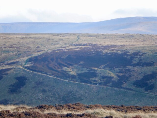
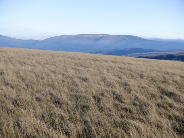
The downs of Calroust Common are characterized by rolling hills covered in lush green grass, providing a serene and tranquil environment. These gentle slopes are ideal for leisurely walks, picnics, and enjoying the stunning panoramic views of the surrounding countryside.

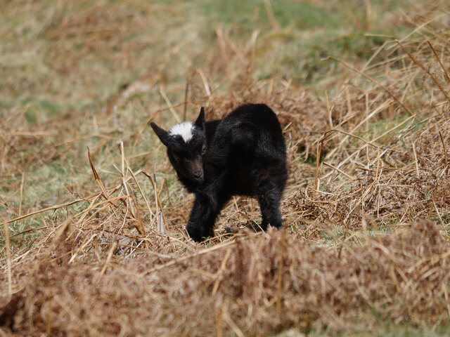
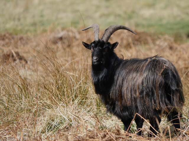
In contrast, the moorland areas of Calroust Common are more rugged and wild, with heather-covered hills and peat bogs. This unique habitat supports a diverse range of flora and fauna, including heather, bilberry bushes, and various species of birds and insects. Nature enthusiasts will delight in spotting rare species such as the golden plover or the short-eared owl, which are known to inhabit the moorland.

Calroust Common is also home to several walking trails, allowing visitors to explore the area at their own pace. The trails range from easy strolls suitable for families to more challenging hikes for experienced hikers. Along these paths, one can discover ancient ruins, hidden waterfalls, and even the occasional herd of wild deer.

Overall, Calroust Common offers a remarkable natural landscape with its downs and moorland, making it an ideal destination for outdoor enthusiasts, nature lovers, and those seeking tranquility in the heart of Scotland.

If you have any feedback on the listing, please let us know in the comments section below.

Calroust Common Images

Images are sourced within 2km of 55.453504/-2.2833701 or Grid Reference NT8217. Thanks to Geograph Open Source API. All images are credited.

Cheviot feral goat kid on Blackbrough Hill A loose herd of approximately 30 Cheviot feral goats including 10 kids were encountered from Blackbrough Hill to Heatherhope Reservoir, this being a shot of one of the more obliging youngsters.

This photograph was taken during the Coronavirus (COVID-19) pandemic of 2020/21/22.
Cheviot feral goat kid on Blackbrough Hill
A loose herd of approximately 30 Cheviot feral goats including 10 kids were encountered from Blackbrough Hill to Heatherhope Reservoir, this being a shot of one of the more obliging youngsters. This photograph was taken during the Coronavirus (COVID-19) pandemic of 2020/21/22.
Cheviot feral goat by the Heatherhope Burn A loose herd of approximately 30 Cheviot feral goats including 10 kids were encountered from Blackbrough Hill to Heatherhope Reservoir, this being a shot of one of the more obliging billy goats.

This photograph was taken during the Coronavirus (COVID-19) pandemic of 2020/21/22.
Cheviot feral goat by the Heatherhope Burn
A loose herd of approximately 30 Cheviot feral goats including 10 kids were encountered from Blackbrough Hill to Heatherhope Reservoir, this being a shot of one of the more obliging billy goats. This photograph was taken during the Coronavirus (COVID-19) pandemic of 2020/21/22.
Craik Moor The Street follows a fence dividing grass from heather.
Craik Moor
The Street follows a fence dividing grass from heather.
Cairn, Berry Hills Some stones from the antiquity have been used to form a more recent cairn.
Cairn, Berry Hills
Some stones from the antiquity have been used to form a more recent cairn.
The Street
The Street
Head of Cribs Hope Scree lined deep defile off Craik Moor.
Head of Cribs Hope
Scree lined deep defile off Craik Moor.
Blackbrough Hill A steep flank of a spur which carries a very striking hill fort.
Blackbrough Hill
A steep flank of a spur which carries a very striking hill fort.
Cloud over the Cheviot Hills The main ridge is holding back a mass of fog and cloud on a southeasterly. There were similar conditions at the time in the Lammermuir Hills. It was also very warm. 
View over the shoulder of Blackbrough Hill from Berry Hills.
Cloud over the Cheviot Hills
The main ridge is holding back a mass of fog and cloud on a southeasterly. There were similar conditions at the time in the Lammermuir Hills. It was also very warm. View over the shoulder of Blackbrough Hill from Berry Hills.
The Street, Craik Moor
Blackbrough Hill The neck between the fort and Craik Moor - the only side not defended by steep slopes.
Blackbrough Hill
The neck between the fort and Craik Moor - the only side not defended by steep slopes.
Calroust Common The Street, an old drove road crosses Calroust Common.
Calroust Common
The Street, an old drove road crosses Calroust Common.
A fence on Craik Moor View to The Cheviot.
A fence on Craik Moor
View to The Cheviot.
Track on Craik Moor Linking the summit easily to The Street.
Track on Craik Moor
Linking the summit easily to The Street.
Grass on Craik Moor Quite a lot of pheasants here, possibly fewer later on as gunfire was heard about an hour later. The Cheviot is in the background.
Grass on Craik Moor
Quite a lot of pheasants here, possibly fewer later on as gunfire was heard about an hour later. The Cheviot is in the background.
Fence on Craik Moor In the background a mass of cloud has formed on the English side of the ridge, where moist and very warm air has been pushed up on a southeasterly.
Fence on Craik Moor
In the background a mass of cloud has formed on the English side of the ridge, where moist and very warm air has been pushed up on a southeasterly.
Stone on Craik Moor
Stone on Craik Moor
Craik Moor View towards the summit and triangulation pillar.
Craik Moor
View towards the summit and triangulation pillar.
Show me another place!

Calroust Common is located at Grid Ref: NT8217 (Lat: 55.453504, Lng: -2.2833701)

Unitary Authority: The Scottish Borders

Police Authority: The Lothians and Scottish Borders

What 3 Words

///scores.hoping.rainwater. Near Kirknewton, Northumberland

Nearby Locations

Calroust Common

Related Wikis

Mowhaugh

Mowhaugh is a hamlet and farm steading near the Calroust Burn and the Bowmont Water, near Morebattle, in the Scottish Borders area of Scotland, and in...

Windy Gyle

Windy Gyle is a mountain in the Cheviot Hills range, on the border between England and Scotland. Like the other hills in the area, it is rounded and grass...

Hownam

Hownam or Hounam is a small village and parish situated 8 miles east of Jedburgh in the Scottish Borders area of Scotland, near the Anglo-Scottish border...

Pennymuir Roman camps

The Pennymuir Roman camps are situated southeast of Jedburgh in the Scottish Borders area of Scotland, near the Anglo-Scottish border, in the former Roxburghshire...

Nearby Amenities

Located within 500m of 55.453504,-2.2833701
Mow Law
Natural: peak
Lat/Long: 55.4570411/-2.2825011
Natural: peak
Lat/Long: 55.4496083/-2.2816858
The data included in this document is from www.openstreetmap.org. The data is made available under ODbL.

Have you been to Calroust Common?

Leave your review of Calroust Common below (or comments, questions and feedback).