Cotterdale Common

Downs, Moorland in Yorkshire Richmondshire

England

Cotterdale Common

Heather slope descending from Sails The slope is seen descending from beside a cairn close to Ure Head.
Wild Boar Fell is the hill in the distance beyond the Mallerstang valley.
Heather slope descending from Sails Credit: Trevor Littlewood

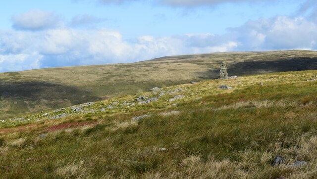
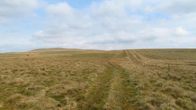
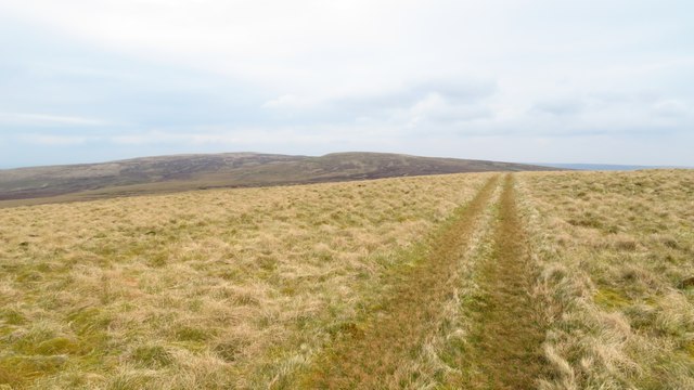
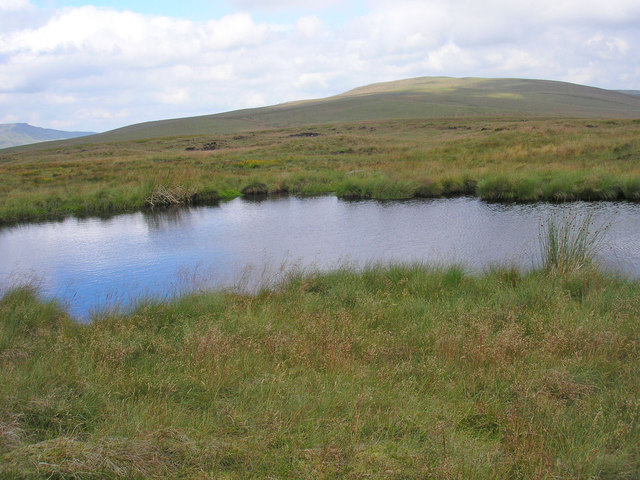
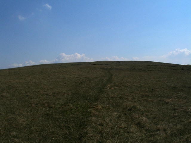
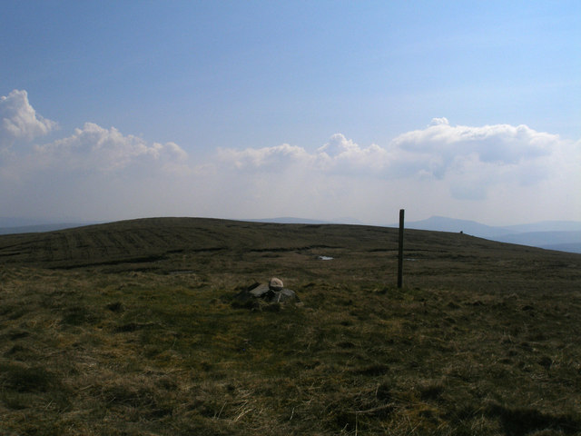
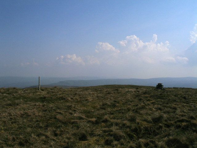
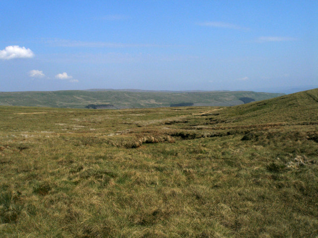
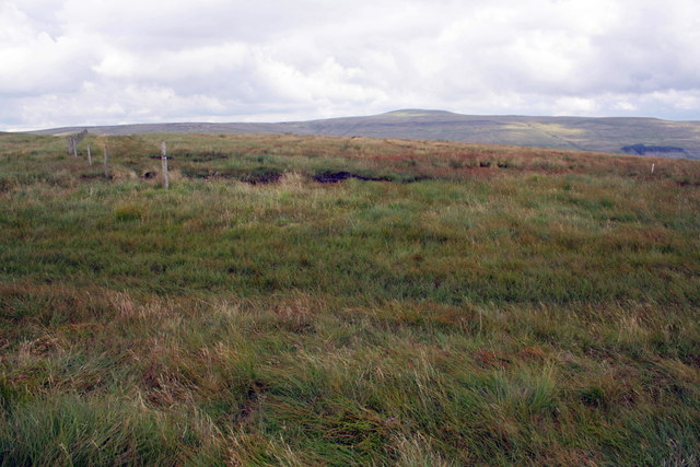
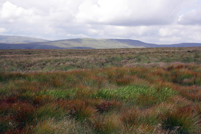
Cotterdale Common is a picturesque area located in the Yorkshire Dales, a region renowned for its stunning natural beauty. Situated in the county of North Yorkshire, England, Cotterdale Common is characterized by its rolling downs and expansive moorland, making it a popular destination for nature enthusiasts and hikers.

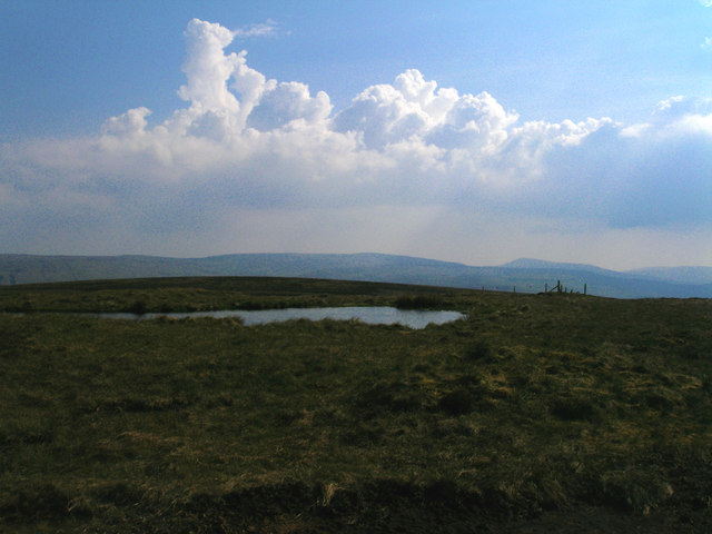
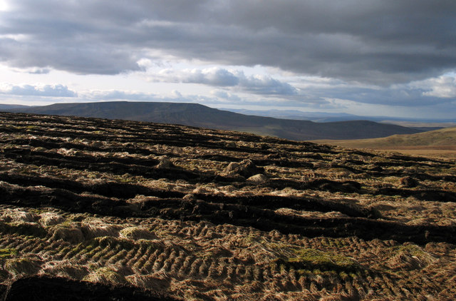
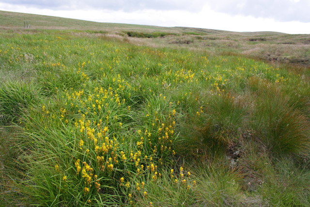
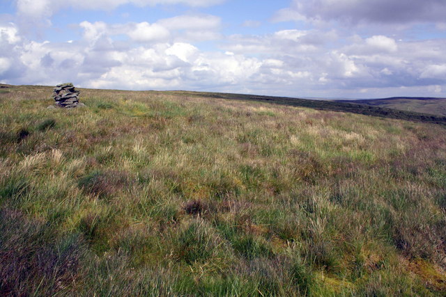
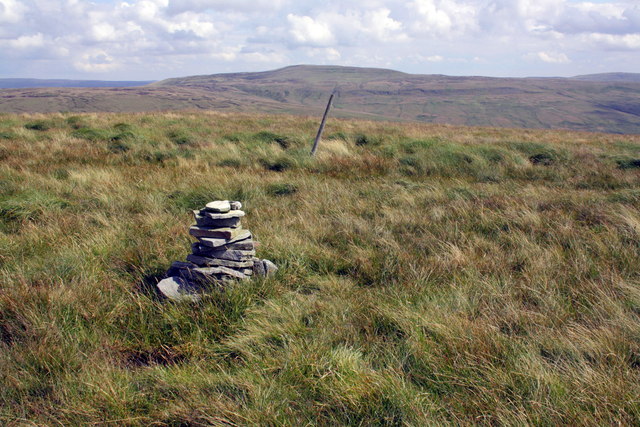
The common is home to a diverse range of flora and fauna, with its open grasslands serving as a habitat for various species of birds, mammals, and wildflowers. The landscape is dotted with dry stone walls, adding to the rustic charm of the area. Walking trails crisscross the common, offering visitors the opportunity to explore its vast expanse and take in breathtaking views of the surrounding countryside.

Cotterdale Common is also rich in history and has been inhabited for centuries. Ancient burial mounds and stone circles can be found in the vicinity, serving as a reminder of the area's past. The common is also associated with traditional farming practices, with sheep grazing on the land during certain times of the year.

Visitors to Cotterdale Common can enjoy the tranquility and solitude of this remote location. The absence of major roads or tourist amenities adds to its appeal as a place to escape the hustle and bustle of everyday life and connect with nature. The area is particularly beautiful during the spring and summer months when wildflowers blanket the landscape in vibrant colors.

Overall, Cotterdale Common offers a unique and idyllic setting for those seeking to immerse themselves in the natural beauty of Yorkshire's countryside.

If you have any feedback on the listing, please let us know in the comments section below.

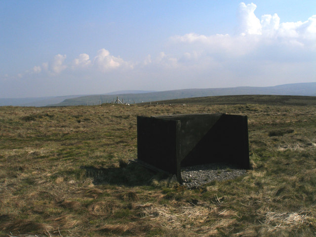
Cotterdale Common Images

Images are sourced within 2km of 54.359173/-2.2843973 or Grid Reference SD8195. Thanks to Geograph Open Source API. All images are credited.

Heather slope descending from Sails The slope is seen descending from beside a cairn close to Ure Head.
Wild Boar Fell is the hill in the distance beyond the Mallerstang valley.
Heather slope descending from Sails
The slope is seen descending from beside a cairn close to Ure Head. Wild Boar Fell is the hill in the distance beyond the Mallerstang valley.
Cairn on Little Fell Nearing the summit.
Cairn on Little Fell
Nearing the summit.
Heading towards Bubble Hill on ATV Track above Garsdale Head
ATV track crossing Ure Head
Tarn A small tarn on Tarn Hill between the High Way and Cotterdale. Looking towards High Seat. Wild Boar Fell is in the distance at the far left.
Tarn
A small tarn on Tarn Hill between the High Way and Cotterdale. Looking towards High Seat. Wild Boar Fell is in the distance at the far left.
On the way to Little Fell
Little Fell summit
Little Fell summit
Summit of Lunds Fell (Sail Fell?) There are several possible names on the OS map
Summit of Lunds Fell (Sail Fell?)
There are several possible names on the OS map
Top of Long Snow Drift Gutter I was going to call this 'headwaters' but 'headbog' would be more appropriate
Top of Long Snow Drift Gutter
I was going to call this 'headwaters' but 'headbog' would be more appropriate
Shooting butt on Tarn Hill There's a line of these new double-sided mega-butts (more like gun emplacements)   Maybe they are heavy duty jobs in case the birds fight back
Shooting butt on Tarn Hill
There's a line of these new double-sided mega-butts (more like gun emplacements) Maybe they are heavy duty jobs in case the birds fight back
Tarn on Tarn Hill
Tarn on Tarn Hill
Ploughed moorland of Little Fell The ploughing seen here is north of the summit of Little Fell - presumably trees will be planted. Wild Boar Fell occupies the horizon.
Ploughed moorland of Little Fell
The ploughing seen here is north of the summit of Little Fell - presumably trees will be planted. Wild Boar Fell occupies the horizon.
Bog asphodel in flower above Keld Gill From Wikipedia:
Narthecium ossifragum, commonly known as bog-, Lancashire- or bastard asphodel, is a plant of Western Europe, found on wet, boggy moorlands up to about 1000 m in elevation. It produces spikes of bright yellow flowers in summer. The bright orange fruits have been used as a colourant to replace saffron by Shetland Islanders. Despite the plant's English name, it is not particularly closely related to the true asphodels.

The Latin name means "weak bone", and refers to a traditional belief that eating the plant caused sheep to develop brittle bones. The probable origin of this story is that sheep eating a calcium-poor diet are likely to develop bone weakness, and N. ossifragum favours acidic, low calcium soils.

The plant causes a disease of sheep called alveld, "elf fire", in Norway. Not all stands of the plant are toxic, and the toxicity may be the side effect of the plant's response to a fungal infection.
Bog asphodel in flower above Keld Gill
From Wikipedia: Narthecium ossifragum, commonly known as bog-, Lancashire- or bastard asphodel, is a plant of Western Europe, found on wet, boggy moorlands up to about 1000 m in elevation. It produces spikes of bright yellow flowers in summer. The bright orange fruits have been used as a colourant to replace saffron by Shetland Islanders. Despite the plant's English name, it is not particularly closely related to the true asphodels. The Latin name means "weak bone", and refers to a traditional belief that eating the plant caused sheep to develop brittle bones. The probable origin of this story is that sheep eating a calcium-poor diet are likely to develop bone weakness, and N. ossifragum favours acidic, low calcium soils. The plant causes a disease of sheep called alveld, "elf fire", in Norway. Not all stands of the plant are toxic, and the toxicity may be the side effect of the plant's response to a fungal infection.
Moorland at Bubble Hill
On the 600m contour
On the 600m contour
A little cairn on Abbotside Common
The cairn and triangulation station pit on Sails In front of the cairn is a hole in which is an Ordnance Survey concrete ring triangulation station: see <span class="nowrap"><a title="http://www.trigpointinguk.com/trigs/trig-details.php?t=7493" rel="nofollow ugc noopener" href="http://www.trigpointinguk.com/trigs/trig-details.php?t=7493">Link</a><img style="margin-left:2px;" alt="External link" title="External link - shift click to open in new window" src="https://s1.geograph.org.uk/img/external.png" width="10" height="10"/></span> for details and photographs.
The cairn and triangulation station pit on Sails
In front of the cairn is a hole in which is an Ordnance Survey concrete ring triangulation station: see LinkExternal link for details and photographs.
The flat top of Little Fell
Show me another place!

Cotterdale Common is located at Grid Ref: SD8195 (Lat: 54.359173, Lng: -2.2843973)

Division: North Riding

Administrative County: North Yorkshire

District: Richmondshire

Police Authority: North Yorkshire

What 3 Words

///gives.formation.fights. Near Kirkby Stephen, Cumbria

Nearby Locations

Cotterdale Common

Related Wikis

Cotterdale

Cotterdale is a small side dale and hamlet on the north side of Wensleydale in North Yorkshire, England. The dale lies to the west of Great Shunner Fell...

Lunds, North Yorkshire

Lunds is a hamlet in North Yorkshire, England, near to the watershed of the Eden and Ure rivers. It is on the border between Cumbria and North Yorkshire...

Hugh Seat

Hugh Seat is a mountain, or more accurately a fell, in Mallerstang on the eastern edge of Cumbria, England. It lies on the border between Cumbria and North...

Vale of Eden

The Vale of Eden is formed by the course of the River Eden, one of the major rivers of Northwest England. It is however of much greater extent than the...

Have you been to Cotterdale Common?

Leave your review of Cotterdale Common below (or comments, questions and feedback).