Burnhope Moor

Downs, Moorland in Durham

England

Burnhope Moor

Peat banks on north-west side of Harwood Common A hill walker following the Tees / Wear watershed on a perfect winter's day.
Harwood Common is a minor moorland hill along the watershed; other hills in the distance are High Field, Chapel Fell and Fendrith Hill.
Peat banks on north-west side of Harwood Common Credit: Trevor Littlewood

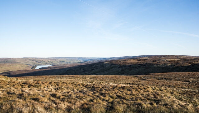
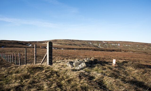
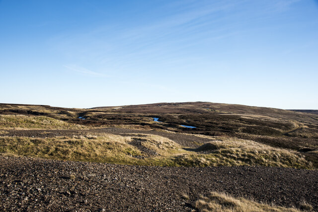
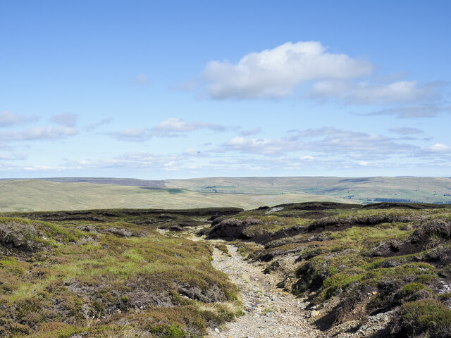
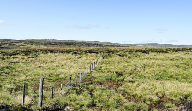
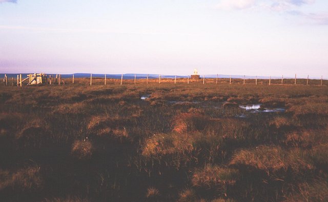
Burnhope Moor is a vast expanse of moorland located in County Durham, England. Situated in the North Pennines Area of Outstanding Natural Beauty, it spans an area of approximately 4,000 hectares. The moorland is characterized by its rolling hills, heather-covered landscapes, and numerous small streams and rivers.

The moor is predominantly composed of acidic peat soil, which provides a unique habitat for a variety of plant and animal species. Heather dominates the vegetation, creating a beautiful purple carpet during the summer months. Other plant species found on the moor include cotton grass, bilberry, and several species of moss.

Burnhope Moor is home to a range of bird species, including the endangered black grouse and the red grouse, which are particularly adapted to the moorland environment. Curlews, lapwings, and golden plovers can also be spotted in the area. The moorland provides an important nesting ground for these birds, as well as a habitat for small mammals such as voles and shrews.

The area has a rich cultural history, with evidence of human activity dating back thousands of years. Archaeological sites, including Bronze Age burial mounds and stone circles, can be found scattered across the moorland. Additionally, the remains of old mine workings serve as a reminder of the area's industrial past.

Burnhope Moor offers visitors a chance to experience the tranquility and natural beauty of the North Pennines. There are several walking and cycling routes that allow exploration of the moor, providing breathtaking views and opportunities for wildlife spotting.

If you have any feedback on the listing, please let us know in the comments section below.

Burnhope Moor Images

Images are sourced within 2km of 54.734507/-2.2893207 or Grid Reference NY8137. Thanks to Geograph Open Source API. All images are credited.

Peat banks on north-west side of Harwood Common A hill walker following the Tees / Wear watershed on a perfect winter's day.
Harwood Common is a minor moorland hill along the watershed; other hills in the distance are High Field, Chapel Fell and Fendrith Hill.
Peat banks on north-west side of Harwood Common
A hill walker following the Tees / Wear watershed on a perfect winter's day. Harwood Common is a minor moorland hill along the watershed; other hills in the distance are High Field, Chapel Fell and Fendrith Hill.
Hill slopes beyond valley of Scraith Burn The stream groove beyond the foreground moorland is that of the Scraith Burn which drains into Burnhope Reservoir, also in the image.
High Field is beyond the shadow of the stream slot.
Hill slopes beyond valley of Scraith Burn
The stream groove beyond the foreground moorland is that of the Scraith Burn which drains into Burnhope Reservoir, also in the image. High Field is beyond the shadow of the stream slot.
Fence crossing Scaud Hill The summit of Scaud Hill has little prominence yet is an obvious location along the fence line following the Tees / Wear watershed. It's a clear high point made more noticeable by the small cairn beside the fence.
Burnhope Seat is the distant, central, moorland hill.
The small rectangle to the right of the cairn looks like a notice but it's just a metal plate fixed to the top wires of the fence to make the presence of the barrier apparent to low-flying grouse.
Fence crossing Scaud Hill
The summit of Scaud Hill has little prominence yet is an obvious location along the fence line following the Tees / Wear watershed. It's a clear high point made more noticeable by the small cairn beside the fence. Burnhope Seat is the distant, central, moorland hill. The small rectangle to the right of the cairn looks like a notice but it's just a metal plate fixed to the top wires of the fence to make the presence of the barrier apparent to low-flying grouse.
Barren, gravelly material on Scaud Hill The rock debris will be the result of mining and ore processing at this remote location close to the 694 m. summit of Scaud Hill. It's supposed that mined material will have been crushed on site and sorted to remove as much waste rock as possible leaving the remaining, useful ore to be transported to a smelt mill. The broken waste rock as seen in the image would be left on site.
Barren, gravelly material on Scaud Hill
The rock debris will be the result of mining and ore processing at this remote location close to the 694 m. summit of Scaud Hill. It's supposed that mined material will have been crushed on site and sorted to remove as much waste rock as possible leaving the remaining, useful ore to be transported to a smelt mill. The broken waste rock as seen in the image would be left on site.
Rough Sike Rough Sike descending towards Burnhope Reservoir which it will reach having merged with the greater stream, Langtae Burn. The reservoir can be seen to be in need of all the water it can get - the level is dramatically low!

Note: A sike, according to Oxford Dictionaries, is... "a small stream or rill, typically one that flows through marshy ground and is often dry in summer"; the term is of Scottish and northern English usage.
Rough Sike
Rough Sike descending towards Burnhope Reservoir which it will reach having merged with the greater stream, Langtae Burn. The reservoir can be seen to be in need of all the water it can get - the level is dramatically low! Note: A sike, according to Oxford Dictionaries, is... "a small stream or rill, typically one that flows through marshy ground and is often dry in summer"; the term is of Scottish and northern English usage.
Plastic mesh matting as hill track Plastic matting of this type is frequently found on moorland to allow vehicle access particularly over wet areas. The track in the image has risen from the valley of the Burnhope Burn. For the majority of the route a hard-surfaced hill road has been built but over the steep boggy ground at this location, the mesh has been used.
Plastic mesh matting as hill track
Plastic matting of this type is frequently found on moorland to allow vehicle access particularly over wet areas. The track in the image has risen from the valley of the Burnhope Burn. For the majority of the route a hard-surfaced hill road has been built but over the steep boggy ground at this location, the mesh has been used.
Peat bank with grouse butt beside Todd Sike The grouse butt is sunken into the peat bank just below the centre of the image. OS, 1:25 000 mapping records a shooting hut in that vicinity but there's not one to be seen and aerial views show nothing either.
The moorland hill Dead Stones is on the horizon just right of centre.
Peat bank with grouse butt beside Todd Sike
The grouse butt is sunken into the peat bank just below the centre of the image. OS, 1:25 000 mapping records a shooting hut in that vicinity but there's not one to be seen and aerial views show nothing either. The moorland hill Dead Stones is on the horizon just right of centre.
Hill track meandering among peat banks The track route has climbed from the valley of the Burnhope Burn beginning as a hard surfaced road, (but not tarmacked), changing in nature according to the type of ground being crossed. Here it's over virtually level ground close to the watershed between Teesdale and Weardale.
Hill track meandering among peat banks
The track route has climbed from the valley of the Burnhope Burn beginning as a hard surfaced road, (but not tarmacked), changing in nature according to the type of ground being crossed. Here it's over virtually level ground close to the watershed between Teesdale and Weardale.
Fence line crossing Langtae Head Langtae Head is an area of moorland along the Tees / Wear watershed taking its name from being the source of the Langtae Burn which drains into Weardale. It's the low point between the moorland hills High Field, (behind the camera position), and Burnhope Seat, which  occupies the left-side horizon in the image.
Fence line crossing Langtae Head
Langtae Head is an area of moorland along the Tees / Wear watershed taking its name from being the source of the Langtae Burn which drains into Weardale. It's the low point between the moorland hills High Field, (behind the camera position), and Burnhope Seat, which occupies the left-side horizon in the image.
Stone-built structure of north side of High Field Tempting to call this a ruin but perhaps it's not. It's certainly in a rickety state but possibly intact. Its purpose is unknown being too small to be used as a pen for any reasonable number of sheep.
Chapel Fell is the distant hill.
Stone-built structure of north side of High Field
Tempting to call this a ruin but perhaps it's not. It's certainly in a rickety state but possibly intact. Its purpose is unknown being too small to be used as a pen for any reasonable number of sheep. Chapel Fell is the distant hill.
Mine shaft south of Scaud Hill The land south of Scaud Hill is scarred with many remnants of the old lead mining industry. Here an old shaft is seen fenced to prevent sheep from falling into it.  The shaft is located almost at the end of an old road climbing from below and is lined with stone at least in its upper section; it has a large and weathered log of timber laid across the top.
In the near distance beyond the shaft old mining deposits can be seen and farther off on the centre skyline is Great Stony Hill or High Field. (To give just two of the names which might be applied to it.)
Mine shaft south of Scaud Hill
The land south of Scaud Hill is scarred with many remnants of the old lead mining industry. Here an old shaft is seen fenced to prevent sheep from falling into it. The shaft is located almost at the end of an old road climbing from below and is lined with stone at least in its upper section; it has a large and weathered log of timber laid across the top. In the near distance beyond the shaft old mining deposits can be seen and farther off on the centre skyline is Great Stony Hill or High Field. (To give just two of the names which might be applied to it.)
Langtae Head
Langtae Head
Scaud Hill
Scaud Hill
High Field
High Field
On Great Stony Hill
On Great Stony Hill
Bog on north side of Scaud Hill Scaud Hill is a minor eminence astride the watershed between Teesdale and Weardale. The view is across moorland slopes and valley grooves, north-west, towards Dead Stones.
Bog on north side of Scaud Hill
Scaud Hill is a minor eminence astride the watershed between Teesdale and Weardale. The view is across moorland slopes and valley grooves, north-west, towards Dead Stones.
Estate road descending on Burnhope Moor Burn Hope is a significant tributary valley to upper Weardale with moorland slopes descending from a number of two thousand foot peaks. The estate road here is descending northwards from the watershed ridge separating Teesdale and Weardale between Great Stony Hill and Scaud Hill.
Estate road descending on Burnhope Moor
Burn Hope is a significant tributary valley to upper Weardale with moorland slopes descending from a number of two thousand foot peaks. The estate road here is descending northwards from the watershed ridge separating Teesdale and Weardale between Great Stony Hill and Scaud Hill.
Shooting hut in Burn Hope Burn Hope is a significant tributary valley to upper Weardale. The shooting hut is a relatively recent construction having a stone in the gable end in view with, presumably, the year of construction, 1996.
Shooting hut in Burn Hope
Burn Hope is a significant tributary valley to upper Weardale. The shooting hut is a relatively recent construction having a stone in the gable end in view with, presumably, the year of construction, 1996.
Show me another place!

Burnhope Moor is located at Grid Ref: NY8137 (Lat: 54.734507, Lng: -2.2893207)

Unitary Authority: County Durham

Police Authority: Durham

What 3 Words

///daredevil.briefer.technical. Near Alston, Cumbria

Nearby Locations

Burnhope Moor

Related Wikis

Far High House Meadows

Far High House Meadows is a Site of Special Scientific Interest in Upper Weardale in west County Durham, England. It consists of three fields, located...

Burnhope Seat

Burnhope Seat is a high moorland fell in the North Pennines Area of Outstanding Natural Beauty (AONB) in northern England. It lies between the heads of...

Burnhope Reservoir railway

The Burnhope Reservoir railway was an industrial narrow gauge railway built to serve the construction of Burnhope Reservoir near Weardale. An extensive...

New House, County Durham

New House or Newhouse is a hamlet in the civil parish of Stanhope, in County Durham, England. It lies on the north side of the River Wear, opposite Ireshopeburn...

Wearhead

Wearhead is a village in the civil parish of Stanhope, in County Durham, England. It is situated at the top of Weardale between Cowshill and Ireshopeburn...

Cornriggs

Cornriggs is a hamlet in the civil parish of Stanhope, in County Durham, England. It is situated on the north side of Weardale in the North Pennines,...

Wearhead railway station

Wearhead railway station served the village of Wearhead, County Durham, England, from 1895 to 1961 on the Weardale Railway. == History == The station opened...

Cowshill

Cowshill is a village in the civil parish of Stanhope, in County Durham, England. It is situated at the top of Weardale, between Lanehead and Wearhead...

Nearby Amenities

Located within 500m of 54.734507,-2.2893207
Hunting Stand
Hunting Stand: grouse_butt
Lat/Long: 54.7347989/-2.2917759
Hunting Stand
Hunting Stand: grouse_butt
Lat/Long: 54.7353835/-2.2916257
Hunting Stand
Hunting Stand: grouse_butt
Lat/Long: 54.7359108/-2.291497
Hunting Stand
Hunting Stand: grouse_butt
Lat/Long: 54.7364334/-2.2913723
Hunting Stand
Hunting Stand: grouse_butt
Lat/Long: 54.7369948/-2.2912288
Hunting Stand
Hunting Stand: grouse_butt
Lat/Long: 54.7375538/-2.291096
Hunting Stand
Hunting Stand: grouse_butt
Lat/Long: 54.7380183/-2.2909766
Hunting Stand
Hunting Stand: grouse_butt
Lat/Long: 54.7385115/-2.2908613
Hunting Stand
Hunting Stand: grouse_butt
Lat/Long: 54.731381/-2.2943777
The data included in this document is from www.openstreetmap.org. The data is made available under ODbL.

Have you been to Burnhope Moor?

Leave your review of Burnhope Moor below (or comments, questions and feedback).