Seedgreen Park

Downs, Moorland in Worcestershire Malvern Hills

England

Seedgreen Park

Oak tree in an arable field Oak tree in an arable field between Astely Cross and Dunley.
Oak tree in an arable field Credit: Philip Halling

Seedgreen Park is a picturesque green space located in Worcestershire, England. It covers a vast area of downs and moorland, offering visitors a tranquil and scenic escape from the hustle and bustle of city life. The park is known for its diverse range of flora and fauna, making it a haven for nature enthusiasts and wildlife lovers.

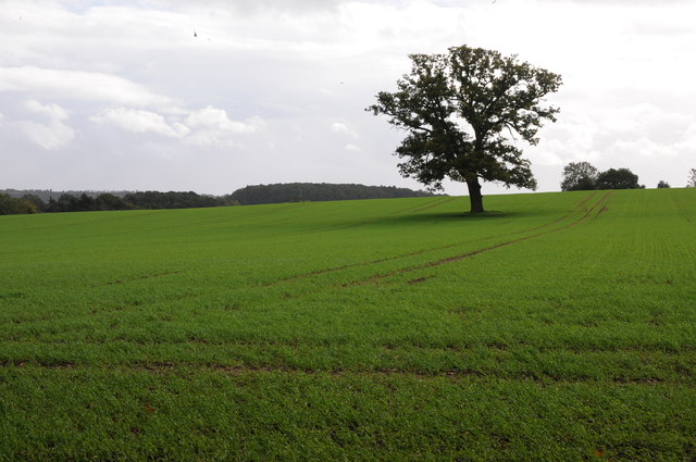
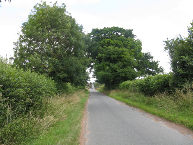
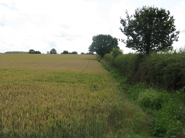
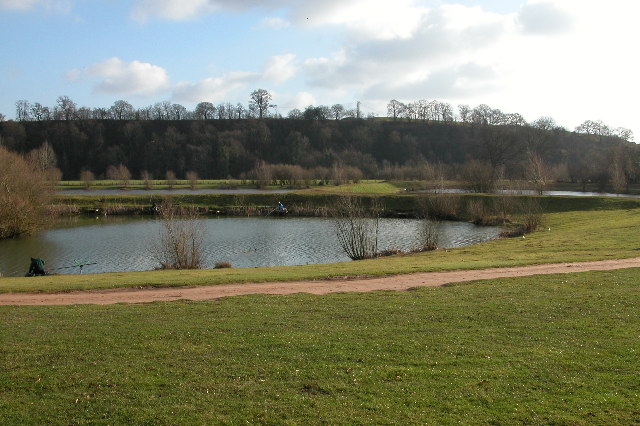
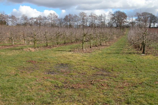
The downs at Seedgreen Park are characterized by their rolling hills and expansive grasslands. These open spaces provide ample opportunities for recreational activities such as picnicking, kite flying, and frisbee. The park also boasts several well-maintained walking and hiking trails, allowing visitors to explore the beautiful landscape at their own pace.

In addition to the downs, Seedgreen Park is also home to vast stretches of moorland. This rugged terrain is covered in heather, gorse, and other vegetation, creating a unique and vibrant ecosystem. The moorland is a popular spot for birdwatching, with various species of birds including skylarks and kestrels frequently spotted in the area.

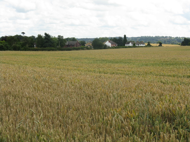
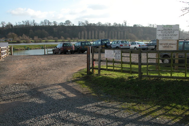
Visitors to Seedgreen Park can enjoy stunning views of the surrounding countryside, with the Malvern Hills visible in the distance. The park is well-equipped with amenities, including picnic areas, public toilets, and ample parking space. There is also a visitor center that provides information on the park's history, wildlife, and walking routes.

Overall, Seedgreen Park in Worcestershire offers a peaceful retreat for individuals and families alike, with its beautiful downs, moorland, and abundant wildlife. It is a must-visit destination for those seeking a connection with nature and a break from the urban environment.

If you have any feedback on the listing, please let us know in the comments section below.

Seedgreen Park Images

Images are sourced within 2km of 52.31577/-2.2750975 or Grid Reference SO8168. Thanks to Geograph Open Source API. All images are credited.

Oak tree in an arable field Oak tree in an arable field between Astely Cross and Dunley.
Oak tree in an arable field
Oak tree in an arable field between Astely Cross and Dunley.
Pool House, Astley Grade II listed Gothic Revival country house in the village of Astley, near Stourport-on-Severn
Pool House, Astley
Grade II listed Gothic Revival country house in the village of Astley, near Stourport-on-Severn
New Barns Farm The old farmhouse is on the right and the barns, now converted into <a href="https://www.geograph.org.uk/photo/218662">SO7969 : The Steadings</a> can be seen in the distance.  Behind the photographer the urban development of <a href="https://www.geograph.org.uk/photo/218636">SO7969 : Edge of Areley Kings</a> and Stourport and then much of the West Midlands commences.
New Barns Farm
The old farmhouse is on the right and the barns, now converted into SO7969 : The Steadings can be seen in the distance. Behind the photographer the urban development of SO7969 : Edge of Areley Kings and Stourport and then much of the West Midlands commences.
Edge of Areley Kings Looking the other way from <a href="https://www.geograph.org.uk/photo/218563">SO7969 : New Barns Farm</a> towards the edge of the Areley Kings area of Stourport.
Edge of Areley Kings
Looking the other way from SO7969 : New Barns Farm towards the edge of the Areley Kings area of Stourport.
The Steadings The converted barns at New Barns Farm on the edge of Stourport-on-Severn. These are the barns just visible from near <a href="https://www.geograph.org.uk/photo/218563">SO7969 : New Barns Farm</a> farmhouse.
The Steadings
The converted barns at New Barns Farm on the edge of Stourport-on-Severn. These are the barns just visible from near SO7969 : New Barns Farm farmhouse.
Straight Lane To Astley Cross
Footpath South
Footpath South
Field Near Oakhampton
Road approaching Burf Cottages, The Burf
The Hampstall Inn, The Burf This is a popular inn overlooking the River Severn between Worcester and Stourport-on-Severn.
The Hampstall Inn, The Burf
This is a popular inn overlooking the River Severn between Worcester and Stourport-on-Severn.
The River Severn at The Burf This is the view of the River Severn from the front of The Hempstalls Inn.
The River Severn at The Burf
This is the view of the River Severn from the front of The Hempstalls Inn.
Fishing lake at Larford Farm This is the southern end of a large fishing lake at Larford Farm. Below the dark bank in the background is the River Severn
Fishing lake at Larford Farm
This is the southern end of a large fishing lake at Larford Farm. Below the dark bank in the background is the River Severn
Fishing lake at Larford Farm Popular fishing lake to the south of Stourport-on-Severn.
Fishing lake at Larford Farm
Popular fishing lake to the south of Stourport-on-Severn.
Longmore Hill Farm Like many farms this farm to the south of Stourport-on-Severn has been converted into residential accommodation.
Longmore Hill Farm
Like many farms this farm to the south of Stourport-on-Severn has been converted into residential accommodation.
Wyneyards, Lineholt
Wyneyards, Lineholt
Little Winnal Farm, Lineholt Former farm which has been converted to residential accommodation.
Little Winnal Farm, Lineholt
Former farm which has been converted to residential accommodation.
Chicken shed near Lincomb
Orchard on Lincomb Lane, Lincomb
Show me another place!

Seedgreen Park is located at Grid Ref: SO8168 (Lat: 52.31577, Lng: -2.2750975)

Administrative County: Worcestershire

District: Malvern Hills

Police Authority: West Mercia

What 3 Words

///shunning.modifies.soaks. Near Stourport-on-Severn, Worcestershire

Related Wikis

Astley Burf

Astley Burf is a hamlet in the parish of Astley, Worcestershire, England, on the banks of the River Severn. Within the hamlet there is one riverside public...

Astley Cross

Astley Cross is a village in Worcestershire, England, located on the outskirts of Stourport-on-Severn. The village lies 1 mile (1.6 km) south of the centre...

Astley Hall, Stourport-on-Severn

Astley Hall is a country house in Astley near Stourport-on-Severn, Worcestershire, England. The hall was the home of Prime Minister Stanley Baldwin from...

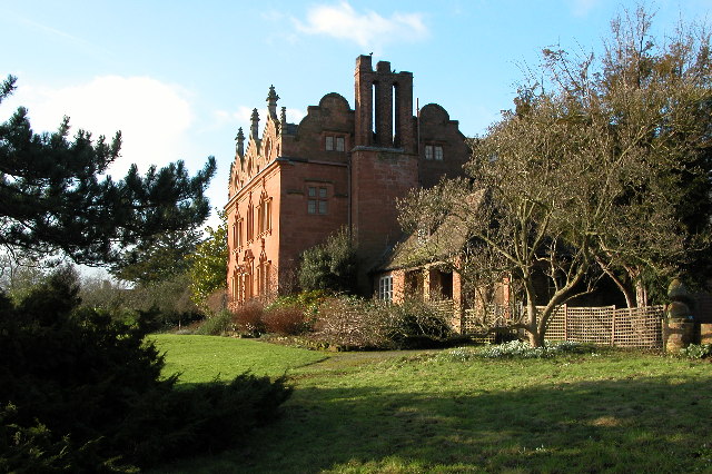
Pool House, Worcestershire

Pool House is a Grade II* listed house in Astley, in the county of Worcestershire, England.In the area close to Stourport-on-Severn, there are several...
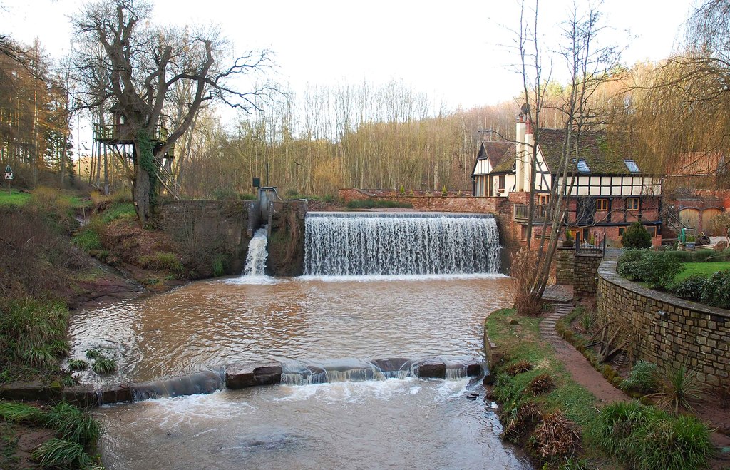
Dick Brook

Dick Brook is small tributary stream of the River Severn that flows through Worcestershire, England.The brook is formed from two small unnamed streams...

Stourport power stations

Stourport power stations were two electricity generating stations that supplied electricity to Stourport-on-Severn, Worcestershire and to the wider West...

Areley Kings

Areley Kings is a village on the River Severn in the Wyre District of Worcestershire, England. It is 10 miles north of Worcester and south of Stourport...

River Stour, Worcestershire

The Stour (, rhymes with "flour") is a river flowing through the counties of Worcestershire, the West Midlands and Staffordshire in the West Midlands region...

Nearby Amenities

Located within 500m of 52.31577,-2.2750975
Power: tower
Lat/Long: 52.3137941/-2.2744045
Barrier: stile
Foot: yes
Lat/Long: 52.3157827/-2.2738707
Barrier: stile
Foot: yes
Lat/Long: 52.3180838/-2.2730199
Power: pole
Lat/Long: 52.3126979/-2.2703667
Power: pole
Lat/Long: 52.3155773/-2.2679554
Power: pole
Lat/Long: 52.3136424/-2.2698437
Power: pole
Lat/Long: 52.3151689/-2.2690256
Power: tower
Lat/Long: 52.314093/-2.2790202
Barrier: fence
Lat/Long: 52.3172456/-2.2796705
Power: pole
Lat/Long: 52.3194404/-2.2736316
Seed Green Park
Power: pole
Transformer: distribution
Voltage Primary: 11000
Lat/Long: 52.3166994/-2.2763467
Power: pole
Lat/Long: 52.3175797/-2.2759353
Power: pole
Lat/Long: 52.3184977/-2.2747716
Power: pole
Lat/Long: 52.3146692/-2.277383
Power: pole
Lat/Long: 52.315741/-2.276794
Severn Sports - Trans
Power: pole
Transformer: distribution
Voltage Primary: 11000
Lat/Long: 52.318145/-2.2728846
Power: pole
Lat/Long: 52.3183358/-2.2738351
Barrier: stile
Lat/Long: 52.3137867/-2.2781307
Power: pole
Lat/Long: 52.3122052/-2.2786653
Scots Cottage
Power: pole
Transformer: distribution
Voltage Primary: 11000
Lat/Long: 52.3125496/-2.2784776
Power: pole
Lat/Long: 52.3130997/-2.2781557
The Firs
Power: pole
Transformer: distribution
Voltage Primary: 11000
Lat/Long: 52.3138318/-2.277803
Power: pole
Lat/Long: 52.3139204/-2.2777708
Power: pole
Lat/Long: 52.3150354/-2.2802156
Power: pole
Lat/Long: 52.3152555/-2.281947
Power: pole
Lat/Long: 52.3150911/-2.2806448
Power: pole
Lat/Long: 52.3149182/-2.2793198
Power: pole
Lat/Long: 52.3147034/-2.2776702
The data included in this document is from www.openstreetmap.org. The data is made available under ODbL.

Have you been to Seedgreen Park?

Leave your review of Seedgreen Park below (or comments, questions and feedback).