East Pasture

Downs, Moorland in Yorkshire Richmondshire

England

East Pasture

Hill track at Arten Gill Moss
Hill track at Arten Gill Moss Credit: Colin Park

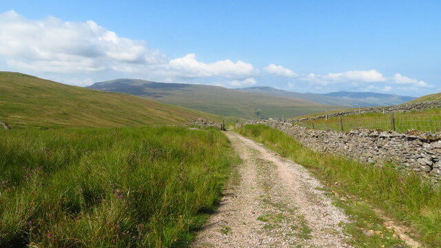
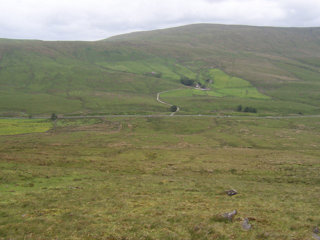
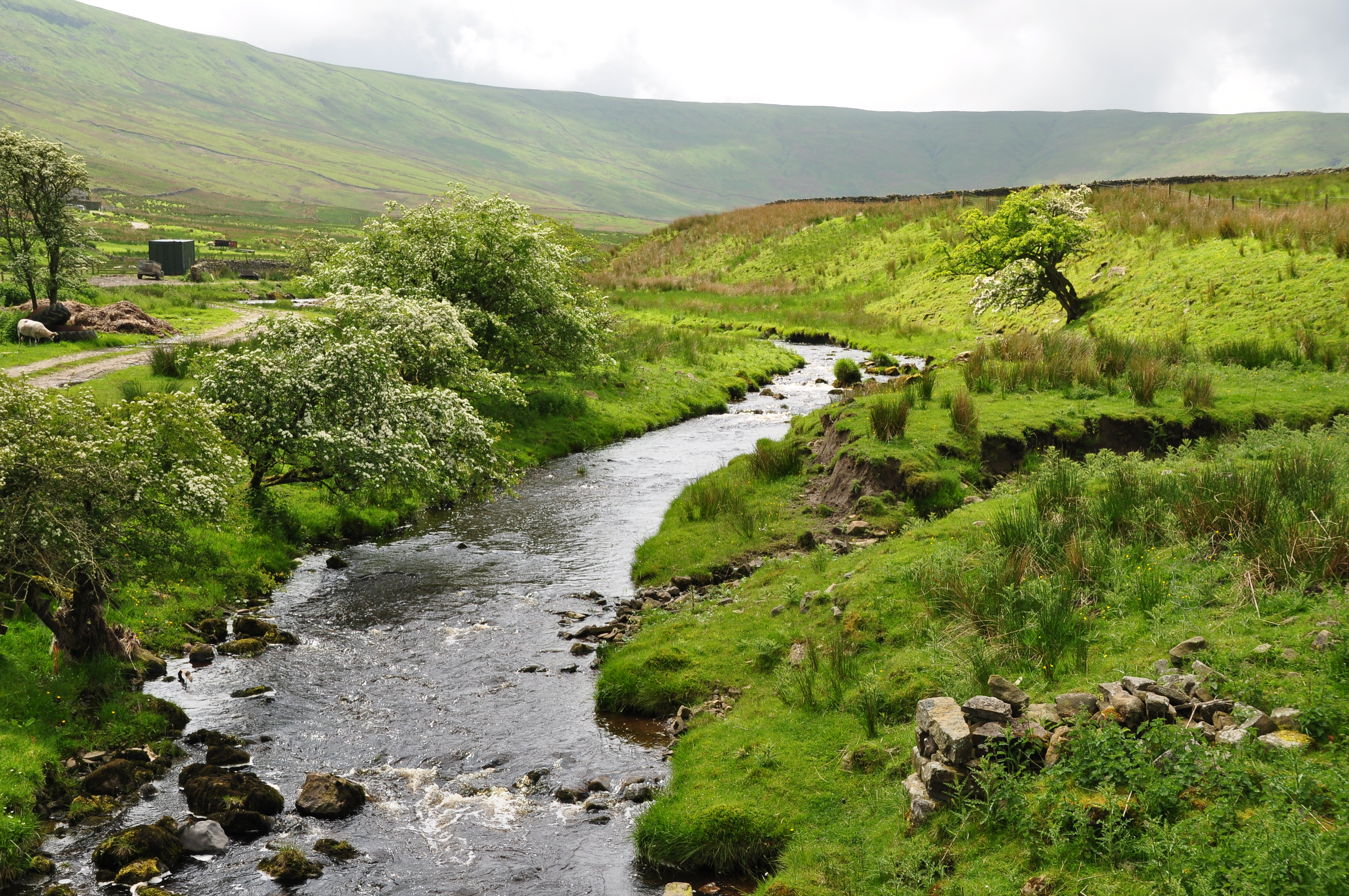
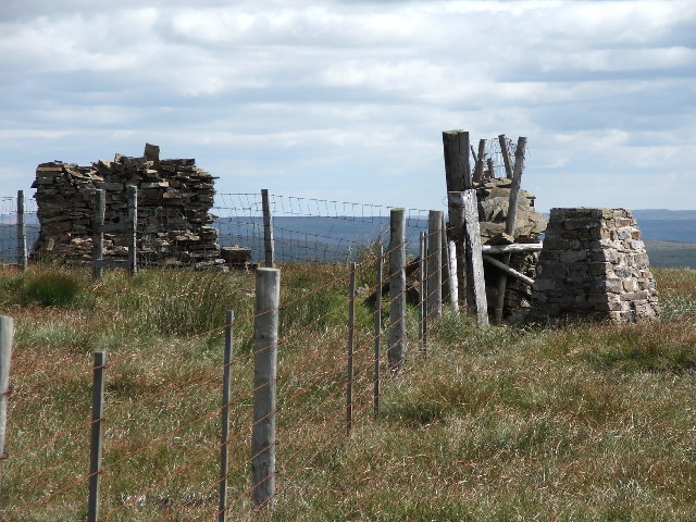
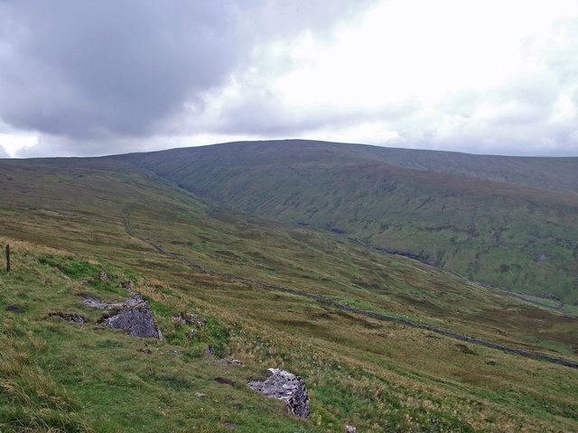
East Pasture is a picturesque area located in Yorkshire, known for its stunning downs and expansive moorland. The landscape is characterized by rolling hills, vast open fields, and rugged terrain, making it a popular destination for hikers, nature enthusiasts, and outdoor adventurers.

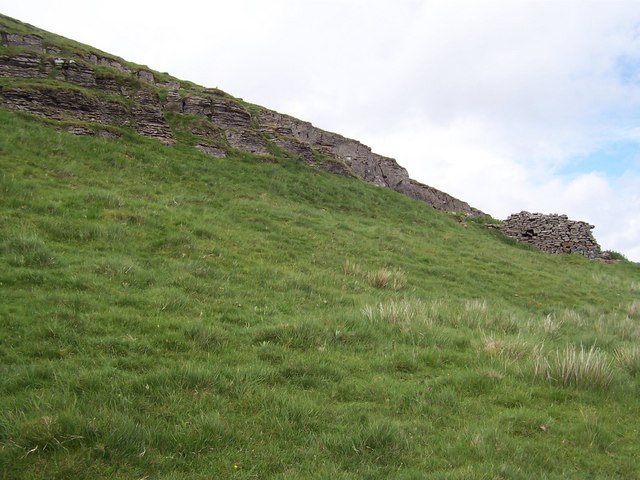
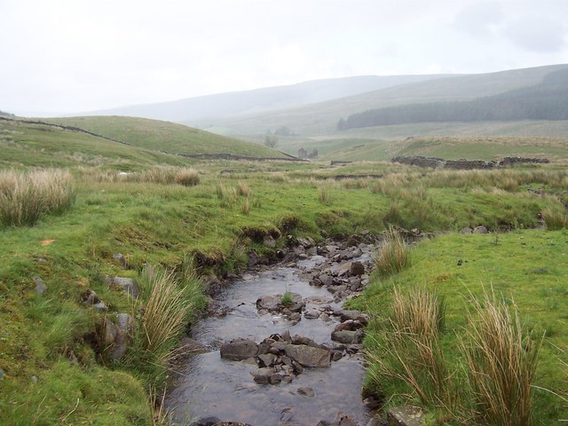
The downs in East Pasture are covered in lush grasses and wildflowers, providing a rich habitat for a variety of wildlife such as birds, rabbits, and deer. The moorland, on the other hand, is made up of heather-covered hills and rocky outcrops, offering breathtaking views of the surrounding countryside.

Visitors to East Pasture can enjoy long walks and hikes along the numerous trails that crisscross the area, taking in the stunning scenery and peaceful surroundings. There are also opportunities for birdwatching, picnicking, and even camping in designated areas.

Overall, East Pasture is a beautiful and tranquil location that showcases the natural beauty of Yorkshire, making it a must-visit destination for those looking to escape the hustle and bustle of city life and immerse themselves in the great outdoors.

If you have any feedback on the listing, please let us know in the comments section below.

East Pasture Images

Images are sourced within 2km of 54.266022/-2.2911248 or Grid Reference SD8185. Thanks to Geograph Open Source API. All images are credited.

Hill track at Arten Gill Moss
Arten Gill Moss Climbing Great Knoutberry Hill.
Arten Gill Moss
Climbing Great Knoutberry Hill.
Old milestone At SD 7984 is the boundary between the old West & North Ridings.   The last West Riding CC milestone south of the boundary is reached has now disappeared completely.   <a href="https://www.geograph.org.uk/photo/6072143">SD7984 : Old Boundary Marker by the B6255, Newby Head, Ingleton parish</a>.   This old, weathered stone is the most southerly one on the B6255, at Widdale Head, probably set up by the Sedbergh Turnpike trust in the early 19C.   This Trust covered a total of 62 miles on roads leading from and near Sedbergh   There is a very faint 6/HAWES near the base which has been highlighted in chalk.
Old milestone
At SD 7984 is the boundary between the old West & North Ridings. The last West Riding CC milestone south of the boundary is reached has now disappeared completely. SD7984 : Old Boundary Marker by the B6255, Newby Head, Ingleton parish. This old, weathered stone is the most southerly one on the B6255, at Widdale Head, probably set up by the Sedbergh Turnpike trust in the early 19C. This Trust covered a total of 62 miles on roads leading from and near Sedbergh There is a very faint 6/HAWES near the base which has been highlighted in chalk.
Ford at Mid Widdale This ford is found at Mid Widdale on the Widdale Beck
Ford at Mid Widdale
This ford is found at Mid Widdale on the Widdale Beck
Mirk Pot Woods The path through Mirk Pot Woods, where there are lots of Red Squirrels.
Mirk Pot Woods
The path through Mirk Pot Woods, where there are lots of Red Squirrels.
Stone Gill Foot At the top of Snaizeholme.
Stone Gill Foot
At the top of Snaizeholme.
Redshaw. Looking NE down the A6255 towards Widdale and Hawes.
Redshaw.
Looking NE down the A6255 towards Widdale and Hawes.
Cottages at West Field Situated above the west bank of Snaizeholme Beck, now surrounded by plantation
Cottages at West Field
Situated above the west bank of Snaizeholme Beck, now surrounded by plantation
Stone Gill Foot Remote farm house in the upper reaches of Snaizeholme Beck - the furthest habitation up the dale
Stone Gill Foot
Remote farm house in the upper reaches of Snaizeholme Beck - the furthest habitation up the dale
Valley of Snaizeholme Beck Perhaps it should be Snaizeholme Dale in these parts.  This looks down the length of this secluded and little visited valley, north towards Wensleydale
Valley of Snaizeholme Beck
Perhaps it should be Snaizeholme Dale in these parts. This looks down the length of this secluded and little visited valley, north towards Wensleydale
Isolated Plantation and Grove Head This was taken while ascending Snaizeholme Fell, now available to walkers through Open Access arrangements.  Grove Head is where Snaizeholme Beck is born.  The high ground above carries the old Roman Cam High Road - a superb green lane now adopted by the Pennine Way.
Isolated Plantation and Grove Head
This was taken while ascending Snaizeholme Fell, now available to walkers through Open Access arrangements. Grove Head is where Snaizeholme Beck is born. The high ground above carries the old Roman Cam High Road - a superb green lane now adopted by the Pennine Way.
Snaizeholme Fell Summit plateau, of a windswept expanse tussocky grass at around 1,770 feet in altitude
Snaizeholme Fell
Summit plateau, of a windswept expanse tussocky grass at around 1,770 feet in altitude
Rocky Outcrops, Snaizeholme Fell Near the summit, one is obliged to negotiate these rock formations to reach the top
Rocky Outcrops, Snaizeholme Fell
Near the summit, one is obliged to negotiate these rock formations to reach the top
Upper Widdale From Snaizeholme Fell, the view across Upper Widdale, with the B6255 Hawes to Ingleton Road at the bottom
Upper Widdale
From Snaizeholme Fell, the view across Upper Widdale, with the B6255 Hawes to Ingleton Road at the bottom
Lings Beck Tumbles off the flanks of Great Knoutberry Fell to help fill the waters of Widdale Beck
Lings Beck
Tumbles off the flanks of Great Knoutberry Fell to help fill the waters of Widdale Beck
Beldie Gill One of the many streams, gills and becks that flow off the heights of Widdale Fell to add to the waters of Widdale Beck
Beldie Gill
One of the many streams, gills and becks that flow off the heights of Widdale Fell to add to the waters of Widdale Beck
Ranley Gill Plantation Large Plantation on the flanks of Widdale Fell. This track passing through is at the foot, running parallel to Widdale Beck
Ranley Gill Plantation
Large Plantation on the flanks of Widdale Fell. This track passing through is at the foot, running parallel to Widdale Beck
Flora, Snaizeholme Fell Despite the hostile conditions at 1,780 feet above sea level, these alpine like plants seem to thrive.  Is it saxifrage?
Flora, Snaizeholme Fell
Despite the hostile conditions at 1,780 feet above sea level, these alpine like plants seem to thrive. Is it saxifrage?
Show me another place!

East Pasture is located at Grid Ref: SD8185 (Lat: 54.266022, Lng: -2.2911248)

Division: North Riding

Administrative County: North Yorkshire

District: Richmondshire

Police Authority: North Yorkshire

What 3 Words

///glaze.sweep.cosmic. Near Sedbergh, Cumbria

Nearby Locations

East Pasture

Related Wikis

Snaizeholme

Snaizeholme is a small side valley of Wensleydale in the Yorkshire Dales National Park (YDNP), North Yorkshire, England. The valley is noted for its red...

Newby Head

Newby Head, Newby Head Farm or Newby Head Inn is part of the Beresford Estate and was a popular drovers' inn in North Yorkshire, England. Now a farmhouse...

Great Knoutberry Hill

Great Knoutberry Hill, also commonly known as Widdale Fell, is a mountain located near Dent at the heads of Ribblesdale, Dentdale and Wensleydale, in the...

Dodd Fell Hill

Dodd Fell Hill is a hill in the Yorkshire Dales, in North Yorkshire, England. It is classed as a Marilyn (a hill with topographic prominence of at least...

Nearby Amenities

Located within 500m of 54.266022,-2.2911248
Power: pole
Lat/Long: 54.2695171/-2.289475
Power: pole
Lat/Long: 54.2689814/-2.2901255
Power: pole
Lat/Long: 54.268407/-2.2908306
Power: pole
Lat/Long: 54.2678677/-2.291478
Power: pole
Lat/Long: 54.2673035/-2.292168
Power: pole
Lat/Long: 54.2667466/-2.2928531
Power: pole
Lat/Long: 54.2661912/-2.2935268
Power: pole
Lat/Long: 54.2656387/-2.2942144
Power: pole
Lat/Long: 54.2651419/-2.2947915
Power: pole
Lat/Long: 54.2646509/-2.2954113
Power: pole
Lat/Long: 54.2642142/-2.2959508
Power: pole
Lat/Long: 54.2637862/-2.2964703
Power: pole
Lat/Long: 54.2698313/-2.2901731
Power: pole
Lat/Long: 54.2703471/-2.2912722
Power: pole
Lat/Long: 54.2665517/-2.2944239
Power: pole
Lat/Long: 54.2670631/-2.2957288
Power: pole
Lat/Long: 54.2674471/-2.2966798
Power: pole
Lat/Long: 54.2679908/-2.2980499
The data included in this document is from www.openstreetmap.org. The data is made available under ODbL.

Have you been to East Pasture?

Leave your review of East Pasture below (or comments, questions and feedback).