Coalcleugh Moor

Downs, Moorland in Northumberland

England

Coalcleugh Moor

Furniture on Killhope Cross County sign, Weardale sign, watershed and the old stone cross stand beside the highest point an "A" Road attains in England.
Furniture on Killhope Cross Credit: Chris Heaton

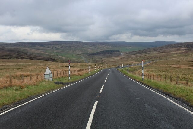
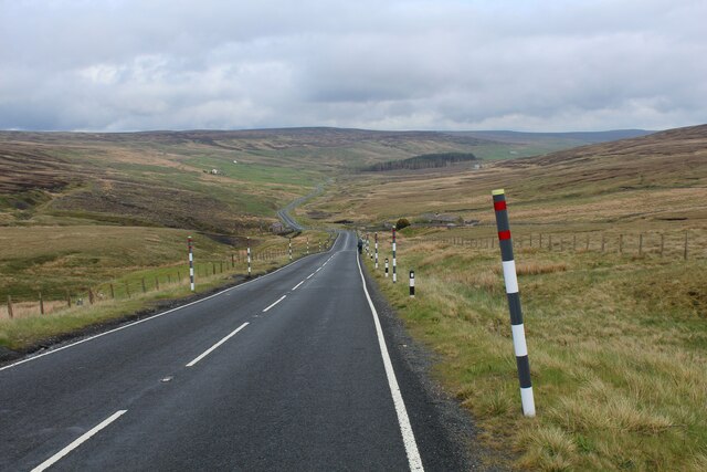
Coalcleugh Moor is a vast expanse of upland moorland situated in the county of Northumberland, England. Covering an area of approximately 1,200 hectares, it forms part of the larger North Pennines Area of Outstanding Natural Beauty.

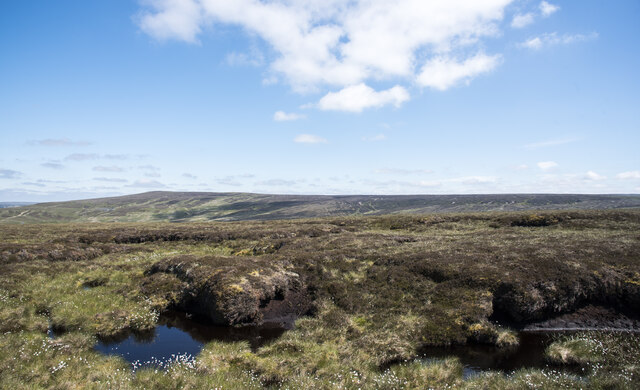
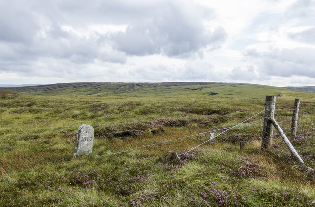
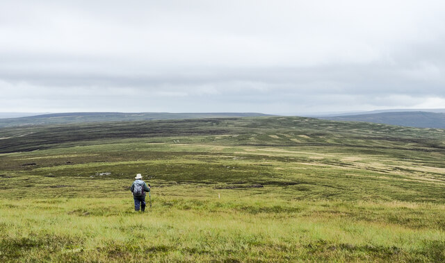
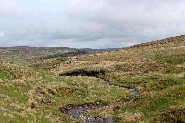
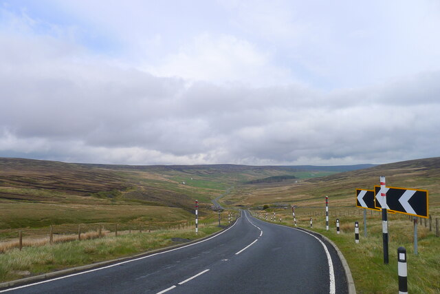
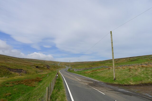
The moorland is characterized by its rolling hills, expansive heather-covered landscapes, and deep valleys carved by rivers over thousands of years. At an elevation of around 500 meters above sea level, the area offers breathtaking panoramic views of the surrounding countryside.

Coalcleugh Moor is known for its rich biodiversity, providing a habitat for a wide range of flora and fauna. The heather-dominated vegetation supports a variety of bird species, including red grouse, skylarks, and curlews. Rare plants such as cotton grass and bog rosemary can also be found in the wetter areas of the moor.

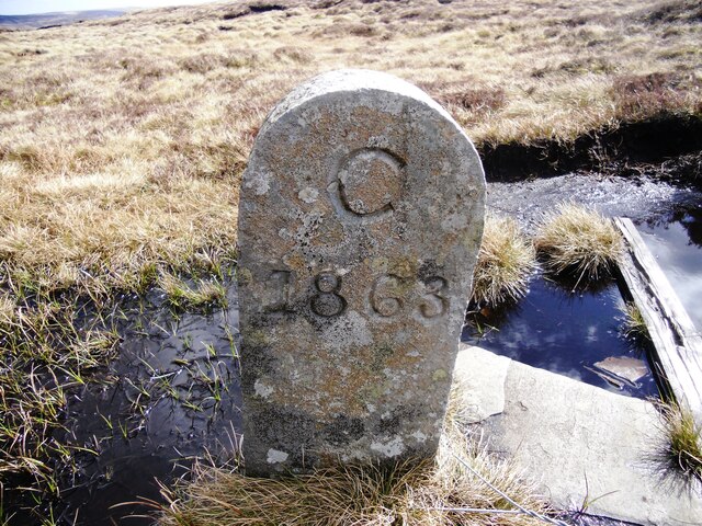
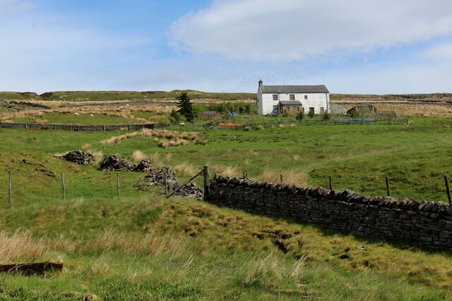
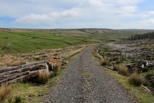
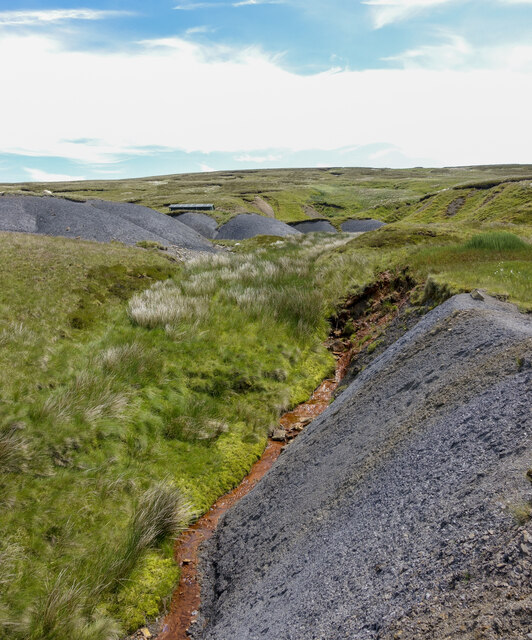
The area has a long history of human activity, with evidence of Bronze Age settlements and mining activities dating back centuries. The remnants of old lead mines and associated structures can still be seen today, serving as a reminder of the area's industrial past.

Coalcleugh Moor offers a tranquil and remote environment for outdoor enthusiasts. It is traversed by a network of footpaths and bridleways, providing opportunities for hiking, cycling, and horse riding. The moorland's unspoiled beauty and sense of isolation make it an ideal destination for those seeking a peaceful retreat in the heart of Northumberland's stunning countryside.

If you have any feedback on the listing, please let us know in the comments section below.

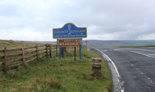
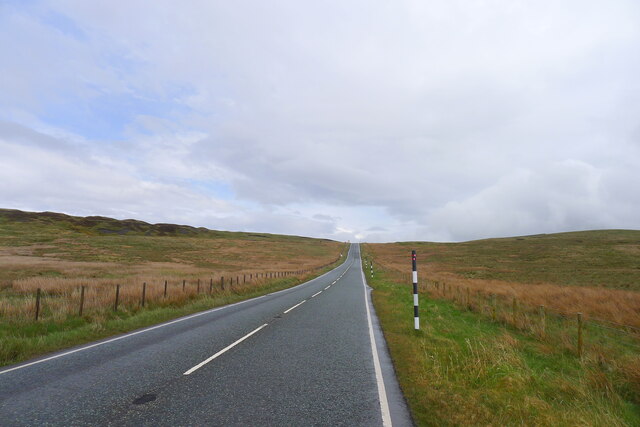
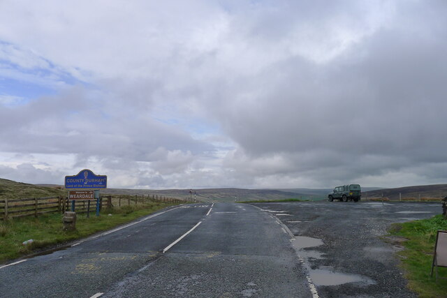
Coalcleugh Moor Images

Images are sourced within 2km of 54.799197/-2.2985403 or Grid Reference NY8044. Thanks to Geograph Open Source API. All images are credited.

Furniture on Killhope Cross County sign, Weardale sign, watershed and the old stone cross stand beside the highest point an "A" Road attains in England.
Furniture on Killhope Cross
County sign, Weardale sign, watershed and the old stone cross stand beside the highest point an "A" Road attains in England.
The A689 climbing eastward to the watershed at Slate Hill Leaving Nentdale and approaching the head of Weardale
The A689 climbing eastward to the watershed at Slate Hill
Leaving Nentdale and approaching the head of Weardale
The A689 crossing the Cumbria/Durham county boundary at the top of Slate Hill The 'Kilhope Cross' stone cross in front of the sign is a Listed Grade II "Boundary marker of uncertain date but possibly medieval; moved to its present site in C18." <span class="nowrap"><a title="https://historicengland.org.uk/listing/the-list/list-entry/1326948?section=official-list-entry" rel="nofollow ugc noopener" href="https://historicengland.org.uk/listing/the-list/list-entry/1326948?section=official-list-entry">Link</a><img style="margin-left:2px;" alt="External link" title="External link - shift click to open in new window" src="https://s1.geograph.org.uk/img/external.png" width="10" height="10"/></span>
The A689 crossing the Cumbria/Durham county boundary at the top of Slate Hill
The 'Kilhope Cross' stone cross in front of the sign is a Listed Grade II "Boundary marker of uncertain date but possibly medieval; moved to its present site in C18." LinkExternal link
Peat banks on The Dodd There's a prominent cairn at the camera position, not in view in the image of course. It's likely that it was built to mark what someone considered to be the hill's summit but others think differently. The authoritative web site 'Hillbagging' has the summit to be at NY 79159 45761, over 100 m. SSW. of the cairn. At a different location again there's an OS spot height of 614 m. which might well be an accurate height but of course there's no necessary claim of that as the highest point. It's impossible to judge; when at The Dodd's summit area there are clearly countless locations which could be the prime one!
The view from the cairn over the peat banks is across the head of West Allendale with Killhope Law distant.
Peat banks on The Dodd
There's a prominent cairn at the camera position, not in view in the image of course. It's likely that it was built to mark what someone considered to be the hill's summit but others think differently. The authoritative web site 'Hillbagging' has the summit to be at NY 79159 45761, over 100 m. SSW. of the cairn. At a different location again there's an OS spot height of 614 m. which might well be an accurate height but of course there's no necessary claim of that as the highest point. It's impossible to judge; when at The Dodd's summit area there are clearly countless locations which could be the prime one! The view from the cairn over the peat banks is across the head of West Allendale with Killhope Law distant.
Boundary stone near fence angle on Slate Hill Slate Hill is a location close to the A689 at Killhope Cross, the highest point reached by any A-classified road in England.
The stone is cleanly and deeply cut, 'C 1863'. It's on the County Durham / Cumbria boundary  which in 1863 would have been between Durham and Cumberland. It's possible then, but not certain that the C denotes the county; there's no corresponding D on the other side, nothing in fact.
Knoutberry Hill is in the distance.
Boundary stone near fence angle on Slate Hill
Slate Hill is a location close to the A689 at Killhope Cross, the highest point reached by any A-classified road in England. The stone is cleanly and deeply cut, 'C 1863'. It's on the County Durham / Cumbria boundary which in 1863 would have been between Durham and Cumberland. It's possible then, but not certain that the C denotes the county; there's no corresponding D on the other side, nothing in fact. Knoutberry Hill is in the distance.
Old Boundary Marker County Boundary Marker against the boundary fence on Slate Hill, north of  Killhope Cross CBED_ALS. On the boundary of Alston Moor, Cumbria, was Cumberland, and Stanhope, County Durham.

Milestone Society National ID: CU_ALMSTA02cb
Old Boundary Marker
County Boundary Marker against the boundary fence on Slate Hill, north of Killhope Cross CBED_ALS. On the boundary of Alston Moor, Cumbria, was Cumberland, and Stanhope, County Durham. Milestone Society National ID: CU_ALMSTA02cb
Heading away from Killhope Law A hill walker heading along the broad moorland ridge separating Weardale lying to the right, and West Allendale. Killhope Law's summit is around 300 metres behind the camera position.
Heading away from Killhope Law
A hill walker heading along the broad moorland ridge separating Weardale lying to the right, and West Allendale. Killhope Law's summit is around 300 metres behind the camera position.
Headwaters of Killhope Burn One of the main feeders of the River Wear, flowing east downstream
Headwaters of Killhope Burn
One of the main feeders of the River Wear, flowing east downstream
Descending East off Killhope Cross A689 descending off Killhope Cross into County Durham and towards Weardale
Descending East off Killhope Cross
A689 descending off Killhope Cross into County Durham and towards Weardale
Killhope Bank The A689 descending off Killhope Cross into Weardale
Killhope Bank
The A689 descending off Killhope Cross into Weardale
White Hall Remote dwelling as seen from the A689, beside the upper reaches of the Killhope Burn
White Hall
Remote dwelling as seen from the A689, beside the upper reaches of the Killhope Burn
Weardale Way descending towards Killhope Lead Mining Museum This is very close to the western terminus of the Weardale Way. 
The track is in the Weardale Forest, which has been recently been felled in this location.
Weardale Way descending towards Killhope Lead Mining Museum
This is very close to the western terminus of the Weardale Way. The track is in the Weardale Forest, which has been recently been felled in this location.
The A689 descending Killhope Bank into the head of Weardale
The A689 leading up to the head of Weardale Cumbria starts at the horizon
The A689 leading up to the head of Weardale
Cumbria starts at the horizon
Moorland on south side of Blackway Head The foreground bog is adjacent to the route of a bridleway now incorporated into the named walk, Isaac's Tea Trail. The shallow dome on the horizon to the right is the minor summit at Blackway Head; to the left of it is the location named as Three Curricks.
Moorland on south side of Blackway Head
The foreground bog is adjacent to the route of a bridleway now incorporated into the named walk, Isaac's Tea Trail. The shallow dome on the horizon to the right is the minor summit at Blackway Head; to the left of it is the location named as Three Curricks.
Ochreous stream beside shaley slope Ochre is an iron oxide or hydroxide present in certain rocks and often found in uplands staining pools and watercourses. The flow of the stream in the image (Bridge Cleugh) is particularly strongly affected.
The loose, shaley material beside the stream is a natural feature. The similar piles higher on the slope have been bulldozed to create a flat parking area for a shooting hut - its roof can be seen.
Ochreous stream beside shaley slope
Ochre is an iron oxide or hydroxide present in certain rocks and often found in uplands staining pools and watercourses. The flow of the stream in the image (Bridge Cleugh) is particularly strongly affected. The loose, shaley material beside the stream is a natural feature. The similar piles higher on the slope have been bulldozed to create a flat parking area for a shooting hut - its roof can be seen.
Trig point and summit area of Killhope Law The pillar stands on the Northumberland / County Durham boundary. It's seen here in dry conditions; more usually there's something of a moat there, as in an image from Andrew Curtis - <a title="https://www.geograph.org.uk/photo/6595945" href="https://www.geograph.org.uk/photo/6595945">Link</a> .
The undulations on the left horizon are the Great and Little Dun Fells and Cross Fell.
Trig point and summit area of Killhope Law
The pillar stands on the Northumberland / County Durham boundary. It's seen here in dry conditions; more usually there's something of a moat there, as in an image from Andrew Curtis - Link . The undulations on the left horizon are the Great and Little Dun Fells and Cross Fell.
Abandoned shooting hut on Killhope Law Almost twelve years on from an earlier image - <a title="https://www.geograph.org.uk/photo/2029676" href="https://www.geograph.org.uk/photo/2029676">Link</a> - there's been significant deterioration to the building. Stone has burst from the bulge in the wall to the left of the door and there's a greater loss at the visible rear corner.
Abandoned shooting hut on Killhope Law
Almost twelve years on from an earlier image - Link - there's been significant deterioration to the building. Stone has burst from the bulge in the wall to the left of the door and there's a greater loss at the visible rear corner.
Show me another place!

Coalcleugh Moor is located at Grid Ref: NY8044 (Lat: 54.799197, Lng: -2.2985403)

Unitary Authority: Northumberland

Police Authority: Northumbria

What 3 Words

///branching.purses.telephone. Near Alston, Cumbria

Related Wikis

Coalcleugh

Coalcleugh is a hamlet in Northumberland, England. It is situated in the Pennines between Penrith and Hexham. In the past it was well known as a lead mining...

Old Moss Lead Vein

Old Moss Lead Vein, also known as Killhope Head, is a Site of Special Scientific Interest in the Wear Valley district of County Durham, England. It consists...

Killhope Cross

Killhope Cross (elevation 627 m; 2,057 ft) is a mountain pass in the English Pennines. The pass divides Weardale to the east and Cumbria to the west. The...

Carr Shield

Carrshield is a village in Northumberland, in England. It is situated in the Pennines approximately between Penrith and Hexham. It is a small village with...

Nearby Amenities

Located within 500m of 54.799197,-2.2985403
Green Hills
Place: locality
Lat/Long: 54.7993366/-2.2959069
Whetstone Mea
Place: locality
Lat/Long: 54.8002166/-2.3042303
The data included in this document is from www.openstreetmap.org. The data is made available under ODbL.

Have you been to Coalcleugh Moor?

Leave your review of Coalcleugh Moor below (or comments, questions and feedback).