Kevelin Moor

Downs, Moorland in Northumberland

England

Kevelin Moor

Old railway goods van near Limestone Brae The location of this old railway goods van is shown in <a href="https://www.geograph.org.uk/photo/2632397">NY7950 : West Allen Dale around Limestone Brae</a> and <a href="https://www.geograph.org.uk/photo/2632414">NY7950 : West Allen Dale north of Limestone Brae</a>.
Old railway goods van near Limestone Brae Credit: Mike Quinn

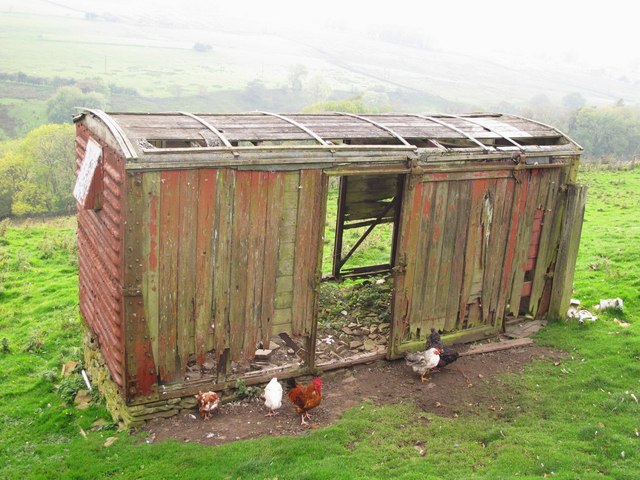
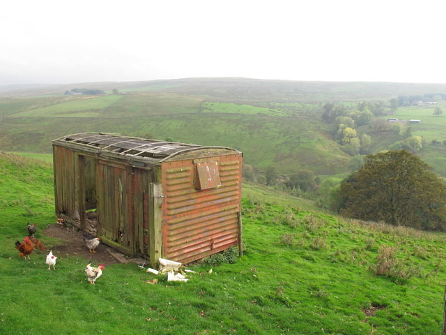
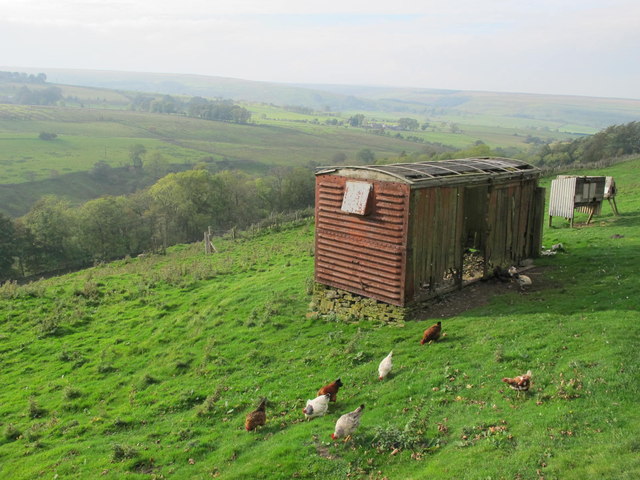
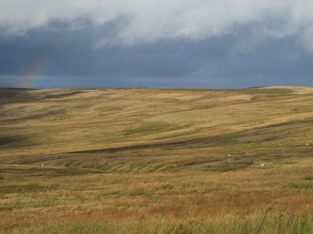
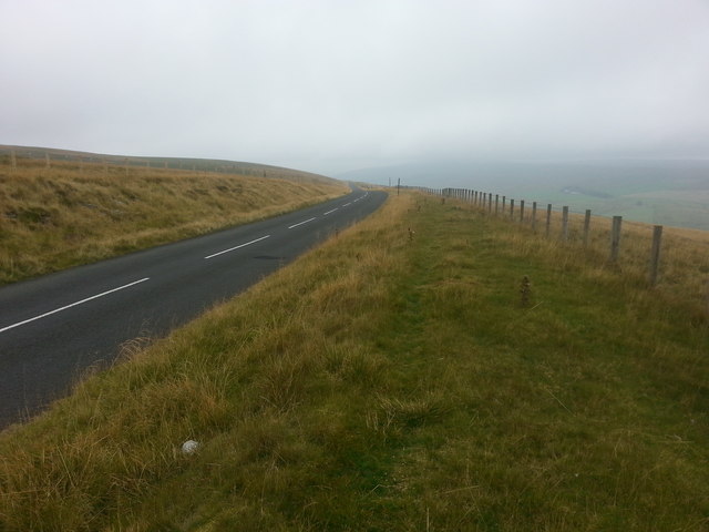
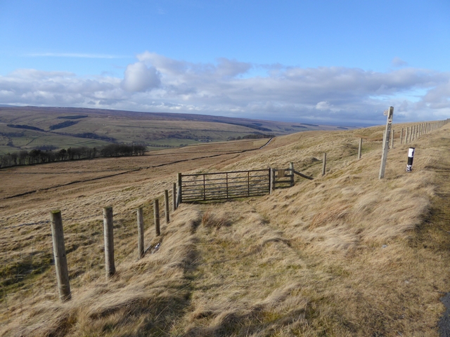
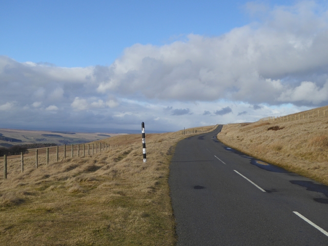
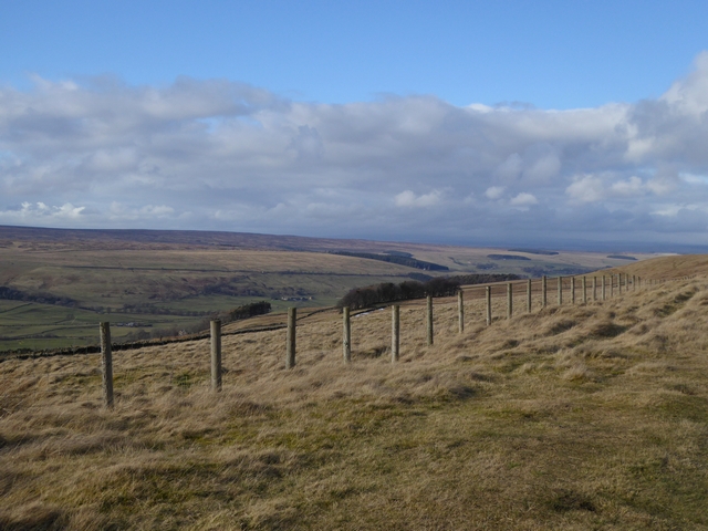
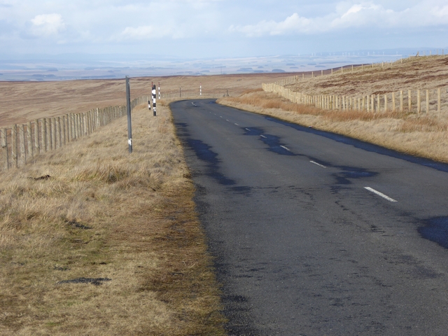
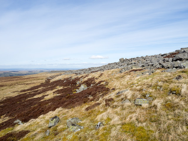
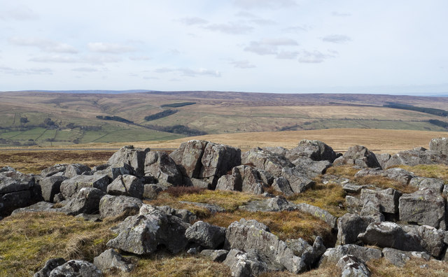
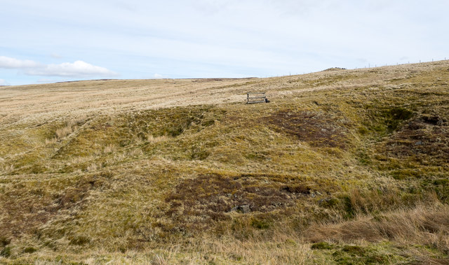
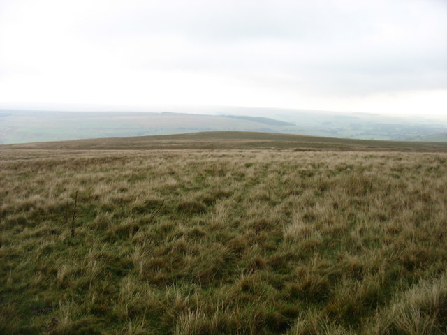
Kevelin Moor is a picturesque area located in Northumberland, England. It is characterized by its stunning downs and moorland scenery, making it a popular destination for nature enthusiasts and hikers. The moorland is a vast open space, covered in heather and grass, offering breathtaking views of the surrounding countryside.

Situated in the northern part of Northumberland, Kevelin Moor is known for its diverse wildlife and rich biodiversity. It is home to a range of bird species, including curlews, lapwings, and red grouse. The moorland provides a natural habitat for these birds, as well as other animals such as rabbits, foxes, and deer. Visitors can often spot these creatures as they explore the area.

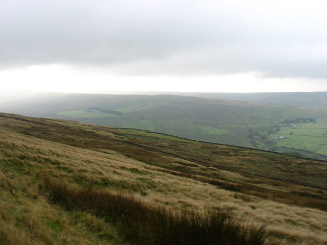
The downs of Kevelin Moor are another highlight of the landscape. Rolling hills covered in green grass create a visually striking panorama. Walking along the downs, visitors can appreciate the tranquility of the surroundings and enjoy the fresh air. On clear days, the views from the higher points of the downs extend for miles, providing an uninterrupted vista of the Northumberland countryside.

Kevelin Moor offers a range of walking trails, catering to both beginners and experienced hikers. These trails allow visitors to explore the moorland and downs, immersing themselves in the natural beauty of the area. The rugged terrain and open spaces make it an ideal location for outdoor activities, such as picnicking, photography, or simply enjoying a peaceful retreat in nature.

Overall, Kevelin Moor, Northumberland, is a captivating destination that showcases the beauty of the English countryside. With its stunning downs, moorland, and diverse wildlife, it offers a unique and unforgettable experience for those who visit.

If you have any feedback on the listing, please let us know in the comments section below.

Kevelin Moor Images

Images are sourced within 2km of 54.848323/-2.2997597 or Grid Reference NY8050. Thanks to Geograph Open Source API. All images are credited.

Old railway goods van near Limestone Brae The location of this old railway goods van is shown in <a href="https://www.geograph.org.uk/photo/2632397">NY7950 : West Allen Dale around Limestone Brae</a> and <a href="https://www.geograph.org.uk/photo/2632414">NY7950 : West Allen Dale north of Limestone Brae</a>.
Old railway goods van near Limestone Brae
The location of this old railway goods van is shown in NY7950 : West Allen Dale around Limestone Brae and NY7950 : West Allen Dale north of Limestone Brae.
West Allen Dale around Limestone Brae Shows the location of <a href="https://www.geograph.org.uk/photo/2632388">NY7950 : Old railway goods van near Limestone Brae</a>.
West Allen Dale around Limestone Brae
West Allen Dale north of Limestone Brae Shows the location of <a href="https://www.geograph.org.uk/photo/2632388">NY7950 : Old railway goods van near Limestone Brae</a>.
West Allen Dale north of Limestone Brae
Dryburn Moor Looking NNE from just south of Dryburn Bridge on the Allendale to Carrshield road across <a href="https://www.geograph.org.uk/photo/413043">NY7952 : Dry Burn Cleugh</a> towards Middle Edge. The top of <a href="https://www.geograph.org.uk/photo/2158383">NY8053 : The southern Allendale lead smelting flue chimney</a> can be seen on the horizon (far right, above a patch of lighter coloured ground).
Dryburn Moor
Looking NNE from just south of Dryburn Bridge on the Allendale to Carrshield road across NY7952 : Dry Burn Cleugh towards Middle Edge. The top of NY8053 : The southern Allendale lead smelting flue chimney can be seen on the horizon (far right, above a patch of lighter coloured ground).
Descending Acton Moor
Path to Taylorburn On the hillside above West Allendale. Compare with the snowy scene at <a href="https://www.geograph.org.uk/photo/1705418">NY7950 : Path to Taylorburn</a>.
Path to Taylorburn
On the hillside above West Allendale. Compare with the snowy scene at NY7950 : Path to Taylorburn.
Moorland road to Allendale This moorland road linking the upper end of West Allendale with Allendale Town rises to almost 500 metres above sea level.
Moorland road to Allendale
This moorland road linking the upper end of West Allendale with Allendale Town rises to almost 500 metres above sea level.
Fence line above West Allendale
Gate and fence above West Allendale
Moorland road to Allendale This moorland road linking Carrshield and Allendale Town rises to almost 500 metres above sea level.
Moorland road to Allendale
This moorland road linking Carrshield and Allendale Town rises to almost 500 metres above sea level.
Greenleycleugh Crags Greenleycleugh Crags is a long, low band of rock on the flank of Brownley Hill overlooking West Allendale. The rock is broken into blocks with little in the way of any continuous rock face.
Greenleycleugh Crags
Greenleycleugh Crags is a long, low band of rock on the flank of Brownley Hill overlooking West Allendale. The rock is broken into blocks with little in the way of any continuous rock face.
Rocks of Greenleycleugh Crags Greenleycleugh Crags is a long, low band of rock on the flank of Brownley Hill overlooking West Allendale which is the valley beyond the blocks. The distant ground is Whitfield Moor.
Rocks of Greenleycleugh Crags
Greenleycleugh Crags is a long, low band of rock on the flank of Brownley Hill overlooking West Allendale which is the valley beyond the blocks. The distant ground is Whitfield Moor.
Moorland across Dryburn Cleugh Dryburn Cleugh is the groove immediately in the foreground of the image; Dryburn Moor lies beyond. The fencing to the right of the image centre surrounds an open shaft in the hill slope which angles down into the ground. In such a location, West Allendale in the North Pennines, it's tempting to think that there's a metal mining connection but the photographer is more inclined towards it being a naturally developed cavity.
Moorland across Dryburn Cleugh
Dryburn Cleugh is the groove immediately in the foreground of the image; Dryburn Moor lies beyond. The fencing to the right of the image centre surrounds an open shaft in the hill slope which angles down into the ground. In such a location, West Allendale in the North Pennines, it's tempting to think that there's a metal mining connection but the photographer is more inclined towards it being a naturally developed cavity.
On Dryburn Moor
On Dryburn Moor
On Kevelin Moor Looking down into West Allen Dale.
On Kevelin Moor
Looking down into West Allen Dale.
Old Milestone on the Allendale to Carrshield road The Milestone is located by the road.  Parish of West Allen (Tynedale District). Carved stone post, Haydon Bridge stone design, erected by the Alston turnpike trust in the 18th century.


Inscription reads:-  
Allendale 6 / (Coalcleugh 2¾) 

Milestone Society National ID: NB_ALCO06
Old Milestone on the Allendale to Carrshield road
The Milestone is located by the road.  Parish of West Allen (Tynedale District). Carved stone post, Haydon Bridge stone design, erected by the Alston turnpike trust in the 18th century. Inscription reads:- Allendale 6 / (Coalcleugh 2¾) Milestone Society National ID: NB_ALCO06
Ford, River West Allen, Limestone Brae A byway here fords the River West Allen in the valley deep below the hamlet of Limestone Brae.
Ford, River West Allen, Limestone Brae
A byway here fords the River West Allen in the valley deep below the hamlet of Limestone Brae.
Zig-zagging byway, Limestone Brae View from across the valley of the byway climbing after fording the River West Allen.
Zig-zagging byway, Limestone Brae
View from across the valley of the byway climbing after fording the River West Allen.
Show me another place!

Kevelin Moor is located at Grid Ref: NY8050 (Lat: 54.848323, Lng: -2.2997597)

Unitary Authority: Northumberland

Police Authority: Northumbria

What 3 Words

///fractions.legwork.groom. Near Alston, Cumbria

Nearby Locations

Brownley Hill Kevelin Moor

Related Wikis

Throssel Hole Buddhist Abbey

Throssel Hole Buddhist Abbey is a Buddhist monastery and retreat centre located in Northumberland, in northern England. The monastic order is equally for...

Allendale Moors

Allendale Moors is a Site of Special Scientific Interest (SSSI) in Northumberland, England. The upland moorland ridge site is listed for its heath, flush...

Acton, Northumberland

Acton is a small hamlet in Northumberland, north-east England, about 3 miles (5 km) south of Allendale Town. Acton is usually Anglo-Saxon Old English...

Carr Shield

Carrshield is a village in Northumberland, in England. It is situated in the Pennines approximately between Penrith and Hexham. It is a small village with...

Nearby Amenities

Located within 500m of 54.848323,-2.2997597
Kevelin Moor
Place: locality
Lat/Long: 54.8477287/-2.3073241
The data included in this document is from www.openstreetmap.org. The data is made available under ODbL.

Have you been to Kevelin Moor?

Leave your review of Kevelin Moor below (or comments, questions and feedback).