Bramsike Moss

Downs, Moorland in Durham

England

Bramsike Moss

Moorland west of Highwatch Currick Highwatch Currick is a location on the broad moorland ridge east from Dead Stones; there's a cairn there and a trig point, both seen in the distance
Moorland west of Highwatch Currick Credit: Trevor Littlewood

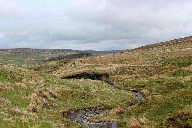
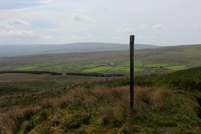
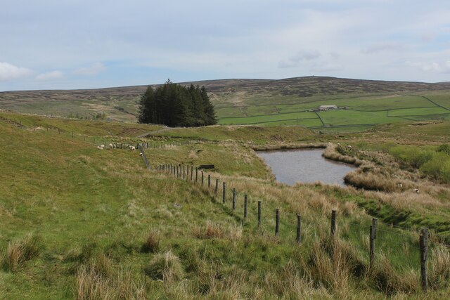
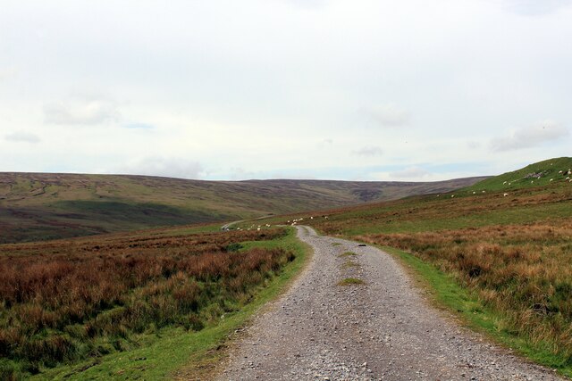
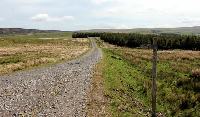
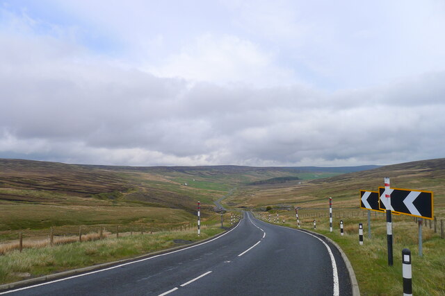
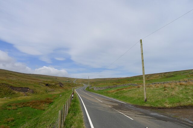
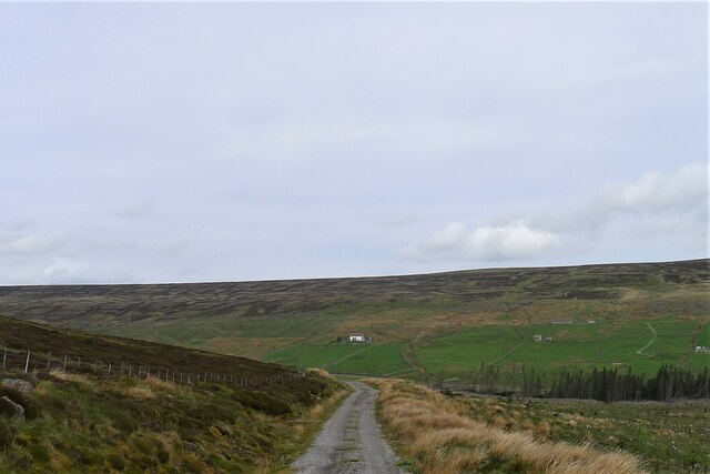
Bramsike Moss is a picturesque area located in Durham, England. It is situated in the Downs and Moorland region, known for its stunning natural beauty and diverse wildlife. The moss is characterized by its vast expanse of marshy land, covered with a variety of moss species, grasses, and heathers.

The landscape of Bramsike Moss is dominated by its unique wetland ecosystem. The area is home to several rare and endangered plant and animal species, making it a haven for nature enthusiasts and wildlife photographers. Visitors can expect to encounter an array of bird species, including the iconic curlew, lapwing, and red grouse.

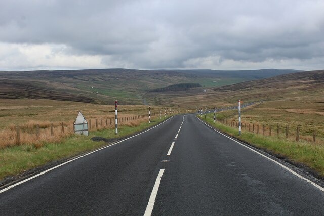
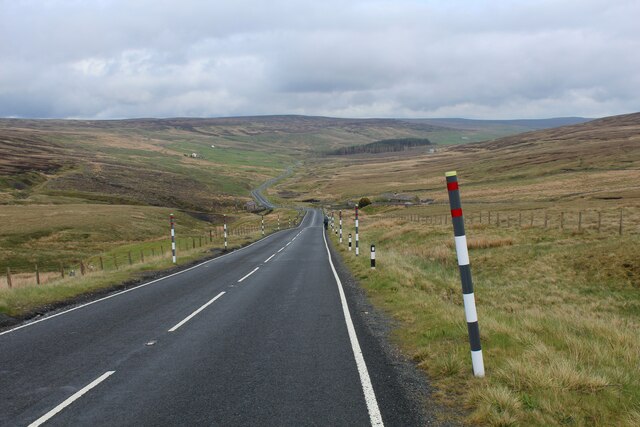
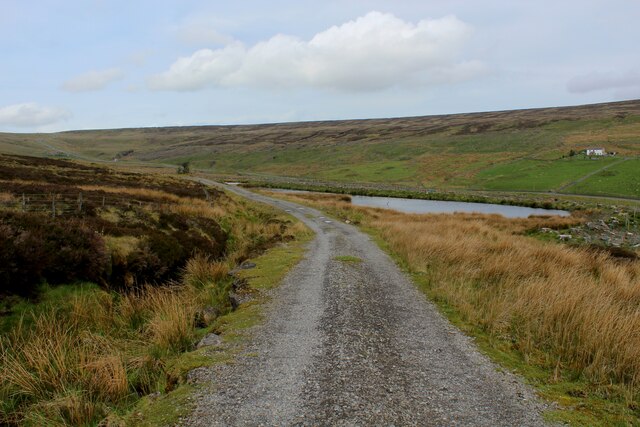
The moss is crisscrossed by a network of walking trails, allowing visitors to explore and immerse themselves in the tranquility of the area. These trails offer breathtaking views of the surrounding countryside, with rolling hills and distant moorlands creating a picturesque backdrop.

Bramsike Moss is also of historical significance, with evidence of human activity dating back thousands of years. Archaeological finds in the area include ancient settlements, burial sites, and remnants of farming practices. These historical remnants add an extra layer of fascination to the natural beauty of the moss.

Overall, Bramsike Moss is a must-visit destination for those seeking to experience the beauty of Durham's Downs and Moorland region. With its diverse flora and fauna, stunning landscapes, and historical significance, it offers a unique and enriching experience for nature lovers and history enthusiasts alike.

If you have any feedback on the listing, please let us know in the comments section below.

Bramsike Moss Images

Images are sourced within 2km of 54.767164/-2.3003714 or Grid Reference NY8041. Thanks to Geograph Open Source API. All images are credited.

Moorland west of Highwatch Currick Highwatch Currick is a location on the broad moorland ridge east from Dead Stones; there's a cairn there and a trig point, both seen in the distance
Moorland west of Highwatch Currick
Highwatch Currick is a location on the broad moorland ridge east from Dead Stones; there's a cairn there and a trig point, both seen in the distance
White Edge
White Edge
Scurraberry
Scurraberry
Old Wall, Scurraberry Quite a surprise to see this old wall in the grass
Old Wall, Scurraberry
Quite a surprise to see this old wall in the grass
Old Boundary Marker near Perry's Dam, Nenthead Mine Reservoir Boundary Marker against a wire fence east of Perry's Dam, south of Nenthead. Alston Moor parish. Inscribed P and A on opposite faces. For information on Perry’s Dam, a Scheduled Monument, see <span class="nowrap"><a title="https://historicengland.org.uk/listing/the-list/list-entry/1015859" rel="nofollow ugc noopener" href="https://historicengland.org.uk/listing/the-list/list-entry/1015859">Link</a><img style="margin-left:2px;" alt="External link" title="External link - shift click to open in new window" src="https://s1.geograph.org.uk/img/external.png" width="10" height="10"/></span>.

Milestone Society National ID: CU_ALSM16em
Old Boundary Marker near Perry's Dam, Nenthead
Mine Reservoir Boundary Marker against a wire fence east of Perry's Dam, south of Nenthead. Alston Moor parish. Inscribed P and A on opposite faces. For information on Perry’s Dam, a Scheduled Monument, see LinkExternal link. Milestone Society National ID: CU_ALSM16em
Old Boundary Marker near Perry's Dam, Nenthead Mine Reservoir Boundary Marker against a wire fence east of Perry's Dam, south of Nenthead. Alston Moor parish. Inscribed P and A on opposite faces. For information on Perry’s Dam, a Scheduled Monument, see <span class="nowrap"><a title="https://historicengland.org.uk/listing/the-list/list-entry/1015859" rel="nofollow ugc noopener" href="https://historicengland.org.uk/listing/the-list/list-entry/1015859">Link</a><img style="margin-left:2px;" alt="External link" title="External link - shift click to open in new window" src="https://s1.geograph.org.uk/img/external.png" width="10" height="10"/></span>.

Milestone Society National ID: CU_ALSM17em
Old Boundary Marker near Perry's Dam, Nenthead
Mine Reservoir Boundary Marker against a wire fence east of Perry's Dam, south of Nenthead. Alston Moor parish. Inscribed P and A on opposite faces. For information on Perry’s Dam, a Scheduled Monument, see LinkExternal link. Milestone Society National ID: CU_ALSM17em
Stone Hut at Dead Stones Looking ESE down the valley of Sally Grain towards Burnhope Reservoir in <a href="https://www.geograph.org.uk/gridref/NY8338">NY8338</a> and <a href="https://www.geograph.org.uk/gridref/NY8438">NY8438</a>.
Stone Hut at Dead Stones
Looking ESE down the valley of Sally Grain towards Burnhope Reservoir in NY8338 and NY8438.
Headwaters of Killhope Burn One of the main feeders of the River Wear, flowing east downstream
Headwaters of Killhope Burn
One of the main feeders of the River Wear, flowing east downstream
Descending East off Killhope Cross A689 descending off Killhope Cross into County Durham and towards Weardale
Descending East off Killhope Cross
A689 descending off Killhope Cross into County Durham and towards Weardale
Killhope Bank The A689 descending off Killhope Cross into Weardale
Killhope Bank
The A689 descending off Killhope Cross into Weardale
Weardale Way approaching Kidd's Dam The long distance footpath in a felled portion of the Weardale Forest - approaching a small reservoir, a relic from the long passed lead mining activities that once thrived here.
Weardale Way approaching Kidd's Dam
The long distance footpath in a felled portion of the Weardale Forest - approaching a small reservoir, a relic from the long passed lead mining activities that once thrived here.
Fingerpost in Weardale Forest Passed by on the Weardale Way long distance footpath as it makes its way through the stumps of a felled forest plantation
Fingerpost in Weardale Forest
Passed by on the Weardale Way long distance footpath as it makes its way through the stumps of a felled forest plantation
Weardale Way approaching Quarry Hill The small reservoir passed by on the Weardale Way is probably associated with the long ceased lead mining operations that prevailed in this location.
Weardale Way approaching Quarry Hill
The small reservoir passed by on the Weardale Way is probably associated with the long ceased lead mining operations that prevailed in this location.
Track over Limekiln Hill
Weardale Way heading for the Plantation on Garrick's Hags A 77 mile route following the River Wear from the sea at the Lindesfarne Memorial, Sunderland to the headwaters in the east Pennines, keeping as close as is possible to the river. It visits Lumley Castle, Durham (where the Castle and Cathedral forms a World Heritage Site), Bishop Auckland and Stanhope. After Stanhope the Way makes a northward loop to Rookhope to take in part of a tributary, Rookhope Burn.
Weardale Way heading for the Plantation on Garrick's Hags
A 77 mile route following the River Wear from the sea at the Lindesfarne Memorial, Sunderland to the headwaters in the east Pennines, keeping as close as is possible to the river. It visits Lumley Castle, Durham (where the Castle and Cathedral forms a World Heritage Site), Bishop Auckland and Stanhope. After Stanhope the Way makes a northward loop to Rookhope to take in part of a tributary, Rookhope Burn.
The A689 descending Killhope Bank into the head of Weardale
The A689 leading up to the head of Weardale Cumbria starts at the horizon
The A689 leading up to the head of Weardale
Cumbria starts at the horizon
Track carrying the Weardale Way along the south-west side of the Killhope plantation Looking towards White Hall on the opposite hillside
Track carrying the Weardale Way along the south-west side of the Killhope plantation
Looking towards White Hall on the opposite hillside
Show me another place!

Bramsike Moss is located at Grid Ref: NY8041 (Lat: 54.767164, Lng: -2.3003714)

Unitary Authority: County Durham

Police Authority: Durham

What 3 Words

///goodbye.trapdoor.flocking. Near Alston, Cumbria

Related Wikis

Killhope Cross

Killhope Cross (elevation 627 m; 2,057 ft) is a mountain pass in the English Pennines. The pass divides Weardale to the east and Cumbria to the west. The...

Old Moss Lead Vein

Old Moss Lead Vein, also known as Killhope Head, is a Site of Special Scientific Interest in the Wear Valley district of County Durham, England. It consists...

Killhope

Killhope is a small settlement at the very highest end of Weardale in the civil parish of Stanhope, in County Durham, England. Killhope Pass, the road...

Nenthead

Nenthead ( NENT-hed) in the county of Cumbria is one of England's highest villages, at around 1,437 feet (438 m). It was not built until the middle of...

Rampghill mine

Rampgill mine is a disused lead mine at Nenthead, Alston Moor, Cumbria, England UK Grid Reference: NY78184351It was one of the most extensive and productive...

Cornriggs

Cornriggs is a hamlet in the civil parish of Stanhope, in County Durham, England. It is situated on the north side of Weardale in the North Pennines,...

Cornriggs Meadows

Cornriggs Meadows is a Site of Special Scientific Interest in Upper Weardale in north-west County Durham, England. It consists of a group of fields, located...

Lanehead

Lanehead is a hamlet in the civil parish of Stanhope, in County Durham, England. It lies at the head of Weardale, approximately 2 km west of Cowshill....

Nearby Amenities

Located within 500m of 54.767164,-2.3003714
Stony Hill
Place: locality
Lat/Long: 54.7656718/-2.3042131
Abandoned: yes
Man Made: mineshaft
Lat/Long: 54.7677363/-2.2927348
Hunting Stand
Hunting Stand: grouse_butt
Lat/Long: 54.7703223/-2.3058441
Hunting Stand
Hunting Stand: grouse_butt
Lat/Long: 54.7699393/-2.3055357
Hunting Stand
Hunting Stand: grouse_butt
Lat/Long: 54.769544/-2.3052286
Hunting Stand
Hunting Stand: grouse_butt
Lat/Long: 54.7691471/-2.3049268
Hunting Stand
Hunting Stand: grouse_butt
Lat/Long: 54.7687518/-2.3046117
Hunting Stand
Hunting Stand: grouse_butt
Lat/Long: 54.7683603/-2.3043032
Hunting Stand
Hunting Stand: grouse_butt
Lat/Long: 54.7679812/-2.3040028
Hunting Stand
Hunting Stand: grouse_butt
Lat/Long: 54.7675936/-2.3037024
Hunting Stand
Hunting Stand: grouse_butt
Lat/Long: 54.7672416/-2.3033443
Hunting Stand
Hunting Stand: grouse_butt
Lat/Long: 54.7668787/-2.3029809
Hunting Stand
Hunting Stand: grouse_butt
Lat/Long: 54.766512/-2.3025946
Archaeological Site: mineral_extraction
Historic: mine_level
Mineral: lead
Source Mineral: NLS-OS-NatGrid-110k-1940-60
Lat/Long: 54.7631529/-2.2969998
Historic: mine_shaft
Mineral: unknown
Source Mineral: NLS-OS-NatGrid-110k-1940-60
Lat/Long: 54.7645525/-2.296266
Historic: mine_shaft
Mineral: unknown
Source Mineral: NLS-OS-NatGrid-110k-1940-60
Lat/Long: 54.7643538/-2.2962703
The data included in this document is from www.openstreetmap.org. The data is made available under ODbL.

Have you been to Bramsike Moss?

Leave your review of Bramsike Moss below (or comments, questions and feedback).