Hapton

Settlement in Lancashire Burnley

England

Hapton

Straightened Leeds & Liverpool Canal The route of the M65 motorway required a new straight cut for the canal rather than a meander around a clough. It must have required major earthworks to keep a level contour on the new cut.
Straightened Leeds & Liverpool Canal Credit: Kevin Waterhouse

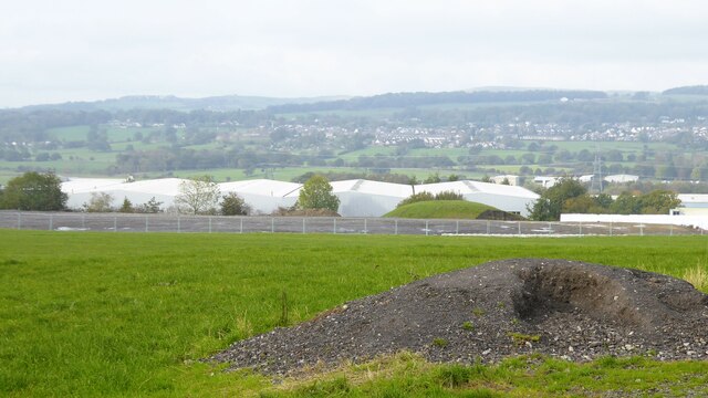
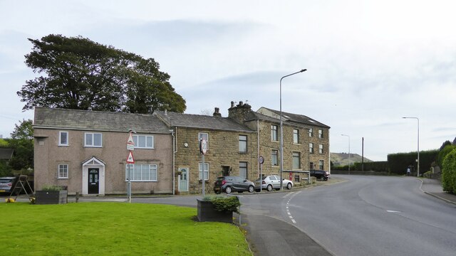
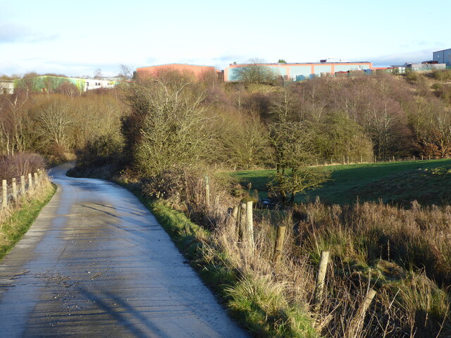
Hapton is a small village located in the county of Lancashire, England. Situated approximately 3 miles northeast of Burnley, it falls under the local government district of Burnley Borough Council. Hapton is nestled in the beautiful countryside of the Pennine Hills, offering its residents and visitors stunning views and a tranquil environment.

Historically, Hapton was an industrial village known for its coal mining and textile manufacturing. However, the decline of these industries in the late 20th century shifted the village's focus towards agriculture and a more rural way of life.

The village itself boasts a variety of amenities and facilities for its residents. These include a primary school, a village hall, a local pub, and a small convenience store. Hapton also benefits from excellent transport links, with regular bus services connecting it to nearby towns and cities.

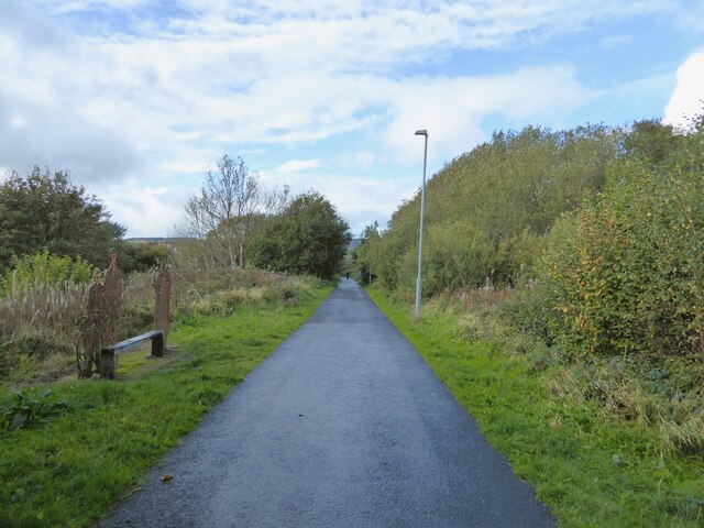
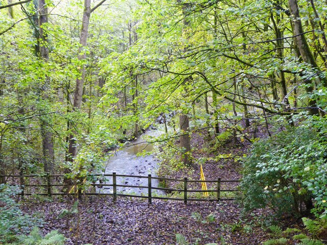
For those seeking outdoor pursuits, Hapton is surrounded by picturesque countryside, offering opportunities for walking, cycling, and exploring nature. The village is also home to a popular cricket ground, providing a recreational space for sports enthusiasts.

Although small in size, Hapton has a strong sense of community. The village hosts various events throughout the year, including a summer fair and a Christmas market, which bring residents together. Overall, Hapton offers a peaceful and close-knit community, with access to both rural and urban amenities, making it an attractive place to live or visit in Lancashire.

If you have any feedback on the listing, please let us know in the comments section below.

Hapton Images

Images are sourced within 2km of 53.780696/-2.3169803 or Grid Reference SD7931. Thanks to Geograph Open Source API. All images are credited.

Straightened Leeds & Liverpool Canal The route of the M65 motorway required a new straight cut for the canal rather than a meander around a clough. It must have required major earthworks to keep a level contour on the new cut.
Straightened Leeds & Liverpool Canal
The route of the M65 motorway required a new straight cut for the canal rather than a meander around a clough. It must have required major earthworks to keep a level contour on the new cut.
Castle Clough Farm View from the Leeds & Liverpool Canal towpath of the complex which appears to be used for various businesses.
Castle Clough Farm
View from the Leeds & Liverpool Canal towpath of the complex which appears to be used for various businesses.
Leeds and Liverpool Canal Following the contours around Castle Clough towards Shuttleworth Hall
Leeds and Liverpool Canal
Following the contours around Castle Clough towards Shuttleworth Hall
Higher Shuttleworth Bridge No.120 On the Leeds & Liverpool Canal, an iron bridge carrying the plate Dallam Forge, Warrington
Higher Shuttleworth Bridge No.120
On the Leeds & Liverpool Canal, an iron bridge carrying the plate Dallam Forge, Warrington
Cycle path following route of former railway The Padiham Greenway approaching the bridge across Park Road. Behind the camera is the fenced off viaduct that took the cycle path over the River Calder but is closed due to structural issues.
Cycle path following route of former railway
The Padiham Greenway approaching the bridge across Park Road. Behind the camera is the fenced off viaduct that took the cycle path over the River Calder but is closed due to structural issues.
Leeds & Liverpool Canal Approaching Altham Bridge that carries Altham Lane across the canal. The tree by the towpath ahead is in a small fenced enclosure that appears to contain a filled old mine shaft. Old OS maps do indicate an old mine in this area.
Leeds & Liverpool Canal
Approaching Altham Bridge that carries Altham Lane across the canal. The tree by the towpath ahead is in a small fenced enclosure that appears to contain a filled old mine shaft. Old OS maps do indicate an old mine in this area.
Groundworks at Altham Business Park There appears to be more ground cleared and fenced for possible further expansion of the business park along Altham Lane
Groundworks at Altham Business Park
There appears to be more ground cleared and fenced for possible further expansion of the business park along Altham Lane
Housing facing the Peace Garden At the junction of Burnley Road with Higher Gate and Lower Gate Road
Housing facing the Peace Garden
At the junction of Burnley Road with Higher Gate and Lower Gate Road
Hedgerow lined Burnley Road Heading towards Hapton
Hedgerow lined Burnley Road
Heading towards Hapton
Hapton Inn On Accrington Road
Hapton Inn
On Accrington Road
Leeds and Liverpool Canal Alongside Accrington Road leaving Rose Grove
Leeds and Liverpool Canal
Alongside Accrington Road leaving Rose Grove
Leeds and Liverpool Canal Approaching the historic Knotts Bridge No.123
Leeds and Liverpool Canal
Approaching the historic Knotts Bridge No.123
Leeds and Liverpool Canal overflow Against the walling for Accrington Road, an overflow point that appears to go to the Green Brook culvert under the canal at Rose Grove
Leeds and Liverpool Canal overflow
Against the walling for Accrington Road, an overflow point that appears to go to the Green Brook culvert under the canal at Rose Grove
Cycle path following route of former railway The route known as Padiham Greenway is on an embankment crossing Green Brook which is in a culvert. The iron figures in the public artwork by the side of the route are on top of the culvert position.
Cycle path following route of former railway
The route known as Padiham Greenway is on an embankment crossing Green Brook which is in a culvert. The iron figures in the public artwork by the side of the route are on top of the culvert position.
Cycle path following route of former railway The route known as Padiham Greenway is about to cross a bridge over the former Knotts Lane. The lane has been obliterated with various earthworks for industry and housing but the masonry bridge still stands.
Cycle path following route of former railway
The route known as Padiham Greenway is about to cross a bridge over the former Knotts Lane. The lane has been obliterated with various earthworks for industry and housing but the masonry bridge still stands.
Green Brook in Spa Wood The stream is entering a culvert which takes it some distance underground, under Accrington Road, the Leeds & Liverpool Canal and the railway.
Green Brook in Spa Wood
The stream is entering a culvert which takes it some distance underground, under Accrington Road, the Leeds & Liverpool Canal and the railway.
M65 crossing the Leeds and Liverpool Canal The bridge is known as Molly Wood bridge <a href="https://www.geograph.org.uk/photo/4377830">SD8032 : Leeds and Liverpool Canal, Bridge #124A (Molly Wood)</a>.
M65 crossing the Leeds and Liverpool Canal
The bridge is known as Molly Wood bridge SD8032 : Leeds and Liverpool Canal, Bridge #124A (Molly Wood).
Concrete farm track Heading towards Billington Road from the farms on the slopes of Hambledon Hill. The buildings of Rossendale Road Industrial Estate are on the skyline.
Concrete farm track
Heading towards Billington Road from the farms on the slopes of Hambledon Hill. The buildings of Rossendale Road Industrial Estate are on the skyline.
Show me another place!

Hapton is located at Grid Ref: SD7931 (Lat: 53.780696, Lng: -2.3169803)

Administrative County: Lancashire

District: Burnley

Police Authority: Lancashire

What 3 Words

///smashes.splash.cycle. Near Hapton, Lancashire

Nearby Locations

Mill Hill Hapton

Related Wikis

Hapton railway station

Hapton railway station serves the village of Hapton 3 miles (5 km) west of Burnley Central railway station on the East Lancashire Line operated by Northern...

Hapton, Lancashire

Hapton is a village and civil parish in the Borough of Burnley in Lancashire, England, 3 miles (4.8 km) west of Burnley, with a railway station on the...

Shuttleworth Hall

Shuttleworth Hall is a 17th-century manor house (and later farmhouse) in the civil parish of Hapton in Lancashire, England. It is protected as a Grade...

Huncoat Power Station

Huncoat Power Station was located in Huncoat near Accrington, Lancashire. It was a 150 MW, coal-fired, electricity generating station in operation from...

Altham, Lancashire

Altham is a village and civil parish in the Borough of Hyndburn, in Lancashire, England. The village is 4.3 miles (6.9 km) west of Burnley, 2.9 miles...

Hapton Valley Colliery

Hapton Valley Colliery was a coal mine on the edge of Hapton near Burnley in Lancashire, England. Its first shafts were sunk in the early 1850s and it...

Padiham Power Station

Padiham Power Station was a coal-fired power station in Padiham, east Lancashire, England, which began operation in 1926 and generated power from 1927...

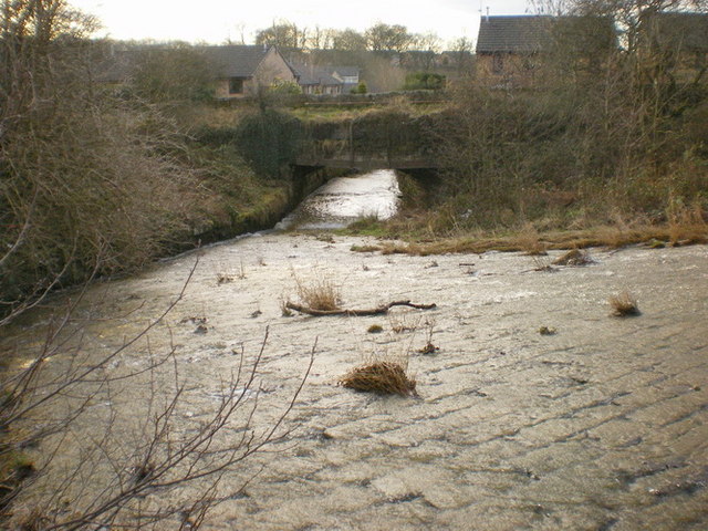
Green Brook, Lancashire

Green Brook is a minor river in Lancashire, England. It is 2.32 miles (3.73 km) long, and including tributaries, has the catchment area of 7.02 square...

Nearby Amenities

Located within 500m of 53.780696,-2.3169803
Motorway Junction
Hapton Interchange
Ref: 8
Lat/Long: 53.7812274/-2.3240144
Power: tower
Source: Yahoo
Lat/Long: 53.7783437/-2.3222388
Power: tower
Lat/Long: 53.7799099/-2.3114846
Power: tower
Lat/Long: 53.7793576/-2.3171299
Power: tower
Lat/Long: 53.7805405/-2.3240867
Railway: level_crossing
Lat/Long: 53.780749/-2.3243019
Railway: level_crossing
Lat/Long: 53.7807836/-2.3243109
Hapton
Naptan AtcoCode: 9100HAPTON
Network: National Rail
Network Website: https://www.nationalrail.co.uk/stations/hpn/
Network Wikidata: Q26334
Operator: Northern Rail
Operator Website: https://www.northernrailway.co.uk/stations/hapton
Operator Wikidata: Q85789775
Public Transport: station
Railway: station
Ref Crs: HPN
Request Stop: yes
Source: npe
Train: yes
Wikidata: Q2211158
Wikipedia: en:Hapton railway station
Lat/Long: 53.7815747/-2.31732
Bus Stop
Railway Inn
Public Transport: platform
Lat/Long: 53.7839352/-2.3148329
Bus Stop
Railway Inn
Naptan AtcoCode: 250011874
Naptan NaptanCode: lanagpjt
Public Transport: platform
Lat/Long: 53.7837729/-2.314911
Bus Stop
Railway Station
Naptan AtcoCode: 2500456
Naptan NaptanCode: lanawjgm
Public Transport: platform
Lat/Long: 53.7810749/-2.3167192
Bus Stop
Railway Station
Public Transport: platform
Lat/Long: 53.7807582/-2.3170212
Bus Stop
Lyndale Road
Naptan AtcoCode: 2500IMG2585
Naptan NaptanCode: langdmda
Public Transport: platform
Lat/Long: 53.7786506/-2.3172902
Bus Stop
Lyndale Road
Naptan AtcoCode: 2500IMG2586
Naptan NaptanCode: langdmdg
Public Transport: platform
Lat/Long: 53.7784584/-2.3170938
Turning Circle
Lat/Long: 53.7768544/-2.3199138
Noexit: yes
Lat/Long: 53.7843433/-2.3139243
Phone
Emergency: phone
Indoor: no
Operator: National Highways
Operator Type: government
Operator Wikidata: Q5760006
Ref: 4288 B
Lat/Long: 53.7822813/-2.3132409
Phone
Emergency: phone
Indoor: no
Operator: National Highways
Operator Type: government
Operator Wikidata: Q5760006
Ref: 4288 A
Lat/Long: 53.7825892/-2.3133422
The data included in this document is from www.openstreetmap.org. The data is made available under ODbL.

Have you been to Hapton?

Leave your review of Hapton below (or comments, questions and feedback).