Farleigh Park

Downs, Moorland in Somerset Mendip

England

Farleigh Park

Entrance to Wick Farm
Entrance to Wick Farm Credit: Anthony Parkes

Farleigh Park, located in Somerset, England, is a sprawling estate that encompasses both downs and moorland landscapes. Covering a significant area, it offers a diverse range of natural features and amenities for visitors to enjoy.

The downs of Farleigh Park are characterized by their rolling grassy hills, providing breathtaking views of the surrounding countryside. This area is ideal for leisurely walks and picnics, allowing visitors to immerse themselves in the peaceful ambiance and take in the beauty of the landscape.

In contrast, the moorland section of the park offers a unique and rugged environment. Here, visitors can explore the heather-covered hills and wild, untamed scenery. This area is particularly popular among hikers and nature enthusiasts, offering a chance to spot a variety of wildlife species in their natural habitat.

Farleigh Park also features well-maintained trails that wind through the estate, allowing visitors to explore the diverse landscapes at their own pace. These trails are suitable for all levels of fitness and offer opportunities for both short walks and longer hikes.

Additionally, the park offers various facilities to enhance visitors' experiences. There are picnic areas, benches, and viewpoints strategically placed throughout the park, providing ample opportunities for relaxation and enjoying the surroundings. The park also has a visitor center, where visitors can obtain information about the park's history, flora, and fauna.

Overall, Farleigh Park in Somerset offers a picturesque and diverse natural environment, inviting visitors to immerse themselves in the beauty of its downs and moorland landscapes.

If you have any feedback on the listing, please let us know in the comments section below.

Farleigh Park Images

Images are sourced within 2km of 51.307146/-2.2878545 or Grid Reference ST8056. Thanks to Geograph Open Source API. All images are credited.

Entrance to Wick Farm
New Entrance to Lower Chartley Farm & Training Centre
A336 from the A36
A336 from the A36
The Hungerford Arms
The Hungerford Arms
Farleigh Road farm shop Farleigh Road Farm Shop and Café <span class="nowrap"><a title="https://www.farleighroadfarmshop.co.uk/" rel="nofollow ugc noopener" href="https://www.farleighroadfarmshop.co.uk/">Link</a><img style="margin-left:2px;" alt="External link" title="External link - shift click to open in new window" src="https://s1.geograph.org.uk/img/external.png" width="10" height="10"/></span> lies just off the A366, the road running from the A36 to Norton St Philip.  To judge by the number of cars parked there (one is just arriving and more were out of shot) it was a popular place to visit on this autumn Tuesday afternoon.
Farleigh Road farm shop
Farleigh Road Farm Shop and Café LinkExternal link lies just off the A366, the road running from the A36 to Norton St Philip. To judge by the number of cars parked there (one is just arriving and more were out of shot) it was a popular place to visit on this autumn Tuesday afternoon.
Farleigh Road Farm Shop and Cafe
Farleigh Service Station This is the current incarnation of the former Esso station seen at <a href="https://www.geograph.org.uk/photo/190400">ST7857 : A36 filling station</a> and <a href="https://www.geograph.org.uk/photo/4886190">ST7857 : Cross roads on A36</a>.  Fairleigh Service Station <span class="nowrap"><a title="https://petrol-stations.co.uk/05682054/Farleigh_Service_Station" rel="nofollow ugc noopener" href="https://petrol-stations.co.uk/05682054/Farleigh_Service_Station">Link</a><img style="margin-left:2px;" alt="External link" title="External link - shift click to open in new window" src="https://s1.geograph.org.uk/img/external.png" width="10" height="10"/></span> is now run by Applegreen and on this day was charging 166.8p a litre for unleaded petrol and 189.8p a litre for diesel.
Farleigh Service Station
This is the current incarnation of the former Esso station seen at ST7857 : A36 filling station and ST7857 : Cross roads on A36. Fairleigh Service Station LinkExternal link is now run by Applegreen and on this day was charging 166.8p a litre for unleaded petrol and 189.8p a litre for diesel.
Field corner
Field corner
The Hungerford Arms
The Hungerford Arms
Woodys, Norton St Philip
Lane heading north near Farleigh Wood
Farleigh Hungerford Castle
Stowford Farm
Stowford Farm
Gatehouse at Farleigh Hungerford Castle Southern gatehouse at Farleigh Hungerford Castle.
Photograph taken from the entrance off the A366.
Gatehouse at Farleigh Hungerford Castle
Southern gatehouse at Farleigh Hungerford Castle. Photograph taken from the entrance off the A366.
Pomeroy Lane Leading to Matthews Farm and Pomeroy Farm.  On this midsummer evening the lane was alive with wildlife, including numerous swallows.
Pomeroy Lane
Leading to Matthews Farm and Pomeroy Farm. On this midsummer evening the lane was alive with wildlife, including numerous swallows.
Belle Coeur Farm A rather fanciful name for one of the three farms reached by Pomeroy Lane, carefully painted on the gatepost.  And grammatically odd, because 'coeur' is a masculine noun but 'belle' is a feminine form.  The cattle grid on the left leads to the farmhouse; further farm buildings can be seen in the centre of the photo.
Belle Coeur Farm
A rather fanciful name for one of the three farms reached by Pomeroy Lane, carefully painted on the gatepost. And grammatically odd, because 'coeur' is a masculine noun but 'belle' is a feminine form. The cattle grid on the left leads to the farmhouse; further farm buildings can be seen in the centre of the photo.
Tellisford packhorse bridge Extensively restored in the seventeenth century, the cobbled packhorse bridge over the River Frome also spans the counties of Somerset (this side) and Wiltshire (far side).
Tellisford packhorse bridge
Extensively restored in the seventeenth century, the cobbled packhorse bridge over the River Frome also spans the counties of Somerset (this side) and Wiltshire (far side).
Pillbox, Tellisford weir A WW2 pillbox, recently cleared of a tonne of rubbish <span class="nowrap"><a title="https://www.wiltshiretimes.co.uk/news/19665459.litter-lout-visitors-trash-river-frome-beauty-spot/" rel="nofollow ugc noopener" href="https://www.wiltshiretimes.co.uk/news/19665459.litter-lout-visitors-trash-river-frome-beauty-spot/">Link</a><img style="margin-left:2px;" alt="External link" title="External link - shift click to open in new window" src="https://s1.geograph.org.uk/img/external.png" width="10" height="10"/></span> , on the Wiltshire bank of the River Frome at Tellisford weir.
Pillbox, Tellisford weir
A WW2 pillbox, recently cleared of a tonne of rubbish LinkExternal link , on the Wiltshire bank of the River Frome at Tellisford weir.
Show me another place!

Farleigh Park is located at Grid Ref: ST8056 (Lat: 51.307146, Lng: -2.2878545)

Administrative County: Somerset

District: Mendip

Police Authority: Avon and Somerset

What 3 Words

///dart.tells.dirt. Near Wingfield, Wiltshire

Nearby Locations

Pomeroy Wood Farleigh Park

Related Wikis

Ravenscroft School, Somerset

Ravenscroft School (founded 1931 at Yelverton, Devon, and until 1978 known as Ravenscroft Preparatory School) was an independent day and boarding school...

Tellisford

Tellisford is a village and civil parish 6 miles (10 km) north-east of Frome in the Mendip district of Somerset, England. The parish includes the village...

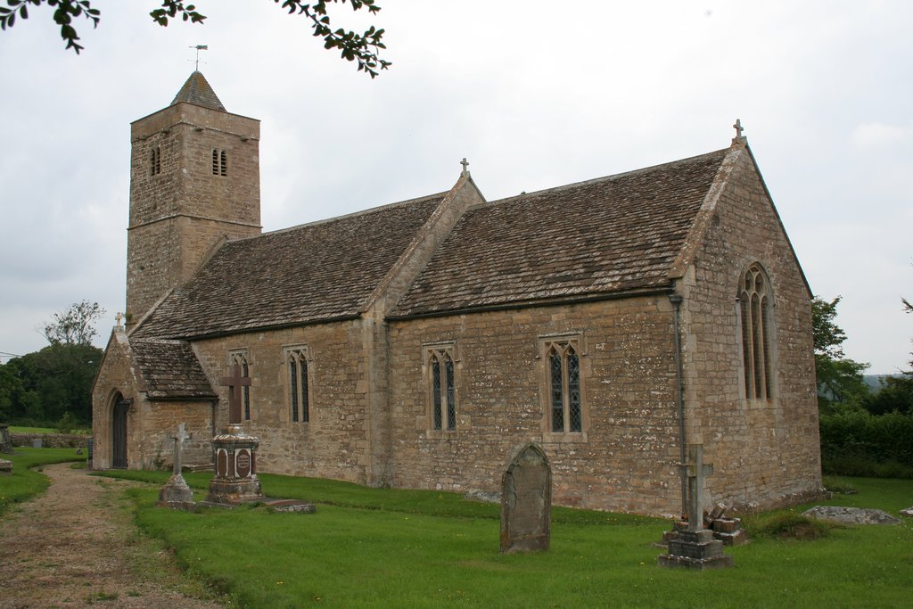
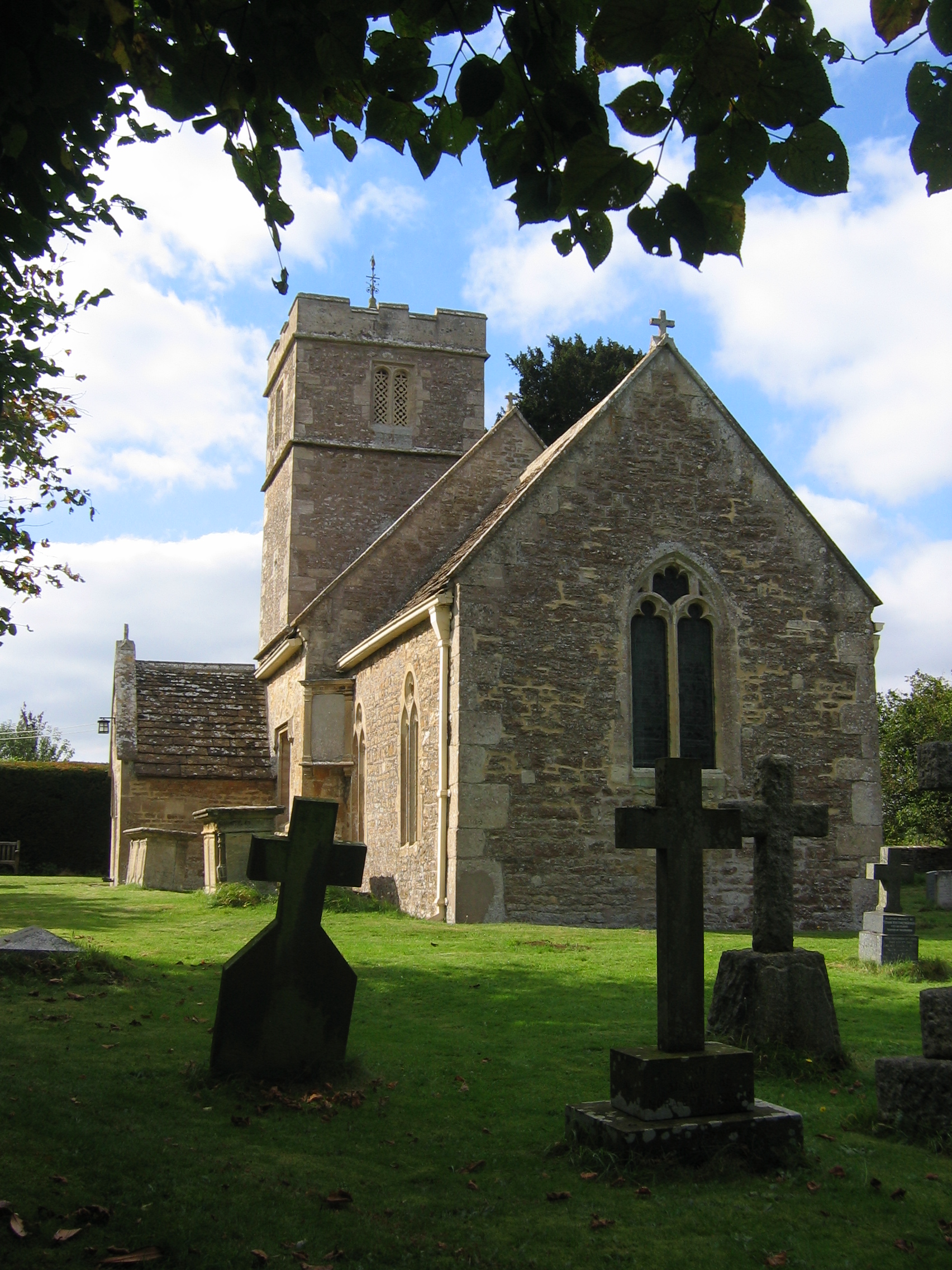
Church of St Leonard, Farleigh Hungerford

The Anglican Church of St Leonard in Farleigh Hungerford, within the English county of Somerset, was consecrated in 1443. It is a Grade II* listed building...
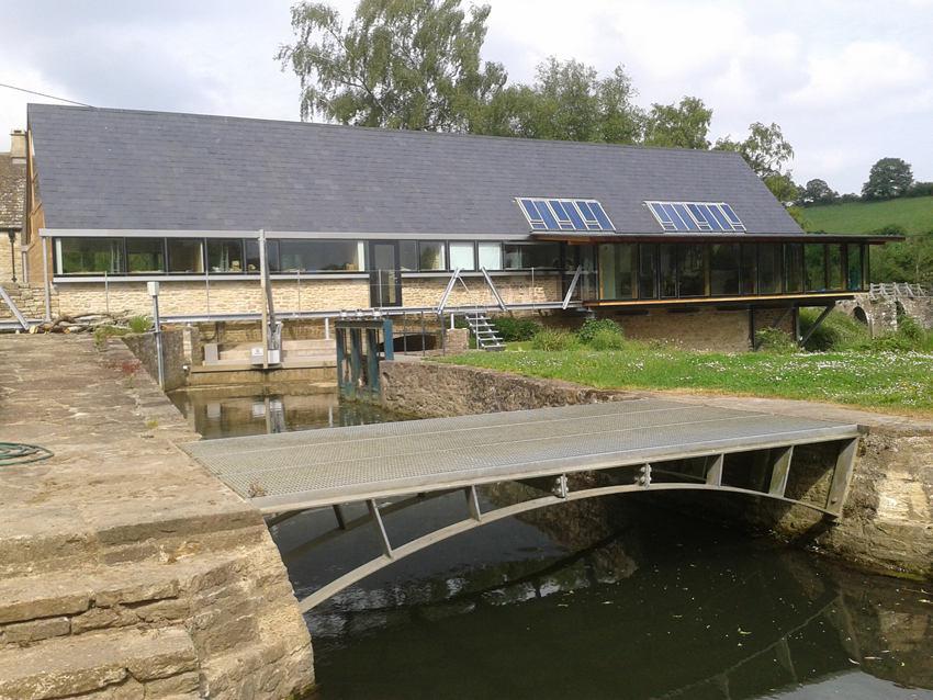
Tellisford Mill

Tellisford Mill is a 55 kilowatts (74 hp) installed capacity micro hydro run-of-the-river power station on the site of a former watermill in the village...

Farleigh Hungerford

Farleigh Hungerford (grid reference ST800576) is a village and former civil parish, now in the parish of Norton St Philip, in the Somerset district, in...

Farleigh Hungerford Castle

Farleigh Hungerford Castle, sometimes called Farleigh Castle or Farley Castle, is a medieval castle in Farleigh Hungerford, Somerset, England. The castle...

Farleigh House

Farleigh House, or Farleigh Castle, sometimes called Farleigh New Castle, is a large English country house in the county of Somerset, formerly the centre...

Trowbridge Village Pump Festival

The Village Pump Festival is a folk music festival that takes place near Trowbridge, England. It has its roots 53 years ago in a barn at the Lamb Inn...

Nearby Amenities

Located within 500m of 51.307146,-2.2878545
Fixme: Check connectivity between here and the rest of the Macmillan Way to the south
Lat/Long: 51.3086754/-2.2865726
Barrier: kissing_gate
Lat/Long: 51.3089283/-2.2869276
The data included in this document is from www.openstreetmap.org. The data is made available under ODbL.

Have you been to Farleigh Park?

Leave your review of Farleigh Park below (or comments, questions and feedback).