Nateby Common

Downs, Moorland in Westmorland Eden

England

Nateby Common

Footpath in groove en route for Nine Standards Rigg The path, seen looking to the west - downhill - is one of the main routes to the summit of Nine Standards Rigg and is a variant of the 'Coast to Coast' long distance path.
Footpath in groove en route for Nine Standards Rigg Credit: Trevor Littlewood

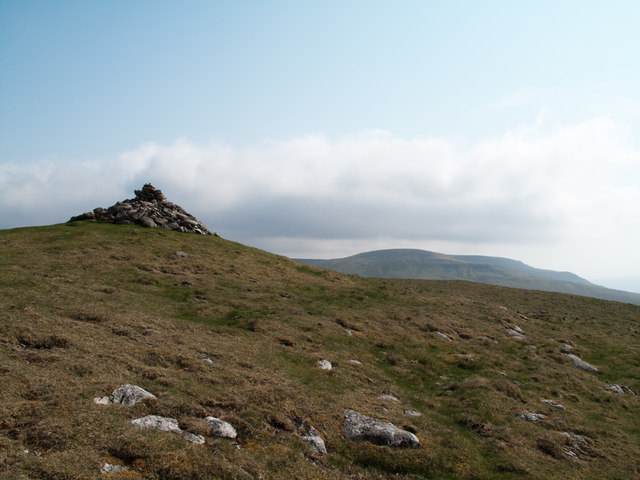
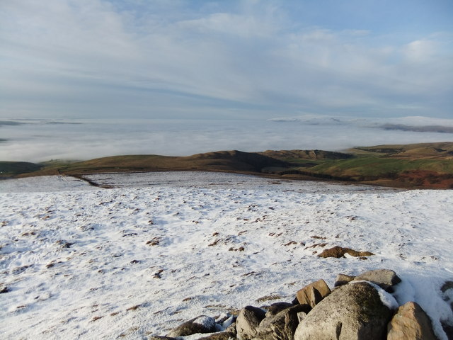
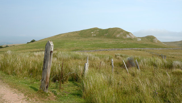
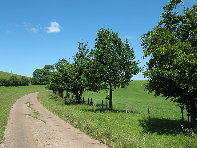
Nateby Common, located in Westmorland, England, is a picturesque and expansive area that showcases the natural beauty of the region. Spread across downs and moorland, it offers a diverse landscape that appeals to nature enthusiasts and outdoor adventurers alike.

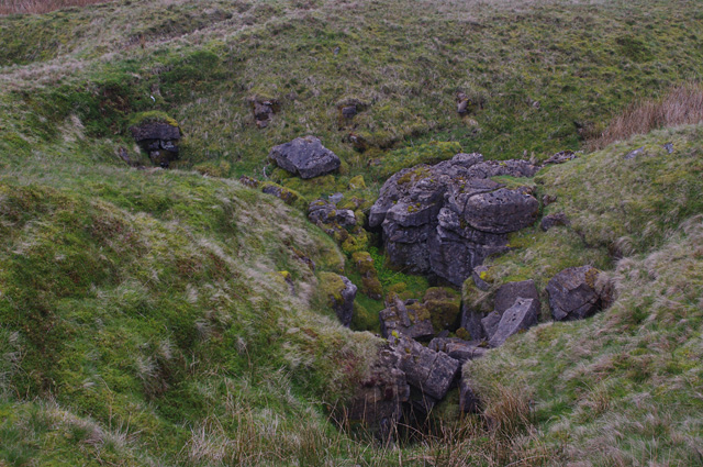
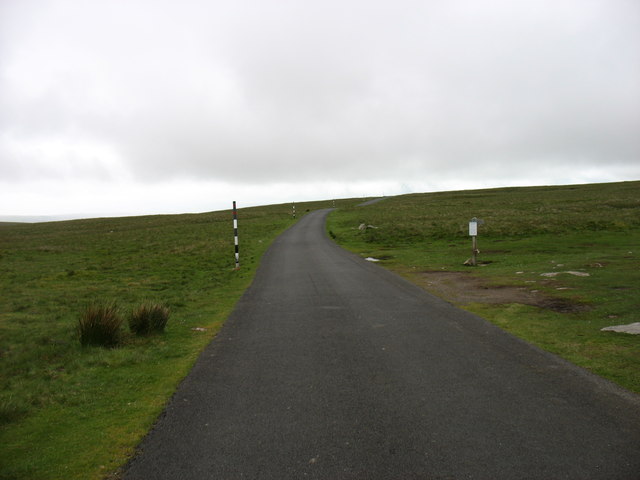
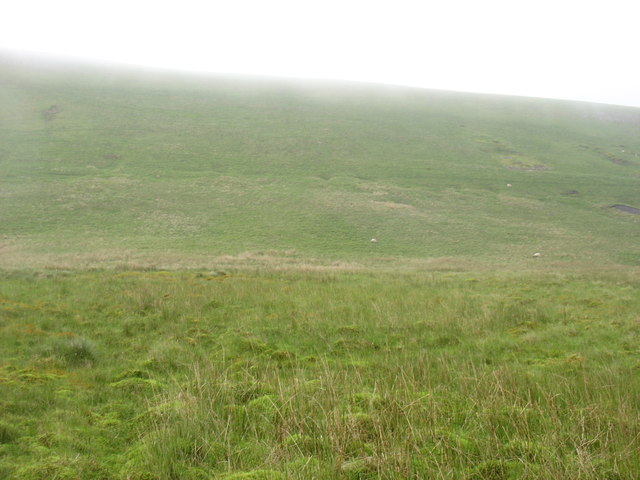
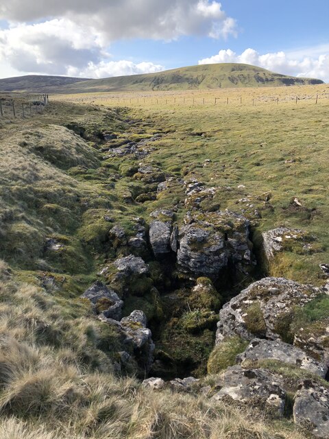
The common is characterized by its rolling hills, heather-covered moors, and open grasslands, providing visitors with breathtaking views of the surrounding countryside. The downs, with their gentle slopes and lush greenery, are ideal for leisurely walks and picnics, while the moorland offers a more rugged terrain for hikers and ramblers seeking a challenge.

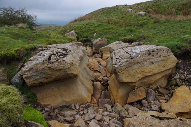
Nateby Common is home to a rich variety of flora and fauna, with vibrant wildflowers dotting the landscape during the warmer months and an array of bird species making the area their nesting grounds. The common also boasts several small streams and ponds, adding to its natural charm.

The tranquility and serenity of Nateby Common make it a popular spot for those seeking respite from the hustle and bustle of city life. Its remote location ensures that visitors can immerse themselves in the peaceful surroundings and enjoy a sense of solitude.

Access to Nateby Common is relatively easy, with designated footpaths and bridleways crisscrossing the area. There are also several car parks available for those arriving by car. Additionally, the common is well-connected to nearby towns and villages, making it an accessible destination for day trips.

Overall, Nateby Common offers a captivating blend of downs and moorland, allowing visitors to experience the natural beauty and tranquility of Westmorland.

If you have any feedback on the listing, please let us know in the comments section below.

Nateby Common Images

Images are sourced within 2km of 54.447612/-2.3109334 or Grid Reference NY7905. Thanks to Geograph Open Source API. All images are credited.

Footpath in groove en route for Nine Standards Rigg The path, seen looking to the west - downhill - is one of the main routes to the summit of Nine Standards Rigg and is a variant of the 'Coast to Coast' long distance path.
Footpath in groove en route for Nine Standards Rigg
The path, seen looking to the west - downhill - is one of the main routes to the summit of Nine Standards Rigg and is a variant of the 'Coast to Coast' long distance path.
Ruined building on south-western slope of Nine Standards Rigg This ruin, close to a junction of bridleways on the slopes of Nine Standards Rigg is not shown on OS maps at either 1:50 000 or 1:25 000 scales; its original purpose is unknown though there is an old quarry to the east and there could be some connection with that. The hill seen at the left side of the image is Tailbridge Hill.
Ruined building on south-western slope of Nine Standards Rigg
This ruin, close to a junction of bridleways on the slopes of Nine Standards Rigg is not shown on OS maps at either 1:50 000 or 1:25 000 scales; its original purpose is unknown though there is an old quarry to the east and there could be some connection with that. The hill seen at the left side of the image is Tailbridge Hill.
Summit area of Tailbridge Hill, with summit cairn A few minor limestone rocks protrude from the grassy covering of Tailbridge Hill and there are exposures of limestone pavement elsewhere on it. The distant hills are those of the west side of the Mallerstang valley.
Summit area of Tailbridge Hill, with summit cairn
A few minor limestone rocks protrude from the grassy covering of Tailbridge Hill and there are exposures of limestone pavement elsewhere on it. The distant hills are those of the west side of the Mallerstang valley.
From Tailbridge Hill Eden Valley under the mist
From Tailbridge Hill
Eden Valley under the mist
Limestone edge on Birkett Hill
Birkett Hill Birkett Hill as seen from the farm/estate road that is also the route of the Coast to Coast Walk.
Birkett Hill
Birkett Hill as seen from the farm/estate road that is also the route of the Coast to Coast Walk.
Road on Hartley Fell This estate and/or farm road climbs from the village of Hartley, close to Kirkby Stephen, towards Nine Standards Rigg; it also acts as the route for the Coast to Coast Walk.
Road on Hartley Fell
This estate and/or farm road climbs from the village of Hartley, close to Kirkby Stephen, towards Nine Standards Rigg; it also acts as the route for the Coast to Coast Walk.
B6270 A snowed up pass between upper Swaledale and Kirkby Stephen past Nine Standards Rigg.
B6270
A snowed up pass between upper Swaledale and Kirkby Stephen past Nine Standards Rigg.
Track to Hartley Fell The public bridleway passes through a bog. This is part of Wainwright's Coast to Coast route.
In the background is the north-eastern Birkett Hill (405m - slightly higher than the other).
Track to Hartley Fell
The public bridleway passes through a bog. This is part of Wainwright's Coast to Coast route. In the background is the north-eastern Birkett Hill (405m - slightly higher than the other).
Track to Hartley Fell This public bridleway is part of Wainwright's Coast to Coast route.
In the background is the south-western Birkett Hill (383m - slightly lower than the other).
Track to Hartley Fell
This public bridleway is part of Wainwright's Coast to Coast route. In the background is the south-western Birkett Hill (383m - slightly lower than the other).
Ruined barn, Reigill In the background on the right is Tailbridge Hill.
Ruined barn, Reigill
In the background on the right is Tailbridge Hill.
Dry stream bed, Reigill A continuation of Faraday Gill, looking downstream.
Dry stream bed, Reigill
A continuation of Faraday Gill, looking downstream.
Footbridge below Nine Standards Rigg Another view of <a href="https://www.geograph.org.uk/photo/2105768">NY8106 : Inadequate Footbridge</a>, when in low cloud.
This concessionary footpath is part of Wainwright's Coast to Coast route.
Footbridge below Nine Standards Rigg
Another view of NY8106 : Inadequate Footbridge, when in low cloud. This concessionary footpath is part of Wainwright's Coast to Coast route.
Shake hole, Dukerdale Pots
Dry stream bed, Dukerdale Pots Almost dry - the infant Rigg Beck, looking upstream.
Dry stream bed, Dukerdale Pots
Almost dry - the infant Rigg Beck, looking upstream.
The B6270 on Nateby Common The sign relates to three different routes for the Coast to Coast walk that should be used depending on the time of year.

The B6270 was closed a short distance behind the camera, at the county border (NY81160405). At first I thought this rather a nuisance, but then realised that it enabled me to stop for photos wherever I wanted without causing any obstruction!
The B6270 on Nateby Common
The sign relates to three different routes for the Coast to Coast walk that should be used depending on the time of year. The B6270 was closed a short distance behind the camera, at the county border (NY81160405). At first I thought this rather a nuisance, but then realised that it enabled me to stop for photos wherever I wanted without causing any obstruction!
Nateby Common
Nateby Common
Lamps Moss A linear section of shake holes and exposed limestone on the edge of Lamps Moss.
Lamps Moss
A linear section of shake holes and exposed limestone on the edge of Lamps Moss.
Show me another place!

Nateby Common is located at Grid Ref: NY7905 (Lat: 54.447612, Lng: -2.3109334)

Administrative County: Cumbria

District: Eden

Police Authority: Cumbria

What 3 Words

///along.hedgehog.dazzling. Near Kirkby Stephen, Cumbria

Nearby Locations

Nateby Common Hartley

Related Wikis

Nateby, Cumbria

Nateby is a village and civil parish in the Eden district of Cumbria, England. The parish had a population of 110 in 2001, increasing to 120 at the 2011...

Nine Standards Rigg

Nine Standards Rigg is the summit of Hartley Fell in the Pennine Hills of England. It lies near the boundary between Cumbria and North Yorkshire, a few...
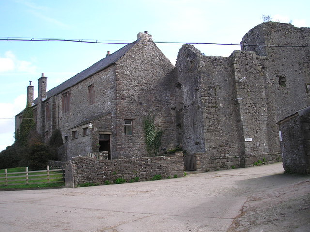
Wharton Hall

Wharton Hall in Wharton, Cumbria, England, is a medieval fortified manor house. == History == At the heart of Wharton Hall is a 15th-century hall, built...

Hartley Castle

Hartley Castle was a castle near Kirkby Stephen, Cumbria, England. == History == The manor was confiscated circa 1315 from Roger de Clifford and granted...

Devil's Grinding Mill

The Devil's Grinding Mill, sometimes known as the Devil's Hole, is part of The Angel's Drainpipe, a partially collapsed cave system on the River Eden in...

Wharton, Cumbria

Wharton is a civil parish near Kirkby Stephen in the Eden District of Cumbria, England, which, historically, was part of Westmorland. It has a population...

Hartley, Cumbria

Hartley is a village and civil parish in the Eden district of Cumbria, England. It is about 0.5 miles (0.8 km) east of Kirkby Stephen. The area has many...

Kirkby Stephen East railway station

Kirkby Stephen East railway station was situated on the South Durham & Lancashire Union Railway (known as the Stainmore Line) between Barnard Castle and...

Nearby Amenities

Located within 500m of 54.447612,-2.3109334
Abandoned: yes
Historic: mine_shaft
Man Made: mineshaft
Lat/Long: 54.4468375/-2.3180004
Abandoned: yes
Historic: mine_shaft
Man Made: mineshaft
Lat/Long: 54.4471854/-2.3179161
Abandoned: yes
Historic: mine_shaft
Man Made: mineshaft
Lat/Long: 54.4439706/-2.3146905
Natural: sinkhole
Lat/Long: 54.4450737/-2.3070056
Natural: sinkhole
Lat/Long: 54.4451738/-2.3068997
Natural: sinkhole
Lat/Long: 54.4451777/-2.3068931
Nateby Cow Close
Place: locality
Lat/Long: 54.4503126/-2.3094468
The data included in this document is from www.openstreetmap.org. The data is made available under ODbL.

Have you been to Nateby Common?

Leave your review of Nateby Common below (or comments, questions and feedback).